1980s Maps of Otero County, New Mexico
Explore 60 historic maps of Otero County from the 1980s. These maps offer a rare glimpse into what life looked like during the 1980s — showing old roads, neighborhoods, homes, and landmarks that have changed or disappeared over time.
Whether you're researching your family's past, planning a metal detecting trip, or studying how Otero County's landscape evolved across the 1980s, these high-resolution maps are a powerful tool for exploring the history of this region.
- Focus on a specific era: All maps on this page are from the 1980s, giving you a focused view of this time period.
- See what’s changed: Compare century-old streets, trails, and buildings to today's modern landscape using overlays and satellite layers.
- Research with precision: Use these maps for genealogy, historical research, land use analysis, or educational projects.
- View, download, or print: Maps are fully viewable online in high resolution, and can be downloaded or printed for your own records.
Start exploring Otero County's history through authentic maps from the 1980s. This is your window into the past.
Otero County, NM maps
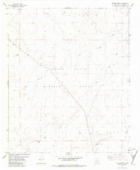
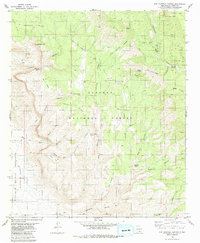
(60)- 1980 Map of Owl Tank Canyon West
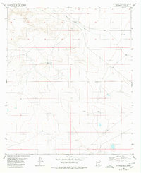
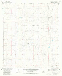
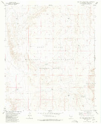 1980 Owl Tank Canyon West1980 Print · USGSThe high desert of Otero County is captured here in the 1970s, showcasing the intersection of military training grounds and ranching history. Researchers can trace vital desert water sources like Foster Ranch Tanks, Childs Tank, and the winding Owl Tank Canyon.
 - 1980 Map of Bassett Lake
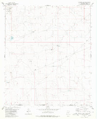 1980 Bassett Lake1980 Print · USGSThe high desert borderlands of Otero County are captured here in the early eighties. Researchers can trace water management and military boundaries across the landscape, from Bassett Lake and Escondida Tank to the vast Fort Bliss Military Reservation.
 - 1980 Map of El Paso Draw
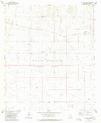 1980 El Paso Draw1980 Print · USGSOtero County in the early eighties was defined by the intersection of military activity and the high desert. Researchers can trace land use through naming conventions at Mc Gregor Range and locate water sources like Ruthford Tanks and Wildcat Draw.
 - 1980 Map of Sixteen Canyon
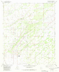
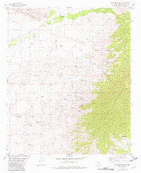
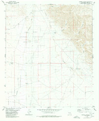 1980 Sixteen Canyon1980 Print · USGSOtero County is captured here in the early 1980s as military and ranching lands meet in a landscape of deep canyons and seasonal rivers. Researchers can locate the Prather Ranch and a lone Grave, or trace water sources like Trammel Well and Shipment Tank.2 unique versions available
 - 1980 Map of Stockard Well
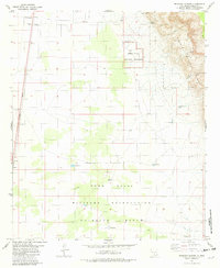
 1980 Stockard Well1980 Print · USGSOtero County ranching lands are captured here in the mid-1970s, showcasing the vital water infrastructure of the high desert. Researchers can trace the legacy of local livestock operations through sites like Stockard Well, Horse Camp Tanks, and Rawhide Tank.
 - 1980 Map of Wilde Tank
 1980 Wilde Tank1980 Print · USGSThe McGregor Range in southern New Mexico is captured here in the early 1980s, showcasing a landscape of military corridors and ranching remnants. Researchers can trace the water history of the region through catchments like Wilde Tank and the Old Wright Place.
 - 1980 Map of Otero Mesa North
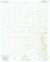
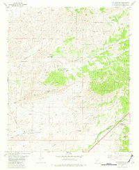
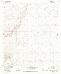 1980 Otero Mesa North1980 Print · USGSOtero County in the early eighties is shown as a dedicated military and ranching landscape. Researchers can trace the water infrastructure of McGregor Range through sites like Double Tanks, Godfrey Tank, and the high-desert Landing Strip.
 - 1980 Map of Owl Tank Canyon East
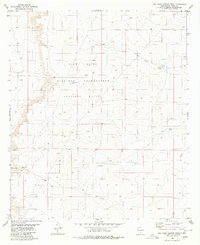 1980 Owl Tank Canyon East1980 Print · USGSOtero County is shown here as a landscape of military range lands and desert water infrastructure in the early 1980s. Researchers can trace the layout of the Mc Gregor Range and locate water sources like Johno Well and the Aqueduct.
 - 1980 Map of Stone Well
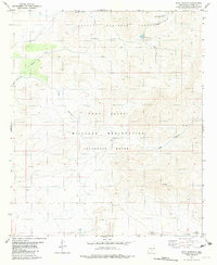
 1980 Stone Well1980 Print · USGSThe high desert of Otero County is shown during the early eighties as part of a massive military training expanse. Researchers can trace the essential water network of the area through landmarks like Stone Well, Antelope Well, and Cockleburr Tank.
 - 1980 Map of Mountain Tank
 1980 Mountain Tank1980 Print · USGSThe high desert borderlands of New Mexico and Texas come into focus here during the late twentieth century. Genealogists and researchers can trace the limits of the Fort Bliss Military Reservation (Mcgregor Range) and find local landmarks like Hat Ranch and Hale Tank.
 - 1981 Map of Malone Draw
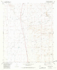
 1981 Malone Draw1981 Print · USGSIn the Tularosa Basin during the early eighties, this area shows the intersection of major defense installations and desert ranching life. Genealogists and local historians can locate specific family-named sites like Mc Natt Well and Daughtery Tank alongside Holloman Air Force Base.
 - 1981 Map of Tularosa
 1981 Tularosa1981 Print · USGSThe high-desert basin around Tularosa is captured here in the early eighties as a hub of military and rail activity. Trace the Southern Pacific line past Three Rivers or explore the vast White Sands Missile Range.2 unique versions available
 - 1981 Map of Three Rivers SW
 1981 Three Rivers SW1981 Print · USGSOtero County is captured in the early 1980s through this aerial-based survey of the high desert and volcanic fields. Researchers can trace the geological boundaries of The Malpais and locate remote desert water sources like Sand Tank and Long Tank.
 - 1981 Map of Golondrina Draw, 1982 Print
 1981 Golondrina Draw1982 Print · USGSHigh-desert ranching and tribal lands in Otero County are documented here as they appeared in the early eighties. Researchers can locate remote sites like the Santo Niño de Atocha Ch Cem, Schoolhouse Well, and the Golondrina Windmill.
 - 1981 Map of Cat Mountain, 1982 Print
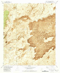
 1981 Cat Mountain1982 Print · USGSOtero County is captured in the early 1980s, showcasing the high desert interface with the Mescalero Apache Indian Reservation. Trace historic water sources and mining claims near Cat Mountain, Aguilar Spring, and Coyote Well.
 - 1981 Map of Culp Canyon, 1982 Print
 1981 Culp Canyon1982 Print · USGSOtero County was a critical intersection of military training and forest management during the early eighties. Researchers can trace water infrastructure and land use across the McGregor Range and Lincoln National Forest, including Upper Juniper Reservoir and Culp Tank.
 - 1981 Map of Deadman Canyon, 1982 Print
 1981 Deadman Canyon1982 Print · USGSOtero County is captured here in the early 1980s as a desert landscape dominated by massive federal reservations and the primary rail line. You can trace the Southern Pacific tracks through Valmont or locate historic watering points like Tony Tank and Laney Spring.
 - 1981 Map of Alamogordo North, 1982 Print
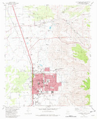 1981 Alamogordo North1982 Print · USGSAlamogordo and the historic village of La Luz are captured in the early eighties as they expanded along the base of the Sacramento Mountains. Researchers can trace local landmarks like the International Space Hall of Fame, the N M State University (Alamogordo Branch), and the old Southern Pacific line.
 - 1981 Map of Capitol Peak SE, 1982 Print
 1981 Capitol Peak SE1982 Print · USGSThe high desert of Otero and Sierra Counties is captured here in the early eighties, revealing the intersection of military testing and volcanic geology. Researchers can trace remote water sources like Malpais Spring and Salt Creek near landmarks such as the Malpais Site.
 - 1981 Map of Bennett Mountain, 1982 Print
 1981 Bennett Mountain1982 Print · USGSThe high desert of the San Andres Mountains meets the military frontiers of New Mexico during the early eighties. Genealogists and desert historians can locate isolated water sources and early landmarks like San Nicolas Spring, Letherman Well, and the Observation Tower.
 - 1981 Map of Three Rivers, 1982 Print
 1981 Three Rivers1982 Print · USGSThe high desert near the Sacramento Mountains comes into focus in the early 1980s, centered on the Three Rivers transit corridor. Researchers can trace the Southern Pacific rail line and locate unique local landmarks like the Petroglyph Site and Crosby Well.
 - 1981 Map of Alamogordo South, 1982 Print
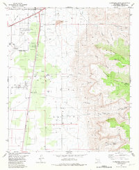 1981 Alamogordo South1982 Print · USGSThe high desert outskirts of Otero County are shown here during a period of significant regional growth and military importance. Researchers can trace the development of Boles Acres, locate the historic Southern Pacific rail line, and find mountain landmarks like Dripping Spring and Mule Peak.2 unique versions available
 - 1981 Map of Bitter Creek, 1982 Print
 1981 Bitter Creek1982 Print · USGSThe high desert of Otero County during the early eighties is dominated by federal land use and sparse water infrastructure. Researchers can trace the boundaries of the White Sands Missile Range and locate isolated landmarks like Bitter Spring, Rita Site, and Rock Tank.
 - 1981 Map of Bug Scuffle Canyon, 1982 Print
 1981 Bug Scuffle Canyon1982 Print · USGSThe Otero County backcountry in the early eighties was a rugged expanse of high timber and military ranges. Researchers can trace land use patterns between the Sacramento Side Camp and landmarks like Bug Scuffle Hill or the Lookout Tower Sacramento.
 - 1981 Map of Oscura, 1982 Print
 1981 Oscura1982 Print · USGSLincoln County ranching and rail history meet the high desert during the early eighties. Genealogists and historians can trace essential water sources like Norton Well and the Southern Pacific rail line serving the village of Oscura.
Showing maps 1-25 of 60
Top cities of Otero County
- Alamogordo historical maps
- Tularosa historical maps
- Boles Acres historical maps
- Alamorosa historical maps
- High Rolls historical maps
- Cloudcroft historical maps
See more
Frequently asked questions
- What are the different types of historical maps available for Otero County?
- What is the oldest map of Otero County?
- Where can I purchase historical maps of Otero County for my home or office?
- Where can I download high-res historical maps of Otero County?
- Are there historical topographic maps available for Otero County?
- Is there historical aerial imagery available for Otero County?
- Where are historical maps of Otero County sourced from?