1970s Maps of Otero County, New Mexico
Explore 28 historic maps of Otero County from the 1970s. These maps offer a rare glimpse into what life looked like during the 1970s — showing old roads, neighborhoods, homes, and landmarks that have changed or disappeared over time.
Whether you're researching your family's past, planning a metal detecting trip, or studying how Otero County's landscape evolved across the 1970s, these high-resolution maps are a powerful tool for exploring the history of this region.
- Focus on a specific era: All maps on this page are from the 1970s, giving you a focused view of this time period.
- See what’s changed: Compare century-old streets, trails, and buildings to today's modern landscape using overlays and satellite layers.
- Research with precision: Use these maps for genealogy, historical research, land use analysis, or educational projects.
- View, download, or print: Maps are fully viewable online in high resolution, and can be downloaded or printed for your own records.
Start exploring Otero County's history through authentic maps from the 1970s. This is your window into the past.
Otero County, NM maps
(28)- 1970 Map of Shiloh Hills SE, 1973 Print
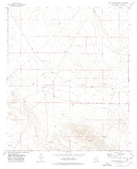
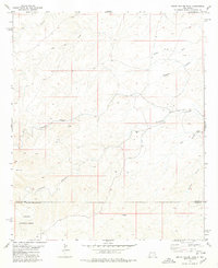
 1970 Shiloh Hills SE1973 Print · USGSThe high-desert borderlands between New Mexico and Texas appear here as they were in the early 1970s, defined by isolated ranching outposts and essential water sources. Researchers can trace the footprint of the McAnally Ranch and find named desert landmarks like Sweet William Well and Cornudas Draw.
 - 1970 Map of Mc Veigh Hills, 1973 Print
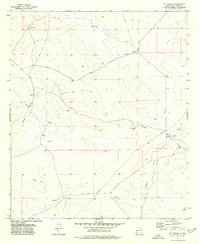
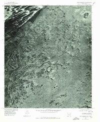
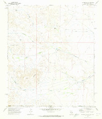 1970 Mc Veigh Hills1973 Print · USGSThe high desert of Otero and Hudspeth counties comes into focus in the early seventies, showing a landscape of isolated ranching and cattle tanks. Researchers can trace land use at the Alton Jones Ranch or locate geographic landmarks like Black Mountain and Cornudas Draw.
 - 1970 Map of Shiloh Hills, 1973 Print
 1970 Shiloh Hills1973 Print · USGSHigh-desert ranching life in Otero County is captured here in the early seventies, centered on the strategic water sources of the Shiloh Hills. Researchers can trace the essential infrastructure of the era through family-named landmarks like Earl Well, Coffelt Tank, and Shiloh Tanks.
 - 1970 Map of Van Winkle Lake, 1973 Print
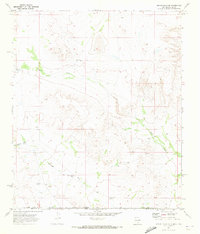
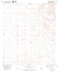
 1970 Van Winkle Lake1973 Print · USGSOtero County ranching and water management are front and center in this 1970s survey of the New Mexico desert. Researchers can locate family landmarks like Brownfield Ranch and Snow Ranch or trace the drainage of Shiloh Draw and Van Winkle Lake.2 unique versions available
 - 1974 Map of Sacramento, 1978 Print
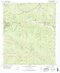
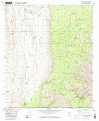
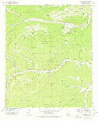 1974 Sacramento1978 Print · USGSThe mountain settlements of Sacramento and Weed are captured in the mid-seventies during a period of active forest management. Genealogists and historians can trace local landmarks like Sivells Camp, the Agua Weed Lookout Tower, and family-named canyons including Charlie Harris Canyon.
 - 1974 Map of Bluff Springs, 1978 Print
 1974 Bluff Springs1978 Print · USGSThe Sacramento Mountains in the mid-seventies reveal a landscape defined by forest service management and early transport routes. Researchers can trace the Old Railroad Grade and locate mountain camps like Camp Wehinahpay and Pine Springs Camp.
 - 1974 Map of Harvey Ranch, 1978 Print
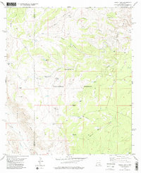
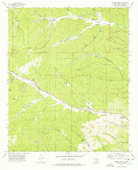 1974 Harvey Ranch1978 Print · USGSThe high Sacramento Mountains in the 1970s reveal a landscape of deep canyons and isolated mountain life. Researchers can trace family sites and local landmarks like the Sixteen Springs Cemetery, Harvey Ranch, and the James Ridge Lookout.
 - 1975 Map of Alamo Mountain, 1977 Print
 1975 Alamo Mountain1977 Print · USGSThe high-desert borderlands of New Mexico and Texas are captured here during the mid-seventies, showing a landscape shaped by ranching and water scarcity. Researchers can trace the water-dependent infrastructure of the era, from the Bennett Ranch and its Landing Strip to local landmarks like Alamo Mountain and Alamo Spring.
 - 1975 Map of Alamo Mountain NE, 1977 Print
 1975 Alamo Mountain NE1977 Print · USGSOtero County ranch lands are captured here in the mid-seventies, showing the vital water and transport networks of the high desert. Researchers can trace remote cattle operations through landmarks like Hat Ranch, Perry Windmill, and Tulloch Lake.
 - 1975 Map of B T Ranch, 1977 Print
 1975 B T Ranch1977 Print · USGSHigh-desert ranching life in Otero County comes into focus in the mid-1970s as the landscape shifts between cattle tanks and dry draws. Researchers can trace historic water rights and land use through CCC Tank, Badger Well, and the namesake B T Ranch.
 - 1975 Map of Cornudas Mountain, 1977 Print
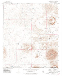 1975 Cornudas Mountain1977 Print · USGSThe high desert of the New Mexico and Texas borderlands comes alive in the mid-seventies, showing a landscape of cattle ranching and isolated peaks. Researchers can trace historic water sources like Alamo Windmill and Cornudas Tank or locate the Cornudas Ranch and its private Landing Strip.
 - 1976 Map of Mule Peak, 1980 Print
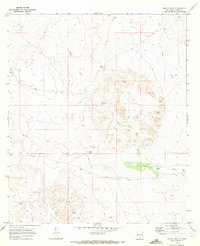
 1976 Mule Peak1980 Print · USGSThe high desert of Otero County is captured in this 1970s orthophoto as rail and road corridors skirt the mountain front. Researchers can trace the development of Omlee and the stark drainage patterns of Mule Canyon and Dog Canyon.
 - 1976 Map of Holloman SW, 1980 Print
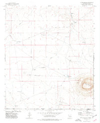
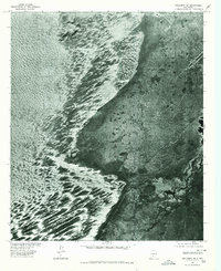 1976 Holloman SW1980 Print · USGSThe stark transition from the white gypsum dunes to the eastern desert scrub is captured during the mid-seventies in Otero County. Researchers can pinpoint specific landmarks like Walters Ranch and the security access at White Sands Gate.
 - 1976 Map of Holloman NE, 1980 Print
 1976 Holloman NE1980 Print · USGSOtero County is captured in detail during the mid-seventies in this aerial orthophotoquad. Researchers can trace the layout of the Mc Natt Ranch and follow the natural drainage patterns of Hay Draw and Arroyo Lavacita.
 - 1976 Map of Tres Hermanos NW, 1980 Print
 1976 Tres Hermanos NW1980 Print · USGSThe Tularosa Basin in the mid-1970s is shown in this detailed orthophotograph of the high desert. Genealogists and historians can trace ranching heritage at White Sands Ranch or examine the geological features of Point of Sands and Twin Buttes.
 - 1976 Map of Holloman SE, 1980 Print
 1976 Holloman SE1980 Print · USGSOtero County's high desert landscape was evolving in the mid-seventies as military aviation expanded across the Tularosa Basin. Trace the structural layout of Holloman Air Force Base, from its intricate runway networks to its specialized desert housing and support facilities.
 - 1976 Map of Alamogordo, 1980 Print
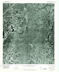
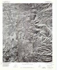 1976 Alamogordo1980 Print · USGSThe high desert plains of Otero County are frozen in the mid-seventies, showing the urban footprint of Alamogordo against the mountain front. Researchers can trace the development of La Luz and the rugged drainage patterns of Dry Canyon and Marble Canyon.
 - 1977 Map of Cloudcroft, 1978 Print
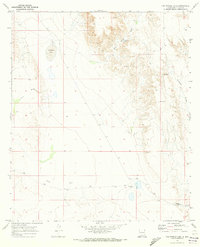
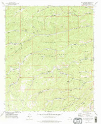
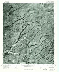
 1977 Cloudcroft1978 Print · USGSCloudcroft and the surrounding high timber of the Sacramento Mountains are detailed here in the late seventies. Researchers can trace family history at Bassi Cem or locate old sites like Russia, Wimsatt, and the Wofford Lookout Tower.
 - 1978 Map of Strychnine Draw
 1978 Strychnine Draw1978 Print · USGSEddy and Chaves counties are mapped in the late seventies, showing a landscape defined by ranching life and deep desert draws. Researchers can locate remote outposts like Strychnine Camp and trace the paths of Buzzard Canyon and Strychnine Draw.
 - 1978 Map of Artesia, 1979 Print
 1978 Artesia1979 Print · USGSThe Pecos River valley in southeastern New Mexico comes alive in the late seventies, showing the intersection of rail-line agriculture and oil-field growth. Trace the path of the Atchison Topeka and Santa Fe through settlements like Dayton, Espuela, and Lakewood near Lake McMillan.
 - 1978 Map of South Taylor Tank, 1979 Print
 1978 South Taylor Tank1979 Print · USGSSoutheastern New Mexico ranchlands are documented here in the late seventies at the border of Chaves and Otero counties. Researchers can trace land use patterns via water catchments like Collier Tank and named drainage systems such as Bear Canyon and Crooked Canyon.
 - 1979 Map of Mack Tanks
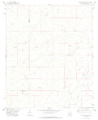
 1979 Mack Tanks1979 Print · USGSOtero County is captured during the late 1970s as a vital desert training landscape within the McGregor Range. Researchers can trace the network of essential water catchments and tactical routes including Mack Tanks, Little Crockett Tank, and various Jeep Trails.
 - 1979 Map of El Paso Gap
 1979 El Paso Gap1979 Print · USGSThe high desert and rugged escarpments of the New Mexico-Texas borderlands are captured here in the late seventies. Genealogists and historians can locate remote outposts like Hughes Ranch, the El Paso Gap Ch, and the high-elevation Guadalupe Mine.
 - 1979 Map of Pickett Hill
 1979 Pickett Hill1979 Print · USGSEddy and Otero counties meet in this 1970s survey of the high desert and canyon lands within the Lincoln National Forest. Genealogists and historians can trace the network of ranching infrastructure through features like Shattuck Well, Pickett Hill, and the dramatic escarpment of The Rim.
 - 1979 Map of Carlsbad
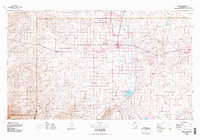
 1979 Carlsbad1979 Print · USGSSoutheast New Mexico is captured here in the late seventies, showing the gateway to the caverns and the fertile Pecos Valley. Genealogists can trace family names near Black River Village or Otis, while collectors will find the Atchison Topeka and Santa Fe rail corridor and Avalon Lake clearly detailed.2 unique versions available
Showing maps 1-25 of 28
Top cities of Otero County
- Alamogordo historical maps
- Tularosa historical maps
- Boles Acres historical maps
- Alamorosa historical maps
- High Rolls historical maps
- Cloudcroft historical maps
See more
Frequently asked questions
- What are the different types of historical maps available for Otero County?
- What is the oldest map of Otero County?
- Where can I purchase historical maps of Otero County for my home or office?
- Where can I download high-res historical maps of Otero County?
- Are there historical topographic maps available for Otero County?
- Is there historical aerial imagery available for Otero County?
- Where are historical maps of Otero County sourced from?