2000s (21st Century) Maps of Otero County, New Mexico
Explore 709 historic maps of Otero County from the 2000s (21st Century). These maps offer a rare glimpse into what life looked like during the 2000s — showing old roads, neighborhoods, homes, and landmarks that have changed or disappeared over time.
Whether you're researching your family's past, planning a metal detecting trip, or studying how Otero County's landscape evolved across the 2000s, these high-resolution maps are a powerful tool for exploring the history of this region.
- Focus on a specific era: All maps on this page are from the 2000s, giving you a focused view of this time period.
- See what’s changed: Compare century-old streets, trails, and buildings to today's modern landscape using overlays and satellite layers.
- Research with precision: Use these maps for genealogy, historical research, land use analysis, or educational projects.
- View, download, or print: Maps are fully viewable online in high resolution, and can be downloaded or printed for your own records.
Start exploring Otero County's history through authentic maps from the 2000s. This is your window into the past.
Otero County, NM maps
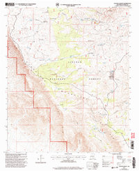
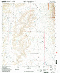
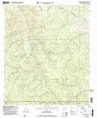
(709)- 2001 Map of Texas Hill, 2003 Print
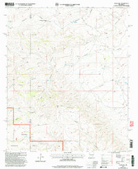 2001 Texas Hill2003 Print · USGSThe ranching and forest lands of Eddy County are captured here just after the turn of the millennium. Local history researchers can trace water sources and ranch sites like Armstrong and Armstrong Ranch, Box Shack Well, and Texas Hill Camp.
 - 2001 Map of Pinon Ranch, 2003 Print
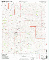
 2001 Pinon Ranch2003 Print · USGSThe ranching country of Chaves County comes into focus at the start of the millennium, showing a landscape defined by water management and isolated homesteads. Researchers can trace the layout of family lands such as Piñon Ranch or Bullis Spring Ranch and locate remote landmarks like Piñon Well.
 - 2001 Map of Packsaddle Canyon, 2003 Print
 2001 Packsaddle Canyon2003 Print · USGSThe southern Guadalupe Mountains of the Lincoln National Forest come into focus during the early 2000s, showing a land of deep canyons and ranching outposts. Researchers can trace the water-management network essential for stock at Antelope Well, Hog Lake, and Panama.
 - 2001 Map of Bullis Spring Ranch, 2003 Print
 2001 Bullis Spring Ranch2003 Print · USGSRanching outposts and high desert water systems are documented in this late-century landscape on the Chaves and Otero county border. Researchers can trace remote homesteads and vital water sources like Bullis Spring Ranch, Peede Ranch, and Sargent Seep.
 - 2001 Map of Pickett Hill, 2003 Print
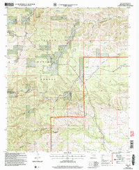
 2001 Pickett Hill2003 Print · USGSEddy and Otero Counties are captured here at the start of the new millennium, showing a landscape defined by ranching and national forest management. Researchers can locate remote water infrastructure and historic corrals like Middleton Well Storage Tank Corral, Thayer Well, and the Pickett Hill Communication Facility.
 - 2001 Map of La Paloma Canyon, 2003 Print
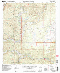
 2001 La Paloma Canyon2003 Print · USGSThe Brokeoff Mountains in Otero County come into sharp focus at the start of the millennium, showing a landscape defined by ranching and high-desert hydrology. Researchers can trace land use through remote landmarks like Hepler Ranch and water sources like La Paloma Tank and Rock Tank.
 - 2001 Map of Panama Ranch, 2003 Print
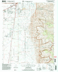
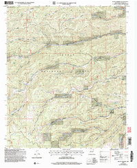
 2001 Panama Ranch2003 Print · USGSNew Mexico's high-desert ranching country is captured here at the turn of the millennium, centered on the Guadalupe Mountains and The Rim. Researchers can trace early water infrastructure and family-named landmarks like Panama Ranch, Jones Farm Tank, and Sargent Well.
 - 2001 Map of El Paso Gap, 2003 Print
 2001 El Paso Gap2003 Print · USGSThe rugged New Mexico-Texas borderlands are mapped here at the turn of the millennium as federal forest and park lands meet at The Rim. Genealogists and historians can trace desert ranching life through Hughes Ranch, the Cem, and the El Paso Gap Ch.
 - 2001 Map of Gowdy Ranch, 2003 Print
 2001 Gowdy Ranch2003 Print · USGSThe Otero County backcountry at the turn of the millennium shows the intersection of desert ranching and protected forest lands. Researchers can trace the water sources and trail networks connecting Gowdy Ranch and Rauch Ranch across the Crow Flats.
 - 2001 Map of Ares Peak, 2003 Print
 2001 Ares Peak2003 Print · USGSEddy County ranching lands and National Forest territory are captured here at the turn of the millennium. Local history researchers can trace the water infrastructure and peaks that defined this landscape, from National Ranch and Ares Peak to the various watering sites like Montgomery Tank.
 - 2001 Map of Algerita Canyon, 2003 Print
 2001 Algerita Canyon2003 Print · USGSThe Lincoln National Forest at the turn of the twenty-first century reveals a landscape of high ridges and desert basins. Trace the water management network through Coon Dog Well Storage Tank, Indian Creek, and the depths of Big Dog Canyon.
 - 2001 Map of Tanner Ranch, 2003 Print
 2001 Tanner Ranch2003 Print · USGSOtero County ranching culture and the high desert of the Sacramento Mountains are detailed here at the turn of the millennium. Researchers can locate specific family outposts like the Jernigan Homestead and Tanner Ranch or trace water sources like Piñon Wash.
 - 2001 Map of South Taylor Tank, 2003 Print
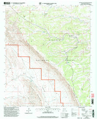
 2001 South Taylor Tank2003 Print · USGSChaves and Otero counties are mapped at the turn of the millennium, showing the remote high-desert terrain within the Lincoln National Forest. Researchers can trace old ranching infrastructure and forest access routes like Bronc Road, South Taylor Tank, and Sargent Canyon.
 - 2004 Map of Mescalero, 2006 Print
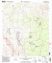
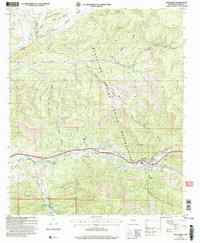 2004 Mescalero2006 Print · USGSThe Mescalero Apache Indian Reservation is documented here in the early 2000s, showing the intersection of tribal lands and the Lincoln National Forest. Researchers can identify local landmarks like the Ceremonial Ground, Blazers Cem, and the old Fish Hatchery near the Tularosa Creek.
 - 2004 Map of Ruidoso Downs, 2006 Print
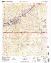 2004 Ruidoso Downs2006 Print · USGSRuidoso Downs and the Sierra Blanca foothills are captured in the early 2000s, showing the town's development near the tribal boundary. Local researchers can trace family roots at Stetson Cem or locate landmarks like the Ruidoso Downs Race Track.
 - 2004 Map of Alamogordo South, 2006 Print
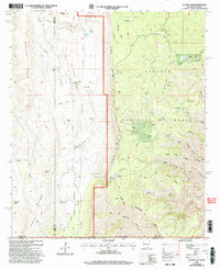
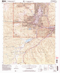
 2004 Alamogordo South2006 Print · USGSAlamogordo expanded toward the Sacramento Mountains at the start of the new millennium, balancing urban growth with the surrounding desert landscape. Historians can trace the city’s early 2000s boundaries and the infrastructure supporting Alamogordo as it borders the national forest.
 - 2004 Map of Ruidoso, 2006 Print
 2004 Ruidoso2006 Print · USGSThe mountain town of Ruidoso and its surrounding canyons are captured here during a period of sustained growth in the early 2000s. Genealogists and local historians can trace the development of Hollywood and Ruidoso Downs or locate the Forest Lawn Cem and the Inn of the Mountain Gods.
 - 2004 Map of Bug Scuffle Canyon, 2006 Print
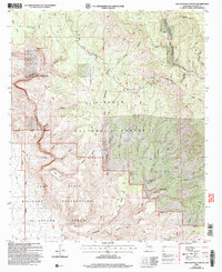 2004 Bug Scuffle Canyon2006 Print · USGSThe Sacramento Mountains meet military territory in the early 2000s, where national forest land borders the McGregor Range. Researchers can trace historic land use through sites like Bug Scuffle Ranch, the Sacramento Lookout, and the remote Langford Trail.
 - 2004 Map of El Paso Canyon, 2006 Print
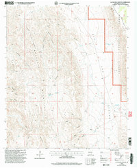
 2004 El Paso Canyon2006 Print · USGSOtero County highland terrain meets restricted military lands in the early 2000s where the forest transitions into the desert. Trace the remote settlement of Timberon and navigate the high-country drainages of El Paso Canyon and the Sacramento River.
 - 2004 Map of Alamogordo North, 2006 Print
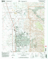 2004 Alamogordo North2006 Print · USGSThe Tularosa Basin and the Sacramento Mountain foothills meet in this 2004 survey of the Alamogordo area. Researchers can trace the development of civic institutions like the Museum of Space History and historic settlements like La Luz.
 - 2004 Map of Firman Canyon, 2006 Print
 2004 Firman Canyon2006 Print · USGSOtero County's high-country canyons and Apache reservation lands are detailed in this mid-2000s survey. Researchers can trace the pathways between remote landmarks like Red Cabin, Shields Dam, and numerous springs such as Silver Springs.
 - 2004 Map of Avis, 2006 Print
 2004 Avis2006 Print · USGSHigh-desert canyon country in Otero County is captured here in the early 2000s, showing the intersection of National Forest lands and rural ranching life. Researchers can locate family landmarks like Avis Cem and Piñon Cem or trace the routes through Dog Canyon and Barclay Draw.
 - 2004 Map of Angus, 2006 Print
 2004 Angus2006 Print · USGSLincoln County in the early 2000s showcases a landscape where alpine wilderness meets growing mountain communities. Researchers can trace the development of Sun Valley and Alpine Village alongside landmark sites like Villa Madonna and the high peaks of the White Mountain Wilderness.
 - 2004 Map of Woodson Canyon, 2006 Print
 2004 Woodson Canyon2006 Print · USGSOtero County's high forest canyons are documented here as they appeared in the early 2000s, reflecting a legacy of ranching and remote mountain life. Researchers can find old burial grounds like Lusk Cem, isolated landmarks like Schoolhouse Tank, and the winding course of Agua Chiquita Creek.
 - 2004 Map of Bluff Springs, 2006 Print
 2004 Bluff Springs2006 Print · USGSOtero County's high forest interior is captured here in the early 2000s, showing a landscape defined by seasonal springs and deep mountain drainages. Researchers can locate established sites like Camp Wehinahpay or trace the geography of Benson Ridge and Rio Penasco.
Showing maps 1-25 of 709
Top cities of Otero County
- Alamogordo historical maps
- Tularosa historical maps
- Boles Acres historical maps
- Alamorosa historical maps
- High Rolls historical maps
- Cloudcroft historical maps
See more
Frequently asked questions
- What are the different types of historical maps available for Otero County?
- What is the oldest map of Otero County?
- Where can I purchase historical maps of Otero County for my home or office?
- Where can I download high-res historical maps of Otero County?
- Are there historical topographic maps available for Otero County?
- Is there historical aerial imagery available for Otero County?
- Where are historical maps of Otero County sourced from?