1970s Maps of Union County, New Mexico
Explore 69 historic maps of Union County from the 1970s. These maps offer a rare glimpse into what life looked like during the 1970s — showing old roads, neighborhoods, homes, and landmarks that have changed or disappeared over time.
Whether you're researching your family's past, planning a metal detecting trip, or studying how Union County's landscape evolved across the 1970s, these high-resolution maps are a powerful tool for exploring the history of this region.
- Focus on a specific era: All maps on this page are from the 1970s, giving you a focused view of this time period.
- See what’s changed: Compare century-old streets, trails, and buildings to today's modern landscape using overlays and satellite layers.
- Research with precision: Use these maps for genealogy, historical research, land use analysis, or educational projects.
- View, download, or print: Maps are fully viewable online in high resolution, and can be downloaded or printed for your own records.
Start exploring Union County's history through authentic maps from the 1970s. This is your window into the past.
Union County, NM maps
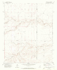
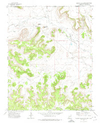
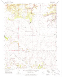
(69)- 1970 Map of Stead, 1973 Print
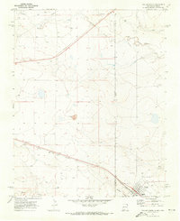
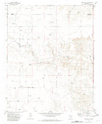
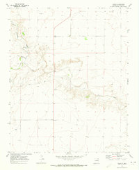 1970 Stead1973 Print · USGSUnion County rangeland meets the Texas border in the early 1970s, showing a landscape of high plains and deep creek draws. Genealogists and local historians can locate rural outposts like Stead and Sparlin situated along the winding Tramperos Creek.
 - 1970 Map of Texline South, 1973 Print
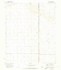
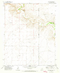
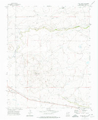
 1970 Texline South1973 Print · USGSThe high plains of the New Mexico and Texas border come alive in this early 1970s survey of the railroad town of Texline. Genealogists and researchers can trace rural infrastructure along the Fort Worth and Denver rail line, Perico Creek, and Carrizo Creek.
 - 1970 Map of Clayton, 1973 Print
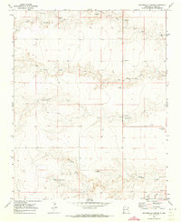
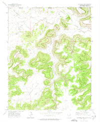
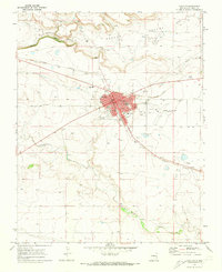 1970 Clayton1973 Print · USGSClayton thrived as a high-plains transportation and agricultural center during the early 1970s. Genealogists and local historians can trace the town's development through landmarks like Alvis School, the Clayton Cemetery, and the Fairground.
 - 1970 Map of Clayton SW, 1973 Print
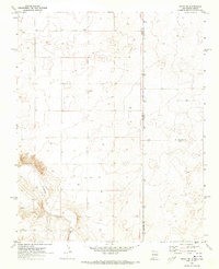
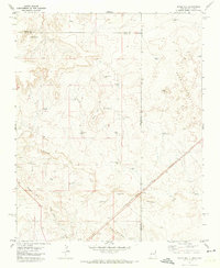
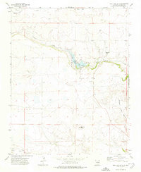
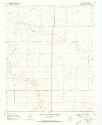 1970 Clayton SW1973 Print · USGSUnion County ranching country and the high plains of New Mexico are captured here just as the 1970s began. Researchers can trace the winding path of Carrizo Creek and locate local landmarks such as the Rardin settlement and Sand Draw.
 - 1970 Map of Texline North, 1973 Print
 1970 Texline North1973 Print · USGSThe high plains borderland at the New Mexico and Texas line is captured here in the early seventies as a hub of rail and ranching life. Researchers can trace the junction of the Ft Worth and Denver railroad near Texline and locate local landmarks like the Rodeo Ground and Worsham.
 - 1970 Map of Sedan, 1973 Print
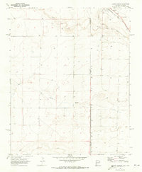
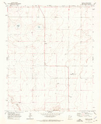
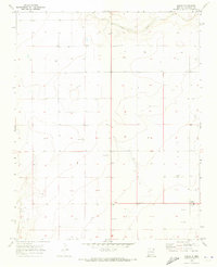 1970 Sedan1973 Print · USGSUnion County ranching country is captured here during the 1970s, showing the precise layout of local land divisions and drainage. Researchers can trace family-named sites like Hopson, locate the Sedan Cem, and follow the paths of Carrizo Creek and Pinabetes Creek.
 - 1970 Map of Sedan SE, 1973 Print
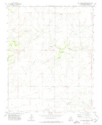
 1970 Sedan SE1973 Print · USGSThe high plains along the border of New Mexico and Texas are captured here during the 1970 field check. Researchers can locate the isolated Shaha Cem and trace the path of Tramperos Creek across the county lines of Union, Dallam, and Hartley.
 - 1970 Map of Sedan NE, 1973 Print
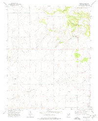
 1970 Sedan NE1973 Print · USGSThe high plains of the New Mexico and Texas border come into focus in the early 1970s, showing a landscape defined by ranching and water management. Researchers can trace the settlement at Campsey and follow the path of Carrizo Creek past numerous remote wells.2 unique versions available
 - 1971 Map of Kerlin Hill, 1972 Print
 1971 Kerlin Hill1972 Print · USGSEastern New Mexico ranching country is documented here in the early seventies, spanning the border between Union and Quay counties. Researchers can trace family-named water sources like North Gregg Well and Laycock Well near the Egerton Ranch.2 unique versions available
 - 1971 Map of Koger Ranch, 1973 Print
 1971 Koger Ranch1973 Print · USGSThe high-plains ranching country along the New Mexico and Texas border comes into focus in the early seventies. Genealogists and historians can trace essential water sources and family-named landmarks like Koger Ranch, Daughty Well, and the fishing spots at Bass Hole.
 - 1971 Map of Centerville Corner, 1973 Print
 1971 Centerville Corner1973 Print · USGSRanching life in Union County is captured here in the early seventies, detailing a landscape defined by its vital water sources and remote outposts. Genealogists and historians can trace family-named landmarks like Copeland Ranch, Fairmount Cem, and Jim Well.
 - 1971 Map of Doyle Hill, 1973 Print
 1971 Doyle Hill1973 Print · USGSThe high plains of the New Mexico-Texas border come into focus in the early seventies, showing a ranching landscape tied to the railroad. Genealogists and historians can trace family-named water sources like Patterson Well or Millican Well and locate isolated landmarks such as the Grave near the SAND HILLS.
 - 1971 Map of Amistad SE, 1973 Print
 1971 Amistad SE1973 Print · USGSHigh plains ranching life at the New Mexico and Texas border comes into focus in the early 1970s. Trace old family water sources like Poteet Well and Whatley Well near the small settlement of Centerville.
 - 1971 Map of Amistad, 1973 Print
 1971 Amistad1973 Print · USGSUnion County ranching and settlement patterns come into focus during the early 1970s. Genealogists and local historians can locate Amistad, its namesake Amistad Cem, and family-named water sources like Cain Ranch and Ellis Well.
 - 1971 Map of Trinchera Pass, 1974 Print
 1971 Trinchera Pass1974 Print · USGSThe high mesa country of the Colorado-New Mexico border is captured here in the early 1970s. Genealogists and local historians can trace the remote Pacheco Cem and landmarks like Trinchera Pass and the Folsom State Monument.
 - 1971 Map of Kiowa, 1974 Print
 1971 Kiowa1974 Print · USGSColfax and Union Counties are captured in the early seventies, showing a landscape of volcanic craters and cattle-country flats. Researchers can trace the Fort Union Road, find the Mountain View Cem, or locate historic Old Railroad Grades.
 - 1971 Map of Robinson Peak, 1974 Print
 1971 Robinson Peak1974 Print · USGSColfax County in the early 1970s was a landscape of high basalt mesas and volcanic peaks where ranching and rail history met. Researchers can trace the Old Railroad Grade, locate the isolated † Grave, and find family-named landmarks like Griego Mesa.
 - 1971 Map of Palo Blanco Mountain, 1974 Print
 1971 Palo Blanco Mountain1974 Print · USGSColfax County ranching country is captured here in the early seventies, showing a landscape shaped by volcanic peaks and seasonal water. Genealogists and historians can locate the Palo Blanco Church, the settlement of Maverick, and family-named sites like Barela Lake.
 - 1972 Map of Seneca, 1974 Print
 1972 Seneca1974 Print · USGSNortheastern New Mexico's high plains are captured in the early seventies, dominated by the path of the historic Cimarron Route. Historians and genealogists can trace the Santa Fe Trail (Cimarron Cutoff) as it passes Lookout Hill and the settlement of Seneca.
 - 1972 Map of Mc Laughlin Bridge, 1974 Print
 1972 Mc Laughlin Bridge1974 Print · USGSUnion County's high plains in the 1970s reveal a landscape still defined by its historic transit corridors and water sources. Trace the path of the Santa Fe Trail and find local landmarks like Grandview Cem and McLaughlin Bridge.
 - 1972 Map of Wedding Cake Butte, 1974 Print
 1972 Wedding Cake Butte1974 Print · USGSThe high mesa country of the New Mexico panhandle comes alive in the early 1970s, showcasing the isolated ranching outposts along the Colorado border. Trace family history and old homesteads near Sloan, Bontz, and the irrigation works of the South Beheimer Ditch.
 - 1972 Map of Mount Dora, 1974 Print
 1972 Mount Dora1974 Print · USGSUnion County, New Mexico, appears here in the early 1970s, defined by the intersection of historic trails and modern ranching. Genealogists and historians can trace the Santa Fe Trail (Cimarron Cutoff), the Colorado and Southern railroad, and landmarks like the Price Ranch.
 - 1972 Map of Travesser Park, 1974 Print
 1972 Travesser Park1974 Print · USGSThe New Mexico and Colorado borderlands appear as a complex network of canyons and mesas during the early 1970s. Researchers can trace remote ranching infrastructure and natural landmarks like Jesus Mesa, the Cimarron River, and the Landing Strip at Travesser Park.2 unique versions available
 - 1972 Map of Bible Top Butte, 1974 Print
 1972 Bible Top Butte1974 Print · USGSUnion County, New Mexico, appears in the early 1970s as a high plains landscape shaped by historic transit and modern recreation. Researchers can trace the path of the Santa Fe Trail (Cimarron Cutoff) and locate local landmarks like Bible Top Butte and the Spring Hill School.
 - 1972 Map of Guy, 1974 Print
 1972 Guy1974 Print · USGSHigh plains ranching and remote settlement in Union County are documented in the early seventies, centered on the community of Guy. Genealogists and historians can trace family locations near the Rivera Cem, Padilla Cem, and Miller Gap.
Showing maps 1-25 of 69
Top cities of Union County
Frequently asked questions
- What are the different types of historical maps available for Union County?
- What is the oldest map of Union County?
- Where can I purchase historical maps of Union County for my home or office?
- Where can I download high-res historical maps of Union County?
- Are there historical topographic maps available for Union County?
- Is there historical aerial imagery available for Union County?
- Where are historical maps of Union County sourced from?