2020s Maps of Hoosick, New York
Explore 5 historic maps of Hoosick from the 2020s. These maps offer a rare glimpse into what life looked like during the 2020s — showing old roads, neighborhoods, homes, and landmarks that have changed or disappeared over time.
Whether you're researching your family's past, planning a metal detecting trip, or studying how Hoosick's landscape evolved across the 2020s, these high-resolution maps are a powerful tool for exploring the history of this region.
- Focus on a specific era: All maps on this page are from the 2020s, giving you a focused view of this time period.
- See what’s changed: Compare century-old streets, trails, and buildings to today's modern landscape using overlays and satellite layers.
- Research with precision: Use these maps for genealogy, historical research, land use analysis, or educational projects.
- View, download, or print: Maps are fully viewable online in high resolution, and can be downloaded or printed for your own records.
Start exploring Hoosick's history through authentic maps from the 2020s. This is your window into the past.
Hoosick, NY maps
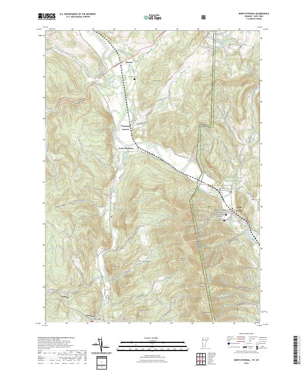
(5)- 2021 Map of North Pownal, 2021 Print
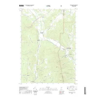 2021 North Pownal2021 Print · USGSCovers Hoosick, including Bennington, Pownal, and other nearby areas
 - 2023 Map of Grafton, 2023 Print
 2023 Grafton2023 Print · USGSRensselaer County’s upland pond and forest country is detailed here, showing the region as it appeared in the early 2020s. Researchers can trace the layout of Grafton Lakes State Park or locate family sites near Warren Cem and Pittstown.
 - 2023 Map of Hoosick Falls, 2023 Print
 2023 Hoosick Falls2023 Print · USGSThe New York and Vermont border country comes alive in this survey of the river valleys north of Hoosick Falls. Genealogists can trace family names at Maple Grove Cem or Kingsley Cem while following the path of the Pan Am Southern rail line.
 - 2023 Map of Eagle Bridge, 2023 Print
 2023 Eagle Bridge2023 Print · USGSRensselaer and Washington counties meet along the Hoosic River in the early twenty-first century, showing a landscape shaped by water and hills. Trace family roots and old land ties near Eagle Bridge, Buskirk, and the West Hoosick Rural Cem.
 - 2024 Map of North Pownal, 2024 Print
 2024 North Pownal2024 Print · USGSThe borderlands of New York and Vermont are captured here in a moment defined by the steep valleys of the Taconic Range. Family historians can locate several specific burial grounds such as the Edgar Rathburn Farm Cem and Hoosick Cem near the winding Hoosic River.
End of results
Showing maps 1-5 of 5
Top cities near Hoosick
- North Adams historical maps
- Brunswick historical maps
- Stillwater historical maps
- Bennington historical maps
- Sand Lake historical maps
- Williamstown historical maps
See more
Top neighborhoods of Hoosick
- Buskirk historical maps
- Mapletown historical maps
- North Hoosick historical maps
- Walloomsac historical maps
- Eagle Bridge historical maps
- East Buskirk historical maps
See more
Frequently asked questions
- What are the different types of historical maps available for Hoosick?
- What is the oldest map of Hoosick?
- Where can I purchase historical maps of Hoosick for my home or office?
- Where can I download high-res historical maps of Hoosick?
- Are there historical topographic maps available for Hoosick?
- Is there historical aerial imagery available for Hoosick?
- Where are historical maps of Hoosick sourced from?