Old Maps of Sampson County, North Carolina for Metal Detecting
Plan your next treasure hunt with 192 historic maps of Sampson County. Find old homesites, ghost towns, trails, and gathering spots that may be lost to time — perfect for identifying promising metal detecting locations.
- Locate forgotten sites: Uncover places like long-lost settlements, abandoned rail lines, or gathering spots.
- Plan better hunts: Use map overlays combined with LiDAR or satellite views to narrow in on historically rich areas.
- Made for detectorists: Thousands of hobbyists use these maps to discover relics, coins, and hidden history.
Use these historic maps to boost your research and find new opportunities beneath the surface of Sampson County.
Sampson County, NC maps
(192)- 1906 Map of Four Oaks
 1906 Four Oaks1906 Print · USGSCoastal plain farming and river commerce define Johnston County at the turn of the century. Genealogists can locate family landmarks like Tarts Store and Bentonville (Beasley PO), alongside historic river crossings at Pierce's Ferry.
 - 1908 Map of Four Oaks
 1908 Four Oaks1908 Print · USGSJohnston County’s agrarian landscape is captured here in the years following the turn of the century, centered on the rail commerce of Four Oaks. Researchers can trace the heritage of local families through landmarks like Peacocks Crossroads, Lees Mill, and Wentworth School.3 unique versions available
 - 1909 Map of Coharie
 1909 Coharie1909 Print · USGSSampson County at the turn of the century is a landscape of creek-side millponds and rural crossroads. Genealogists can trace family roots through numerous local landmarks like Owen Grove Church, Wilsons Store, and Enterprise School.3 unique versions available
 - 1953 Map of Florence, 1964 Print
 1953 Florence1964 Print · USGSThe Carolina borderlands in the mid-fifties were a landscape of vast river swamps and rising rail towns. Trace the legacy of the Seaboard Air Line through Florence or explore the wetlands surrounding Lake Waccamaw and the Green Swamp.3 unique versions available
 - 1953 Map of Raleigh, 1965 Print
 1953 Raleigh1965 Print · USGSCentral North Carolina in the early sixties shows a landscape of growing towns and military hubs before the full expansion of the interstate system. Genealogists can trace family footprints across the Piedmont through Wake Forest, Siler City, and the large Fort Bragg Military Reservation.4 unique versions available
 - 1954 Map of Florence
 1954 Florence1954 Print · USGSThe Carolinas borderlands come alive in the early fifties, showing the vital rail-and-river networks of the coastal plain. Genealogists can trace family footprints across the Green Swamp or through settlements like Red Springs, Chadbourn, and McColl.
 - 1954 Map of Raleigh
 1954 Raleigh1954 Print · USGSThe North Carolina Piedmont and Sandhills are captured in the mid-fifties during a period of steady regional growth. Genealogists and historians can trace the development of towns like Siler City or locate landmarks such as Falls of Neuse and Camp Mackall.
 - 1954 Map of White Lake, 1956 Print
 1954 White Lake1956 Print · USGSCoastal Bladen and Sampson counties are shown here in the mid-fifties, dominated by the unique elliptical depressions of the Carolina Bays. Family researchers can locate remote landmarks like Kates Chapel Cem, Smith Crossroads, and the various landings along the Cape Fear River.
 - 1955 Map of Atkinson, 1957 Print
 1955 Atkinson1957 Print · USGSCoastal plain life in the mid-1950s revolves around the timberlands and rail-stops between the Black River and Moores Creek. Genealogists and historians can trace family ties through dozens of rural landmarks like Newtons Crossroads, St. Marys Ch, and Bland High Sch.2 unique versions available
 - 1959 Map of Roseboro, 1960 Print
 1959 Roseboro1960 Print · USGSSampson and Bladen Counties appear here in the late fifties, showcasing a unique geography of elliptical bays and vast swamps. Local historians can locate the Cedar Grove Lookout Tower, trace the railroad through Roseboro, or find family sites near Dove Chapel and Simmons Mill Pond.2 unique versions available
 - 1959 Map of Garland, 1960 Print
 1959 Garland1960 Print · USGSSampson County at the end of the fifties shows a rural landscape of small townships and vital rail connections along the Atlantic Coast Line. Genealogists can locate family-named landmarks and country crossroads such as Butlers Crossroads, Andrews Chapel, and Elizabeth Ch.2 unique versions available
 - 1962 Map of Rose Hill, 1964 Print
 1962 Rose Hill1964 Print · USGSCoastal plain life in the early sixties centers on the rail-aligned towns of Rose Hill and Warsaw. Genealogists and local historians can locate dozens of country churches and schools, from Holly Grove Ch to the Williams Sch, alongside the Rose Hill Speedway.
 - 1973 Map of Dunn, 1975 Print
 1973 Dunn1975 Print · USGSDunn and Benson were thriving railroad and agricultural hubs in the early 1970s. Genealogists and local historians can trace family church roots at Jonesboro Ch and Mingo Hill Ch or locate landmarks like the Young Lookout Tower.2 unique versions available
 - 1974 Map of Salemburg, 1977 Print
 1974 Salemburg1977 Print · USGSSampson County in the mid-1970s reveals a landscape of rural crossroads and intricate swamp networks. Researchers can trace the communities of Salemburg and Rebel City, locating landmarks like Clement Sch, Crumpler Millpond, and numerous family burial sites.
 - 1974 Map of Wade, 1977 Print
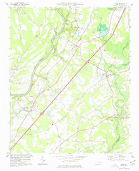 1974 Wade1977 Print · USGSCumberland County communities like Wade and Godwin are shown in the mid-1970s as they balanced rural tradition with expanding transit corridors. Genealogists and local historians can trace family locations through numerous rural landmarks, including Westminster Cem, Spring Hill Ch, and the Averasboro Battleground Monument.2 unique versions available
 - 1974 Map of Stedman, 1977 Print
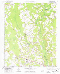 1974 Stedman1977 Print · USGSCumberland County’s coastal plain landscape is captured here in the mid-1970s, as rural communities thrived along the South River and the rail line. Researchers can trace family roots through numerous sites like Bethany Crossroads, Fisher Cem, and Magnolia Ch.2 unique versions available
 - 1974 Map of Mingo, 1977 Print
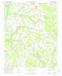 1974 Mingo1977 Print · USGSSampson County's rural landscape is mapped here in the mid-seventies, showing a community defined by its sprawling swamp basins and country churches. Genealogists can trace family landmarks like Naylor Cem, Jackson Cem, and the Tart Millpond near the settlement of Mingo.
 - 1975 Map of Faison, 1977 Print
 1975 Faison1977 Print · USGSThe coastal plain of North Carolina is captured here in the mid-seventies, showing the intersection of the Seaboard Coast Line and rural farming life. Genealogists can locate family landmarks like Millers Chapel, Hargrove Sch, and dozens of unnamed rural cemeteries near Faison.
 - 1978 Map of Dobbersville
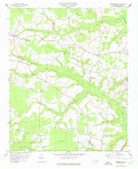 1978 Dobbersville1978 Print · USGSSampson County and the surrounding tri-county area are shown in the late 1970s, characterized by rural settlements and expansive swamp systems. Genealogists can trace family connections through numerous country churches like Brownings Ch and Goshen Ch or locate homes near Suttontown.
 - 1982 Map of Elizabethtown, 1983 Print
 1982 Elizabethtown1983 Print · USGSSoutheastern North Carolina's coastal plain is captured here in the early eighties, showcasing a landscape defined by the Cape Fear River and mysterious Carolina Bays. Genealogists and researchers can trace the rail network of the Seaboard Coast Line through rural communities like Autryville, Ivanhoe, and the recreational hub of White Lake.
 - 1984 Map of Harrells
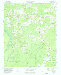 1984 Harrells1984 Print · USGSSampson County settlement patterns in the early eighties are anchored by the rural community of Harrells. Genealogists and historians can trace family roots through numerous sites like Iron Mine Burial Park, Bland Sch, and the Melvin Cem.
 - 1984 Map of Delway
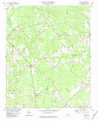 1984 Delway1984 Print · USGSCoastal Plain landscapes along the Sampson and Duplin county line are shown in the early eighties, revealing a world of isolated crossroads and bay pocosins. Trace family roots at Evergreen Cem and Merritt Mem Cem, or locate landmarks like Taylors Bridge and the unique Pig In Bay.
 - 1984 Map of Turkey
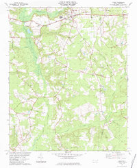 1984 Turkey1984 Print · USGSCoastal plain settlements in Sampson County are mapped here in the early eighties, showing a landscape shaped by the SEABOARD rail line and numerous creek branches. Researchers can trace rural church history and family sites at St Stephens Ch, Piney Grove Ch, and Moltonville.
 - 1984 Map of Atkinson
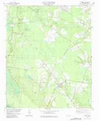 1984 Atkinson1984 Print · USGSThe town of Atkinson and the Black River bottomlands are captured here in the early 1980s, revealing a landscape of family-run farms and vast bay-swamp geography. Researchers can trace local history through sites like New Zion Ch, Atkinson Cem, and the old Railroad Grade.
 - 1984 Map of Wallace West
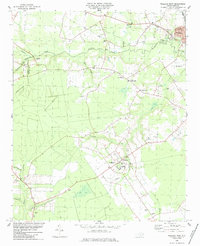 1984 Wallace West1984 Print · USGSIn the 1980s, the Pender County countryside reflected a mix of New Deal planning and deep-rooted family history. Trace the layout of Penderlea or locate family sites like Alderman Cem and Newkirk Chapel along the Rockfish Creek basin.
Showing maps 1-25 of 192
Top cities of Sampson County
- Clinton historical maps
- Roseboro historical maps
- Newton Grove historical maps
- Keener historical maps
- Salemburg historical maps
- Delway historical maps
See more
Frequently asked questions
- What are the different types of historical maps available for Sampson County?
- What is the oldest map of Sampson County?
- Where can I purchase historical maps of Sampson County for my home or office?
- Where can I download high-res historical maps of Sampson County?
- Are there historical topographic maps available for Sampson County?
- Is there historical aerial imagery available for Sampson County?
- Where are historical maps of Sampson County sourced from?