Old Maps of Wayne County, North Carolina for Hiking & Exploration
Hike through history with 126 historic maps of Wayne County. Explore old trails, ghost towns, and forgotten backroads — perfect for outdoor adventurers and local explorers.
- Rediscover forgotten places: Map out old mining camps, roads, and footpaths that no longer exist on modern maps.
- Layer with modern tools: Combine with LiDAR or satellite views to plan hikes through historical terrain.
- Made for exploration: Popular among hikers, overlanders, and local history lovers.
Use these maps to find adventure and explore the hidden past of Wayne County.
Wayne County, NC maps
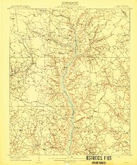
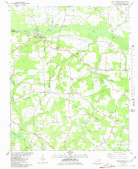
(126)- 1902 Map of Kenly
 1902 Kenly1902 Print · USGSCoastal plain settlements in Johnston and Wilson Counties flourished along the rail lines during the early nineteen-hundreds. Genealogists can locate family landmarks like Moores Crossroads and Hares Crossroads or trace the Atlantic Coast Line through Kenly and Micro.2 unique versions available
 - 1903 Map of Kenly
 1903 Kenly1903 Print · USGSCoastal plain settlements and crossroads thrive along the rail corridors of Johnston and Wilson counties at the dawn of the twentieth century. Genealogists can locate family-named sites like Hornes Mill and Barnes Store or trace the early paths through Beulahtown and Kenly.2 unique versions available
 - 1904 Map of Wilson, 1942 Print
 1904 Wilson1942 Print · USGSCoastal plain settlements and tobacco-country rail lines emerge in this turn-of-the-century look at eastern North Carolina. Genealogists and historians can trace the early footprints of Wilson, Stantonsburg, and Eureka alongside the Atlantic Coast Line railroad.3 unique versions available
 - 1906 Map of Four Oaks
 1906 Four Oaks1906 Print · USGSCoastal plain farming and river commerce define Johnston County at the turn of the century. Genealogists can locate family landmarks like Tarts Store and Bentonville (Beasley PO), alongside historic river crossings at Pierce's Ferry.
 - 1908 Map of Four Oaks
 1908 Four Oaks1908 Print · USGSJohnston County’s agrarian landscape is captured here in the years following the turn of the century, centered on the rail commerce of Four Oaks. Researchers can trace the heritage of local families through landmarks like Peacocks Crossroads, Lees Mill, and Wentworth School.3 unique versions available
 - 1909 Map of Coharie
 1909 Coharie1909 Print · USGSSampson County at the turn of the century is a landscape of creek-side millponds and rural crossroads. Genealogists can trace family roots through numerous local landmarks like Owen Grove Church, Wilsons Store, and Enterprise School.3 unique versions available
 - 1953 Map of Rocky Mount, 1964 Print
 1953 Rocky Mount1964 Print · USGSEastern North Carolina in the mid-fifties is defined by its deep river basins and the vast wetlands of the Tidewater. Genealogists can trace family roots through hubs like Kinston and New Bern or explore the wilderness of Pettigrew State Park and Lake Mattamuskeet.4 unique versions available
 - 1953 Map of Raleigh, 1965 Print
 1953 Raleigh1965 Print · USGSCentral North Carolina in the early sixties shows a landscape of growing towns and military hubs before the full expansion of the interstate system. Genealogists can trace family footprints across the Piedmont through Wake Forest, Siler City, and the large Fort Bragg Military Reservation.4 unique versions available
 - 1954 Map of Rocky Mount
 1954 Rocky Mount1954 Print · USGSEastern North Carolina is mapped in the mid-fifties, showing a landscape of sounds, swamps, and steam-era rail lines. Genealogists can trace the rural road networks and rail spurs connecting towns like Tarboro, Greenville, and the remote Columbia.
 - 1954 Map of Raleigh
 1954 Raleigh1954 Print · USGSThe North Carolina Piedmont and Sandhills are captured in the mid-fifties during a period of steady regional growth. Genealogists and historians can trace the development of towns like Siler City or locate landmarks such as Falls of Neuse and Camp Mackall.
 - 1957 Map of Goldsboro, 1958 Print
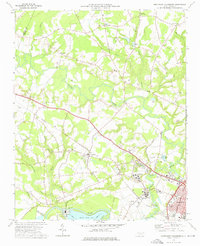
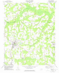
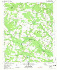
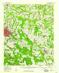 1957 Goldsboro1958 Print · USGSGoldsboro and the surrounding tobacco and timber lands are captured here in the mid-fifties as the local rail network and military presence shaped Wayne County. Genealogists can locate family landmarks like Old Smoky Cem, Garris Chapel, and Mays Store across the rural landscape.2 unique versions available
 - 1957 Map of Seven Springs, 1959 Print
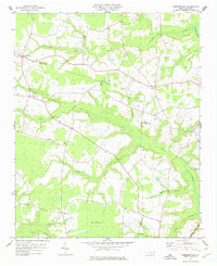
 1957 Seven Springs1959 Print · USGSEastern North Carolina was a patchwork of crossroads communities and swampy river bottoms in the late fifties. Genealogists can locate family-named landmarks like Williams Millpond, trace rural congregations at Indian Springs, and find old centers like Scotts Store.
 - 1974 Map of Grantham, 1976 Print
 1974 Grantham1976 Print · USGSWestern Wayne County in the mid-seventies is a landscape of winding creeks and rural crossroads. Local historians can trace established community centers like Grantham, Stevens Mill, and numerous country churches including Selah Ch and Bethany Ch.
 - 1974 Map of Northwest Goldsboro, 1976 Print
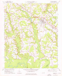
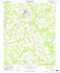
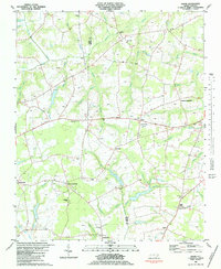
 1974 Northwest Goldsboro1976 Print · USGSWayne County just west of Goldsboro in the mid-1970s reveals a landscape of expanding institutional campuses and rural crossroads. Local historians can trace the grounds of CHERRY HOSPITAL, the community at Rosewood, and family landmarks like Spring Hill Ch.2 unique versions available
 - 1974 Map of Princeton, 1976 Print
 1974 Princeton1976 Print · USGSNear the Johnston and Wayne county line in the mid-1970s, this area centers on the railroad town of Princeton and its surrounding wetlands. Local historians can locate numerous rural landmarks like Bakers Chapel, Raynor Town, and Bizzell Grove Memorial Gardens.
 - 1974 Map of Southwest Goldsboro, 1976 Print
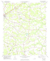
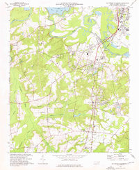 1974 Southwest Goldsboro1976 Print · USGSWayne County in the mid-seventies is a landscape of river-bottom swamps and growing rural towns along the rail lines. Genealogists can trace family landmarks and congregations from Dudley up to Genoa, including St Matthews Ch, Augusta Ch, and the Wayne Mem Park.2 unique versions available
 - 1977 Map of Mount Olive
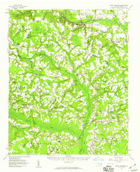
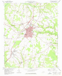 1977 Mount Olive1977 Print · USGSMount Olive and the surrounding Wayne County farmlands are seen here in the late seventies as the region's rail and educational centers expanded. Genealogists can trace family landmarks and numerous rural congregations like Rones Chapel, Mt Gilead Ch, and Maplewood Cem.
 - 1978 Map of Fremont
 1978 Fremont1978 Print · USGSFremont and the surrounding Wayne County wetlands are shown in detail during the late seventies as the region maintained its rural character. Researchers can trace family roots at New Daniels Chapel, Mt Nelson Ch, and the schools of Norwayne Sch and Aycock High Sch.
 - 1978 Map of Stantonsburg
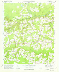
 1978 Stantonsburg1978 Print · USGSStantonsburg and the rural crossroads of Wilson and Wayne counties are captured in the late 1970s before modern development. Genealogists and historians can trace family-named sites like Applewhite or visit community landmarks including St Lukes Ch and Union Grove Ch.
 - 1978 Map of Dobbersville
 1978 Dobbersville1978 Print · USGSSampson County and the surrounding tri-county area are shown in the late 1970s, characterized by rural settlements and expansive swamp systems. Genealogists can trace family connections through numerous country churches like Brownings Ch and Goshen Ch or locate homes near Suttontown.
 - 1978 Map of Kenly East
 1978 Kenly East1978 Print · USGSCoastal plain agriculture and rail-side industry meet in this late 1970s survey of the Johnston and Wayne County borders. Genealogists can locate family burial sites, rural parishes like Daniels Chapel, and old milling sites at Sasser Millpond and Newsom Millpond.
 - 1980 Map of Seven Springs
 1980 Seven Springs1980 Print · USGSCoastal plain life in eastern North Carolina comes into focus during the late seventies, centered on the oxbows of the Neuse River. Genealogists and historians can trace community roots at Outlaws Bridge, Husseys Crossroads, and the grounds of New Jerusalem Ch.
 - 1980 Map of Williams, 1981 Print
 1980 Williams1981 Print · USGSCoastal plain settlements and river bottomlands define this Wayne and Duplin County border region during the early eighties. Genealogists can trace family-named sites like Whitfields Pond or visit historic gathering places such as Indian Springs, Best Chapel, and Spring Creek Sch.2 unique versions available
 - 1982 Map of Jason, 1983 Print
 1982 Jason1983 Print · USGSGreene and Wayne counties are shown in the late seventies as a network of crossroads settlements and swamp-fed farmsteads. Genealogists can trace family landmarks and rural congregations like St Johns Ch, Cokers Crossroads, and Lovicks Chapel.2 unique versions available
 - 1982 Map of Southeast Goldsboro, 1983 Print
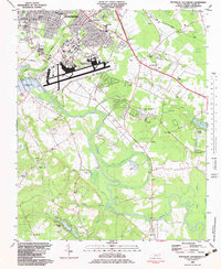 1982 Southeast Goldsboro1983 Print · USGSGoldsboro and its southern outskirts are shown in the early eighties as military and suburban life intersected with the Neuse River lowlands. Researchers can locate numerous local churches and schools like Atkinson Chapel, Holly Green Ch, and Greenwood Sch.2 unique versions available
Showing maps 1-25 of 126
Top cities of Wayne County
- Goldsboro historical maps
- Mount Olive historical maps
- Fremont historical maps
- Walnut Creek historical maps
- Pikeville historical maps
- Eureka historical maps
See more
Frequently asked questions
- What are the different types of historical maps available for Wayne County?
- What is the oldest map of Wayne County?
- Where can I purchase historical maps of Wayne County for my home or office?
- Where can I download high-res historical maps of Wayne County?
- Are there historical topographic maps available for Wayne County?
- Is there historical aerial imagery available for Wayne County?
- Where are historical maps of Wayne County sourced from?