2020s Maps of Wayne County, North Carolina
Explore 17 historic maps of Wayne County from the 2020s. These maps offer a rare glimpse into what life looked like during the 2020s — showing old roads, neighborhoods, homes, and landmarks that have changed or disappeared over time.
Whether you're researching your family's past, planning a metal detecting trip, or studying how Wayne County's landscape evolved across the 2020s, these high-resolution maps are a powerful tool for exploring the history of this region.
- Focus on a specific era: All maps on this page are from the 2020s, giving you a focused view of this time period.
- See what’s changed: Compare century-old streets, trails, and buildings to today's modern landscape using overlays and satellite layers.
- Research with precision: Use these maps for genealogy, historical research, land use analysis, or educational projects.
- View, download, or print: Maps are fully viewable online in high resolution, and can be downloaded or printed for your own records.
Start exploring Wayne County's history through authentic maps from the 2020s. This is your window into the past.
Wayne County, NC maps
(17)- 2022 Map of Fremont, 2022 Print
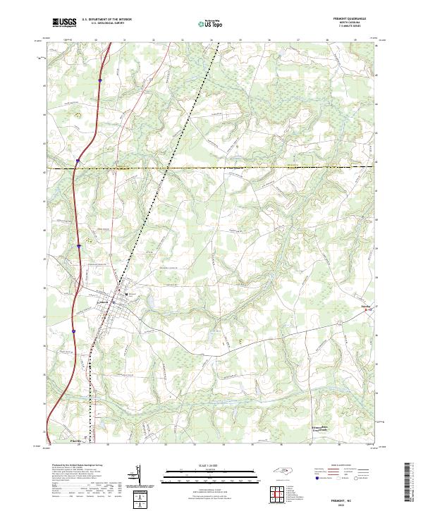 2022 Fremont2022 Print · USGSIn the modern era, the Wilson and Wayne County line remains a landscape of sprawling wetlands and rural crossroads. Researchers can trace family ties and historic routes through Fremont, Eureka, and landmarks like Elmwood Cem or Aycock Swamp.
 - 2022 Map of Seven Springs, 2022 Print
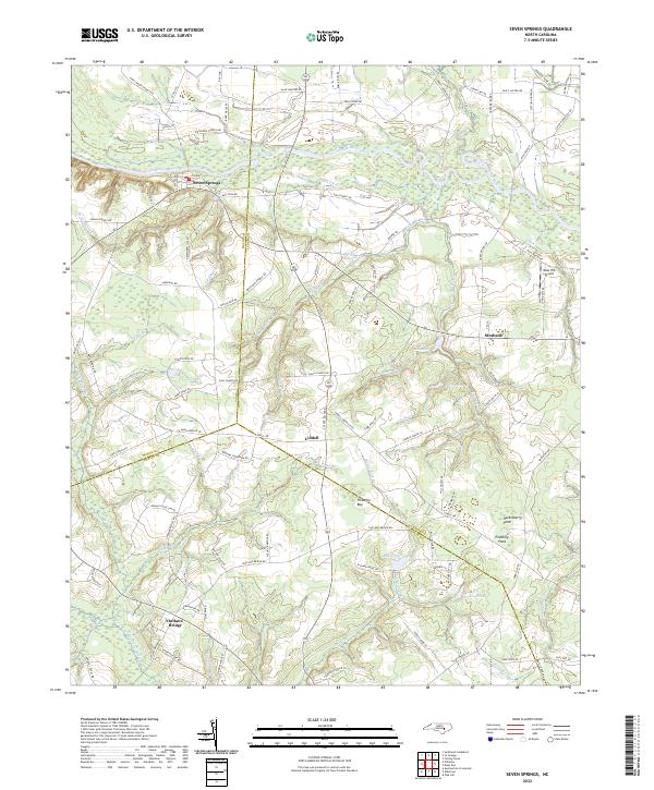 2022 Seven Springs2022 Print · USGSCoastal plain settlements and river bottomlands converge at the junction of Wayne, Lenoir, and Duplin Counties in the early 2020s. Researchers can trace family-named landmarks like Hardy Millpond and Outlaws Bridge or locate the historic center of Seven Springs along the Neuse River.
 - 2022 Map of Stantonsburg, 2022 Print
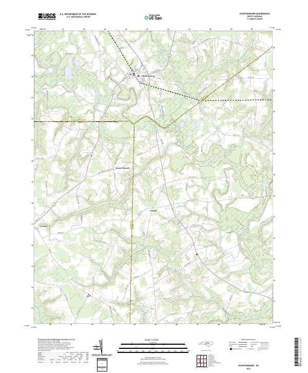 2022 Stantonsburg2022 Print · USGSStantonsburg and the surrounding Carolina swamps appear here in the early 2020s, showing a landscape defined by the winding Contentnea Creek. Genealogists and local historians can trace connections between Eureka, Lindell, and Faro, or locate old routes like St James Church Rd.
 - 2022 Map of Mount Olive, 2022 Print
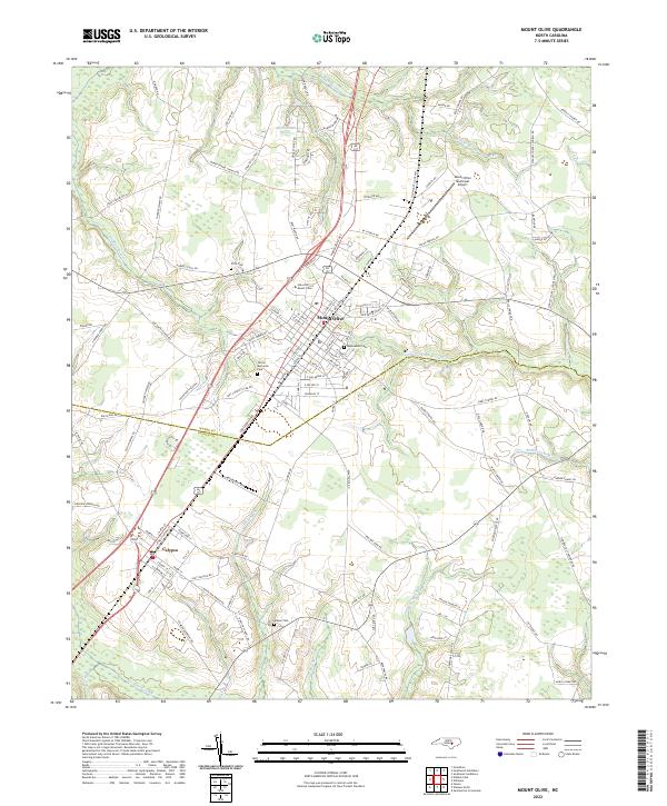 2022 Mount Olive2022 Print · USGSMount Olive and the neighboring village of Calypso are documented in this contemporary survey of the North Carolina coastal plain. Researchers can trace family sites near Maplewood Cem, study the layout of the University of Mount Olive, or follow the Northeast Cape Fear River.
 - 2022 Map of Dobbersville, 2022 Print
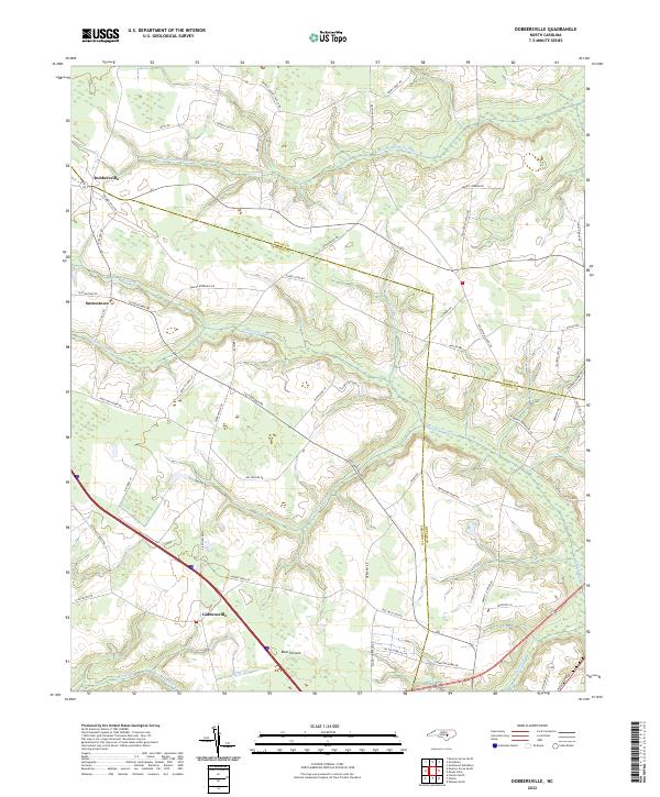 2022 Dobbersville2022 Print · USGSSampson and Wayne County borderlands are mapped here in the early 2020s, showing a landscape defined by traditional agriculture and vast wetlands. Researchers can trace rural lineages through named crossroads like Dobbersville and Suttontown or locate family lands near Bear Pocosin and Goshen Swamp.
 - 2022 Map of Grantham, 2022 Print
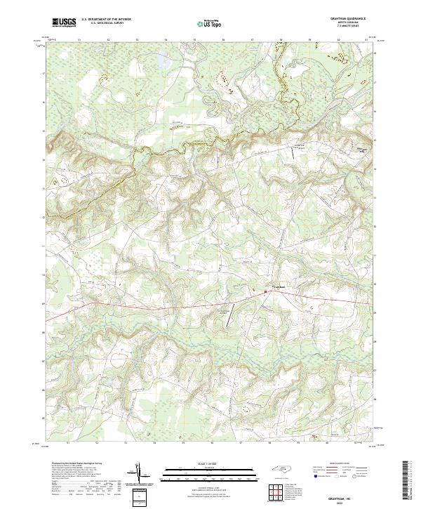 2022 Grantham2022 Print · USGSIn the early twenty-first century, this rural stretch of the Johnston and Wayne county line remains defined by its deep agricultural roots and the winding Neuse River. Researchers can trace local lineage through named landmarks like Stevens Mill or follow long-standing community connections along Selah Church Rd and Manley Grove Church Rd.
 - 2022 Map of Newton Grove North, 2022 Print
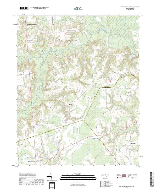 2022 Newton Grove North2022 Print · USGSNorth Carolina's coastal plain comes into focus in this recent survey of the rural landscape where Johnston, Sampson, and Wayne counties meet. Genealogists and local historians can trace family-named landmarks and old road networks connecting Strickland Crossroads, Harper, and the wetlands along Kill Swamp.
 - 2022 Map of Kenly East, 2022 Print
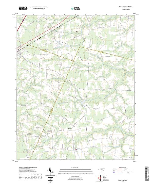 2022 Kenly East2022 Print · USGSThe rural borders of Wilson, Johnston, and Wayne Counties are captured here in the early twenty-first century. Genealogists and local historians can trace family-named sites like Kirbys Crossing, the Edgerton Cem, and the milling history at Sasser Millpond.
 - 2022 Map of Newton Grove South, 2022 Print
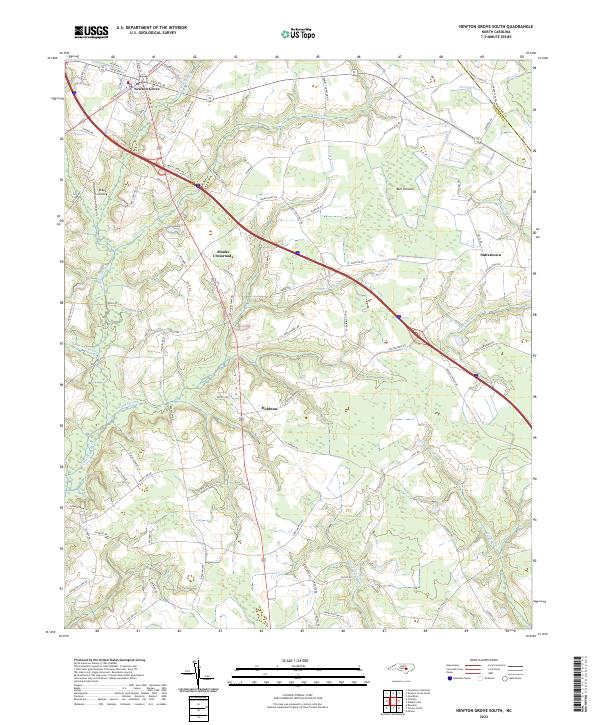 2022 Newton Grove South2022 Print · USGSSampson County in the twenty-first century reveals a landscape still deeply defined by its riparian boundaries and rural crossroads. Trace family land or local history through Monks Crossroads, Hobbton, and the edges of Bull Pocosin.
 - 2022 Map of La Grange, 2022 Print
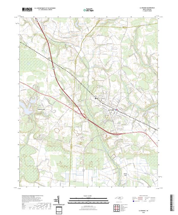 2022 La Grange2022 Print · USGSThe eastern Coastal Plain at the junction of Wayne, Greene, and Lenoir Counties is shown in the early 2020s. Researchers can trace the layout of La Grange and locate rural landmarks like Walters Millpond, Old Lagrange Cem, and Jones Pocosin.
 - 2022 Map of Northeast Goldsboro, 2022 Print
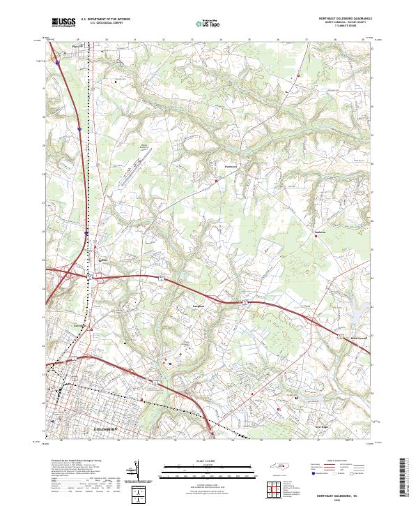 2022 Northeast Goldsboro2022 Print · USGSWayne County’s northern edge comes into focus during the early 2020s, revealing a landscape of historic crossroads and shifting rural boundaries. Researchers can trace family sites near Pikeville Cem or follow the paths of Stoney Cr and The Slough.
 - 2022 Map of Jason, 2022 Print
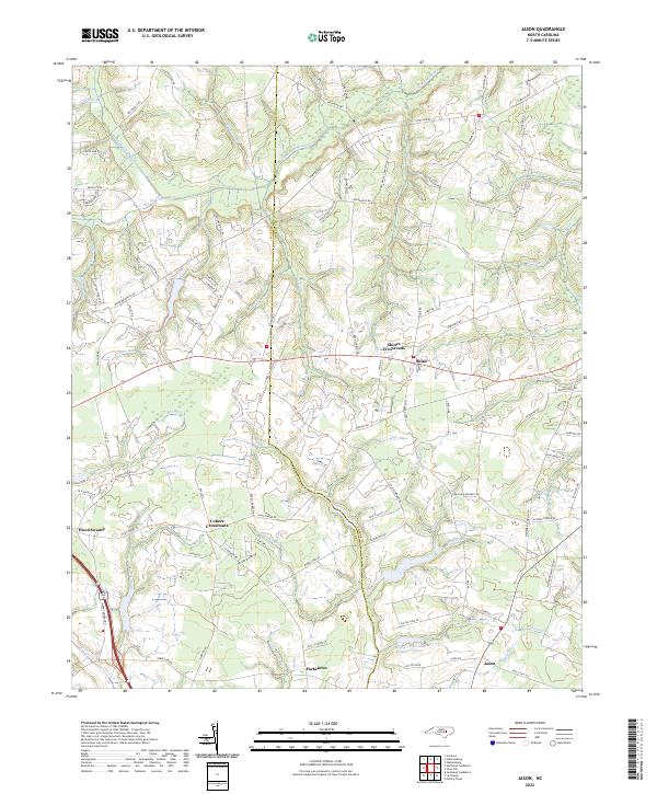 2022 Jason2022 Print · USGSCoastal plain settlements and winding swamp systems define this portion of North Carolina in 2022. Researchers can trace rural family roots and old crossroads at Shines Crossroads, Jason, and along the shores of Bear Cr W/S Lake Number Fifteen.
 - 2022 Map of Williams, 2022 Print
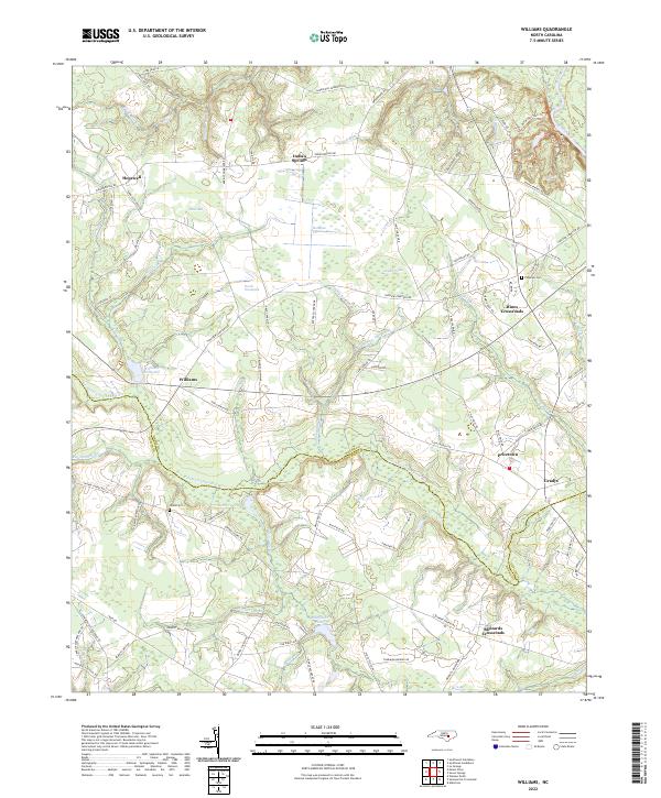 2022 Williams2022 Print · USGSWayne and Duplin counties are captured here in the early 2020s as the river-and-creek landscape continues to shape rural life. Genealogists can trace family landmarks and burial sites like Pineview Cem, Williams Millpond, and Hines Crossroads.
 - 2022 Map of Southeast Goldsboro, 2022 Print
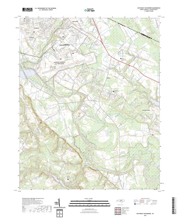 2022 Southeast Goldsboro2022 Print · USGSSoutheast of Goldsboro in the early 2020s, the landscape is a mix of military infrastructure and coastal plain wetlands. Researchers can trace the boundaries of Seymour Johnson Air Force Base or locate family sites at Willow Dale Cem and New Hope Friends Cem.
 - 2022 Map of Northwest Goldsboro, 2022 Print
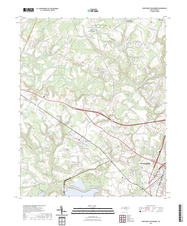 2022 Northwest Goldsboro2022 Print · USGSWestern Wayne County comes into focus in the early 2020s as modern residential growth meets its rural roots. Researchers can trace family sites near Evergreen Memorial Cem or follow the banks of the Little River and Neuse River.
 - 2022 Map of Southwest Goldsboro, 2022 Print
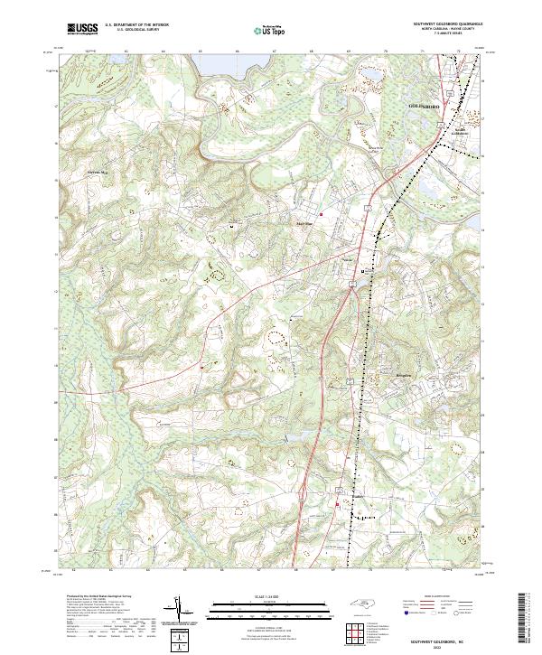 2022 Southwest Goldsboro2022 Print · USGSWayne County's riverfront and agricultural outskirts are captured in this modern survey of the communities south of the Neuse. Genealogists and researchers can trace local family landmarks such as Rhodes Cem and the settlements of Brogden, Genoa, and Stevens Mill.
 - 2022 Map of Princeton, 2022 Print
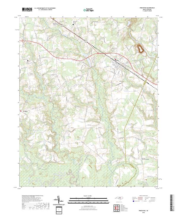 2022 Princeton2022 Print · USGSCoastal plain settlements and river lowlands southeast of Smithfield are documented in this recent survey. Local historians can trace family-named routes and landmarks from Pine Level down to the Neuse River, including Thompson Cem and Raynor Town.
End of results
Showing maps 1-17 of 17
Top cities of Wayne County
- Goldsboro historical maps
- Mount Olive historical maps
- Fremont historical maps
- Walnut Creek historical maps
- Pikeville historical maps
- Eureka historical maps
See more
Frequently asked questions
- What are the different types of historical maps available for Wayne County?
- What is the oldest map of Wayne County?
- Where can I purchase historical maps of Wayne County for my home or office?
- Where can I download high-res historical maps of Wayne County?
- Are there historical topographic maps available for Wayne County?
- Is there historical aerial imagery available for Wayne County?
- Where are historical maps of Wayne County sourced from?