1990s Maps of Bowman County, North Dakota
Explore 9 historic maps of Bowman County from the 1990s. These maps offer a rare glimpse into what life looked like during the 1990s — showing old roads, neighborhoods, homes, and landmarks that have changed or disappeared over time.
Whether you're researching your family's past, planning a metal detecting trip, or studying how Bowman County's landscape evolved across the 1990s, these high-resolution maps are a powerful tool for exploring the history of this region.
- Focus on a specific era: All maps on this page are from the 1990s, giving you a focused view of this time period.
- See what’s changed: Compare century-old streets, trails, and buildings to today's modern landscape using overlays and satellite layers.
- Research with precision: Use these maps for genealogy, historical research, land use analysis, or educational projects.
- View, download, or print: Maps are fully viewable online in high resolution, and can be downloaded or printed for your own records.
Start exploring Bowman County's history through authentic maps from the 1990s. This is your window into the past.
Bowman County, ND maps
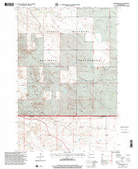
(9)- 1993 Map of Ladner NE, 1996 Print
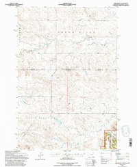 1993 Ladner NE1996 Print · USGSThe North Dakota and South Dakota borderlands come alive in this early nineties survey of ranching country. Genealogists and historians can locate remote outposts like the Grand River Sch and Janvrin Ranch or trace old routes along Bullock Road.
 - 1993 Map of Eagles Nest Butte, 1996 Print
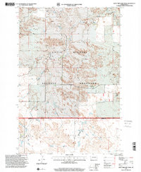
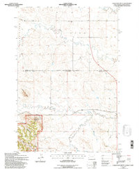 1993 Eagles Nest Butte1996 Print · USGSThe North Dakota and South Dakota borderlands come into focus in this late twentieth-century record of the high plains. Researchers can trace the ranching history of the area through landmarks like Feist Ranch, the Lone Tree Sch, and Eagles Nest Butte.
 - 1997 Map of Stewart Lake, 2001 Print
 1997 Stewart Lake2001 Print · USGSThe North Dakota badlands and grasslands are documented here in the late nineties, centered on the Stewart Lake National Wildlife Refuge. Genealogists and researchers can trace the Cottage Sch, find early mines, and locate landmarks like Chalk Butte.
 - 1997 Map of Marmarth, 2001 Print
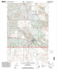 1997 Marmarth2001 Print · USGSThe rail-and-river town of Marmarth is shown in the late nineties as it sits within the Little Missouri National Grassland. Researchers can trace the local landscape from Riverside Cem to the Rodeo Ground and the banks of the Little Missouri River.
 - 1997 Map of Marmarth SE, 2001 Print
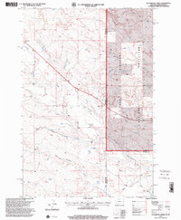
 1997 Marmarth SE2001 Print · USGSThe North Dakota badlands near the turn of the millennium are defined here by cattle country and pioneer history. Trace the site of a famous wagon train siege at Fort Dilts State Historic Site or follow the waters of Indian Creek and Bacon Creek.
 - 1997 Map of Waterhole Creek, 2001 Print
 1997 Waterhole Creek2001 Print · USGSThe Montana-North Dakota state line comes into focus in the late nineties, documenting a landscape of remote ranchlands and prairie. Genealogists and historians can locate the Fertile Prairie Sch and Fertile Prairie Cem near Waterhole Creek.
 - 1997 Map of Ives, 2001 Print
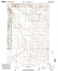
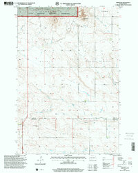
 1997 Ives2001 Print · USGSThe North Dakota badlands of Slope and Bowman counties are shown in the late 1990s as a landscape of remote ranches and high prairie. Researchers can trace family homesteads like Weisz Ranch and Fischer Ranch or locate the rural St Paul Cem near the railway siding at Ives.
 - 1997 Map of West Fork Deep Creek, 2001 Print
 1997 West Fork Deep Creek2001 Print · USGSThe North Dakota badlands of the late nineties are laid bare in this study of the border between Slope and Bowman counties. Researchers can trace the ranching history of the Little Missouri National Grassland and find local landmarks like the Bloomgren Ranch and Slope Center.
 - 1997 Map of Amidon SE, 2001 Print
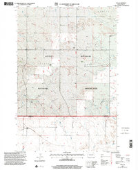
 1997 Amidon SE2001 Print · USGSSlope and Bowman Counties in the late nineties remain a landscape of vast open ranges and agricultural pockets. Genealogists and historians can trace property markers near the Chalky Butte National Grassland or locate the local Cem and Sheets Mineral Springs.
End of results
Showing maps 1-9 of 9
Top cities of Bowman County
- Bowman historical maps
- Scranton historical maps
- Rhame historical maps
- Haley historical maps
- Gascoyne historical maps
Frequently asked questions
- What are the different types of historical maps available for Bowman County?
- What is the oldest map of Bowman County?
- Where can I purchase historical maps of Bowman County for my home or office?
- Where can I download high-res historical maps of Bowman County?
- Are there historical topographic maps available for Bowman County?
- Is there historical aerial imagery available for Bowman County?
- Where are historical maps of Bowman County sourced from?