1970s Maps of Bowman County, North Dakota
Explore 20 historic maps of Bowman County from the 1970s. These maps offer a rare glimpse into what life looked like during the 1970s — showing old roads, neighborhoods, homes, and landmarks that have changed or disappeared over time.
Whether you're researching your family's past, planning a metal detecting trip, or studying how Bowman County's landscape evolved across the 1970s, these high-resolution maps are a powerful tool for exploring the history of this region.
- Focus on a specific era: All maps on this page are from the 1970s, giving you a focused view of this time period.
- See what’s changed: Compare century-old streets, trails, and buildings to today's modern landscape using overlays and satellite layers.
- Research with precision: Use these maps for genealogy, historical research, land use analysis, or educational projects.
- View, download, or print: Maps are fully viewable online in high resolution, and can be downloaded or printed for your own records.
Start exploring Bowman County's history through authentic maps from the 1970s. This is your window into the past.
Bowman County, ND maps
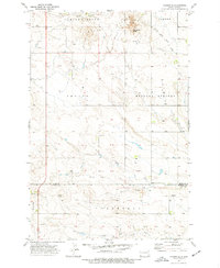
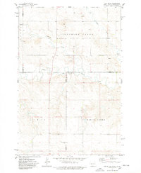
(20)- 1973 Map of Kid Creek, 1976 Print
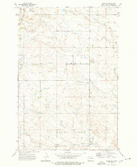
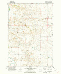
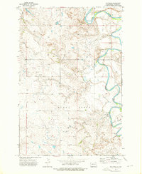 1973 Kid Creek1976 Print · USGSThe rural expanse of Bowman County is captured here in the early seventies, showing a land defined by the winding Little Missouri River. Researchers can locate isolated landmarks like the Sunny Slope Sch, a local Cem, and numerous named wells.
 - 1973 Map of Warnke Hill, 1976 Print
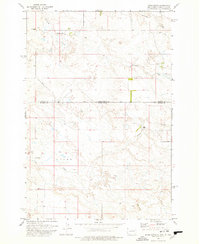
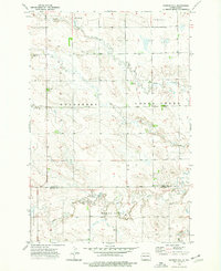 1973 Warnke Hill1976 Print · USGSThe northern Great Plains of southwestern North Dakota are documented here in the early 1970s, showcasing a landscape of high-prairie ranching and townships. Researchers can locate family landmarks like Pierce Cem, the Bob Denny Hills, and the settlement of Warnke.
 - 1973 Map of Mineral Springs, 1976 Print
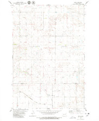
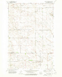 1973 Mineral Springs1976 Print · USGSThe rural plains of Slope and Bowman Counties are mapped here in the early seventies, centered on the local hub of Mineral Springs. Researchers can locate the Mineral Springs School and trace the meandering North Fork Cedar Creek through the Bob Denny Hills.
 - 1973 Map of Talbot Butte, 1977 Print
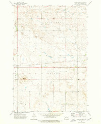 1973 Talbot Butte1977 Print · USGSBowman County, North Dakota, in the early 1970s is shown here as a landscape of rail-driven transit and prairie agriculture. Trace the path of the Chicago Milwaukee St Paul and Pacific railroad or locate local landmarks like the Drive-in Theater and Talbot Butte.
 - 1973 Map of Amidon SE, 1977 Print
 1973 Amidon SE1977 Print · USGSSlope and Bowman counties appear in the early seventies, a time when the prairie landscape was defined by its water sources and high buttes. Local historians can trace family ties via the Cem and the geographic markers of Chalky Buttes and Rattlesnake Butte.
 - 1973 Map of Scranton SW, 1977 Print
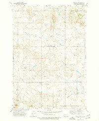
 1973 Scranton SW1977 Print · USGSBowman County prairie lands are shown here in the early seventies, organized into historical townships and rural sections. Researchers can trace local landmarks like Union Prairie Church, follow the path of Lightning Creek, and locate a historical Gravel Pit.
 - 1973 Map of Cedar Lake, 1977 Print
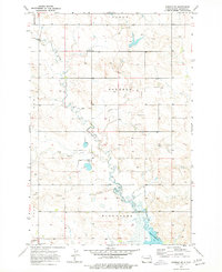
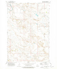
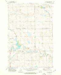 1973 Cedar Lake1977 Print · USGSThe western North Dakota plains in the early 1970s reveal a landscape of managed waterways and remote homesteads. Genealogists and historians can trace local landmarks like Cedar Lake, the small Cem, and the prairie waters of Rustan Lake.
 - 1973 Map of Camel Butte, 1977 Print
 1973 Camel Butte1977 Print · USGSBowman County prairie life in the early seventies centers on remote schoolhouses and winding creek beds. Genealogists and local historians can locate rural landmarks like Nebo Sch, Bethany Ch, and family-named features like Camel Butte.
 - 1973 Map of Rhame SE, 1977 Print
 1973 Rhame SE1977 Print · USGSBowman County ranchlands are documented here in the early 1970s, showing the rural section lines and watercourses of the high plains. Genealogists and historians can trace the drainages of Cold Turkey Creek and Alkali Creek, or locate landmarks like Medicine Pole and the Adelaide Hills.
 - 1973 Map of Bowman SE, 1977 Print
 1973 Bowman SE1977 Print · USGSNorth Dakota's southwestern plains are captured in the early seventies, showing a landscape defined by prairie creeks and rural townships. Researchers can trace the historic Stage Road, locate the Eden School, and find the local landmark Watson near the banks of Spring Creek.
 - 1973 Map of Stewart Lake, 1977 Print
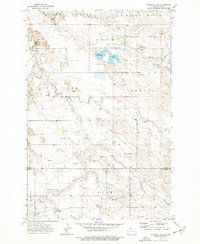 1973 Stewart Lake1977 Print · USGSThe high plains of Slope and Bowman Counties are captured in the early 1970s, showcasing a landscape of wildlife conservation and rugged prairie. Researchers can trace the boundaries of the Stewart Lake National Wildlife Refuge and locate rural landmarks like Cottage and Chalky Butte.
 - 1973 Map of Griffin, 1977 Print
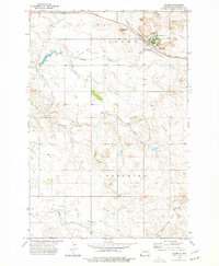
 1973 Griffin1977 Print · USGSBowman County is captured in the early 1970s, showing the high plains landscape as a mix of rail-side industry and cattle country. Genealogists and historians can trace the Chicago Milwaukee St Paul and Pacific rail line through Griffin and locate old Scoria Pits near the Medicine Pole Hills.
 - 1973 Map of Cedar Hills, 1977 Print
 1973 Cedar Hills1977 Print · USGSBowman County, North Dakota, is shown in the early 1970s as a landscape of high buttes and winding river valleys. Researchers can trace the path of the Little Missouri River and locate isolated landmarks like Sunset Butte and the Jeep Trail.
 - 1973 Map of Mud Buttes, 1977 Print
 1973 Mud Buttes1977 Print · USGSBowman County, North Dakota, is depicted in the early 1970s as a land of dramatic breaks and seasonal waterways. You can locate the winding Little Missouri River and trace the contours of landmarks like Mud Buttes and Rattlesnake Buttes.
 - 1973 Map of Rhame, 1977 Print
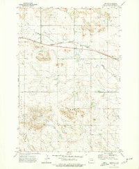
 1973 Rhame1977 Print · USGSRhame and the surrounding Adelaide township are shown here during the early 1970s as the rail-and-ranch economy of Bowman County remained firmly established. Researchers can locate Tuttle Cem, trace the Chicago Milwaukee St Paul and Pacific rail line, and find local landmarks like Post Office Butte.
 - 1973 Map of Cedar Ridge, 1977 Print
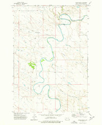 1973 Cedar Ridge1977 Print · USGSSlope County's river valley and early energy development are captured here in the early 1970s. Researchers can trace the winding Little Missouri River and locate historic Oil Wells and a Ford used for crossing the water.
 - 1974 Map of Cow Butte, 1978 Print
 1974 Cow Butte1978 Print · USGSThe Dakota borderlands come into focus in the mid-1970s at the intersection of four counties. Genealogists and local historians can locate rural landmarks like Mamre Ch and Golden Valley Ch Cem along the North Fork Grand River.
 - 1977 Map of Doaks Butte, 1978 Print
 1977 Doaks Butte1978 Print · USGSThe North Dakota and South Dakota borderlands meet along the Little Missouri River in this late seventies survey. Map collectors can trace the high plains terrain around Doaks Butte and locate local landmarks like the Gravel Pit and Soda Creek.
 - 1978 Map of Dogie Butte
 1978 Dogie Butte1978 Print · USGSThe high plains along the North Dakota and South Dakota border are captured here in the late seventies. Genealogists and local historians can locate the Mud Butte School, the Miller Ranch, and the remote outpost at Arnett.
 - 1979 Map of Ives, 1980 Print
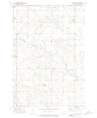
 1979 Ives1980 Print · USGSThe borderlands of Slope and Bowman counties are shown in the late 1970s as the regional rail economy persists. Researchers can trace the path of the Chicago Milwaukee St Paul and Pacific railroad past Ives and the St Paul Cem.
End of results
Showing maps 1-20 of 20
Top cities of Bowman County
- Bowman historical maps
- Scranton historical maps
- Rhame historical maps
- Haley historical maps
- Gascoyne historical maps
Frequently asked questions
- What are the different types of historical maps available for Bowman County?
- What is the oldest map of Bowman County?
- Where can I purchase historical maps of Bowman County for my home or office?
- Where can I download high-res historical maps of Bowman County?
- Are there historical topographic maps available for Bowman County?
- Is there historical aerial imagery available for Bowman County?
- Where are historical maps of Bowman County sourced from?