1900s (20th Century) Maps of Burke County, North Dakota
Explore 43 historic maps of Burke County from the 1900s (20th Century). These maps offer a rare glimpse into what life looked like during the 1900s — showing old roads, neighborhoods, homes, and landmarks that have changed or disappeared over time.
Whether you're researching your family's past, planning a metal detecting trip, or studying how Burke County's landscape evolved across the 1900s, these high-resolution maps are a powerful tool for exploring the history of this region.
- Focus on a specific era: All maps on this page are from the 1900s, giving you a focused view of this time period.
- See what’s changed: Compare century-old streets, trails, and buildings to today's modern landscape using overlays and satellite layers.
- Research with precision: Use these maps for genealogy, historical research, land use analysis, or educational projects.
- View, download, or print: Maps are fully viewable online in high resolution, and can be downloaded or printed for your own records.
Start exploring Burke County's history through authentic maps from the 1900s. This is your window into the past.
Burke County, ND maps
(43)- 1947 Map of Bowbells NW, 1958 Print
 1947 Bowbells NW1958 Print · USGSThe international border between North Dakota and Saskatchewan meets the prairie landscape of Burke County just after the war. Local historians can trace rural school locations like School No 3 and the early conservation boundaries of the Upper Des Lacs Lake refuge.
 - 1947 Map of Flaxton, 1965 Print
 1947 Flaxton1965 Print · USGSNear the international border in the late 1940s, this area of Burke County shows a landscape of prairie farms and critical rail connections. Researchers can trace the town of Flaxton and rural landmarks like the Danish Ch and the Minneapolis St Paul and Sault Ste Marie line.
 - 1947 Map of Bowbells, 1966 Print
 1947 Bowbells1966 Print · USGSBowbells sits at the busy junction of two major rail lines just after the war, anchoring a landscape of scattered prairie townships. Genealogists and local historians can locate Bowbells Cem, early country schools like School No 4, and the CCC Dam along Stony Creek.
 - 1947 Map of Columbus, 1977 Print
 1947 Columbus1977 Print · USGSThe northern plains of Burke County meet the Canadian border in this mid-century survey of a remote rail corridor. Genealogists and historians can trace local ties to the Pleasant Prairie Ch, the town of Larson, and the Columbus Cem along the historic rail lines.
 - 1948 Map of Flaxton
 1948 Flaxton1948 Print · USGSThe international boundary in northwestern North Dakota meets the prairie at the end of the 1940s. Genealogists and historians can trace the rail-centered growth of Flaxton and locate rural landmarks like the Danish Ch, Flaxton Cem, and Sch No 3.
 - 1948 Map of Beaver Lake
 1948 Beaver Lake1948 Print · USGSBurke County, North Dakota, is documented here in the late 1940s as a landscape of isolated farmsteads and rural school districts. Genealogists and local historians can trace the foundations of Grandview Ch, Tonset Ch, and early landmarks like the Strip Mine.
 - 1948 Map of Coteau
 1948 Coteau1948 Print · USGSThe Burke County prairie in the late 1940s centers on the rail junction at Coteau during a period of steady rural growth. Researchers can trace local landmarks like School No 1, the Danish Cem, and a small Strip Mine near Stony Creek.
 - 1948 Map of Woburn
 1948 Woburn1948 Print · USGSBurke County was a landscape of rail-connected settlements and one-room schoolhouses in the late 1940s. Genealogists and local historians can trace family roots through Zion Cem or locate former school sites like Woburn Sch and Scandia Sch.
 - 1948 Map of Stampede
 1948 Stampede1948 Print · USGSThe North Dakota-Canada border area comes into focus during the late 1940s, showing a landscape of prairie wetlands and remote rail outposts. Researchers can trace the Great Northern tracks through Stampede or locate the Short Creek Ch along the winding Short Creek.
 - 1948 Map of Vanville NE, 1967 Print
 1948 Vanville NE1967 Print · USGSThe Burke and Ward County borderlands appear here in the late 1940s, showing a prairie landscape shaped by the Great Northern railroad. Researchers can trace rural school locations like Masters Sch and landmarks such as Ward Hill and Little Butte.
 - 1949 Map of Columbus SW
 1949 Columbus SW1949 Print · USGSNorthwestern North Dakota's coal and farming country is captured here in the late forties, detailing a landscape of dispersed prairie homesteads. Genealogists can locate family landmarks like South St Olaf Ch, School No 2, and the Prairie Chapel Cem.3 unique versions available
 - 1949 Map of Mosquito Butte
 1949 Mosquito Butte1949 Print · USGSThe North Dakota prairie near the Burke, Ward, and Mountrail county lines is captured here in the late 1940s. Genealogists and local historians can locate early landmarks like Buck Sch and Bethlehem Ch or trace the drainage of Christensen Slough.
 - 1949 Map of Bowbells
 1949 Bowbells1949 Print · USGSBowbells and its surrounding townships thrive as a vital rail hub in the late 1940s. Genealogists can locate family landmarks like St Joseph Cem, School No 2, and the local Golf Course along the banks of Stony Creek.
 - 1949 Map of Atcoal
 1949 Atcoal1949 Print · USGSNorth Dakota's northern coal country is captured here shortly after the war, showing the industrial landscape along the international border. Genealogists and industrial historians can trace early mining operations at the Strip Mine and find rural landmarks like Strange Siding and School No 4.2 unique versions available
 - 1949 Map of Rennie Lake
 1949 Rennie Lake1949 Print · USGSNorthwestern North Dakota's prairie landscape is captured here in the late Forties, showing the intersection of rail transit and rural education. You can trace the Great Northern rail line past local landmarks like Scandia Sch and Rennie Lake.
 - 1949 Map of Bowbells SE
 1949 Bowbells SE1949 Print · USGSNorth Dakota's northern plains are captured here just after the war, showing a landscape defined by the Des Lacs Migratory Bird Refuge. Local historians can trace early section-line roads to Nine Mile Corner and the Lake View School No 2.
 - 1949 Map of Bowbells NW
 1949 Bowbells NW1949 Print · USGSThe North Dakota-Saskatchewan border meets the Des Lacs Migratory Bird Refuge in this late 1940s survey of the prairie. Genealogists and local historians can locate early rural landmarks like School No 3 and School No 5 across North Star and Minnesota townships.
 - 1949 Map of Niobe
 1949 Niobe1949 Print · USGSThe northern plains of Ward and Burke Counties come into focus in the late 1940s, highlighting the railroad siding at Niobe. Researchers can trace old township schoolhouses like Ellendale Sch and Spencer Sch or locate gravesites at Bethany Cem.2 unique versions available
 - 1949 Map of Bowbells NE
 1949 Bowbells NE1949 Print · USGSThe international border meets the North Dakota prairie in the late 1940s, highlighting the transition from Saskatchewan into Burke County. Family historians can locate rural schoolhouses such as Masek Sch and Lake View Sch No 1 alongside the protected waters of the Upper Des Lacs Migratory Bird Refuge.
 - 1949 Map of Portal
 1949 Portal1949 Print · USGSThe border country of Burke County comes into focus just after the war as Portal and Lignite thrive along the railroad lines. Genealogists can trace family footprints through numerous local landmarks, including the St. Marys Cem, Scontia Sch, and the Norwegian Cem.
 - 1949 Map of Columbus
 1949 Columbus1949 Print · USGSUpper Burke County sits along the international boundary in the late 1940s, showing a prairie landscape shaped by dual rail lines. Researchers can trace the heritage of Columbus and Larson or locate local landmarks like Pleasant Prairie Ch and Brookside Sch.
 - 1949 Map of Northgate
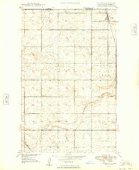 1949 Northgate1949 Print · USGSThe international border at Burke County is captured here in the late 1940s, showing the vital junction of two major rail lines. Genealogists and rail historians can trace the paths of the Great Northern and Soo Line through Northgate and the siding at Perella.
 - 1949 Map of Columbus SE
 1949 Columbus SE1949 Print · USGSBurke County in the late 1940s reveals a prairie landscape of small school districts and coal extraction. Genealogists can locate family landmarks like St Olaf Cem, Bethany Ch, and Coal Valley School No 3.2 unique versions available
 - 1950 Map of Vanville NE
 1950 Vanville NE1950 Print · USGSPost-war Burke County rural life centers on isolated schoolhouses and the rail line in the early fifties. Locate family roots near Big Spring Sch, Ward Hill, and the tracks of the Great Northern railroad.
 - 1950 Map of Bowbells
 1950 Bowbells1950 Print · USGSThe Burke County prairie meets the international border in the mid-twentieth century, centered on the vital rail junction at Bowbells. Genealogists and historians can trace rural school districts like Masek Sch and explore the early water management of the CCC Dam.2 unique versions available
Showing maps 1-25 of 43
Top cities of Burke County
- Bowbells historical maps
- Powers Lake historical maps
- Lignite historical maps
- Columbus historical maps
- Portal historical maps
- Battleview historical maps
See more
Frequently asked questions
- What are the different types of historical maps available for Burke County?
- What is the oldest map of Burke County?
- Where can I purchase historical maps of Burke County for my home or office?
- Where can I download high-res historical maps of Burke County?
- Are there historical topographic maps available for Burke County?
- Is there historical aerial imagery available for Burke County?
- Where are historical maps of Burke County sourced from?