
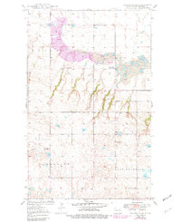
1949 Map of Columbus SE
USGS Topo · Published 1949About this map
Leaf Mountain anchors the southern portion of this landscape, which reveals a rural North Dakota community defined by small school districts and an emerging industrial presence. The Great Northern railroad tracks cut across the northern terrain, passing by several localized institutions including Bethany Ch and the Town Hall. This 1949 study was compiled as part of the Department of the Interior program for the development of the Missouri River Basin, capturing the area just after aerial surveys in 1946.
Find a feature on this map
17 named features on this map. Tap any name to fly to it.
Don’t see what you’re looking for? This feature index may not catch every label — zoom into the map to look around manually.
Map Details
Editions of this 1949 Columbus SE Map
2 editions found
Other maps of this area

1947 · Columbus
USGS Topo · 1:24,000

1948 · Beaver Lake
USGS Topo · 1:24,000

1948 · Stampede
USGS Topo · 1:24,000

1949 · Columbus SW
USGS Topo · 1:24,000

1949 · Atcoal
USGS Topo · 1:24,000

1949 · Columbus
USGS Topo · 1:24,000

1950 · Columbus
USGS Topo · 1:62,500

1950 · Portal
USGS Topo · 1:62,500

1953 · Williston
USGS Topo · 1:250,000

1957 · Williston
USGS Topo · 1:250,000