Old Maps of Walsh County, North Dakota for Academic Research
Study the evolution of Walsh County with 277 high-resolution historic maps. Whether you're teaching, researching, or modeling changes in land use, these maps provide essential visual documentation of urban, environmental, and geographic change.
- Analyze long-term change: Track patterns in development, transportation, and natural features.
- Ideal for environmental or urban studies: Support academic projects with primary historical map data.
- Use in the classroom or lab: Educators and researchers rely on these maps to bring historical context to life.
These maps are a powerful tool for teaching, research, and visualizing how Walsh County has changed over the decades.
Walsh County, ND maps
(277)- 1918 Map of Acton
 1918 Acton1918 Print · USGSThe Red River Valley's winding borderlands are captured here during the First World War, showing the transition from wild wetlands to managed farmland. Genealogists can trace small settlements and rural schoolhouses like Acton, Bigwoods, and St. Andrews.
 - 1926 Map of Ardoch, 1944 Print
 1926 Ardoch1944 Print · USGSWalsh and Grand Forks Counties at the peak of the rail era show a landscape shaped by steam and drainage. Trace the routes of three major railroads through Ardoch, find country schools, and locate early crossings like Public Xing.-865 and the Cem. near Forest River.
 - 1939 Map of Drayton, 1954 Print
 1939 Drayton1954 Print · USGSThe Red River valley at the onset of the Second World War shows a landscape defined by tight river bends and a thriving railroad economy. Genealogists and local historians can trace family locations near dozens of rural schools and churches like Daymon Sch, Tabitha Ch, and the settlement of Bowesmont.2 unique versions available
 - 1939 Map of Glasston, 1958 Print
 1939 Glasston1958 Print · USGSNorth Dakota's fertile Red River Valley is captured here in the late 1930s, showing a landscape defined by rail and agriculture. Trace the Great Northern line to find Sugar Siding or locate early rural schools like Union Sch and School No 52.
 - 1941 Map of Drayton
 1941 Drayton1941 Print · USGSThe Red River of the North snakes across the border of North Dakota and Minnesota during the late 1930s. Genealogists and historians can trace rail-side towns like Bowesmont and Drayton, or locate rural landmarks such as Skjeberg Ch and the Airway Beacon.2 unique versions available
 - 1941 Map of Glasston
 1941 Glasston1941 Print · USGSThe Red River Valley's agricultural heartland is documented here just before the mid-century, showing a landscape defined by rail-side elevators and rural townships. Researchers can trace family roots through numerous country schools like Quam Sch and landmarks such as the Norwegian Cem near Sugar Siding.
 - 1943 Map of Grafton
 1943 Grafton1943 Print · USGSWalsh County farming communities are caught in transition during this mid-century period as the rail network still dictated local commerce. Genealogists and historians can trace the exact locations of rural Schools, Cemeteries, and early rail stops like Cashel, Voss, and Herriot.
 - 1944 Map of Crystal
 1944 Crystal1944 Print · USGSPembina and Walsh Counties during the early 1940s show a landscape of rail-reliant prairie towns and numerous one-room schoolhouses. Genealogists can locate family-named landmarks like Scheving Sch and Fisher Sch or the rural St Johns Ch.
 - 1952 Map of Thief River Falls, 1967 Print
 1952 Thief River Falls1967 Print · USGSThe Red River Valley's agricultural and conservation landscape is captured in the mid-1950s, detailing a web of rail lines and international border crossings. Researchers can trace family roots in towns like Thief River Falls, locate the State School for Blind, and survey landmarks like the Agassiz National Wildlife Refuge.2 unique versions available
 - 1953 Map of Devils Lake, 1968 Print
 1953 Devils Lake1968 Print · USGSNorth Dakota's northern plains are captured here in the mid-fifties, showing a landscape of rail-fed grain elevators and prairie wetlands. Genealogists can locate family landmarks like Rose Hill School, Hurricane Lake Church, and the Turtle Mountain Indian Reservation.3 unique versions available
 - 1956 Map of Thief River Falls
 1956 Thief River Falls1956 Print · USGSThe Red River Valley in the mid-1950s is captured here as a sprawling network of rail corridors and wildlife refuges along the Canadian border. Trace the vanished transport routes of the Dismantled railroad and Abandoned railroad or locate local landmarks like the Herrick Elevator and State School for Blind.
 - 1956 Map of Devils Lake
 1956 Devils Lake1956 Print · USGSNorthern North Dakota is shown at a mid-century peak of rail-driven agriculture, where the Soo Line and Great Northern railroads cross the prairie. Trace the borders of the Turtle Mountain Indian Reservation and locate local landmarks like Rose Hill School or Camp Grafton.
 - 1957 Map of Thief River Falls
 1957 Thief River Falls1957 Print · USGSThe Red River Valley in the mid-fifties is captured here as a thriving network of rail towns and conservation lands. Genealogists and historians can trace family roots through settlements like Grafton, Pembina, and Hallock, or locate landmarks such as the State School for Blind and the Great Northern RR corridor.
 - 1960 Map of Grafton, 1961 Print
 1960 Grafton1961 Print · USGSGrafton serves as a vital rail and medical hub in Walsh County during the early sixties. Genealogists and local historians can trace the town's institutional footprint through labels for St Johns Cem, the State Sch, and St Joseph Hospital.
 - 1960 Map of Big Woods NW, 1961 Print
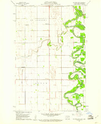 1960 Big Woods NW1961 Print · USGSThe Red River Valley at the turn of the 1960s reveals a sparse but structured landscape of township schools and river crossings. Researchers can trace the boundaries of St Andrews and Acton, locating rural landmarks like St Joseph Ch and Zion Cem.2 unique versions available
 - 1960 Map of Oakwood, 1961 Print
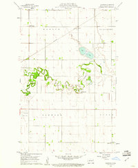 1960 Oakwood1961 Print · USGSWalsh County's fertile river plains are captured here in the early sixties as the regional rail and water networks supported a thriving agricultural landscape. Researchers can locate specific rural landmarks like School No 59, the Northern Pacific depot at Cashel, and the winding Horseshoe Coulee.
 - 1963 Map of Crystal SE, 1964 Print
 1963 Crystal SE1964 Print · USGSPembina County farming townships are captured here in the early sixties as the rural grid of the Red River Valley remained firmly established. Genealogists and local historians can locate St Johns Ch or trace the path of the Great Northern railroad near the North Branch Park River.
 - 1963 Map of Crystal, 1964 Print
 1963 Crystal1964 Print · USGSNortheastern North Dakota's agricultural heartland is captured here in the early sixties as a network of rail-side towns and rural townships. Genealogists and local historians can trace family locations near Crystal, Hoople, and the West Point Cem.2 unique versions available
 - 1963 Map of Inkster NE, 1964 Print
 1963 Inkster NE1964 Print · USGSThe rural border of Walsh and Grand Forks counties comes into focus in this mid-sixties survey of the North Dakota prairie. Genealogists and local researchers can trace the agricultural grid around Strabane and Johnstown or locate the Midway High Sch and Soo Line rail corridor.
 - 1963 Map of Edinburg, 1964 Print
 1963 Edinburg1964 Print · USGSWalsh County's agricultural heartland is documented here in the early sixties, showing the rail-dependent growth of Edinburg and the surrounding townships. Genealogists and local historians can trace rural property lines and find specific sites like Garfield Ch, Calvary Cem, and the Great Northern rail stops.2 unique versions available
 - 1963 Map of Pleasant Valley, 1964 Print
 1963 Pleasant Valley1964 Print · USGSWalsh County at the dawn of the 1960s reveals a quiet landscape of agricultural townships and winding prairie rivers. Genealogists and researchers can trace local landmarks like Pleasant Valley, the crossings at Rush Ford, and numerous Gravel Pits.
 - 1963 Map of Gardar, 1964 Print
 1963 Gardar1964 Print · USGSNortheastern North Dakota's prairie landscape is captured here in the early sixties, showing the rural townships of Gardar and Crystal. Genealogists can locate family landmarks like Stokesville Cem and the Hvidsten Ch Cem along the branches of the Park River.
 - 1963 Map of Pisek, 1964 Print
 1963 Pisek1964 Print · USGSWalsh County's agricultural heartland is documented here in the early 1960s, centered on the railroad town of Pisek. Genealogists and historians can trace property lines through the township of Rushford and locate landmarks like St Johns Cem.
 - 1963 Map of Veseleyville, 1964 Print
 1963 Veseleyville1964 Print · USGSThe rural prairie of Walsh County is captured here in the early sixties, showing the agricultural heart of the Red River Valley. Genealogists and local historians can locate the community of Veseleyville, St Lukes Cem, and the Prairie Center Sch along the Forest River.
 - 1963 Map of Fordville, 1964 Print
 1963 Fordville1964 Print · USGSFordville and the surrounding Walsh County prairies are captured in the early sixties as the local rail and river network shaped the land. Researchers can trace the Soo Line through town, locate family plots at Oak Grove Cem, or follow the winding South Branch Forest River.2 unique versions available
Showing maps 1-25 of 277
Top cities of Walsh County
- Grafton historical maps
- Park River historical maps
- Minto historical maps
- Hoople historical maps
- Fordville historical maps
- Edinburg historical maps
See more
Frequently asked questions
- What are the different types of historical maps available for Walsh County?
- What is the oldest map of Walsh County?
- Where can I purchase historical maps of Walsh County for my home or office?
- Where can I download high-res historical maps of Walsh County?
- Are there historical topographic maps available for Walsh County?
- Is there historical aerial imagery available for Walsh County?
- Where are historical maps of Walsh County sourced from?