1960s Maps of Walsh County, North Dakota
Explore 22 historic maps of Walsh County from the 1960s. These maps offer a rare glimpse into what life looked like during the 1960s — showing old roads, neighborhoods, homes, and landmarks that have changed or disappeared over time.
Whether you're researching your family's past, planning a metal detecting trip, or studying how Walsh County's landscape evolved across the 1960s, these high-resolution maps are a powerful tool for exploring the history of this region.
- Focus on a specific era: All maps on this page are from the 1960s, giving you a focused view of this time period.
- See what’s changed: Compare century-old streets, trails, and buildings to today's modern landscape using overlays and satellite layers.
- Research with precision: Use these maps for genealogy, historical research, land use analysis, or educational projects.
- View, download, or print: Maps are fully viewable online in high resolution, and can be downloaded or printed for your own records.
Start exploring Walsh County's history through authentic maps from the 1960s. This is your window into the past.
Walsh County, ND maps
(22)- 1960 Map of Grafton, 1961 Print
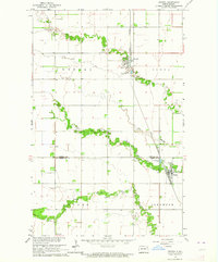
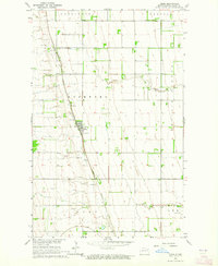
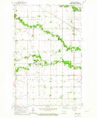
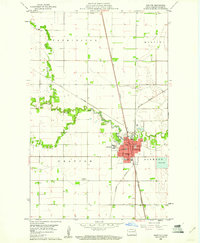 1960 Grafton1961 Print · USGSGrafton serves as a vital rail and medical hub in Walsh County during the early sixties. Genealogists and local historians can trace the town's institutional footprint through labels for St Johns Cem, the State Sch, and St Joseph Hospital.
 - 1960 Map of Big Woods NW, 1961 Print
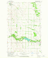
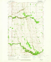
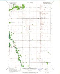
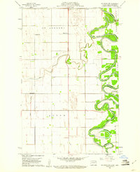 1960 Big Woods NW1961 Print · USGSThe Red River Valley at the turn of the 1960s reveals a sparse but structured landscape of township schools and river crossings. Researchers can trace the boundaries of St Andrews and Acton, locating rural landmarks like St Joseph Ch and Zion Cem.2 unique versions available
 - 1960 Map of Oakwood, 1961 Print
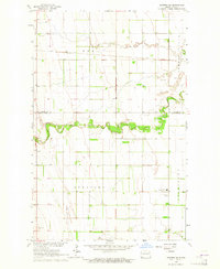
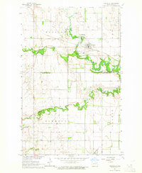
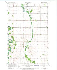
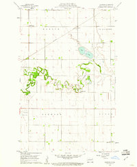 1960 Oakwood1961 Print · USGSWalsh County's fertile river plains are captured here in the early sixties as the regional rail and water networks supported a thriving agricultural landscape. Researchers can locate specific rural landmarks like School No 59, the Northern Pacific depot at Cashel, and the winding Horseshoe Coulee.
 - 1963 Map of Crystal SE, 1964 Print
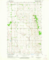
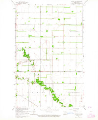 1963 Crystal SE1964 Print · USGSPembina County farming townships are captured here in the early sixties as the rural grid of the Red River Valley remained firmly established. Genealogists and local historians can locate St Johns Ch or trace the path of the Great Northern railroad near the North Branch Park River.
 - 1963 Map of Crystal, 1964 Print
 1963 Crystal1964 Print · USGSNortheastern North Dakota's agricultural heartland is captured here in the early sixties as a network of rail-side towns and rural townships. Genealogists and local historians can trace family locations near Crystal, Hoople, and the West Point Cem.2 unique versions available
 - 1963 Map of Inkster NE, 1964 Print
 1963 Inkster NE1964 Print · USGSThe rural border of Walsh and Grand Forks counties comes into focus in this mid-sixties survey of the North Dakota prairie. Genealogists and local researchers can trace the agricultural grid around Strabane and Johnstown or locate the Midway High Sch and Soo Line rail corridor.
 - 1963 Map of Edinburg, 1964 Print
 1963 Edinburg1964 Print · USGSWalsh County's agricultural heartland is documented here in the early sixties, showing the rail-dependent growth of Edinburg and the surrounding townships. Genealogists and local historians can trace rural property lines and find specific sites like Garfield Ch, Calvary Cem, and the Great Northern rail stops.2 unique versions available
 - 1963 Map of Pleasant Valley, 1964 Print
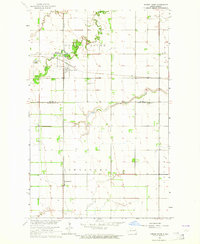
 1963 Pleasant Valley1964 Print · USGSWalsh County at the dawn of the 1960s reveals a quiet landscape of agricultural townships and winding prairie rivers. Genealogists and researchers can trace local landmarks like Pleasant Valley, the crossings at Rush Ford, and numerous Gravel Pits.
 - 1963 Map of Gardar, 1964 Print
 1963 Gardar1964 Print · USGSNortheastern North Dakota's prairie landscape is captured here in the early sixties, showing the rural townships of Gardar and Crystal. Genealogists can locate family landmarks like Stokesville Cem and the Hvidsten Ch Cem along the branches of the Park River.
 - 1963 Map of Pisek, 1964 Print
 1963 Pisek1964 Print · USGSWalsh County's agricultural heartland is documented here in the early 1960s, centered on the railroad town of Pisek. Genealogists and historians can trace property lines through the township of Rushford and locate landmarks like St Johns Cem.
 - 1963 Map of Veseleyville, 1964 Print
 1963 Veseleyville1964 Print · USGSThe rural prairie of Walsh County is captured here in the early sixties, showing the agricultural heart of the Red River Valley. Genealogists and local historians can locate the community of Veseleyville, St Lukes Cem, and the Prairie Center Sch along the Forest River.
 - 1963 Map of Fordville, 1964 Print
 1963 Fordville1964 Print · USGSFordville and the surrounding Walsh County prairies are captured in the early sixties as the local rail and river network shaped the land. Researchers can trace the Soo Line through town, locate family plots at Oak Grove Cem, or follow the winding South Branch Forest River.2 unique versions available
 - 1963 Map of Nash, 1964 Print
 1963 Nash1964 Print · USGSWalsh County's rural townships and river branches are captured here in the early sixties, as the agrarian landscape centered on the Great Northern railroad. Trace family roots at Concordia Cem or explore small hubs like Nash and Manda.
 - 1963 Map of Park River, 1964 Print
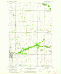 1963 Park River1964 Print · USGSWalsh County during the early 1960s was a landscape defined by the Great Northern rail line and the winding branches of the Park River. Genealogists and local historians can trace the town grid of Park River and find quiet rural landmarks like Calvary Cem and Park Center Ch.
 - 1963 Map of Inkster, 1964 Print
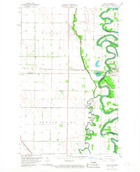
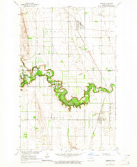 1963 Inkster1964 Print · USGSThe eastern North Dakota prairie comes alive in the early sixties as the Forest River winds through fertile agricultural lands. Trace family history and rural development through the Forest River Colony, St Marks Cem, and the rail junction at Inkster.
 - 1963 Map of Forest River, 1964 Print
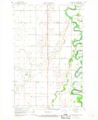
 1963 Forest River1964 Print · USGSWalsh and Grand Forks counties are captured in the early 1960s at the height of the prairie's rail-and-river era. Genealogists and local historians can trace the gridded settlements of Forest River and Johnstown along the Soo Line and Northern Pacific railroads.
 - 1966 Map of Big Woods NE, 1968 Print
 1966 Big Woods NE1968 Print · USGSThe Red River Valley along the Minnesota-North Dakota border is captured here in the mid-1960s, showing a landscape defined by industrial-scale drainage and agriculture. Researchers can locate the Fork Cem near Snake Fork and trace the paths of Judicial Ditch No 9 and the Tamarac River.
 - 1966 Map of Oslo NE, 1968 Print
 1966 Oslo NE1968 Print · USGSThe Red River Valley in the mid-sixties shows a landscape of precise township grids and vital rail connections along the Minnesota-North Dakota border. Genealogists can trace rural family sites near Mesopotamia Cem, Oak Park Ch, and the Soo Line rail corridor.
 - 1966 Map of Big Woods, 1968 Print
 1966 Big Woods1968 Print · USGSThe Red River Valley landscape of the mid-1960s is captured here, showing the intricate drainage network along the Minnesota and North Dakota border. Researchers can locate early rural landmarks including the Big Woods Ch, Malm Cem, and the community Townhall.
 - 1966 Map of Oslo, 1968 Print
 1966 Oslo1968 Print · USGSThe Red River Valley in the mid-sixties shows a landscape defined by sharp river bends and the precision of the SOO LINE railroad. Genealogists and local historians can trace the community of Oslo, family landmarks like Riverside Cem, and the GREAT NORTHERN rail line.3 unique versions available
 - 1966 Map of Big Woods SW, 1968 Print
 1966 Big Woods SW1968 Print · USGSThe Red River valley in the late sixties shows a landscape of deep river bends and established prairie townships. Genealogists can trace property lines in Pulaski and Walshville or follow the wooded reaches of Big Woods and Oak Park.2 unique versions available
 - 1967 Map of Thief River Falls
 1967 Thief River Falls1967 Print · USGSThe Red River Valley and the international border come alive in the 1960s, showing a landscape shaped by major rail lines and river commerce. Genealogists and historians can trace the paths of the Great Northern and Soo Line through towns like Thief River Falls, Grafton, and Hallock.
End of results
Showing maps 1-22 of 22
Top cities of Walsh County
- Grafton historical maps
- Park River historical maps
- Minto historical maps
- Hoople historical maps
- Fordville historical maps
- Edinburg historical maps
See more
Frequently asked questions
- What are the different types of historical maps available for Walsh County?
- What is the oldest map of Walsh County?
- Where can I purchase historical maps of Walsh County for my home or office?
- Where can I download high-res historical maps of Walsh County?
- Are there historical topographic maps available for Walsh County?
- Is there historical aerial imagery available for Walsh County?
- Where are historical maps of Walsh County sourced from?