2020s Maps of Comanche County, Oklahoma
Explore 25 historic maps of Comanche County from the 2020s. These maps offer a rare glimpse into what life looked like during the 2020s — showing old roads, neighborhoods, homes, and landmarks that have changed or disappeared over time.
Whether you're researching your family's past, planning a metal detecting trip, or studying how Comanche County's landscape evolved across the 2020s, these high-resolution maps are a powerful tool for exploring the history of this region.
- Focus on a specific era: All maps on this page are from the 2020s, giving you a focused view of this time period.
- See what’s changed: Compare century-old streets, trails, and buildings to today's modern landscape using overlays and satellite layers.
- Research with precision: Use these maps for genealogy, historical research, land use analysis, or educational projects.
- View, download, or print: Maps are fully viewable online in high resolution, and can be downloaded or printed for your own records.
Start exploring Comanche County's history through authentic maps from the 2020s. This is your window into the past.
Comanche County, OK maps
(25)- 2022 Map of Cooperton, 2022 Print
 2022 Cooperton2022 Print · USGSThe Kiowa and Comanche county line divides this rugged section of Oklahoma as it appeared in the 2020s. Researchers can locate the Springhill Cem near Cooperton or trace the drainage of Sugar Cr through the Wichita Mountains.
 - 2022 Map of Taupa, 2022 Print
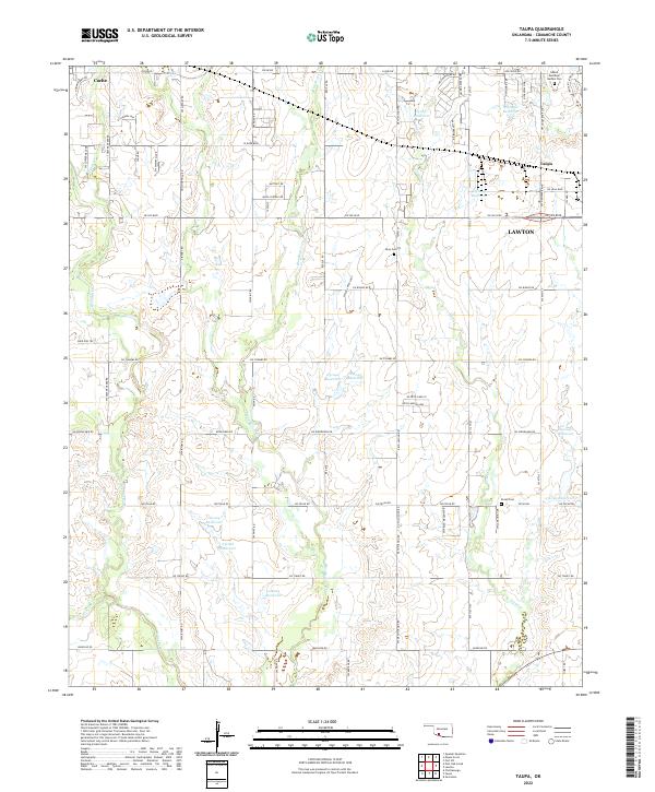 2022 Taupa2022 Print · USGSSouthwestern Oklahoma near the town of Cache is mapped here during its modern development, showing the transition between rural prairie and the expanding reach of Lawton. Genealogists can locate family sites near Sunset Memorial Garden Cem or trace the lands around Pecan Cem and Deyo Cem.
 - 2022 Map of Fort Sill, 2022 Print
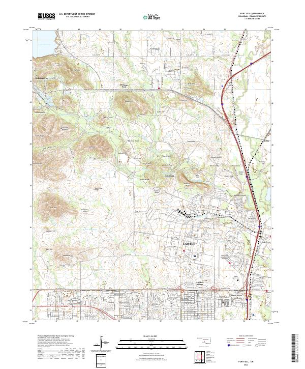 2022 Fort Sill2022 Print · USGSComanche County's military and mountain landscapes are on display in this contemporary study of the Lawton area. Researchers can trace historic sites like the Fort Sill Post Cem and the Indian Agency Cem alongside the peaks of the Wichita Mountains.
 - 2022 Map of Rocky Ford, 2022 Print
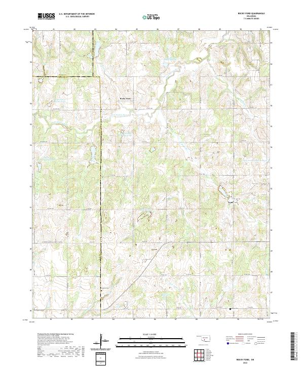 2022 Rocky Ford2022 Print · USGSThe rural landscapes of Grady and Caddo counties are captured here in the early twenty-first century, centered on the communities of Rocky Ford and Acme. Researchers can trace local genealogy at Simpson Cem or follow the managed waters of the Little Washita River.
 - 2022 Map of Temple NW, 2022 Print
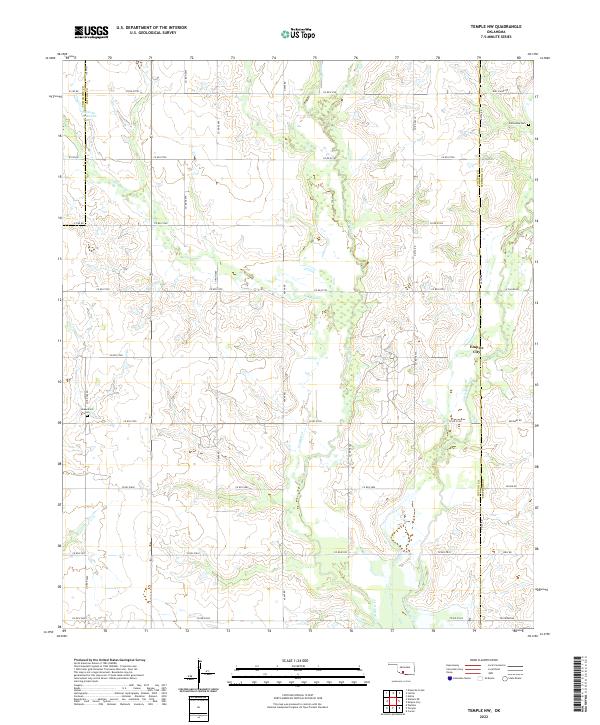 2022 Temple NW2022 Print · USGSThe Cotton County landscape north of Temple shows its established oil and agricultural character in the 2020s. Genealogists and historians can locate Comanche Cem and Shakelford Cem or trace the drainage of Beaver Cr near Empire City.
 - 2022 Map of Indiahoma, 2022 Print
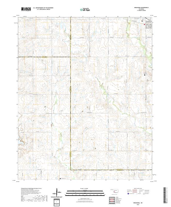 2022 Indiahoma2022 Print · USGSIndiahoma and the surrounding southwestern Oklahoma prairies are captured here in the early twenty-first century. Researchers can locate family sites and rural landmarks like Post Oak Cem, Indiahoma IOOF Cem, and the waters of Horse Cr.
 - 2022 Map of Richards Spur, 2022 Print
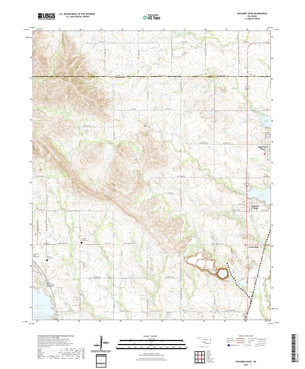 2022 Richards Spur2022 Print · USGSNorth of Lawton in the early 2020s, the boundary between Comanche and Caddo counties is defined by the expansive waters of Lake Ellsworth and Lake Lawtonka. Genealogists and local researchers can pinpoint family burial sites like Paradise Valley Cem and Mountain Scott Cem amidst the residential growth at Lakeside Village.
 - 2022 Map of Ninemile Creek, 2022 Print
 2022 Ninemile Creek2022 Print · USGSThe eastern suburbs of Lawton meet the rural Oklahoma prairie in the early 2020s, showing a landscape defined by creeks and small reservoirs. Researchers can locate the Flower Mound Community Cem and trace aviation landmarks like Hill Top Private Airport and DJS Airport.
 - 2022 Map of Fletcher, 2022 Print
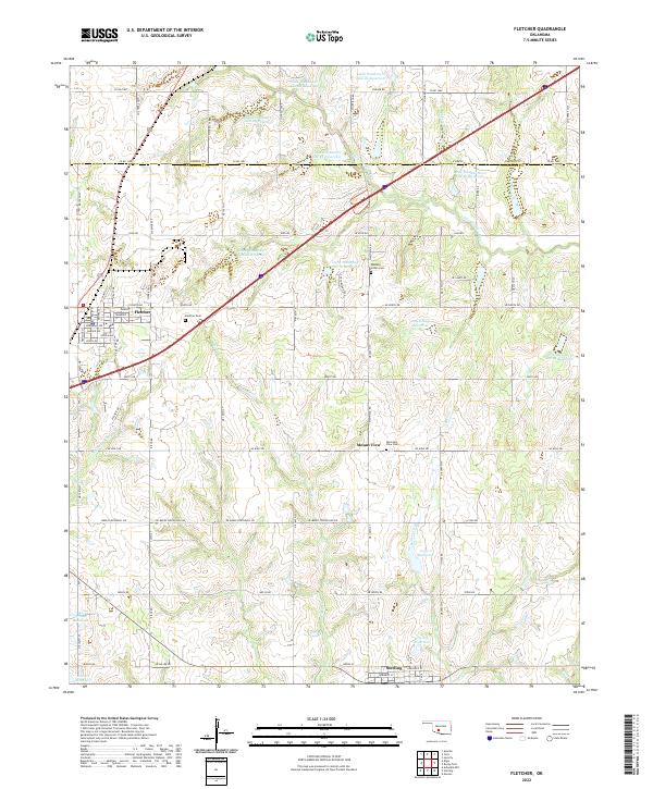 2022 Fletcher2022 Print · USGSThe Oklahoma prairie between Fletcher and Sterling is captured here as a landscape of managed waterways and historic settlements. Genealogists and researchers can locate family sites at the Washita Indian Cem or trace the path of the old Ozark Trl.
 - 2022 Map of Post Oak Creek, 2022 Print
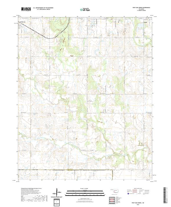 2022 Post Oak Creek2022 Print · USGSThe rural expanse between Indiahoma and Cache is documented here during the early twenty-first century. Genealogists and local historians can locate the Cache Indian Cemetery and trace family-named routes like Mr Benson's Rd along Post Oak Creek.
 - 2022 Map of Letitia, 2022 Print
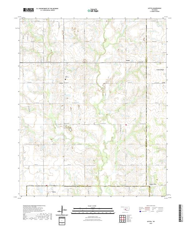 2022 Letitia2022 Print · USGSSoutheastern Oklahoma's rural section lines and creek drainages are mapped here in the modern era. Genealogists can locate family landmarks like the Letitia Community Cem or trace the small settlements of Letitia, Bethel, and Central High.
 - 2022 Map of Sterling, 2022 Print
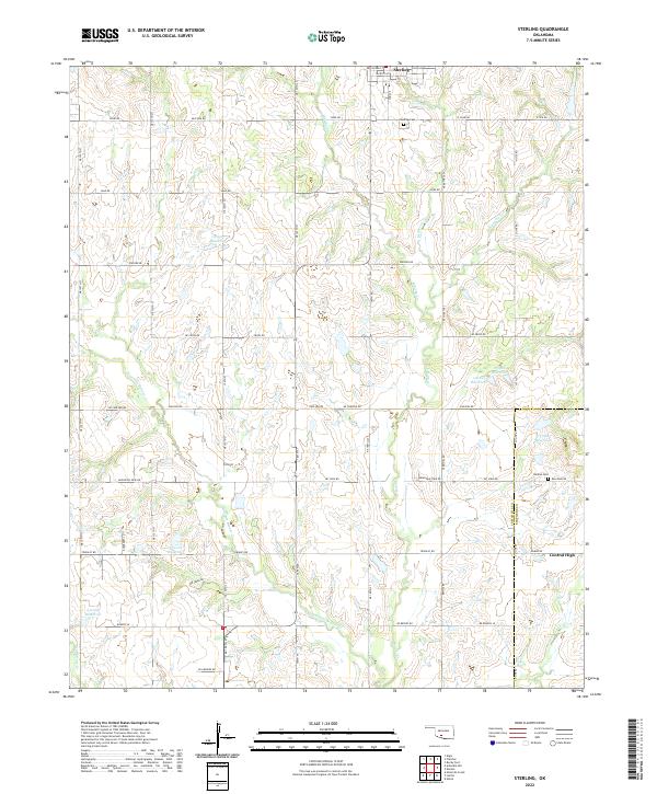 2022 Sterling2022 Print · USGSThe area surrounding Sterling and Central High is shown here as it appeared in the 2020s, defined by its rural road grid and intricate creek systems. Genealogists and researchers can locate family landmarks like the Sterling Cem and Denton Cem among the various reservoirs and drainage basins.
 - 2022 Map of Odetta, 2022 Print
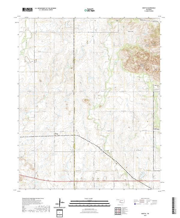 2022 Odetta2022 Print · USGSSouthwest Oklahoma's ranching country meets the granite peaks of the Wichita Mountains in this modern survey. Researchers can trace the drainage of Deep Red Cr or locate family landmarks like Sunset Peak, Bell Mtn, and the small settlement of Odetta.
 - 2022 Map of Denton, 2022 Print
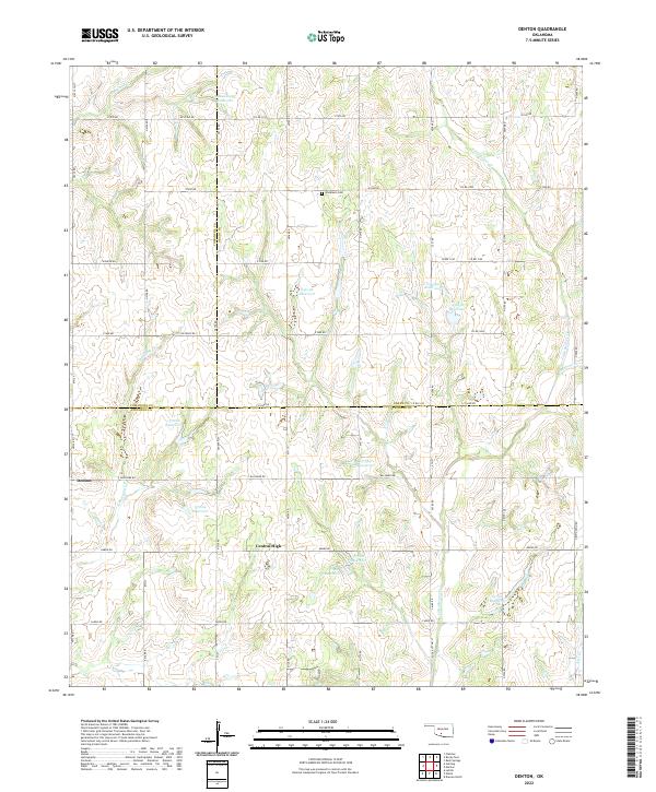 2022 Denton2022 Print · USGSThe borders of Comanche, Grady, and Stephens counties meet in this 2020s rural landscape. Researchers can locate Woodlawn Cem and trace the many waterways like Little Beaver Cr and Cottonwood Cr that define the local terrain.
 - 2022 Map of Faxon, 2022 Print
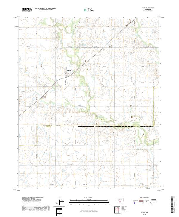 2022 Faxon2022 Print · USGSFaxon and the surrounding Comanche County prairie are captured here in the early twenty-first century. Researchers can locate family plots at Faxon Cem and trace the drainage of the local watershed along W Cache Cr and Blue Beaver Cr.
 - 2022 Map of Walters NE, 2022 Print
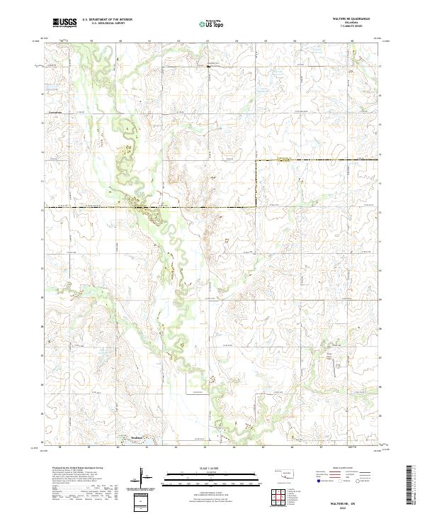 2022 Walters NE2022 Print · USGSCotton and Comanche Counties in the early 2020s remain defined by a deep-rooted agricultural grid centered on the drainage of E Cache Cr. Local researchers can trace family landmarks and burial sites including Allendale Cem, Devine Cem, and the Jones Farm Field.
 - 2022 Map of Geronimo, 2022 Print
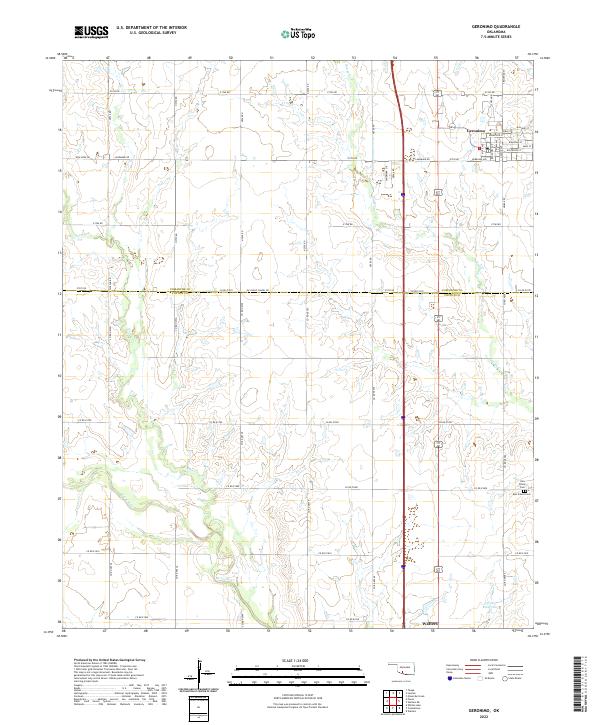 2022 Geronimo2022 Print · USGSGeronimo and the surrounding prairie of Comanche and Cotton Counties are captured here at a time when traditional section-line farming still defines the landscape. Trace local heritage and early family sites at Elm Grove Cem, New Salem Cem, or along the banks of Snake Cr.
 - 2022 Map of Saddle Mountain, 2022 Print
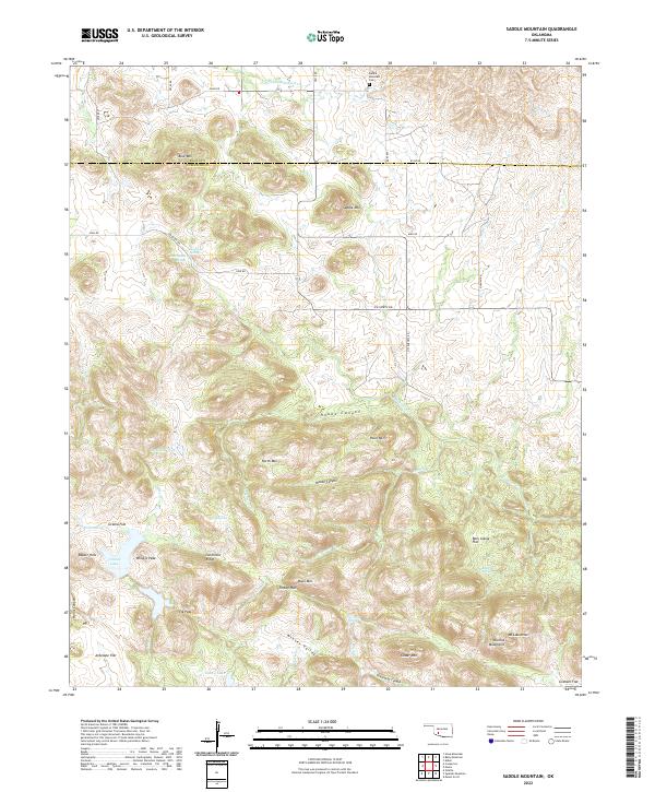 2022 Saddle Mountain2022 Print · USGSThe Wichita Mountains and southern plains of Kiowa and Comanche counties are shown here in modern detail. Researchers can trace family sites near Saddle Mountain Cem or explore geographic landmarks like Geronimo Ridge and Kiowa Lake.
 - 2022 Map of Lawton, 2022 Print
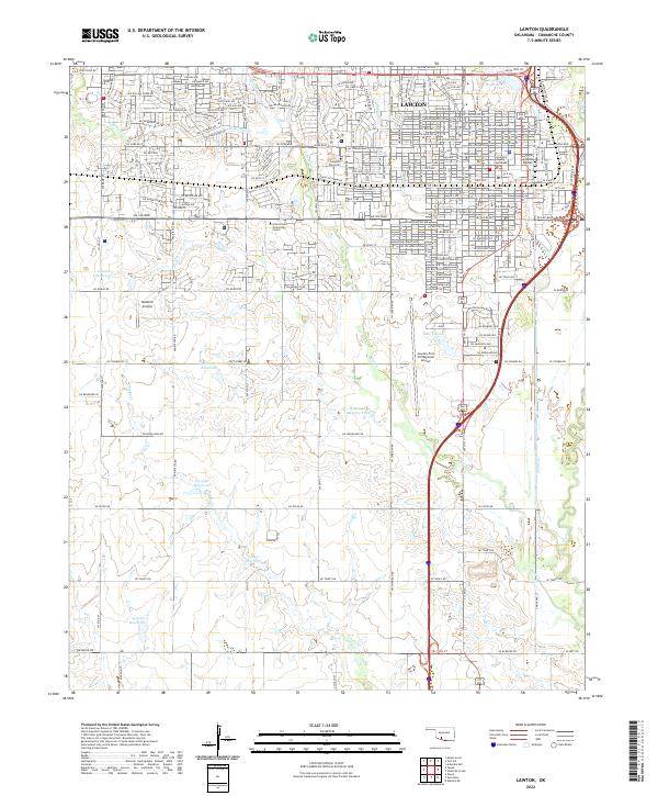 2022 Lawton2022 Print · USGSThe city of Lawton thrives as a regional hub in southwestern Oklahoma during this early twenty-first-century survey. Researchers can locate civic landmarks like the Comanche County Courthouse and the Rock Island Depot, or trace water features such as Lake Lawton and Numu Creek.
 - 2022 Map of Mount Scott, 2022 Print
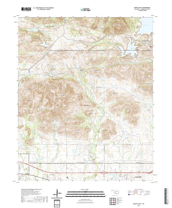 2022 Mount Scott2022 Print · USGSThe granite peaks of the Wichita Mountains and the unique resort architecture of Medicine Park define this Oklahoma landscape. Researchers can trace the Military Res Boundary Line or locate sites like The Holy City, Cache Cem, and Mt Scott.
 - 2022 Map of Arbuckle Hill, 2022 Print
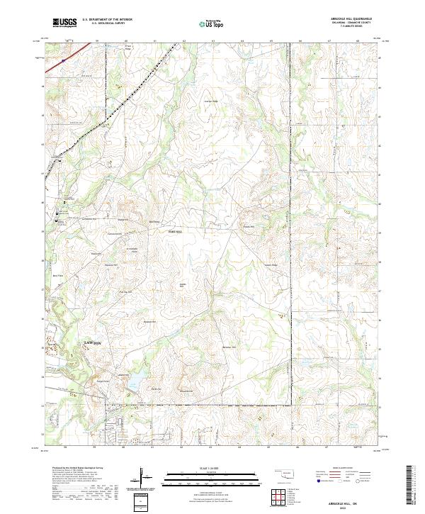 2022 Arbuckle Hill2022 Print · USGSNorth of Lawton in the 2020s, this landscape preserves significant indigenous landmarks and high-country terrain. Genealogists and historians can locate several burial grounds like Otipoby Comanche Cem and Beef Creek Apache Cem alongside landmarks such as Geronimo Hill.
 - 2022 Map of Elgin, 2022 Print
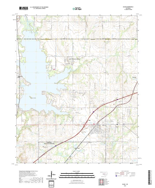 2022 Elgin2022 Print · USGSElgin and the shores of Lake Ellsworth come into focus in the early twenty-first century as the region balances modern growth with its rural character. Genealogists can locate several key burial sites including Fort Sill National Cemetery, Saint Anns Cemetery, and Elgin Cemetery.
 - 2022 Map of Meers, 2022 Print
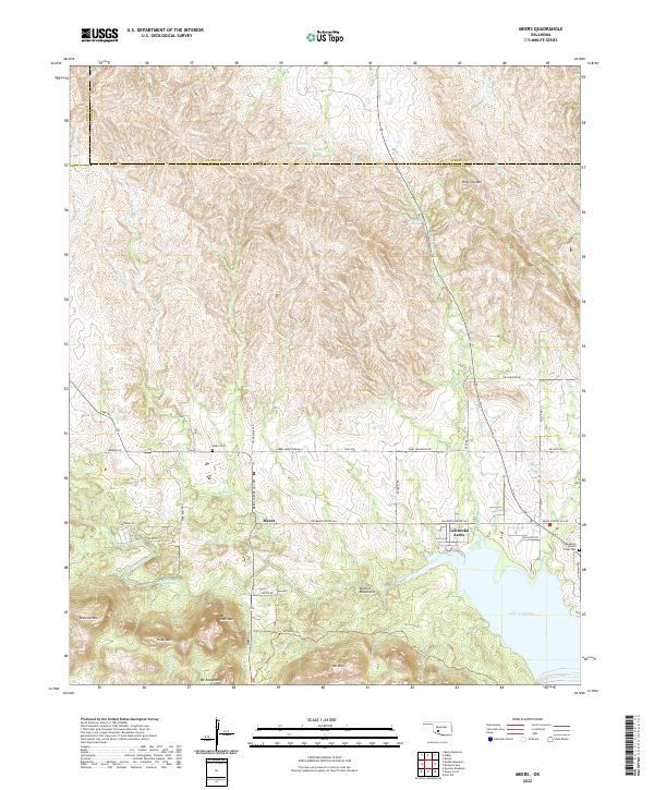 2022 Meers2022 Print · USGSThe Wichita Mountains of Oklahoma meet the shores of Lake Lawtonka in this contemporary record of Comanche County. Local historians and genealogists can trace the landscape around Meers, including the Mountain Scott Tribal Cem and Mt Sheridan.
 - 2022 Map of Quanah Mountain, 2022 Print
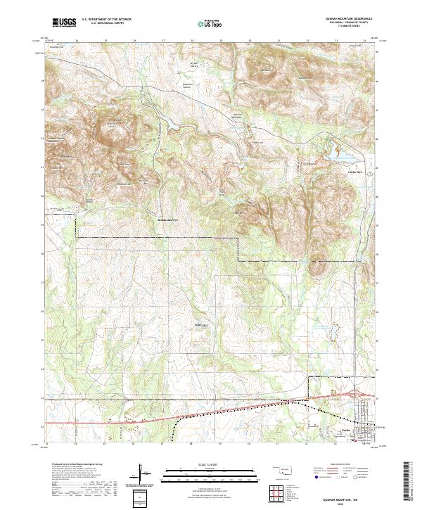 2022 Quanah Mountain2022 Print · USGSThe Wichita Mountains in Comanche County are documented here in recent years, showing a landscape defined by rocky peaks and managed water reservoirs. Researchers can trace the layout of Cache or locate landmarks like Forty Foot Hole and Centennial Arch.
 - 2022 Map of Chattanooga, 2022 Print
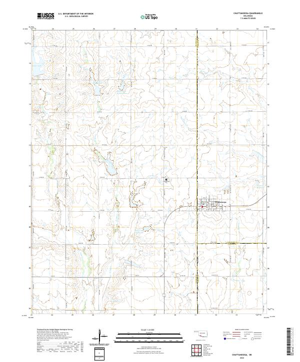 2022 Chattanooga2022 Print · USGSChattanooga and the intersection of Comanche and Tillman counties are captured here in the early twenty-first century. Genealogists and local historians can trace family plots at Chattanooga Cem or study the water systems at Jack Cr Site 2a Reservoir and Kinder Lake.
End of results
Showing maps 1-25 of 25
Top cities of Comanche County
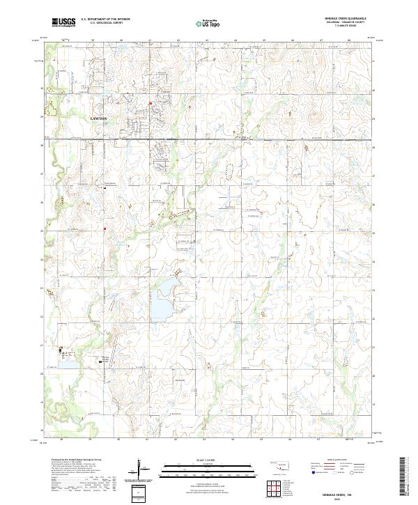
- Lawton historical maps
- Cache historical maps
- Elgin historical maps
- Geronimo historical maps
- Fletcher historical maps
- Sterling historical maps
See more
Frequently asked questions
- What are the different types of historical maps available for Comanche County?
- What is the oldest map of Comanche County?
- Where can I purchase historical maps of Comanche County for my home or office?
- Where can I download high-res historical maps of Comanche County?
- Are there historical topographic maps available for Comanche County?
- Is there historical aerial imagery available for Comanche County?
- Where are historical maps of Comanche County sourced from?