1980s Maps of Kingfisher County, Oklahoma
Explore 10 historic maps of Kingfisher County from the 1980s. These maps offer a rare glimpse into what life looked like during the 1980s — showing old roads, neighborhoods, homes, and landmarks that have changed or disappeared over time.
Whether you're researching your family's past, planning a metal detecting trip, or studying how Kingfisher County's landscape evolved across the 1980s, these high-resolution maps are a powerful tool for exploring the history of this region.
- Focus on a specific era: All maps on this page are from the 1980s, giving you a focused view of this time period.
- See what’s changed: Compare century-old streets, trails, and buildings to today's modern landscape using overlays and satellite layers.
- Research with precision: Use these maps for genealogy, historical research, land use analysis, or educational projects.
- View, download, or print: Maps are fully viewable online in high resolution, and can be downloaded or printed for your own records.
Start exploring Kingfisher County's history through authentic maps from the 1980s. This is your window into the past.
Kingfisher County, OK maps
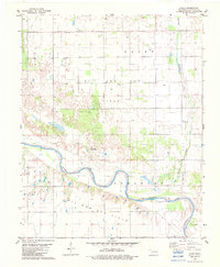
(10)- 1982 Map of Bison
 1982 Bison1982 Print · USGSGarfield and Kingfisher Counties are shown here in the early eighties, where historical treaty lines intersect with the Oklahoma energy boom. Researchers can trace the Old Indian Treaty Boundary or locate rural landmarks like Hope Cem and the Pribyl Ranch Landing Strip.2 unique versions available
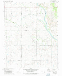
 - 1982 Map of Union
 1982 Union1982 Print · USGSOklahoma's prairie landscape in the early eighties reveals a region defined by agricultural traditions and oil extraction. Genealogists and historians can locate rural landmarks like St Josephs Cem, the settlement of Union, and the Oak Grove Ch.
 - 1982 Map of Barr, 1983 Print
 1982 Barr1983 Print · USGSNorth-central Oklahoma's prairie landscape is captured here in the early eighties, where the Old Indian Treaty Boundary meets a modern energy economy. Researchers can locate family roots at Wildwood Cem and Cimarron Valley Cem or trace rural life around Barr and Kennedy.
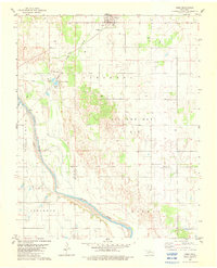
 - 1982 Map of Hennessey, 1983 Print
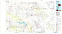
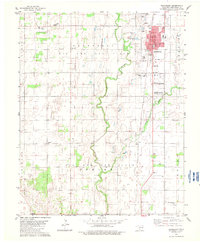 1982 Hennessey1983 Print · USGSHennessey and northern Kingfisher County are shown here in the early 1980s, highlighting the region's active energy and agricultural production. Genealogists and historians can locate the Old Indian Treaty Boundary and several local burial grounds including Hennessey Cem and the Evans and Burns Cem.
 - 1982 Map of Lacey, 1983 Print
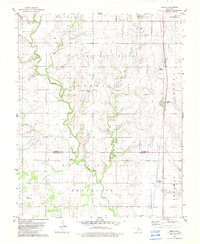
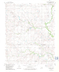
 1982 Lacey1983 Print · USGSKingfisher County's river valley is captured here in the early eighties, showing a landscape defined by the Cimarron River and energy production. Researchers can locate the Lacey settlement, trace family roots at Lacey Cem, and identify old private airfields like Huff Landing Strip.
 - 1982 Map of Ames, 1983 Print
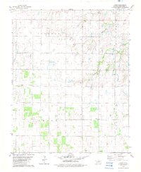
 1982 Ames1983 Print · USGSAmes and the surrounding Major County oil fields are captured here in the early eighties as industrial and historical boundaries intersected. Genealogists and researchers can trace the Major Co Old Indian Treaty Boundary and locate landmarks like the Burlington Northern rail line and Crystal Lakes.
 - 1982 Map of Parvin, 1983 Print
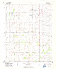
 1982 Parvin1983 Print · USGSOklahoma's river-bottom energy country is documented here in the early eighties along the Cimarron River and the Blaine-Kingfisher county line. Researchers can pinpoint rural landmarks like Parvin, the East Cooper Cem, and numerous active Gravel Pits.
 - 1982 Map of Steinerts Lake, 1983 Print
 1982 Steinerts Lake1983 Print · USGSGarfield and Kingfisher Counties are shown here in the early eighties, divided by a historic treaty line. Genealogists can trace family footprints near Bison Cem, Pleasant Valley Ch, and the waters of Steinerts Lake.
 - 1985 Map of Watonga
 1985 Watonga1985 Print · USGSCentral Oklahoma in the mid-eighties shows a robust network of river-valley settlements and rural rail lines. Genealogists and historians can trace the footprint of Southwestern State College, the historic Fort Reno, and family-named landmarks like Dead Women Crossing.2 unique versions available
 - 1986 Map of Fairview
 1986 Fairview1986 Print · USGSMajor County and the Cimarron River valley are shown here in the mid-1980s as the rail networks of the Atchison Topeka and Santa Fe still linked the plains. Researchers can trace rural lineages through settlements like Cheyenne Valley, Bouse Junction, and the terrain surrounding Canton Lake.2 unique versions available
End of results
Showing maps 1-10 of 10
Top cities of Kingfisher County
Frequently asked questions
- What are the different types of historical maps available for Kingfisher County?
- What is the oldest map of Kingfisher County?
- Where can I purchase historical maps of Kingfisher County for my home or office?
- Where can I download high-res historical maps of Kingfisher County?
- Are there historical topographic maps available for Kingfisher County?
- Is there historical aerial imagery available for Kingfisher County?
- Where are historical maps of Kingfisher County sourced from?