Old Maps of Kingfisher County, Oklahoma for Hiking & Exploration
Hike through history with 175 historic maps of Kingfisher County. Explore old trails, ghost towns, and forgotten backroads — perfect for outdoor adventurers and local explorers.
- Rediscover forgotten places: Map out old mining camps, roads, and footpaths that no longer exist on modern maps.
- Layer with modern tools: Combine with LiDAR or satellite views to plan hikes through historical terrain.
- Made for exploration: Popular among hikers, overlanders, and local history lovers.
Use these maps to find adventure and explore the hidden past of Kingfisher County.
Kingfisher County, OK maps
(175)- 1892 Map of Kingfisher, 1957 Print
 1892 Kingfisher1957 Print · USGSOklahoma Territory was in a state of rapid transition during the 1890s as railroads and cattle trails shared the same landscape. Researchers can trace the original Chisholm Trail alongside early settlements like Mathewson and river crossings such as Kirby Ford.
 - 1893 Map of Fort Reno
 1893 Fort Reno1893 Print · USGSCentral Oklahoma's frontier landscape is documented here in the final decade of the nineteenth century. Genealogists and historians can locate the Darlington Agency, the early enclave of African City, and the military post at Fort Reno.2 unique versions available
 - 1893 Map of Lovell
 1893 Lovell1893 Print · USGSOklahoma Territory was still in its infancy when this survey was conducted, showing the land just after the first settlers arrived. Genealogists can trace the early locations of Marshall, Sheridan, and Columbia along the banks of Skeleton Creek.
 - 1893 Map of Hennessey
 1893 Hennessey1893 Print · USGSOklahoma Territory is captured during its formative years of settlement as the iron rail connects the prairie to the wider world. Genealogists and historians can trace the early foundations of Hennessey or locate smaller, early outposts like Buffalo Springs, Paris, and Myrtle.
 - 1893 Map of Loyal
 1893 Loyal1893 Print · USGSOklahoma Territory was still in its first decade of settlement when these early communities began to dot the landscape. Researchers can trace the original locations of Omega, Alpha, and Huntsville alongside the borders of the Cheyenne and Arapahoe Reservation.2 unique versions available
 - 1893 Map of Ames
 1893 Ames1893 Print · USGSOklahoma territory is captured here during the early surveying era, showing the river-dominated landscape of Major and Kingfisher counties. Local historians can trace early settlement patterns at Lacey and Parvin or locate the historic Washburns Crossing on the Cimarron River.2 unique versions available
 - 1895 Map of Kingfisher
 1895 Kingfisher1895 Print · USGSOklahoma Territory during the mid-1890s reveals a rapidly developing frontier defined by river crossings and expanding rail lines. Genealogists and historians can trace the early foundations of Kingfisher, Elreno, and Yukon alongside historic river crossings like Gould Ford.4 unique versions available
 - 1941 Map of Fort Reno
 1941 Fort Reno1941 Print · USGSThe North Canadian River valley was a center of agricultural and military life in the late thirties. Genealogists can trace family footprints across dozens of country schools and churches like Sunny Hill Sch, Swappingback Indian Chapel, and the historic Fort Reno grounds.3 unique versions available
 - 1942 Map of Fort Reno
 1942 Fort Reno1942 Print · USGSOklahoma's Canadian County plains come alive in this early-forties survey, showcasing a landscape defined by military depots and tribal schools. Researchers can trace rural lineages through dozens of local sites like Banner Sch, Canadian Valley Cem, and the Fort Reno garrison.
 - 1949 Map of Fort Reno
 1949 Fort Reno1949 Print · USGSOklahoma's Canadian County comes to life in this mid-century survey, capturing the unique intersection of military history, tribal education, and Route 66 commerce. Genealogists can locate family landmarks like Swappingback Indian Chapel, Calumet, and the expansive Fort Reno Military Reservation.
 - 1954 Map of Oklahoma City
 1954 Oklahoma City1954 Print · USGSOklahoma City and its surrounding counties are captured here in the early fifties during a period of significant postwar growth. Researchers can trace the development of the Turner Turnpike and locate aviation hubs like Tinker Field or Will Rogers Field.
 - 1955 Map of Clinton, 1964 Print
 1955 Clinton1964 Print · USGSWestern Oklahoma during the mid-century transition shows a landscape of growing reservoirs and active military flight lines. Genealogists and historians can locate rural landmarks such as Mountain View Church, Berlin School, and the Riverside Indian School Reserve.3 unique versions available
 - 1955 Map of Enid, 1966 Print
 1955 Enid1966 Print · USGSNorth-central Oklahoma's transition from open plains to the blackjack hills of the Osage Indian Reservation is captured in the mid-1950s. Researchers can trace the development of the Naval Reserve Oil Field, the grounds of Vance AFB, and the early footprints of Tulsa and Stillwater.4 unique versions available
 - 1955 Map of Woodward, 1967 Print
 1955 Woodward1967 Print · USGSNorthwest Oklahoma and the bordering plains are captured during the mid-sixties, showing a landscape defined by river valleys and massive water projects. Researchers can trace family roots in towns like Woodward and Alva or locate landmarks such as the Western Oklahoma State Hospital and Kegelman AF.3 unique versions available
 - 1956 Map of Ames, 1957 Print
 1956 Ames1957 Print · USGSMajor and Garfield counties are captured here in the mid-1950s, centered on the railroad town of Ames and the Cimarron River. Genealogists can trace rural life through landmarks like Antioch Ch, Mound Ridge Sch, and the Cimarron Valley Cem.2 unique versions available
 - 1956 Map of Hennessey, 1957 Print
 1956 Hennessey1957 Print · USGSHennessey and the surrounding wheat lands are captured here in the mid-fifties, centered on the busy Chicago Rock Island and Pacific rail corridor. Researchers can trace rural life through landmarks like Lyon Valley Sch (Abandoned), Bison Cem, and Union Chapel.2 unique versions available
 - 1957 Map of Clinton
 1957 Clinton1957 Print · USGSWestern Oklahoma in the mid-fifties is captured here as a landscape of river-valley settlements and emerging energy fields. Genealogists can trace family roots through numerous rural landmarks like the Swapping Back Indian School, Hebron Church, and the Riverside Indian School Reserve.
 - 1957 Map of Oklahoma City, 1969 Print
 1957 Oklahoma City1969 Print · USGSCentral Oklahoma is captured here in a period of significant mid-century growth and industrialization. Researchers can trace family roots through numerous rural markers like Memory Lane Cem, New Hope School, and the sprawling grounds of Tinker Air Force Base.3 unique versions available
 - 1958 Map of Enid
 1958 Enid1958 Print · USGSNorthern Oklahoma is mapped here in the late fifties, showcasing a dense network of petroleum production and historic tribal lands. Researchers can trace the legacy of the Osage Indian Reservation, early energy hubs like the Cushing Oil Field, and the Chilocco Indian Agricultural School.2 unique versions available
 - 1958 Map of Woodward
 1958 Woodward1958 Print · USGSNorthwest Oklahoma and the neighboring panhandle borders are shown here during a period of steady mid-century growth. Researchers can trace the rail networks of the Atchison Topeka and Santa Fe and locate landmarks like the Western Oklahoma State Hospital and Port Supply Reservoir.2 unique versions available
 - 1963 Map of Oklahoma City
 1963 Oklahoma City1963 Print · USGSCentral Oklahoma in the early sixties showcases a landscape of rapid suburban growth and established oil production. Researchers can trace historic rail lines like the Chicago Rock Island and Pacific RR or locate rural landmarks such as Mayflower School and Bethel Church.
 - 1966 Map of Piedmont, 1967 Print
 1966 Piedmont1967 Print · USGSMid-century Piedmont and its surrounding rural townships appear here during a period of urban expansion and petroleum development. Researchers can find old family cemeteries like Kansas Cem, trace the Old Railroad Grade, and locate the early infrastructure of the West Edmond Oil and Gas Field.3 unique versions available
 - 1969 Map of Crescent NW, 1972 Print
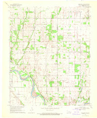 1969 Crescent NW1972 Print · USGSKingfisher and Logan counties are shown in the late sixties as the regional economy balanced agriculture with energy production. Genealogists can locate family-named sites like Borelli and Wandel or trace burial sites at Oak Vale Cem and Oak Grove Cem.
 - 1970 Map of Cashion, 1972 Print
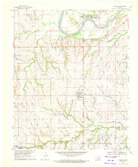 1970 Cashion1972 Print · USGSThe Kingfisher and Logan County line comes alive in the early seventies, dominated by the river valley and oil production. Trace family roots at Mt Zion Cem or explore the industrial footprint of the Sooner Trend Oil Field and Cashion Landing Strip.2 unique versions available
 - 1972 Map of Kingfisher SE, 1974 Print
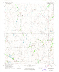 1972 Kingfisher SE1974 Print · USGSThe rural outskirts of Kingfisher County are documented here in the early seventies as petroleum interests began to reshape the prairie. Genealogy researchers can locate family plots at Pleasant Valley Cem or trace the path of the Old Railroad Grade near Reeding.
Showing maps 1-25 of 175
Top cities of Kingfisher County
Frequently asked questions
- What are the different types of historical maps available for Kingfisher County?
- What is the oldest map of Kingfisher County?
- Where can I purchase historical maps of Kingfisher County for my home or office?
- Where can I download high-res historical maps of Kingfisher County?
- Are there historical topographic maps available for Kingfisher County?
- Is there historical aerial imagery available for Kingfisher County?
- Where are historical maps of Kingfisher County sourced from?