1950s Maps of Kingfisher County, Oklahoma
Explore 10 historic maps of Kingfisher County from the 1950s. These maps offer a rare glimpse into what life looked like during the 1950s — showing old roads, neighborhoods, homes, and landmarks that have changed or disappeared over time.
Whether you're researching your family's past, planning a metal detecting trip, or studying how Kingfisher County's landscape evolved across the 1950s, these high-resolution maps are a powerful tool for exploring the history of this region.
- Focus on a specific era: All maps on this page are from the 1950s, giving you a focused view of this time period.
- See what’s changed: Compare century-old streets, trails, and buildings to today's modern landscape using overlays and satellite layers.
- Research with precision: Use these maps for genealogy, historical research, land use analysis, or educational projects.
- View, download, or print: Maps are fully viewable online in high resolution, and can be downloaded or printed for your own records.
Start exploring Kingfisher County's history through authentic maps from the 1950s. This is your window into the past.
Kingfisher County, OK maps
(10)- 1954 Map of Oklahoma City
 1954 Oklahoma City1954 Print · USGSOklahoma City and its surrounding counties are captured here in the early fifties during a period of significant postwar growth. Researchers can trace the development of the Turner Turnpike and locate aviation hubs like Tinker Field or Will Rogers Field.
 - 1955 Map of Clinton, 1964 Print
 1955 Clinton1964 Print · USGSWestern Oklahoma during the mid-century transition shows a landscape of growing reservoirs and active military flight lines. Genealogists and historians can locate rural landmarks such as Mountain View Church, Berlin School, and the Riverside Indian School Reserve.3 unique versions available
 - 1955 Map of Enid, 1966 Print
 1955 Enid1966 Print · USGSNorth-central Oklahoma's transition from open plains to the blackjack hills of the Osage Indian Reservation is captured in the mid-1950s. Researchers can trace the development of the Naval Reserve Oil Field, the grounds of Vance AFB, and the early footprints of Tulsa and Stillwater.4 unique versions available
 - 1955 Map of Woodward, 1967 Print
 1955 Woodward1967 Print · USGSNorthwest Oklahoma and the bordering plains are captured during the mid-sixties, showing a landscape defined by river valleys and massive water projects. Researchers can trace family roots in towns like Woodward and Alva or locate landmarks such as the Western Oklahoma State Hospital and Kegelman AF.3 unique versions available
 - 1956 Map of Ames, 1957 Print
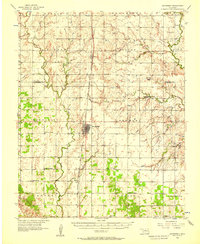
 1956 Ames1957 Print · USGSMajor and Garfield counties are captured here in the mid-1950s, centered on the railroad town of Ames and the Cimarron River. Genealogists can trace rural life through landmarks like Antioch Ch, Mound Ridge Sch, and the Cimarron Valley Cem.2 unique versions available
 - 1956 Map of Hennessey, 1957 Print
 1956 Hennessey1957 Print · USGSHennessey and the surrounding wheat lands are captured here in the mid-fifties, centered on the busy Chicago Rock Island and Pacific rail corridor. Researchers can trace rural life through landmarks like Lyon Valley Sch (Abandoned), Bison Cem, and Union Chapel.2 unique versions available
 - 1957 Map of Clinton
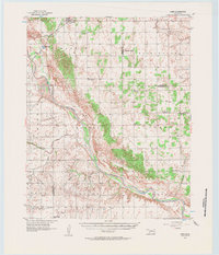
 1957 Clinton1957 Print · USGSWestern Oklahoma in the mid-fifties is captured here as a landscape of river-valley settlements and emerging energy fields. Genealogists can trace family roots through numerous rural landmarks like the Swapping Back Indian School, Hebron Church, and the Riverside Indian School Reserve.
 - 1957 Map of Oklahoma City, 1969 Print
 1957 Oklahoma City1969 Print · USGSCentral Oklahoma is captured here in a period of significant mid-century growth and industrialization. Researchers can trace family roots through numerous rural markers like Memory Lane Cem, New Hope School, and the sprawling grounds of Tinker Air Force Base.3 unique versions available
 - 1958 Map of Enid
 1958 Enid1958 Print · USGSNorthern Oklahoma is mapped here in the late fifties, showcasing a dense network of petroleum production and historic tribal lands. Researchers can trace the legacy of the Osage Indian Reservation, early energy hubs like the Cushing Oil Field, and the Chilocco Indian Agricultural School.2 unique versions available
 - 1958 Map of Woodward
 1958 Woodward1958 Print · USGSNorthwest Oklahoma and the neighboring panhandle borders are shown here during a period of steady mid-century growth. Researchers can trace the rail networks of the Atchison Topeka and Santa Fe and locate landmarks like the Western Oklahoma State Hospital and Port Supply Reservoir.2 unique versions available
End of results
Showing maps 1-10 of 10
Top cities of Kingfisher County
Frequently asked questions
- What are the different types of historical maps available for Kingfisher County?
- What is the oldest map of Kingfisher County?
- Where can I purchase historical maps of Kingfisher County for my home or office?
- Where can I download high-res historical maps of Kingfisher County?
- Are there historical topographic maps available for Kingfisher County?
- Is there historical aerial imagery available for Kingfisher County?
- Where are historical maps of Kingfisher County sourced from?