Old Maps of Cooperton, Oklahoma for Academic Research
Study the evolution of Cooperton with 18 high-resolution historic maps. Whether you're teaching, researching, or modeling changes in land use, these maps provide essential visual documentation of urban, environmental, and geographic change.
- Analyze long-term change: Track patterns in development, transportation, and natural features.
- Ideal for environmental or urban studies: Support academic projects with primary historical map data.
- Use in the classroom or lab: Educators and researchers rely on these maps to bring historical context to life.
These maps are a powerful tool for teaching, research, and visualizing how Cooperton has changed over the decades.
Cooperton, OK maps
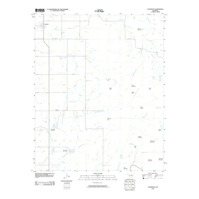
(18)- 1949 Map of Cooperton, 1953 Print
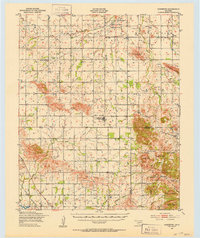 1949 Cooperton1953 Print · USGSKiowa and Comanche counties at the close of the 1940s reveal a landscape defined by the Rainy Mountain Indian School Reservation and the rising Wichita Mountains. Genealogists and researchers can trace rural life through the Gold Mine (Abandoned), Union Dale Cem, and the village of Cooperton.2 unique versions available
 - 1955 Map of Lawton, 1958 Print
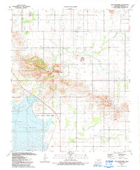
 1955 Lawton1958 Print · USGSSouthwestern Oklahoma and North Texas are shown here in the mid-fifties, dominated by the Wichita Mountains and the vital Red River watershed. Genealogists and historians can trace the foundations of Lawton alongside rural landmarks like Rainy Mountain Church and Pleasant Hill School.5 unique versions available
 - 1956 Map of Glen Mountains, 1959 Print
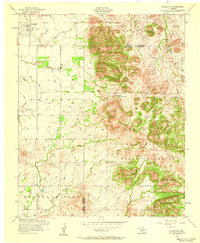
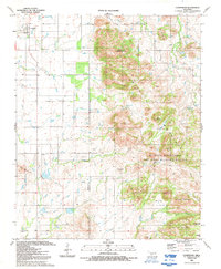
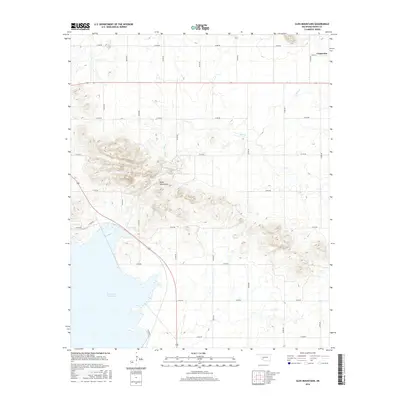
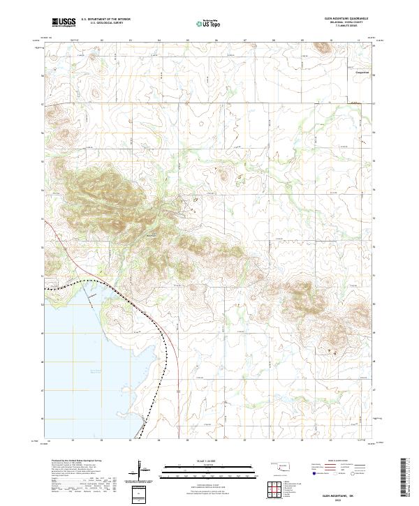
 1956 Glen Mountains1959 Print · USGSKiowa County, Oklahoma, is captured here in the mid-1950s as a landscape of rocky ridges and emerging infrastructure. Researchers can trace the St Louis San Francisco rail line or locate the Gold Mine (Abandoned) near Glen Creek.2 unique versions available
 - 1956 Map of Cooperton, 1959 Print
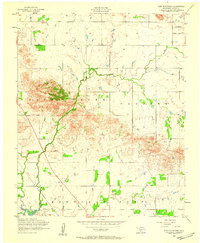
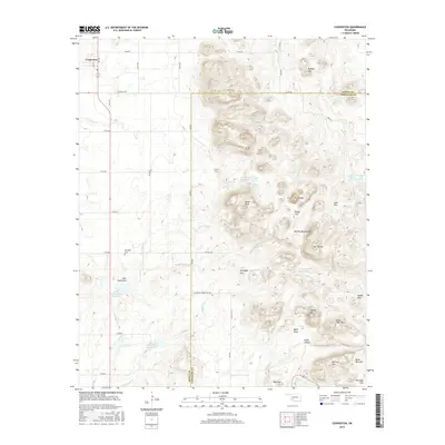
 1956 Cooperton1959 Print · USGSThe Oklahoma plains meet the Wichita Mountains in the mid-1950s, showing a landscape of isolated peaks and rural church communities. Researchers can trace local history at Springhill Cemetery or explore landmarks like Cut Throat Lake and Baker Peak.2 unique versions available
 - 1956 Map of Cooperton, 1960 Print
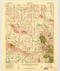 1956 Cooperton1960 Print · USGSThe Kiowa County plains meet the granite peaks of the Wichita Mountains during the mid-1950s. Genealogists and historians can trace the Rainy Mountain Indian Reservation, find rural landmarks like Richland Union Church, or locate the Abandoned gold mine.2 unique versions available
 - 1981 Map of Lawton
 1981 Lawton1981 Print · USGSSouthwestern Oklahoma in the early eighties shows a landscape shaped by military history and the rising peaks of the Wichitas. Researchers can trace the boundaries of the Fort Sill Military Reservation and locate early settlements like Meers, Chattanooga, and Richards Spur.
 - 1991 Map of Glen Mountains, 1992 Print
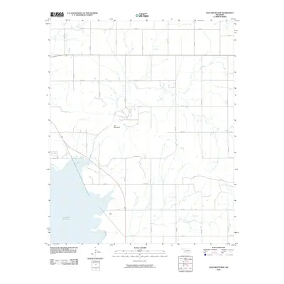
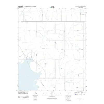
 1991 Glen Mountains1992 Print · USGSThe Oklahoma landscape in the early nineties is defined here by the waters of the Tom Steed Reservoir. Researchers can trace the development of Great Plains State Park and locate a Mine (Abandoned) or Quarry within the Glen Mountains.
 - 1991 Map of Cooperton, 1992 Print
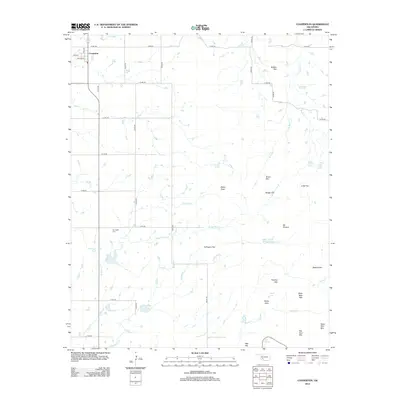
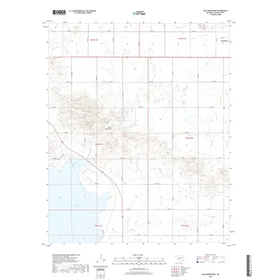
 1991 Cooperton1992 Print · USGSThe Kiowa and Comanche county line area comes into focus in the early 1990s, where agricultural plains meet the granite peaks of the southwest. Researchers can locate the Springhill Cem, trace the waters of Cut Throat Lake, and explore the high ground of Mount Pinchot.
 - 2010 Map of Cooperton, 2010 Print
 2010 Cooperton2010 Print · USGSCovers Cooperton, including Comanche County, Kiowa County, and other nearby areas
 - 2010 Map of Glen Mountains, 2010 Print
 2010 Glen Mountains2010 Print · USGSCovers Cooperton, including Kiowa County, United States, and other nearby areas
 - 2012 Map of Cooperton, 2012 Print
 2012 Cooperton2012 Print · USGSCovers Cooperton, including Comanche County, Kiowa County, and other nearby areas
 - 2012 Map of Glen Mountains, 2012 Print
 2012 Glen Mountains2012 Print · USGSCovers Cooperton, including Kiowa County, United States, and other nearby areas
 - 2016 Map of Cooperton, 2016 Print
 2016 Cooperton2016 Print · USGSCovers Cooperton, including Comanche County, Kiowa County, and other nearby areas
 - 2016 Map of Glen Mountains, 2016 Print
 2016 Glen Mountains2016 Print · USGSCovers Cooperton, including Kiowa County, United States, and other nearby areas
 - 2018 Map of Glen Mountains, 2018 Print
 2018 Glen Mountains2018 Print · USGSCovers Cooperton, including Kiowa County, United States, and other nearby areas
 - 2018 Map of Cooperton, 2018 Print
 2018 Cooperton2018 Print · USGSCovers Cooperton, including Comanche County, Kiowa County, and other nearby areas
 - 2022 Map of Cooperton, 2022 Print
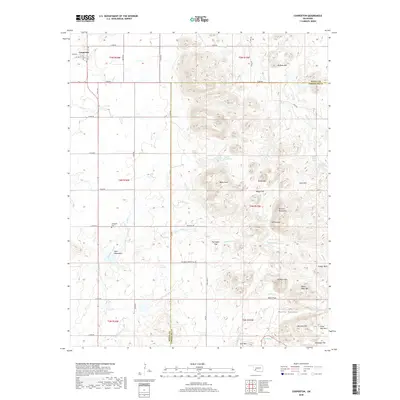
 2022 Cooperton2022 Print · USGSThe Kiowa and Comanche county line divides this rugged section of Oklahoma as it appeared in the 2020s. Researchers can locate the Springhill Cem near Cooperton or trace the drainage of Sugar Cr through the Wichita Mountains.
 - 2022 Map of Glen Mountains, 2022 Print
 2022 Glen Mountains2022 Print · USGSKiowa County's rugged terrain meets modern water management in this contemporary survey of southwestern Oklahoma. Researchers can trace the rural road grid around the Glen Mountains and see the interface between the settlement of Cooperton and the Tom Steed Reservoir.
End of results
Showing maps 1-18 of 18
Top cities near Cooperton
- Hobart historical maps
- Snyder historical maps
- Mountain Park historical maps
- Roosevelt historical maps
- Gotebo historical maps
Frequently asked questions
- What are the different types of historical maps available for Cooperton?
- What is the oldest map of Cooperton?
- Where can I purchase historical maps of Cooperton for my home or office?
- Where can I download high-res historical maps of Cooperton?
- Are there historical topographic maps available for Cooperton?
- Is there historical aerial imagery available for Cooperton?
- Where are historical maps of Cooperton sourced from?