1980s Maps of Klamath County, Oregon
Explore 111 historic maps of Klamath County from the 1980s. These maps offer a rare glimpse into what life looked like during the 1980s — showing old roads, neighborhoods, homes, and landmarks that have changed or disappeared over time.
Whether you're researching your family's past, planning a metal detecting trip, or studying how Klamath County's landscape evolved across the 1980s, these high-resolution maps are a powerful tool for exploring the history of this region.
- Focus on a specific era: All maps on this page are from the 1980s, giving you a focused view of this time period.
- See what’s changed: Compare century-old streets, trails, and buildings to today's modern landscape using overlays and satellite layers.
- Research with precision: Use these maps for genealogy, historical research, land use analysis, or educational projects.
- View, download, or print: Maps are fully viewable online in high resolution, and can be downloaded or printed for your own records.
Start exploring Klamath County's history through authentic maps from the 1980s. This is your window into the past.
Klamath County, OR maps
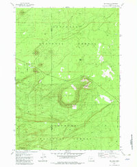
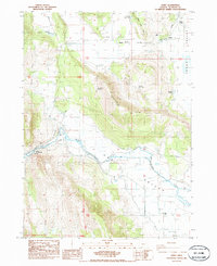
(111)- 1980 Map of Williamson River, 1997 Print
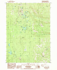
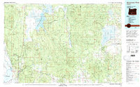 1980 Williamson River1997 Print · USGSSouthern Oregon in the late twentieth century was a landscape of high-desert forests and vast marshes managed by multiple federal agencies. Genealogists and historians can trace the rail-side settlements of Lenz and Kirk, or locate the historic Klamath Agency and Fort Klamath.
 - 1981 Map of Wickiup Spring, 1982 Print
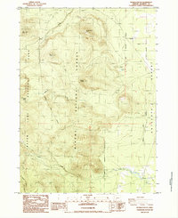
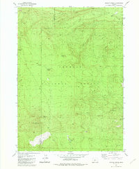 1981 Wickiup Spring1982 Print · USGSThe Fremont National Forest high country comes into focus in this late-century survey of the Klamath and Lake county border. Researchers can trace the network of 4WD trails connecting vital water sources like Wickiup Spring, Mush Spring, and the Forest Service Sta.
 - 1981 Map of Stams Mtn, 1982 Print
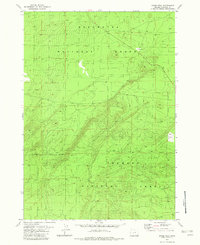
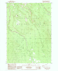
 1981 Stams Mtn1982 Print · USGSKlamath County's high forest terrain is captured here in the early eighties as a network of service roads and water sources. Researchers can trace the locations of isolated landmarks like Stams Well, Mowich Spring, and Timber Butte.2 unique versions available
 - 1982 Map of Grass Well
 1982 Grass Well1982 Print · USGSThe high plateau of Klamath County meets the intersection of three major forests in the early 1980s. Researchers can trace the water infrastructure and resource management markers of the region, including Grass Well and a local Borrow Pit.
 - 1982 Map of Big Hole
 1982 Big Hole1982 Print · USGSThe high volcanic country of Lake County is documented here in the early eighties, showing the intersection of two national forests. Trace the location of the Summit Stage Station (Site) and explore the unique geology of Big Hole.
 - 1983 Map of Cedarville
 1983 Cedarville1983 Print · USGSNortheastern California at the turn of the 1980s reveals a landscape of high-altitude basins and remote mountain ranges. Researchers can trace historic mining operations at Yellow Jacket Mines, locate the XL Ranch Indian Reservation, and follow the Southern Pacific line through Willow Ranch.2 unique versions available
 - 1983 Map of Oakridge
 1983 Oakridge1983 Print · USGSThe Cascades of Lane County are shown in the early eighties, centered on the timber and rail corridors of the Willamette. Genealogists and historians can trace the Southern Pacific line through Oakridge or find old mining sites like Mayflower Mine.
 - 1984 Map of Tulelake, 1985 Print
 1984 Tulelake1985 Print · USGSThe high desert and volcanic basins of the California-Oregon border are captured here in the mid-eighties. Researchers can trace the legacy of the Southern Pacific railroad through settlements like Stronghold, Newell, and the sprawling Lava Beds National Monument.2 unique versions available
 - 1985 Map of Shoalwater Bay
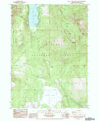
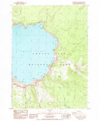
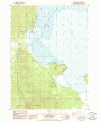
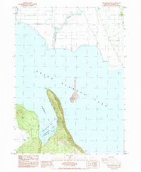 1985 Shoalwater Bay1985 Print · USGSUpper Klamath Lake and the Williamson River delta are shown here in the mid-eighties, defined by an intricate network of dikes and levees. Researchers can locate the David Hill Cem, trace the Southern Pacific rail line, and explore the protected Shoalwater Bay Wildlife Area.
 - 1985 Map of Agency Lake
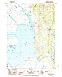 1985 Agency Lake1985 Print · USGSUpper Klamath Lake's northern marshes and reclaimed valleys are shown in the mid-1980s as a landscape of levees and river diversions. Researchers can trace historic sites like the Klamath Agency, Lobert Cem, and the Modoc Point Main Line railroad.
 - 1985 Map of Rustler Peak
 1985 Rustler Peak1985 Print · USGSThe high Cascades at the Jackson and Klamath County line are captured here in the mid-1980s, showing the intersection of major national forests. Hikers and historians can trace the Pacific Crest Nat Scenic Tr as it passes Rustler Peak, McKee Lake, and the North Blue Lake Group.
 - 1985 Map of Modoc Point
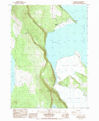
 1985 Modoc Point1985 Print · USGSThe eastern shores of Upper Klamath Lake are mapped here in the mid-1980s, where the massive Modoc Rim meets the water. Researchers can trace the path of the Southern Pacific railroad past Sucker Spring and explore the interior of the Winema National Forest.
 - 1985 Map of Lake of The Woods South
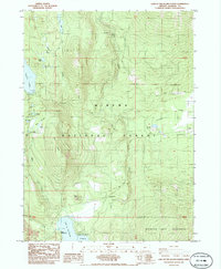
 1985 Lake of The Woods South1985 Print · USGSThe Cascades of Southern Oregon are shown in the mid-1980s as a landscape of conservation and forest recreation. Local historians and genealogists can trace early camp locations like Camp Esther Applegate and Low Echo Camp or locate landmarks like Burton Butte.
 - 1985 Map of Pumice Desert East
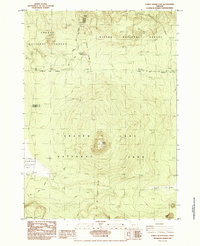 1985 Pumice Desert East1985 Print · USGSThe high volcanic country of Klamath County is captured here in the mid-1980s as it transitions from national forest to national park. Map collectors and hikers can trace the Pacific Crest National Scenic Trail past Timber Crater and the unique expanse of the Pumice Desert.
 - 1985 Map of Devils Peak
 1985 Devils Peak1985 Print · USGSKlamath County's volcanic ridges and high-altitude water systems are captured in the mid-1980s, showcasing the intersection of two national forests. You can trace the Pacific Crest National Scenic Trail as it passes landmarks like Seven Lakes Basin and the heights of Devils Peak.
 - 1985 Map of Thousand Springs
 1985 Thousand Springs1985 Print · USGSThe Southern Cascades meet in the mid-1980s at the intersection of federal lands and rugged volcanic terrain. Researchers can trace the headwaters of the Rogue River and locate seasonal sites like Whisky Camp, Huckleberry Mtn Camp, and the unique Sphagnum Bog.
 - 1985 Map of Dairy
 1985 Dairy1985 Print · USGSKlamath County's agricultural heartland is documented here in the mid-1980s, centered on the rail-side settlement of Dairy. Genealogists and researchers can trace the path of the Oregon California and Eastern railroad or locate landmarks like Olene Hot Springs and Stevenson Park.
 - 1985 Map of Crater Lake East
 1985 Crater Lake East1985 Print · USGSCrater Lake's eastern caldera and high ridgelines are captured here in the mid-1980s. Geologists and local historians can trace the paths to Phantom Ship, the unique formation at Pumice Castle, and the high Lookout House.2 unique versions available
 - 1985 Map of Pothole Butte
 1985 Pothole Butte1985 Print · USGSThe Klamath County high country in the mid-1980s shows a landscape of volcanic buttes and critical water sources. Trace the Old Indian Reservation Boundary near Pothole Station or locate remote landmarks like Lookout Butte and the Pothole Well.
 - 1985 Map of Maklaks Crater
 1985 Maklaks Crater1985 Print · USGSThe volcanic heights of the southern Cascades are captured here in the 1980s, revealing the intersection of protected wilderness and forest lands. Researchers can trace the Old Indian Reservation Boundary and locate backcountry landmarks like Maklaks Crater, The Pinnacles, and Mares Egg Spring.
 - 1985 Map of Pelican Bay
 1985 Pelican Bay1985 Print · USGSUpper Klamath Lake and the surrounding marshes are captured here in the mid-1980s during a period of managed forest and wildlife preservation. Researchers can trace recreational landmarks like Harriman Lodge or the industrial footprint of the Odessa Cinder Pit.
 - 1985 Map of Lake of The Woods North
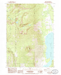
 1985 Lake of The Woods North1985 Print · USGSThe southern Oregon Cascades come alive in the mid-1980s, showcasing a landscape of high-altitude lakes and timbered wilderness. Map collectors and researchers can trace the shores of Fourmile Lake, locate the secluded Seldom, or find the grounds of Camp McLoughlin.
 - 1985 Map of Aspen Lake
 1985 Aspen Lake1985 Print · USGSSouthern Oregon's high country is documented here in the mid-1980s, showcasing the intersection of the Mountain Lakes Wilderness and the Aspen Lake shore. Trace high-altitude landmarks like Mt Harriman or find old resource sites such as the Cinder Pit.
 - 1985 Map of Howard Bay
 1985 Howard Bay1985 Print · USGSUpper Klamath Lake and its surrounding marshes were undergoing significant water management in the 1980s. Researchers can trace the engineered landscape of Caledonia Marsh and locate local landmarks like Running Y Ranch and Porter Butte.
 - 1985 Map of Pelican Butte
 1985 Pelican Butte1985 Print · USGSKlamath County's high-elevation backcountry is captured here in the mid-1980s, centered on the heights of Pelican Butte. Hikers and researchers can trace the original path of the Pacific Crest National Scenic Trail past Wind Lake and through the Dwarf Lakes Area.
Showing maps 1-25 of 111
Top cities of Klamath County
- Klamath Falls historical maps
- Altamont historical maps
- Merrill historical maps
- Chiloquin historical maps
- Malin historical maps
- Bonanza historical maps
Frequently asked questions
- What are the different types of historical maps available for Klamath County?
- What is the oldest map of Klamath County?
- Where can I purchase historical maps of Klamath County for my home or office?
- Where can I download high-res historical maps of Klamath County?
- Are there historical topographic maps available for Klamath County?
- Is there historical aerial imagery available for Klamath County?
- Where are historical maps of Klamath County sourced from?