1960s Maps of Klamath County, Oregon
Explore 40 historic maps of Klamath County from the 1960s. These maps offer a rare glimpse into what life looked like during the 1960s — showing old roads, neighborhoods, homes, and landmarks that have changed or disappeared over time.
Whether you're researching your family's past, planning a metal detecting trip, or studying how Klamath County's landscape evolved across the 1960s, these high-resolution maps are a powerful tool for exploring the history of this region.
- Focus on a specific era: All maps on this page are from the 1960s, giving you a focused view of this time period.
- See what’s changed: Compare century-old streets, trails, and buildings to today's modern landscape using overlays and satellite layers.
- Research with precision: Use these maps for genealogy, historical research, land use analysis, or educational projects.
- View, download, or print: Maps are fully viewable online in high resolution, and can be downloaded or printed for your own records.
Start exploring Klamath County's history through authentic maps from the 1960s. This is your window into the past.
Klamath County, OR maps
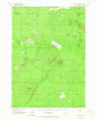
(40)- 1960 Map of Gerber Reservoir, 1961 Print
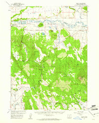
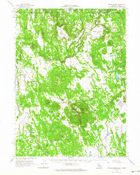
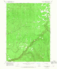
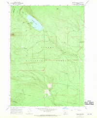
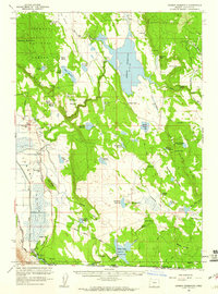 1960 Gerber Reservoir1961 Print · USGSKlamath County ranching and water management are at the forefront of this mid-century study of the high desert. Researchers can trace historic family holdings like the Noble Ranch and Antelope Ranch or follow the path of the Old Railroad Grade.2 unique versions available
 - 1960 Map of Riverbed Butte, 1961 Print
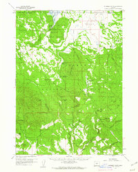 1960 Riverbed Butte1961 Print · USGSKlamath and Lake counties are shown here in the early sixties, highlighting a remote wilderness of high-desert forests and marshes. Researchers can trace historic family holdings and industrial traces such as McCartie Ranch, Obenchain Ranch, and an Old Logging Railroad.2 unique versions available
 - 1960 Map of Bly, 1961 Print
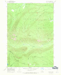
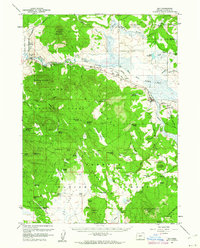 1960 Bly1961 Print · USGSBly and the surrounding high-timber country of Klamath County are shown here at the start of the 1960s. Genealogists and historians can trace old homesteads like Vinson Ranch, find the Masekesket Cem, and follow the path of the Oregon California and Eastern Railroad.2 unique versions available
 - 1960 Map of Strawberry Butte, 1961 Print
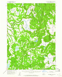 1960 Strawberry Butte1961 Print · USGSLake County ranching and forest service life are captured here at the start of the 1960s, spanning the border into California. Researchers can trace historic family-named outposts like Hunt Ranch and Reed Ranch, or locate forest infrastructure such as the Barnes Valley Guard Station and the Old Stage Road.2 unique versions available
 - 1960 Map of Beatty, 1961 Print
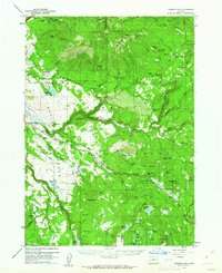
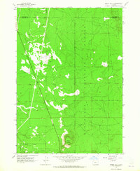
 1960 Beatty1961 Print · USGSKlamath County's high country and the Sprague River valley are documented here during a period of transition for the reservation and local rail industry. Researchers can trace historic sites like the Yainax Agency, Paiute Cem, and the Oregon California and Eastern Railroad line.3 unique versions available
 - 1960 Map of Fuego Mountain, 1962 Print
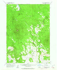 1960 Fuego Mountain1962 Print · USGSUpper Klamath County is shown here in the early sixties, a landscape of high forests and sprawling meadows defined by the headwaters of the Sprague and Sycan rivers. Researchers can locate remote outposts like Yamsay Ranch and family-named landmarks such as Buckmaster Point and Teddy Powers Meadow.2 unique versions available
 - 1960 Map of Fishhole Mtn, 1962 Print
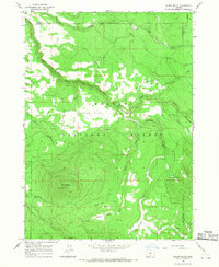
 1960 Fishhole Mtn1962 Print · USGSThe high timber and ranching country of southern Oregon is documented here during the early sixties, showing the transition from rail-based logging to forest management. Genealogists and researchers can find remote outposts like Swede Cabin, the Mitchell Monument, and ancient Indian Petroglyphs.2 unique versions available
 - 1960 Map of Yamsay Mountain, 1968 Print
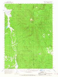 1960 Yamsay Mountain1968 Print · USGSThe high timberlands of the Cascades transition into the Klamath Basin during the early 1960s. Researchers can locate remote legacy sites like Lamms Camp (Site) and trace early travel routes along the Old Indian Reservation Boundary Road.
 - 1962 Map of Alturas
 1962 Alturas1962 Print · USGSThe high desert of Modoc and Siskiyou counties is shown in the early sixties as a hub of timber, rail, and agriculture. Genealogists and historians can trace rail-side life via the Southern Pacific RR, the Tionesta PO, and the McArthur Grain Elevator.
 - 1962 Map of Steele Swamp, 1964 Print
 1962 Steele Swamp1964 Print · USGSNortheastern California rangelands and the Oregon borderlands come alive in the early sixties, showing a landscape shaped by remote ranching and forest management. Trace family-named outposts like Grohs Ranch or find administrative markers like the State Line Guard Sta and Crowder Flat Ranger Station.2 unique versions available
 - 1963 Map of Hamner Butte, 1964 Print
 1963 Hamner Butte1964 Print · USGSThe Deschutes and Klamath county line ran through a wild volcanic landscape in the early sixties. Researchers can trace remote recreational sites like West Davis Lake Campground and local landmarks such as Black Rock Ranch and the Cinder Pit.3 unique versions available
 - 1963 Map of Masten Butte, 1965 Print
 1963 Masten Butte1965 Print · USGSThe Deschutes and Klamath county line area was defined by its rail and river corridors in the early sixties. Researchers can trace the winding Little Deschutes River, the Great Northern tracks, and local landmarks like Wagon Trail Ranch.2 unique versions available
 - 1963 Map of Odell Lake, 1965 Print
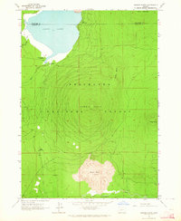
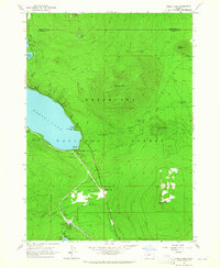 1963 Odell Lake1965 Print · USGSHigh in the Cascades during the early sixties, this area shows the intersection of the Southern Pacific rail line and mountain recreation. Trace the route of the Oregon Skyline Trail past Maiden Peak or locate the Davis Lake Guard Station.2 unique versions available
 - 1963 Map of Spring Butte, 1965 Print
 1963 Spring Butte1965 Print · USGSDeschutes National Forest in the early sixties reveals a landscape shaped by volcanic buttes and remote forest service stations. Trace the network of trails leading to Jones Well Guard Station, the Cinder Pit, and the fire lookout at Lookout Spring Butte.2 unique versions available
 - 1963 Map of Moffitt Butte, 1965 Print
 1963 Moffitt Butte1965 Print · USGSThe timberlands and rail lines of the Oregon high country are preserved here as they appeared in the early sixties. Researchers can trace the path of the Great Northern railroad and locate isolated landmarks like Moffit Butte and Dealys Well.2 unique versions available
 - 1963 Map of Cryder Butte, 1965 Print
 1963 Cryder Butte1965 Print · USGSCentral Oregon's volcanic highlands are captured here in the early 1960s, showing a landscape defined by timber and high-altitude peaks. Researchers can trace forest access via Jeep Trails and locate landmarks like Kemp Bridge or the slopes of Cryder Butte.2 unique versions available
 - 1965 Map of Alturas
 1965 Alturas1965 Print · USGSNortheastern California and southern Oregon appear in this mid-century survey of the high plateau and volcanic highlands. Researchers can trace the path of the Southern Pacific railroad through Alturas or locate rural outposts like Stronghold and Eagleville.
 - 1966 Map of Shake Butte, 1968 Print
 1966 Shake Butte1968 Print · USGSThe Fremont National Forest high country comes alive in the mid-1960s, showing a landscape defined by timber management and old travel routes. Researchers can locate the Emigrant Crossing (Site), the Currier Guard Station, and the Lookout Tower atop Shake Butte.2 unique versions available
 - 1966 Map of Sandhill Crossing, 1968 Print
 1966 Sandhill Crossing1968 Print · USGSThe Oregon high country at the border of Klamath and Lake counties is shown here during the mid-sixties, dominated by federal forest and mountain wilderness. Researchers can locate remote outposts like Ryan Cabin and Conrad Place, or trace the winding North Fork Sprague River to the Sandhill Crossing.2 unique versions available
 - 1967 Map of Burn Butte, 1970 Print
 1967 Burn Butte1970 Print · USGSThe high Cascades at the meeting point of three national forests are documented here during the late sixties. Hikers and historians can trace the Skyline Trail (Pacific Crest Trail) as it passes Cappy Mountain and the Little Deschutes River.2 unique versions available
 - 1967 Map of Chemult, 1970 Print
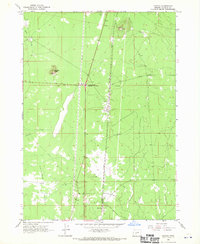
 1967 Chemult1970 Print · USGSChemult and the surrounding national forest lands are shown in the late 1960s as a vital junction for the Southern Pacific and Great Northern railroads. Researchers can trace the industrial footprint of the era through the Pumice Pit, Willow Campground, and the remote Diamond Lake (Siding).
 - 1967 Map of Muttonchop Butte, 1970 Print
 1967 Muttonchop Butte1970 Print · USGSThe high Oregon cascades in the late 1960s were a hub of timber transport and volcanic industry. Researchers can trace the dual rail lines of the Great Northern and Southern Pacific through Mowich and past several local Pumice Pits.
 - 1967 Map of Miller Lake, 1970 Print
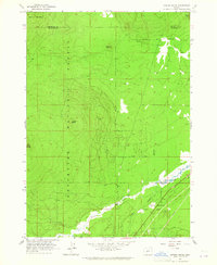
 1967 Miller Lake1970 Print · USGSKlamath County's high forest terrain is documented here in the late sixties, showcasing the intersection of the Umpqua and Winema National Forests. Researchers can trace the Old Indian Treaty Boundary and locate early recreation sites like Digit Point Campground and Miller Lake.2 unique versions available
 - 1967 Map of Mazama, 1970 Print
 1967 Mazama1970 Print · USGSKlamath County at the end of the sixties reveals a landscape of high-desert infrastructure and transit corridors. Trace the path of the Southern Pacific railroad through Mazama and Yamsay, or locate the Old Indian Treaty Boundary near Buckeye Butte.
 - 1967 Map of Walker Mtn, 1970 Print
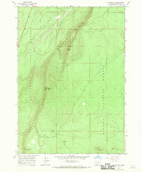 1967 Walker Mtn1970 Print · USGSUpper Klamath County as it appeared in the late 1960s reveals a high-country landscape of forest boundaries and prominent lookouts. Trace the old network of mountain springs and primitive roads like Walker Rim Spring and the Jeep Tr near Walker Mtn.
Showing maps 1-25 of 40
Top cities of Klamath County
- Klamath Falls historical maps
- Altamont historical maps
- Merrill historical maps
- Chiloquin historical maps
- Malin historical maps
- Bonanza historical maps
Frequently asked questions
- What are the different types of historical maps available for Klamath County?
- What is the oldest map of Klamath County?
- Where can I purchase historical maps of Klamath County for my home or office?
- Where can I download high-res historical maps of Klamath County?
- Are there historical topographic maps available for Klamath County?
- Is there historical aerial imagery available for Klamath County?
- Where are historical maps of Klamath County sourced from?