1980s Maps of Pennington County, South Dakota
Explore 10 historic maps of Pennington County from the 1980s. These maps offer a rare glimpse into what life looked like during the 1980s — showing old roads, neighborhoods, homes, and landmarks that have changed or disappeared over time.
Whether you're researching your family's past, planning a metal detecting trip, or studying how Pennington County's landscape evolved across the 1980s, these high-resolution maps are a powerful tool for exploring the history of this region.
- Focus on a specific era: All maps on this page are from the 1980s, giving you a focused view of this time period.
- See what’s changed: Compare century-old streets, trails, and buildings to today's modern landscape using overlays and satellite layers.
- Research with precision: Use these maps for genealogy, historical research, land use analysis, or educational projects.
- View, download, or print: Maps are fully viewable online in high resolution, and can be downloaded or printed for your own records.
Start exploring Pennington County's history through authentic maps from the 1980s. This is your window into the past.
Pennington County, SD maps
(10)- 1981 Map of Wall
 1981 Wall1981 Print · USGSWestern South Dakota in the early eighties reveals a landscape of high tables and deep draws where the prairie meets the Badlands. Researchers can trace the path of the Chicago and North Western rail line and locate rural outposts like Scenic, Conata, and Interior.
 - 1983 Map of Horse Tooth, 1984 Print
 1983 Horse Tooth1984 Print · USGSPennington County ranching country and the Bad River headwaters are captured here in the early eighties. Genealogists can locate Severson Ranch, St Paul Cem, and community centers like Big White Sch.
 - 1983 Map of Elm Creek Ranch, 1984 Print
 1983 Elm Creek Ranch1984 Print · USGSPennington and Haakon counties in the early eighties are mapped here as a landscape of isolated homesteads and high plains drainages. Researchers can locate family landmarks like Elm Creek Ranch and private aviation sites including the Clark Landing Strip.
 - 1983 Map of Lake Hill, 1984 Print
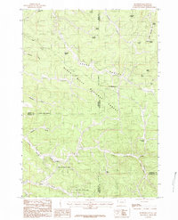
 1983 Lake Hill1984 Print · USGSPennington County ranch lands are captured here in the early 1980s, showing a landscape defined by deep draws and remote outposts. Researchers can trace the Chicago and North Western rail line and locate historic family holdings like the Trask Ranch and Hoffman Ranch.
 - 1984 Map of Buckhorn
 1984 Buckhorn1984 Print · USGSThe Black Hills highlands at the Wyoming and South Dakota border are captured here in the early 1980s. Researchers can locate the Hardy Campus, the settlement of Buckhorn, and numerous family-named landmarks like McInerney Spring.2 unique versions available
 - 1984 Map of Camp Creek
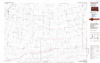 1984 Camp Creek1984 Print · USGSMeade County ranching country comes into focus in the mid-1980s, showcasing the remote settlements and airstrips of the South Dakota plains. Researchers can locate family landmarks like the Vig Ranch Landing Strip, the small community of Opal, and the high terrain of Fox Ridge.2 unique versions available
 - 1984 Map of Parmlee Canyon
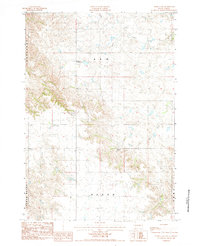
 1984 Parmlee Canyon1984 Print · USGSThe Wyoming and South Dakota borderlands were still being meticulously charted in the early eighties as the national forest boundary was refined. Researchers can trace remote water sources and terrain features like Mallo Camp, Slicker Dick Spring, and Thoeming Draw.
 - 1984 Map of Pedro 4 NW
 1984 Pedro 4 NW1984 Print · USGSPennington County ranching and community life are documented here in the mid-1980s. Local researchers can trace the drainage of Deep Creek and locate family landmarks like the Willuweit Ranch or the Creighton Community Hall.2 unique versions available
 - 1984 Map of Moon
 1984 Moon1984 Print · USGSThe high plateau of the Black Hills is captured here in the mid-1980s, documenting the borderlands of Wyoming and South Dakota. Local historians can trace early water rights and land use through named features like Moon, Rudenvale Spring, and Stockade Beaver Creek.
 - 1984 Map of New Underwood
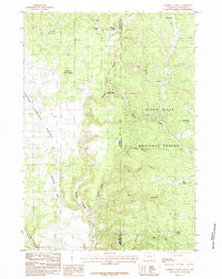
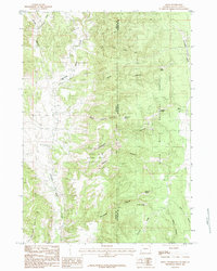
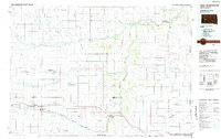 1984 New Underwood1984 Print · USGSPennington and Meade counties in the mid-1980s show a landscape of river-fed agriculture and prairie management. Genealogists and historians can trace rail and road development through New Underwood and Wasta or locate features like Elm Springs and Hubbard Hill.2 unique versions available
End of results
Showing maps 1-10 of 10
Top cities of Pennington County
- Rapid City historical maps
- Box Elder historical maps
- Hill City historical maps
- Wall historical maps
- New Underwood historical maps
- Keystone historical maps
See more
Frequently asked questions
- What are the different types of historical maps available for Pennington County?
- What is the oldest map of Pennington County?
- Where can I purchase historical maps of Pennington County for my home or office?
- Where can I download high-res historical maps of Pennington County?
- Are there historical topographic maps available for Pennington County?
- Is there historical aerial imagery available for Pennington County?
- Where are historical maps of Pennington County sourced from?