1900-1909 Maps of Pennington County, South Dakota
Explore 6 historic maps of Pennington County from 1900-1909. These maps offer a rare glimpse into what life looked like during the 1900s — showing old roads, neighborhoods, homes, and landmarks that have changed or disappeared over time.
Whether you're researching your family's past, planning a metal detecting trip, or studying how Pennington County's landscape evolved across the 1900s, these high-resolution maps are a powerful tool for exploring the history of this region.
- Focus on a specific era: All maps on this page are from the 1900s, giving you a focused view of this time period.
- See what’s changed: Compare century-old streets, trails, and buildings to today's modern landscape using overlays and satellite layers.
- Research with precision: Use these maps for genealogy, historical research, land use analysis, or educational projects.
- View, download, or print: Maps are fully viewable online in high resolution, and can be downloaded or printed for your own records.
Start exploring Pennington County's history through authentic maps from the 1900s. This is your window into the past.
Pennington County, SD maps
(6)- 1901 Map of Hermosa
 1901 Hermosa1901 Print · USGSThe Black Hills frontier comes alive in this survey of Pennington and Custer counties during the height of the regional mining boom. Researchers can trace the early footprints of Keystone, Rockerville, and Wind Cave, along with vanished industrial sites like Etta Mill.4 unique versions available
 - 1901 Map of Harney Peak
 1901 Harney Peak1901 Print · USGSThe Black Hills at the dawn of the twentieth century was a hub of hard-rock mining and frontier ranching. Genealogists and historians can trace dozens of family-named homesteads like Hawks Ranch alongside significant early mines such as the Storm Hill Mine and Grizzly Bear Mine.4 unique versions available
 - 1901 Map of Deadwood
 1901 Deadwood1901 Print · USGSThe Black Hills gold mining region and the bustling camps of Lawrence County are captured here just before the modern era. Genealogists and historians can trace the early rail networks of the Burlington and Missouri River Railroad through remote outposts like Bulldog Ranch and Rochford.2 unique versions available
 - 1901 Map of Newcastle
 1901 Newcastle1901 Print · USGSThe Wyoming-South Dakota borderlands come alive in this survey conducted just before the turn of the century, centered on the railroad hub of Newcastle. Genealogists and historians can trace early cattle history at Lak Ranch and the industrial spur leading to the coal-mining town of Cambria.3 unique versions available
 - 1902 Map of Sundance
 1902 Sundance1902 Print · USGSThe Wyoming and South Dakota borderlands come into focus at the turn of the century as ranching and early mining outposts take hold. Genealogists and historians can trace family-named sites like Mc Creadys Ranch and early settlements including Manhattan and Buckhorn.4 unique versions available
 - 1903 Map of Rapid
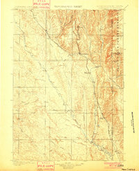
 1903 Rapid1903 Print · USGSThe Black Hills transition from mountains to plains at the turn of the century, centered on the growing rail hub of Rapid. Researchers can trace the early rail corridor of the Fremont Elkhorn and Missouri Valley through Fort Meade and Piedmont.4 unique versions available
End of results
Showing maps 1-6 of 6
Top cities of Pennington County
- Rapid City historical maps
- Box Elder historical maps
- Hill City historical maps
- Wall historical maps
- New Underwood historical maps
- Keystone historical maps
See more
Frequently asked questions
- What are the different types of historical maps available for Pennington County?
- What is the oldest map of Pennington County?
- Where can I purchase historical maps of Pennington County for my home or office?
- Where can I download high-res historical maps of Pennington County?
- Are there historical topographic maps available for Pennington County?
- Is there historical aerial imagery available for Pennington County?
- Where are historical maps of Pennington County sourced from?