2020s Maps of Pennington County, South Dakota
Explore 85 historic maps of Pennington County from the 2020s. These maps offer a rare glimpse into what life looked like during the 2020s — showing old roads, neighborhoods, homes, and landmarks that have changed or disappeared over time.
Whether you're researching your family's past, planning a metal detecting trip, or studying how Pennington County's landscape evolved across the 2020s, these high-resolution maps are a powerful tool for exploring the history of this region.
- Focus on a specific era: All maps on this page are from the 2020s, giving you a focused view of this time period.
- See what’s changed: Compare century-old streets, trails, and buildings to today's modern landscape using overlays and satellite layers.
- Research with precision: Use these maps for genealogy, historical research, land use analysis, or educational projects.
- View, download, or print: Maps are fully viewable online in high resolution, and can be downloaded or printed for your own records.
Start exploring Pennington County's history through authentic maps from the 2020s. This is your window into the past.
Pennington County, SD maps
(85)- 2021 Map of Moon, 2021 Print
 2021 Moon2021 Print · USGSThe Black Hills borderlands at the Wyoming and South Dakota line are captured here in the early twenty-first century. Researchers can trace the drainage of Stockade Beaver Cr and locate high-altitude landmarks like Summit Ridge and Martin Thompson Reservoir.
 - 2021 Map of Creston, 2021 Print
 2021 Creston2021 Print · USGSPennington County's river-bottom land and high plateaus are documented here in the early twenty-first century. Local history researchers can trace the settlement at Creston and landforms like Kube Table or the vast reaches of Buffalo Gap National Grassland.
 - 2021 Map of Quinn Table, 2021 Print
 2021 Quinn Table2021 Print · USGSPennington County’s high tables and badlands are captured here in the early twenty-first century as they interact with vast public lands. Researchers can trace the drainage of Sage Cr and Beaver Cr across Quinn Table and Brennan Flat.
 - 2021 Map of Ditch Creek, 2021 Print
 2021 Ditch Creek2021 Print · USGSIn the high country of the Black Hills during the early twenty-first century, this area remains a landscape of mountain meadows and managed forest. Map collectors and hikers can trace the winding paths of Gillette Prairie Rd and specialized trails like Snow 2 Trl leading to remote water sources such as Green Mountain Spring.
 - 2021 Map of Red Shirt NE, 2021 Print
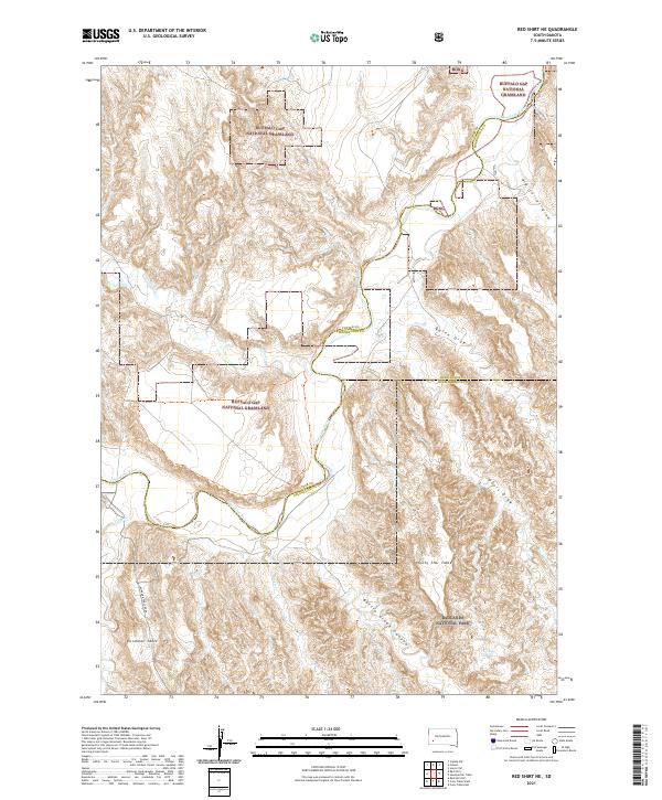 2021 Red Shirt NE2021 Print · USGSThe high tablelands of Custer and Pennington Counties are documented here as they appeared in 2021. Researchers can trace the winding Cheyenne River and locate remote landmarks like Plenty Star Table, Blindman Table, and Battle Creek Canyon.
 - 2021 Map of Conata, 2021 Print
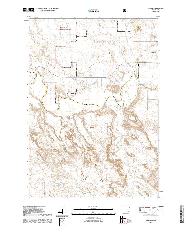
 2021 Conata2021 Print · USGSThe high plains and river breaks of Oglala Lakota County are mapped here during the early twenty-first century. Researchers can trace the winding course of the White River through the Buffalo Gap National Grassland and locate the small settlement of Conata.
 - 2021 Map of Hayward, 2021 Print
 2021 Hayward2021 Print · USGSCovers Pennington County, including Custer County, United States, and other nearby areas
 - 2021 Map of Brennan Flat, 2021 Print
 2021 Brennan Flat2021 Print · USGSPennington County, South Dakota, is captured here in the early twenty-first century as a landscape of broad plateaus and winding river bends. Local history researchers can trace family-named landmarks and rural routes like Kube Table, Seventyone Table, and Owanka Rd.
 - 2021 Map of Conata NE, 2021 Print
 2021 Conata NE2021 Print · USGSJackson County and the grasslands of South Dakota are captured here in the early 2020s, showcasing a landscape defined by river valleys and open range. Researchers can trace the meandering White River and follow rural tracks like Agate North Trl and SN 44.
 - 2021 Map of Bouquet Table, 2021 Print
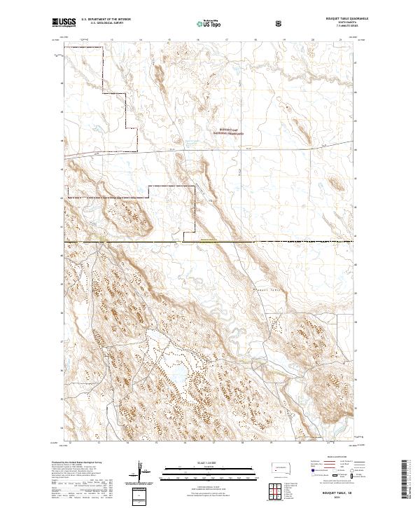 2021 Bouquet Table2021 Print · USGSThe high plateau of Bouquet Table and the Buffalo Gap National Grassland define this corner of South Dakota in the early 2020s. Researchers can trace the rugged course of the White River and the rural network of 185th Ave across the county line.
 - 2021 Map of Scenic, 2021 Print
 2021 Scenic2021 Print · USGSPennington County's high plains and eroded breaks are captured here in the early 2020s. Researchers can trace local landmarks like Scenic Cem and the distinct geography of Kube Table and Scenic Basin.
 - 2021 Map of Hermosa NW, 2021 Print
 2021 Hermosa NW2021 Print · USGSPennington County southeast of the city center is shown here in the early 2020s as modern subdivisions meet the rural landscape. Researchers can trace land use patterns near Ajax or locate local landmarks like Potato Butte, Gobbler Knob, and the Mulligan Mile.
 - 2021 Map of Signal Hill, 2021 Print
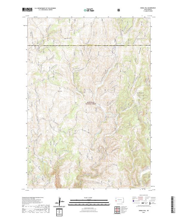 2021 Signal Hill2021 Print · USGSPennington and Custer counties come together in this contemporary look at the western Black Hills. Researchers and outdoorsmen can trace the rugged network of forest roads and named water sources like Alkali Spring, Signal Hill, and West Hell Canyon.
 - 2021 Map of Hill City, 2021 Print
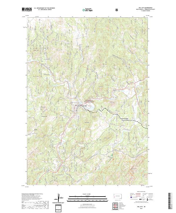 2021 Hill City2021 Print · USGSHill City and the surrounding Black Hills highlands appear here in the early twenty-first century as a landscape of timber, trails, and deep-cut gulches. Researchers can locate the Hill City Cem, trace the George S. Mickelson Trl, and explore the terrain around Kennedyville and Major Lake.
 - 2021 Map of Wall NE, 2021 Print
 2021 Wall NE2021 Print · USGSThe prairie around Quinn is documented here as it appeared in the early 2020s. Researchers can trace the borders of the Buffalo Gap National Grassland and locate local landmarks like Quinn Butte and Mount Hope Cem.
 - 2021 Map of Medicine Mountain, 2021 Print
 2021 Medicine Mountain2021 Print · USGSPennington County’s high forest country is captured here in the early twenty-first century, showing the ridges and remote draws of the central Black Hills. Local historians can trace the geography around Tigerville and Medicine Mountain, or follow the trails through Gillette Prairie and Bear Mountain Basin.
 - 2021 Map of Wall SE, 2021 Print
 2021 Wall SE2021 Print · USGSThe rugged boundary between Pennington and Jackson counties comes into sharp focus in this 2021 look at the South Dakota Badlands. Historians and outdoor enthusiasts can trace routes through Big Foot Pass or identify landmarks like The Castle and Norbeck Pass.
 - 2021 Map of Hermosa, 2021 Print
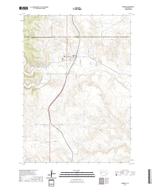 2021 Hermosa2021 Print · USGSHermosa and the ranchlands of Custer County are captured in this 2021 survey as the regional road network weaves through the Black Hills foothills. Genealogists can locate family-named routes like Mielke Pl and Hasselstrom Pl or trace drainage at L Seven Draw.
 - 2021 Map of Hermosa NE, 2021 Print
 2021 Hermosa NE2021 Print · USGSPennington County’s open plains are captured here in the early twenty-first century, showing the rural road network and vital watercourses. Researchers can trace the paths of Rapid Creek and Spring Cr or locate family land near Antelope Creek Rd.
 - 2021 Map of Quinn Table SE, 2021 Print
 2021 Quinn Table SE2021 Print · USGSPennington County’s protected prairies and badlands are documented here during the early 2020s. Researchers can trace the rugged transition from Badlands National Park to Buffalo Gap National Grassland via Sage Creek Pass.
 - 2021 Map of Berne, 2021 Print
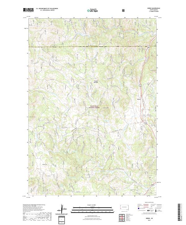 2021 Berne2021 Print · USGSThe Black Hills of South Dakota are shown here in the modern era, centered on the recreational corridor between Berne and Custer. Trace the George S. Mickelson Trl past landmarks like Medicine Mtn, Bugtown Gulch, and Vestal Springs.
 - 2021 Map of Dead Horse Flats, 2021 Print
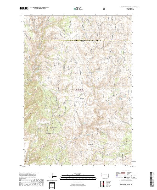 2021 Dead Horse Flats2021 Print · USGSThe southern Black Hills are captured here in the early twenty-first century, showing a remote landscape of canyons and ridges along the Pennington and Custer County line. Local historians and hunters can trace the terrain from Yellow Butte to the springs at Dead Horse Flats and The Seeps.
 - 2021 Map of Imlay, 2021 Print
 2021 Imlay2021 Print · USGSPennington County's high plains and badlands are shown here in the early twenty-first century. Researchers can trace the plateau boundaries of Keester Table and Hunt Table or locate the remote settlement of Imlay near Cain Cr.
 - 2021 Map of Quinn Table SW, 2021 Print
 2021 Quinn Table SW2021 Print · USGSPennington County’s dramatic tablelands and protected plains are documented here in the early twenty-first century. Researchers can trace the intersection of Badlands National Park and Buffalo Gap National Grassland along routes like Sage Creek Rd.
 - 2021 Map of Wall SW, 2021 Print
 2021 Wall SW2021 Print · USGSPennington County’s dramatic badlands landscape is captured here in the early twenty-first century, showing the rugged interface of public lands. Researchers can trace remote routes like Sagecreek Rim Rd and Agate North Trl through The Pinnacles and the Conata Basin.
Showing maps 1-25 of 85
Top cities of Pennington County
- Rapid City historical maps
- Box Elder historical maps
- Hill City historical maps
- Wall historical maps
- New Underwood historical maps
- Keystone historical maps
See more
Frequently asked questions
- What are the different types of historical maps available for Pennington County?
- What is the oldest map of Pennington County?
- Where can I purchase historical maps of Pennington County for my home or office?
- Where can I download high-res historical maps of Pennington County?
- Are there historical topographic maps available for Pennington County?
- Is there historical aerial imagery available for Pennington County?
- Where are historical maps of Pennington County sourced from?