Old Maps of Pennington County, South Dakota for Academic Research
Study the evolution of Pennington County with 456 high-resolution historic maps. Whether you're teaching, researching, or modeling changes in land use, these maps provide essential visual documentation of urban, environmental, and geographic change.
- Analyze long-term change: Track patterns in development, transportation, and natural features.
- Ideal for environmental or urban studies: Support academic projects with primary historical map data.
- Use in the classroom or lab: Educators and researchers rely on these maps to bring historical context to life.
These maps are a powerful tool for teaching, research, and visualizing how Pennington County has changed over the decades.
Pennington County, SD maps
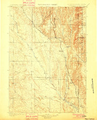
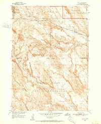
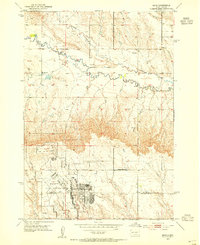
(456)- 1893 Map of Rapid
 1893 Rapid1893 Print · USGSThe Black Hills frontier comes alive in the late nineteenth century as rail lines and military outposts shape the territory. Genealogists and researchers can trace the early layout of Rapid, locate Fort Meade, and find family-named landmarks like Doe Dotie Ranch or Piedmont.2 unique versions available
 - 1894 Map of Deadwood
 1894 Deadwood1894 Print · USGSThe Black Hills gold mining region is documented here in the early 1890s, capturing the industrial density of Deadwood and Lead. Researchers can trace early rail lines and find specific mountain locations like the Normal School in Spearfish, Bull Dog Ranch, and Lookout Mill.2 unique versions available
 - 1894 Map of Hermosa
 1894 Hermosa1894 Print · USGSThe Black Hills gold and ranching frontier comes into focus during the late nineteenth century as mining camps and rail lines began to anchor the territory. Genealogists and historians can trace early families in Keystone, Rockerville, and around the Etta Mine.2 unique versions available
 - 1896 Map of Harney Peak
 1896 Harney Peak1896 Print · USGSThe Black Hills were at the height of their early development in the 1890s as railroads and mining settlements reshaped the mountains. Genealogists and historians can trace the early tracks of the Burlington and Missouri River and locate the original town sites of Hill City, Custer, and Pringle.
 - 1898 Map of Sundance
 1898 Sundance1898 Print · USGSNorthwestern Wyoming and the Black Hills border come alive in the 1890s, when Sundance served as a key regional hub. Genealogists and local historians can trace early wagon routes connecting settlements like Manhattan, Welcome, and Inyankara.
 - 1898 Map of Rapid
 1898 Rapid1898 Print · USGSThe Black Hills foothills come alive in the 1890s, where early railroads meet military outposts and pioneer settlements. Trace the early streets of Rapid City, the grounds of Fort Meade, and localized landmarks like Crystal Cave.2 unique versions available
 - 1899 Map of Newcastle, 1964 Print
 1899 Newcastle1964 Print · USGSThe Wyoming-South Dakota borderlands appear here at the close of the nineteenth century, as railroads and ranching reshaped the Black Hills. Researchers can trace early cattle operations like YT Ranch and mining infrastructure at Cambria and Newcastle.
 - 1901 Map of Hermosa
 1901 Hermosa1901 Print · USGSThe Black Hills frontier comes alive in this survey of Pennington and Custer counties during the height of the regional mining boom. Researchers can trace the early footprints of Keystone, Rockerville, and Wind Cave, along with vanished industrial sites like Etta Mill.4 unique versions available
 - 1901 Map of Harney Peak
 1901 Harney Peak1901 Print · USGSThe Black Hills at the dawn of the twentieth century was a hub of hard-rock mining and frontier ranching. Genealogists and historians can trace dozens of family-named homesteads like Hawks Ranch alongside significant early mines such as the Storm Hill Mine and Grizzly Bear Mine.4 unique versions available
 - 1901 Map of Deadwood
 1901 Deadwood1901 Print · USGSThe Black Hills gold mining region and the bustling camps of Lawrence County are captured here just before the modern era. Genealogists and historians can trace the early rail networks of the Burlington and Missouri River Railroad through remote outposts like Bulldog Ranch and Rochford.2 unique versions available
 - 1901 Map of Newcastle
 1901 Newcastle1901 Print · USGSThe Wyoming-South Dakota borderlands come alive in this survey conducted just before the turn of the century, centered on the railroad hub of Newcastle. Genealogists and historians can trace early cattle history at Lak Ranch and the industrial spur leading to the coal-mining town of Cambria.3 unique versions available
 - 1902 Map of Sundance
 1902 Sundance1902 Print · USGSThe Wyoming and South Dakota borderlands come into focus at the turn of the century as ranching and early mining outposts take hold. Genealogists and historians can trace family-named sites like Mc Creadys Ranch and early settlements including Manhattan and Buckhorn.4 unique versions available
 - 1903 Map of Rapid
 1903 Rapid1903 Print · USGSThe Black Hills transition from mountains to plains at the turn of the century, centered on the growing rail hub of Rapid. Researchers can trace the early rail corridor of the Fremont Elkhorn and Missouri Valley through Fort Meade and Piedmont.4 unique versions available
 - 1916 Map of Deadwood
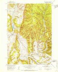
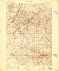 1916 Deadwood1916 Print · USGSThe Black Hills mining district at the peak of its early industrial era shows a dense network of rail and timber camps. Researchers can trace the narrow-gauge C B & Q RR lines to the Queen Bee Mine and the Fort Meade Military Reservation.3 unique versions available
 - 1950 Map of Conata
 1950 Conata1950 Print · USGSThe Pine Ridge Indian Reservation and the northern prairies meet here in the early fifties. Genealogists and historians can trace the Chicago Milwaukee St Paul and Pacific rail line through Conata and locate an early Oil Well.2 unique versions available
 - 1950 Map of Sheep Mountain Table, 1952 Print
 1950 Sheep Mountain Table1952 Print · USGSThe South Dakota badlands meet the Pine Ridge Indian Reservation in the early fifties, revealing a landscape of high mesas and deep-cut creeks. Researchers can trace the geological boundaries of Sheep Mountain Table or locate local landmarks like Cedar Butte and Heck Table.7 unique versions available
 - 1950 Map of Imlay, 1952 Print
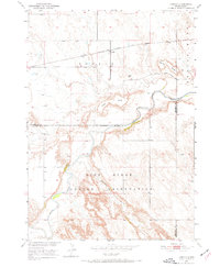
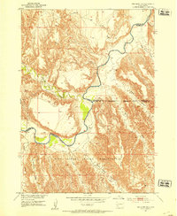
 1950 Imlay1952 Print · USGSPennington County at the midpoint of the twentieth century shows a landscape divided by federal land designations and the steam-and-diesel era. Trace the path of the Chicago Milwaukee St Paul and Pacific through Imlay or the northern reaches of the Pine Ridge Indian Reservation.3 unique versions available
 - 1950 Map of Bouquet Table, 1972 Print
 1950 Bouquet Table1972 Print · USGSThe South Dakota badlands and the Pine Ridge Indian Reservation meet during the mid-twentieth century on this detailed survey. Genealogists and historians can trace local landmarks like the Cain Creek Sch and the route of the Chicago Milwaukee St Paul and Pacific railroad.
 - 1951 Map of Heutmacher Table, 1953 Print
 1951 Heutmacher Table1953 Print · USGSThe high plateau country of Pennington and Shannon Counties is captured here in the early fifties, where the northern border of the Pine Ridge Indian Reservation meets the plains. Map researchers can trace the steep terrain around Cottonwood Pass and family-named landmarks like Heutmacher Table and Zebell Table.
 - 1951 Map of Fanny Peak, 1953 Print
 1951 Fanny Peak1953 Print · USGSThe Wyoming and South Dakota borderlands come into focus in the early 1950s, highlighting the rugged terrain where the Black Hills meet the high plains. Researchers can trace the layout of the L A K Ranch, locate the Sweet School, and identify high-altitude points like Fanny Peak.4 unique versions available
 - 1951 Map of Red Shirt NE, 1953 Print
 1951 Red Shirt NE1953 Print · USGSThe northern reaches of the Pine Ridge Indian Reservation and the winding Cheyenne River are captured here in the early fifties. Local history researchers can trace the intricate network of draws and tables, including Blindman Table and Plenty Star Table.3 unique versions available
 - 1952 Map of Conata NE
 1952 Conata NE1952 Print · USGSThe South Dakota badlands and the Pine Ridge Indian Reservation meet along the river in the early fifties. Researchers can trace the path of the Chicago Milwaukee St Paul and Pacific rail and locate the Hurley Sch (Abandoned).2 unique versions available
 - 1952 Map of Bouquet Table
 1952 Bouquet Table1952 Print · USGSThe border between the Pine Ridge Indian Reservation and Badlands National Monument is captured here in the early 1950s. Trace local landmarks like the Cain Creek Sch and the Chicago Milwaukee St Paul and Pacific rail line.
 - 1952 Map of Conata
 1952 Conata1952 Print · USGSThe northern edge of the Oglala Lakota lands meets the rail-line economy of the early fifties, centered on the Milwaukee Road. Researchers can trace the winding White River through the Pine Ridge Indian Reservation past Conata and Hurley Butte.
 - 1953 Map of Bend, 1954 Print
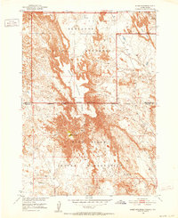
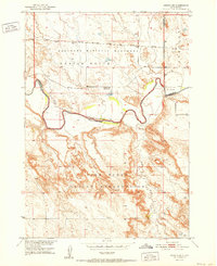
 1953 Bend1954 Print · USGSMeade and Pennington Counties were undergoing significant change in the early fifties as military infrastructure expanded into the rural landscape. Researchers can trace the development of Ellsworth Air Force Base and locate community landmarks like Bend Sch and Elk Dale Sch.2 unique versions available
Showing maps 1-25 of 456
Top cities of Pennington County
- Rapid City historical maps
- Box Elder historical maps
- Hill City historical maps
- Wall historical maps
- New Underwood historical maps
- Keystone historical maps
See more
Frequently asked questions
- What are the different types of historical maps available for Pennington County?
- What is the oldest map of Pennington County?
- Where can I purchase historical maps of Pennington County for my home or office?
- Where can I download high-res historical maps of Pennington County?
- Are there historical topographic maps available for Pennington County?
- Is there historical aerial imagery available for Pennington County?
- Where are historical maps of Pennington County sourced from?