Old Maps of Okreek Segment, South Dakota for Hiking & Exploration
Hike through history with 99 historic maps of Okreek Segment. Explore old trails, ghost towns, and forgotten backroads — perfect for outdoor adventurers and local explorers.
- Rediscover forgotten places: Map out old mining camps, roads, and footpaths that no longer exist on modern maps.
- Layer with modern tools: Combine with LiDAR or satellite views to plan hikes through historical terrain.
- Made for exploration: Popular among hikers, overlanders, and local history lovers.
Use these maps to find adventure and explore the hidden past of Okreek Segment.
Okreek Segment, SD maps
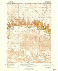
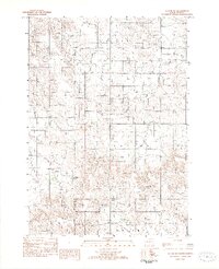
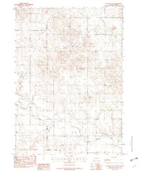
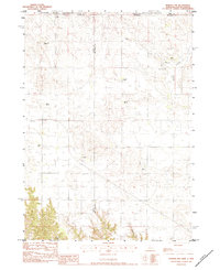
(99)- 1950 Map of Norden
 1950 Norden1950 Print · USGSThe Niobrara River valley in the early fifties shows a rugged landscape of family-run cattle operations and scattered rural school districts. Genealogists can locate family holdings like Worth Ranch or McMara Ranch and burial sites at Sparks Cem.2 unique versions available
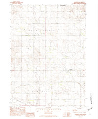
 - 1950 Map of Sparks, 1952 Print
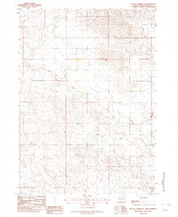
 1950 Sparks1952 Print · USGSThe Niobrara River canyon cuts through Cherry County during the mid-twentieth century, revealing a landscape of remote ranches and conservation lands. Researchers can trace the Chicago and North Western rail line and locate rural landmarks like Smith Falls, Bryant Ranch, and several numbered schoolhouses.3 unique versions available
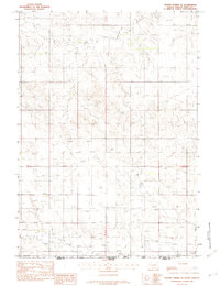
 - 1952 Map of Norden
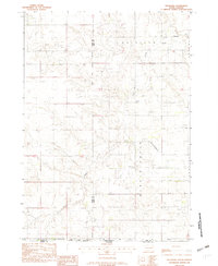
 1952 Norden1952 Print · USGSKeya Paha and Brown counties meet along the winding Niobrara River in the early fifties, capturing a period of transition for Nebraska's ranching country. Genealogists can trace family footprints at Norden, Sparks Cem, and numerous schoolhouses from Rockford Sch to School No 74.
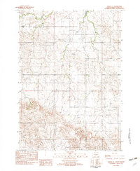
 - 1955 Map of Martin, 1968 Print
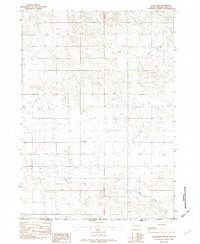
 1955 Martin1968 Print · USGSTribal lands and rail corridors define the South Dakota plains in the mid-fifties, from the sand hills to the badlands. Genealogists and historians can trace the early layout of Pine Ridge Indian Reservation settlements and find small rail towns like Stamford and Witten.2 unique versions available
 - 1957 Map of Valentine, 1960 Print
 1957 Valentine1960 Print · USGSNorthern Nebraska's ranching country and the vast Sand Hills are detailed here in the late fifties. Genealogists and historians can locate numerous family-named landmarks like the Dahlgren Ranch and trace the path of the Chicago and North Western railroad through Valentine.3 unique versions available
 - 1958 Map of Martin
 1958 Martin1958 Print · USGSSouth Dakota's southern plains are documented here in the late fifties, showing the expansive Pine Ridge and Rosebud Indian Reservations. Genealogists and historians can locate early settlements along the Chicago Milwaukee St Paul and Pacific line or find family roots near Martin and the Indian Cemetery.
 - 1959 Map of Valentine
 1959 Valentine1959 Print · USGSThe northern Nebraska Sand Hills are captured here in the late fifties, showcasing a vast ranching landscape shaped by the Niobrara and Loup rivers. Genealogists and historians can trace rail-town development along the Chicago and North Western and locate remote outposts like Brownlee or Kennedy.
 - 1982 Map of Keyapaha SE
 1982 Keyapaha SE1982 Print · USGSThe Keya Paha River valley in the early eighties shows a sparse ranching landscape along the South Dakota border. Genealogists and local historians can locate rural landmarks like the Church of God and the townships of Wortman and Huggins.
 - 1982 Map of Witten
 1982 Witten1982 Print · USGSTripp County life in the early 1980s centers around the small community of Witten and its surrounding farm sections. Researchers can locate St John the Baptist Cem and trace the winding paths of Cottonwood Creek and Jordan Junction.
 - 1982 Map of Hidden Timber
 1982 Hidden Timber1982 Print · USGSTodd County's high plains terrain is documented here in the early eighties as the landscape of the Rosebud Reservation remained largely open. Genealogists and local historians can locate rural landmarks like Hidden Timber and Klein Sch along the Keya Paha River.
 - 1982 Map of Okreek
 1982 Okreek1982 Print · USGSThe community of Okreek is captured in the early eighties as it serves the surrounding Rosebud Indian Reservation. Researchers can trace the layout of the settlement, identifying local landmarks like St Peters Ch and the Post Office along the banks of Oak Creek.
 - 1982 Map of Witten SW
 1982 Witten SW1982 Print · USGSTripp and Todd Counties are shown in the late 1970s and early 1980s along the edge of the Rosebud Indian Reservation. Genealogists and historians can trace township lines through Carter and Taylor while locating rural features like De Bell Creek.
 - 1982 Map of Clearfield
 1982 Clearfield1982 Print · USGSThe rural expanse of southern Tripp County is documented here in the early 1980s, centered on the settlement of Clearfield. Genealogists and local historians can trace the foundations of this community through landmarks like the Star Prairie Ch and the Star Prairie Sch.
 - 1982 Map of Hidden Timber SE
 1982 Hidden Timber SE1982 Print · USGSTodd County during the early 1980s reveals a quiet landscape shaped by reservation boundaries and cross-border creeks. Genealogists and researchers can trace the course of Eagle Creek and Sand Creek as they wind through the South Dakota Nebraska borderlands.
 - 1982 Map of Okreek SE
 1982 Okreek SE1982 Print · USGSTodd County's open landscapes within the Rosebud Indian Reservation appear here in the early eighties. Researchers can trace the winding paths of White Horse Creek, Oak Creek, and West White Horse Creek alongside a prominent regional Transmission Line.
 - 1982 Map of Keyapaha NW
 1982 Keyapaha NW1982 Print · USGSTripp County and the edge of the Rosebud Reservation are captured here in the early eighties. Genealogists and local historians can trace rural landmarks such as Jerusalem Cem, Gabler Sch, and the winding path of the Keya Paha River.
 - 1982 Map of Carter
 1982 Carter1982 Print · USGSTripp County and the surrounding tribal lands are captured here in the early eighties as rail service gave way to rural roads. Genealogists and local historians can trace the boundary of the Rosebud Indian Res and locate sites like Carter or the Schlakker Landing Strip.
 - 1982 Map of Mosher
 1982 Mosher1982 Print · USGSMellette and Todd Counties were still defined by remote prairie drainages and quiet outposts in the early 1980s. Genealogists and historians can trace the Old R.R. Grade through the Rosebud Indian Reservation and locate the Advent Cem near Mosher.
 - 1982 Map of Hidden Timber NE
 1982 Hidden Timber NE1982 Print · USGSTodd County's prairie landscape is captured in the early eighties as part of the Rosebud Indian Reservation. Local history researchers can trace the hydrology of the Keya Paha River and the paths of Crazy Hole Creek and Eagle Creek across these tribal lands.
 - 1982 Map of Keyapaha
 1982 Keyapaha1982 Print · USGSIn the early 1980s, the plains of Tripp County remained a quiet agricultural landscape defined by the Rosebud Indian Reservation Boundary. Genealogists and researchers can trace local landmarks like Linden Pioneer Cem, St Anns Ch, and the Beaver Creek Sch.
 - 1982 Map of Wood South
 1982 Wood South1982 Print · USGSThe northern edge of the Rosebud Reservation comes into focus during the early 1980s, centered on the community of Wood. Researchers can trace local landmarks and burial sites like the Grandstand Rodeo Arena, Evergreen Cem, and Rattlesnake Butte.
 - 1982 Map of Littleburg
 1982 Littleburg1982 Print · USGSThe South Dakota and Nebraska borderlands are captured here in the early 1980s, centered on the settlement of Littleburg. Local historians can trace the Indian Reservation Boundary and follow the natural drainages of Eagle Creek and Sand Creek.
 - 1982 Map of Mission, 1983 Print
 1982 Mission1983 Print · USGSThe Rosebud Reservation in the early eighties shows a landscape of plains communities and aviation outposts. Genealogists and researchers can trace local centers like Mission, Rosebud, and St Francis, or locate family landmarks near Antelope Lake and the Keya Paha River.
 - 1983 Map of Sparks, 1984 Print
 1983 Sparks1984 Print · USGSThe Niobrara River valley in Cherry County was a landscape of remote farmsteads and river crossings in the early 1980s. Researchers can locate community landmarks like Kewanee Sch and St Joseph Cem, or trace early transit points at Berry Bridge and Sparks.
 - 1983 Map of Norden NW, 1984 Print
 1983 Norden NW1984 Print · USGSRanching life on the Nebraska-South Dakota border is detailed in this early 1980s survey of the High Plains. Genealogists and local historians can locate family landmarks like Lawrence Ranch, Sparks Cem, and the Shadley Creek Sch.
Showing maps 1-25 of 99
Top cities near Okreek Segment
Top neighborhoods of Okreek Segment
Frequently asked questions
- What are the different types of historical maps available for Okreek Segment?
- What is the oldest map of Okreek Segment?
- Where can I purchase historical maps of Okreek Segment for my home or office?
- Where can I download high-res historical maps of Okreek Segment?
- Are there historical topographic maps available for Okreek Segment?
- Is there historical aerial imagery available for Okreek Segment?
- Where are historical maps of Okreek Segment sourced from?