1940s Maps of Hamilton County, Tennessee
Explore 36 historic maps of Hamilton County from the 1940s. These maps offer a rare glimpse into what life looked like during the 1940s — showing old roads, neighborhoods, homes, and landmarks that have changed or disappeared over time.
Whether you're researching your family's past, planning a metal detecting trip, or studying how Hamilton County's landscape evolved across the 1940s, these high-resolution maps are a powerful tool for exploring the history of this region.
- Focus on a specific era: All maps on this page are from the 1940s, giving you a focused view of this time period.
- See what’s changed: Compare century-old streets, trails, and buildings to today's modern landscape using overlays and satellite layers.
- Research with precision: Use these maps for genealogy, historical research, land use analysis, or educational projects.
- View, download, or print: Maps are fully viewable online in high resolution, and can be downloaded or printed for your own records.
Start exploring Hamilton County's history through authentic maps from the 1940s. This is your window into the past.
Hamilton County, TN maps
(36)- 1940 Map of Chattanooga
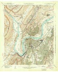
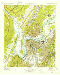 1940 Chattanooga1940 Print · USGSChattanooga and the Tennessee River valley are captured here at the dawn of the 1940s, showcasing a bustling rail and river hub. Researchers can trace the legacy of Union Station, find family plots in National Cem, or locate the historic Cravens House on the slopes of Lookout Mountain.2 unique versions available
 - 1940 Map of Ooltewah, 1954 Print
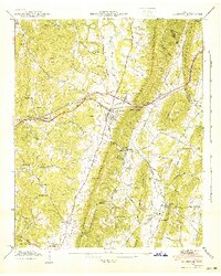
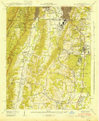
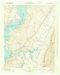
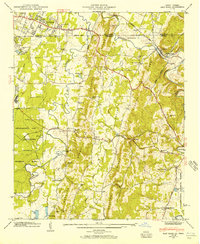
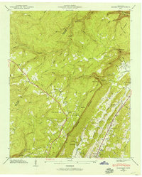
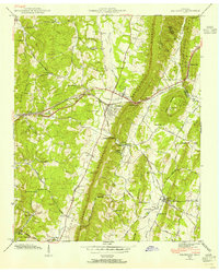 1940 Ooltewah1954 Print · USGSSoutheast Tennessee is captured here just before the mid-century as a landscape of ridge-and-valley farming and emerging education. Genealogists can trace family names at Sylar Cem and Pollard Cem or locate the early campus of Southern Junior College.
 - 1940 Map of Mc Donald, 1956 Print
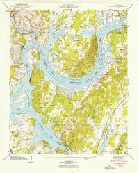
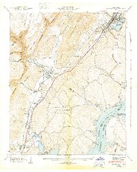
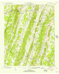 1940 Mc Donald1956 Print · USGSThe rural ridges of Bradley and Hamilton County are captured here just before the war, when rail sidings and country schools anchored local life. Genealogists can locate family landmarks like Tucker Cem and Triplett Cem or trace the old Lee Highway corridor.
 - 1941 Map of Mc Donald
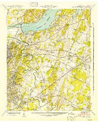
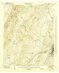
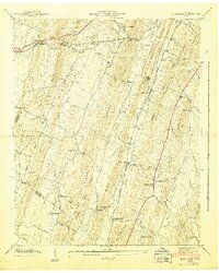 1941 Mc Donald1941 Print · USGSIn the early 1940s, this Bradley County landscape was a network of ridgeline farms and rail-dependent hamlets. Researchers can trace the Southern Railway through McDonald or locate old community centers like Lebanon School and Bethel Ch.
 - 1941 Map of Chattanooga
 1941 Chattanooga1941 Print · USGSChattanooga was a powerhouse of rail and river industry just before the Second World War. Genealogists and historians can trace the early city grid from Union Station to MISSIONARY RIDGE, locating landmarks like Ruby Falls and National Cem.5 unique versions available
 - 1941 Map of Ooltewah
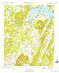
 1941 Ooltewah1941 Print · USGSThe valleys and ridges of Hamilton and Bradley counties are shown here just before the mid-century industrial boom. Genealogists can locate family names and sites like Bell Mill, Mineral Park Chapel, and the campus of Southern Junior College.
 - 1942 Map of Big Spring
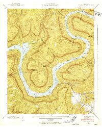
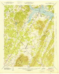
 1942 Big Spring1942 Print · USGSThe Tennessee and Hiwassee Rivers meet in the early 1940s, revealing a landscape of reservoir development and deep-rooted farm communities. Genealogists can locate Big Spring and family sites like Shaver Cem, while historians can trace the Cotton Port Ferry.
 - 1942 Map of East Chattanooga
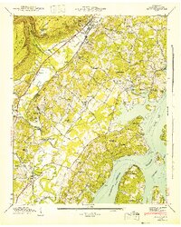
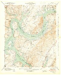
 1942 East Chattanooga1942 Print · USGSHamilton County's river landscape underwent massive changes during the early Forties as the Tennessee Valley Authority completed the Chickamauga Dam. Genealogists can trace family roots through the Silverdale Confederate Cem, Brainerd Cem, and numerous rural schools like Jersey Sch.2 unique versions available
 - 1942 Map of Fort Oglethorpe, 1946 Print
 1942 Fort Oglethorpe1946 Print · USGSThe Tennessee-Georgia borderlands are captured here during the early 1940s, highlighting the transition from historic battlefields to growing residential communities. Genealogists and historians can trace family-named sites like Snodgrass House, McCallie Lake, and Lee and Gordon Mill.3 unique versions available
 - 1942 Map of Wauhatchie, 1952 Print
 1942 Wauhatchie1952 Print · USGSMarion and Hamilton counties are mapped here during the early years of the Hales Bar Reservoir era. Genealogists can locate family landmarks like Stanley Sett, Pot Cem, and schools such as McNabb Sch nestled among the hollows.2 unique versions available
 - 1942 Map of Snow Hill, 1954 Print
 1942 Snow Hill1954 Print · USGSHamilton County communities adapt to a changing riverfront in the early 1940s as the Chickamauga Reservoir fills the valley. Researchers can trace dozens of family landmarks like Scoggins Mill, Anderson Cem, and Savannah Ch.
 - 1942 Map of Graysville, 1956 Print
 1942 Graysville1956 Print · USGSRhea County and the Tennessee River valley appear here in the early 1940s as newly formed reservoirs altered the landscape. Researchers can trace the historic Blythe Ferry crossing and find long-established local sites like New Providence Sch and the Old Browder Cem.2 unique versions available
 - 1942 Map of Birchwood, 1960 Print
 1942 Birchwood1960 Print · USGSSoutheast Tennessee rural life is captured here during the early 1940s as the river landscape was being reshaped. Researchers can trace family roots through landmarks like Mc Clanahan Cem, St Elmo Sch, and the community at Georgetown.
 - 1943 Map of Daisy
 1943 Daisy1943 Print · USGSThe Tennessee River valley near Daisy was being transformed by the new Chickamauga Reservoir during the early years of the war. Genealogists and local historians can trace legacy sites like Jackson Chapel, Burks Chapel, and the Barker Cem before modern development altered the shoreline.2 unique versions available
 - 1943 Map of Wauhatchie
 1943 Wauhatchie1943 Print · USGSMarion and Hamilton County terrain is defined by the winding Tennessee River during the era of the Tennessee Valley Authority. Genealogists can trace family footprints at Kellys Ferry, rural schools like Suck Port Sch, and family burial sites including Francis Cem.
 - 1943 Map of Dalton
 1943 Dalton1943 Print · USGSWhitfield and Murray counties come alive in the 1940s, showing the early industrial growth of the carpet capital and the surrounding farming settlements. Researchers can locate family landmarks like Praters Mill, Gregorys Mill, and the many rural sites such as Shiloh Ch or Oak Grove Sch.2 unique versions available
 - 1943 Map of Snow Hill
 1943 Snow Hill1943 Print · USGSSnow Hill and the eastern banks of the Tennessee River are shown here in the early 1940s as the new reservoir transformed the landscape. Researchers can trace family history through dozens of landmarks, including Scoggins Mill, Snow Hill, and the Penny Cem.2 unique versions available
 - 1943 Map of Graysville
 1943 Graysville1943 Print · USGSEast Tennessee at the dawn of the 1940s reveals a landscape of ridge-and-valley settlements tied to the river and rail. Genealogists can trace family names through the Graysville Cem, New Providence Sch, and numerous churches like Garrison Ch.2 unique versions available
 - 1943 Map of Birchwood
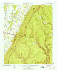
 1943 Birchwood1943 Print · USGSSoutheast Tennessee is captured here during the mid-forties as the landscape adjusted to the new shoreline of the Chickamauga Reservoir. Genealogists and local historians can trace family locations near Georgetown, Birchwood, and the Johnson Cem.
 - 1943 Map of South Cleveland, 1946 Print
 1943 South Cleveland1946 Print · USGSThe foothills of Bradley County come alive in this mid-1940s survey of the ridge-and-valley landscape around the Cleveland city limits. Genealogists and historians can trace the foundations of local society at the Pentecostal Orphanage, find the Lead Mine, or locate family burial grounds like Seaborn Cem.4 unique versions available
 - 1943 Map of Big Spring, 1946 Print
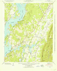
 1943 Big Spring1946 Print · USGSThe Tennessee River valley in the early 1940s reveals a landscape reshaped by the newly formed Chickamauga Reservoir. Genealogists and local historians can trace family land near Big Spring, the Cotton Port Ferry, and numerous country churches like Burkett Chapel.2 unique versions available
 - 1943 Map of East Ridge, 1957 Print
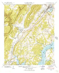
 1943 East Ridge1957 Print · USGSThe Tennessee-Georgia borderlands come to life in the 1940s as a landscape of rural schools, family cemeteries, and military reservations. Genealogists can trace family roots through Lomenick Cem, Boynton, and landmarks like Burning Bush Sch.
 - 1943 Map of Ketner Gap, 1960 Print
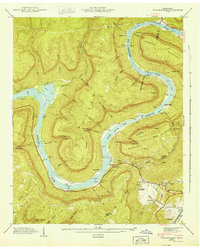
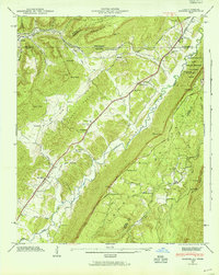
 1943 Ketner Gap1960 Print · USGSMarion and Sequatchie Counties are shown here during the early 1940s as the river valley and plateau transitioned into the modern era. Family historians can locate several local landmarks, from Kelley Chapel and Powells Crossroads to the Suck Creek Sch and Pickett Cem.5 unique versions available
 - 1945 Map of Hooker, 1954 Print
 1945 Hooker1954 Print · USGSThe Georgia-Tennessee borderlands appear here in the mid-1940s, showing the intersection of heavy rail and mountain terrain. Genealogists can trace family landmarks like Sarah Chapel, West Brow Sch, and the Dickens Cem along the slopes of Lookout Mountain.2 unique versions available
 - 1945 Map of Fairmount, 1957 Print
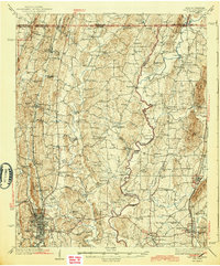
 1945 Fairmount1957 Print · USGSThe Cumberland Plateau meets the valley floor north of Chattanooga in the mid-1940s. Local researchers can trace family landmarks along Sawyer Road and locate rural hubs like Lone Oak, Summertown, and the Nathan L Bachman Sch.
Showing maps 1-25 of 36
Top cities of Hamilton County
- Chattanooga historical maps
- East Ridge historical maps
- Soddy-Daisy historical maps
- Collegedale historical maps
- Signal Mountain historical maps
- Walden historical maps
See more
Frequently asked questions
- What are the different types of historical maps available for Hamilton County?
- What is the oldest map of Hamilton County?
- Where can I purchase historical maps of Hamilton County for my home or office?
- Where can I download high-res historical maps of Hamilton County?
- Are there historical topographic maps available for Hamilton County?
- Is there historical aerial imagery available for Hamilton County?
- Where are historical maps of Hamilton County sourced from?