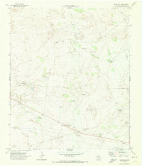
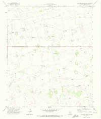
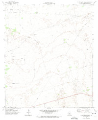
1970s Maps of Andrews County, Texas
Explore 22 historic maps of Andrews County from the 1970s. These maps offer a rare glimpse into what life looked like during the 1970s — showing old roads, neighborhoods, homes, and landmarks that have changed or disappeared over time.
Whether you're researching your family's past, planning a metal detecting trip, or studying how Andrews County's landscape evolved across the 1970s, these high-resolution maps are a powerful tool for exploring the history of this region.
- Focus on a specific era: All maps on this page are from the 1970s, giving you a focused view of this time period.
- See what’s changed: Compare century-old streets, trails, and buildings to today's modern landscape using overlays and satellite layers.
- Research with precision: Use these maps for genealogy, historical research, land use analysis, or educational projects.
- View, download, or print: Maps are fully viewable online in high resolution, and can be downloaded or printed for your own records.
Start exploring Andrews County's history through authentic maps from the 1970s. This is your window into the past.
Andrews County, TX maps
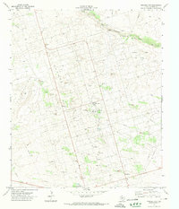
(22)- 1970 Map of Cedar Point Ranch, 1973 Print
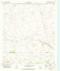
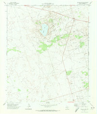
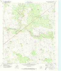
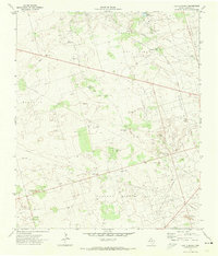
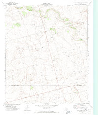 1970 Cedar Point Ranch1973 Print · USGSGaines County ranching and oil production meet in the early seventies along the Gaines Co Andrews Co border. Researchers can map the footprint of the McFarland Oil Field and Arrow Field alongside the Cedar Point Ranch and Seminole Draw.
 - 1970 Map of Patricia SW, 1973 Print
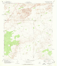
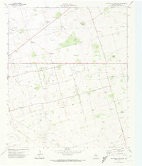
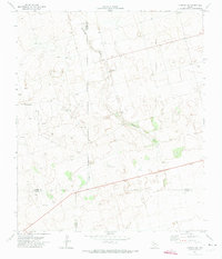 1970 Patricia SW1973 Print · USGSThe West Texas plains at the start of the 1970s are defined here by petroleum exploration and the intersection of four county lines. Researchers can trace land use through Oil Wells, McKenzie Draw, and the isolated Mill in the Flat Pond.
 - 1970 Map of Seminole SE, 1973 Print
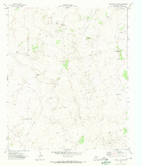
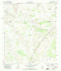
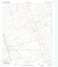 1970 Seminole SE1973 Print · USGSThe Permian Basin oil fields of Gaines and Andrews County appear in high detail during the early 1970s. Trace the industrial footprint of the Means North Field and Nolley Oil Field alongside Telephone Road and local Roadside Parks.2 unique versions available
 - 1970 Map of McKenzie Lake SE, 1973 Print
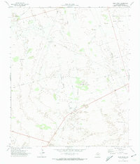
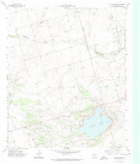
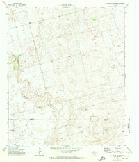 1970 McKenzie Lake SE1973 Print · USGSThe Permian Basin oil industry is in full swing on the Gaines and Andrews County line during the early seventies. Trace the industrial footprint of the Glasco Oil Field through its network of Oil Wells and the Florey Pumping Sta.
 - 1971 Map of Brinson Ranch, 1973 Print
 1971 Brinson Ranch1973 Print · USGSThe high plains of West Texas are captured here in the early seventies, spanning the border of Gaines and Andrews County. Researchers can trace the industrial footprint of the Permian Basin through numerous drill holes and pipelines surrounding the Brinson Ranch.
 - 1971 Map of Paynes Corner SE, 1973 Print
 1971 Paynes Corner SE1973 Print · USGSThe West Texas oil country comes into sharp focus during the early 1970s, showing a landscape defined by industry and county boundaries. Researchers can trace the extensive footprints of the Doss Robertson Oil Field and the Fullerton Oil Field alongside Monument Draw.
 - 1971 Map of Five Wells Ranch NW, 1973 Print
 1971 Five Wells Ranch NW1973 Print · USGSAndrews County, Texas, was a center of intensive oil production in the early seventies, where industrial pipelines met the remnants of old ranching life. Researchers can find family-named landmarks and infrastructure like the Bird Ranch, Antelope Windmill, and the Andrews Municipal Aqueduct.
 - 1971 Map of Florey, 1974 Print
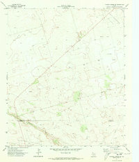
 1971 Florey1974 Print · USGSThe oil-rich plains of Andrews County are captured here in the early seventies, showing a landscape transformed by energy production. Researchers can trace the infrastructure of the Means Oil Field and locate settlements like Florey or the Old Florey Park.
 - 1971 Map of Frankel City, 1974 Print
 1971 Frankel City1974 Print · USGSThe Permian Basin during the early 1970s reveals a high-intensity energy landscape centered on the Fullerton Oil Field. Researchers can trace the industrial footprint of Frankel City through its Gas Plant, Substa, and an extensive Aqueduct.
 - 1971 Map of Jumbo Hill, 1974 Print
 1971 Jumbo Hill1974 Print · USGSAndrews County in the early 1970s reveals a landscape transitioning from traditional ranching to intensive energy production. Researchers can trace the layout of the Fullerton Oil Field alongside local landmarks like McWhorter Ranch and Jumbo Hill.
 - 1971 Map of Five Wells Ranch SE, 1974 Print
 1971 Five Wells Ranch SE1974 Print · USGSAndrews County ranching and oil operations are captured here during the early seventies. Genealogists and historians can trace family land through named landmarks like Bullwell Windmill, Buffalo Windmill, and the Prairie Dog Flat rangeland.
 - 1971 Map of Figure Seven Ranch, 1974 Print
 1971 Figure Seven Ranch1974 Print · USGSAndrews County ranching and oil production intersect in the early seventies, capturing a landscape of industrial expansion. Researchers can trace the layout of the Block 12 Oil Field and locate landmarks like the Figure Seven Ranch or Deadman Windmill.
 - 1971 Map of Whalen Lake, 1974 Print
 1971 Whalen Lake1974 Print · USGSThe Texas oil patch of the early 1970s is captured here, showing the dense network of drilling and infrastructure around Whalen Lake. Genealogists and industrial historians can trace the development of the Fullerton Oil Field, the Gasoline Plant, and the settlement at Cotten.
 - 1971 Map of Bedford Ranch, 1974 Print
 1971 Bedford Ranch1974 Print · USGSWinkler and Andrews counties come alive in the early seventies, where the cattle-ranching West meets the industrial Permian Basin. Trace the landscape of the Goldsmith Oil Field and And Ector Oil Field alongside local landmarks like Bedford Ranch and the Green Gate Windmill.
 - 1971 Map of Frankel City SW, 1974 Print
 1971 Frankel City SW1974 Print · USGSAndrews County ranch lands and oil fields are captured here in the early seventies, showing a landscape defined by water and oil. Genealogists and historians can trace family-named landmarks like Knight Well, Robison Well, and the Old Headquarters Windmill.
 - 1971 Map of Sand Ranch, 1974 Print
 1971 Sand Ranch1974 Print · USGSThe Andrews County ranchlands meet the Permian Basin oil boom in the early 1970s. Local researchers can trace the industrial footprint of the Three Bar Oil Field alongside ranching landmarks like Sand Ranch and Burma Windmill.
 - 1971 Map of Five Wells Ranch, 1974 Print
 1971 Five Wells Ranch1974 Print · USGSAndrews County ranching meets the 1970s oil boom in this detailed look at the High Plains landscape. Researchers can locate named landmarks like Five Wells Ranch and trace the extensive Hutex Oil Field alongside local features like Hog Eye Windmill.
 - 1971 Map of Five Wells Ranch SW, 1974 Print
 1971 Five Wells Ranch SW1974 Print · USGSThe West Texas ranchlands of Andrews County meet the energy boom of the seventies in this survey of the Permian Basin. Trace the intersection of industry and agriculture through labels for the Wemac Oil Field, Old Midland Road, and the Aermotor Windmill.
 - 1971 Map of Shafter Lake, 1974 Print
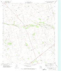
 1971 Shafter Lake1974 Print · USGSThe Andrews County plains in the early 1970s reveal an intersection of ranching history and the oil boom. Trace the remnants of local settlements at Underwood or locate family history at the Shafter Lake Cem near the banks of Shafter Lake.
 - 1971 Map of Y T Ranch, 1974 Print
 1971 Y T Ranch1974 Print · USGSWinkler and Andrews Counties are shown here in the early 1970s, as the ranching economy of the Permian Basin met the growing petroleum industry. Researchers can locate named landmarks like YT Ranch, the Old Headquarters Windmill, and the East Witcher Windmill.
 - 1971 Map of Lazy X Ranch, 1974 Print
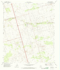
 1971 Lazy X Ranch1974 Print · USGSTexas petroleum country comes into sharp focus in the early 1970s, showing the complex web of drilling operations near Andrews. Researchers can trace the development of the Deep Rock Oil Field and find named landmarks like the Lucky Strike Well and Lazy X Ranch.
 - 1978 Map of Jal, 1979 Print
 1978 Jal1979 Print · USGSSoutheast New Mexico in the late seventies is a landscape shaped by energy production and the rugged Llano Estacado. Genealogists and industrial historians can trace the growth of Jal and Eunice along the Texas-New Mexico RR and across the Jal Oil Field.
End of results
Showing maps 1-22 of 22
Top cities of Andrews County
Frequently asked questions
- What are the different types of historical maps available for Andrews County?
- What is the oldest map of Andrews County?
- Where can I purchase historical maps of Andrews County for my home or office?
- Where can I download high-res historical maps of Andrews County?
- Are there historical topographic maps available for Andrews County?
- Is there historical aerial imagery available for Andrews County?
- Where are historical maps of Andrews County sourced from?