Old Maps of Andrews County, Texas for Genealogy
Trace your family roots with 246 historic maps of Andrews County. These high-res maps reveal old neighborhoods, homesites, landmarks, and streets — helping you uncover where your ancestors lived and how the area evolved over time.
- Explore historic neighborhoods: Identify where your relatives may have lived in the 1800s or 1900s.
- Compare maps over time: Trace the changes in streets, buildings, and landmarks for multi-generational research.
- Perfect for genealogy & ancestry research: Used by family historians and researchers to map out lineage and migration.
These maps are an incredible resource for exploring your personal connection to Andrews County's past.
Andrews County, TX maps
(246)- 1954 Map of Hobbs, 1963 Print
 1954 Hobbs1963 Print · USGSThe High Plains and Permian Basin transition is captured here at the height of the mid-century energy boom. Genealogists and industrial historians can trace the foundations of Humble City, locate the Potash Mine and Plant, and follow the Texas-New Mexico RR.2 unique versions available
 - 1958 Map of Hobbs
 1958 Hobbs1958 Print · USGSThe High Plains of the Texas-New Mexico border are shown here during the height of the mid-century oil boom. Genealogists and historians can trace the development of Hobbs, Lovington, and Jal, alongside ranching landmarks like James Ranch and the early Texas-New Mexico Railway.
 - 1963 Map of Andrews, 1977 Print
 1963 Andrews1977 Print · USGSAndrews flourished as a West Texas petroleum hub during the early seventies, surrounded by vast oil fields and ranching outposts. Genealogists and researchers can trace the local infrastructure from the Courthouse to family-named landmarks like Allen Windmill and Adobe Ranch.
 - 1966 Map of Mabee Ranch, 1968 Print
 1966 Mabee Ranch1968 Print · USGSThe West Texas plains in the mid-sixties show the heavy footprint of the energy industry along the border of Andrews and Martin counties. Researchers can trace the development of the Mabee Oil Field through its pumping station, pipelines, and the historic Mabee Ranch.2 unique versions available
 - 1966 Map of Scharbauer Ranch, 1968 Print
 1966 Scharbauer Ranch1968 Print · USGSThe high plains of the Permian Basin come into focus during the mid-sixties, showing the intersection of cattle ranching and the oil industry. Researchers can trace land use through landmarks like Scharbauer Ranch, Mustang Draw, and Old L 7 Ranch.
 - 1966 Map of Bird Ranch, 1968 Print
 1966 Bird Ranch1968 Print · USGSThe West Texas plains at the border of Andrews and Martin counties come into focus during the mid-sixties energy boom. Researchers can trace petroleum infrastructure like the Mabee Oil Field alongside local landmarks such as Bird Ranch and Glass.
 - 1966 Map of Northwest Midland, 1968 Print
 1966 Northwest Midland1968 Print · USGSMidland expands northward during the mid-sixties, showcasing a landscape where local ranching and early suburban growth meet. Trace the development of neighborhood schools like Lee High Sch, the Drive-in Theater, and the unique High Sky Girls Ranch.3 unique versions available
 - 1967 Map of North Cowden, 1970 Print
 1967 North Cowden1970 Print · USGSThe West Texas oil fields were in full production by the late sixties, reshaping the landscape of Ector and Andrews counties. Genealogists and researchers can trace local ranching history through sites like Flynt Ranch and oddly named landmarks like the Rich Uncle Windmill.2 unique versions available
 - 1968 Map of Baird Lake, 1970 Print
 1968 Baird Lake1970 Print · USGSHigh plains ranching meets the 1960s oil boom in this corner of Andrews County. Researchers can trace the layout of the Mabee Oil Field or locate named landmarks like the C Ranch, Baird Lake, and a local Archaeological Site.
 - 1968 Map of Coyote Corner, 1970 Print
 1968 Coyote Corner1970 Print · USGSThe West Texas oil patch comes alive in the late sixties as drilling infrastructure expands across the Ector and Andrews county line. Genealogists and historians can locate family holdings like Wyche Ranch or trace industrial sites in the Goldsmith Oil Field and around Coyote Corner.
 - 1968 Map of North Cowden NW, 1970 Print
 1968 North Cowden NW1970 Print · USGSThe West Texas oil country comes into sharp focus during the late 1960s, revealing a landscape defined by industry. Energy researchers and local historians can trace the extent of the Fuhrman Mascho Oil Field and the Embar Oil Field.
 - 1968 Map of Gardendale NW, 1970 Print
 1968 Gardendale NW1970 Print · USGSAndrews County was dominated by the mid-century energy boom during the late sixties. Researchers can trace the sprawling infrastructure of the Midland Farms Oil Field and locate landmarks like the Gasoline Plant and Double Windmill.
 - 1968 Map of Clabber Hill Ranch, 1970 Print
 1968 Clabber Hill Ranch1970 Print · USGSAndrews County ranching and petroleum production intersect in the late 1960s as a complex industrial network. Researchers can trace land use through family landmarks like the Jackson Parker Windmill and the expansive Fuhrman Mascho Oil Field.
 - 1968 Map of Hackberry Lake, 1970 Print
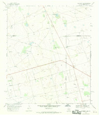 1968 Hackberry Lake1970 Print · USGSIn the Permian Basin during the late sixties, this area shows the intersection of the cattle-ranching past and the oil-industry future. Trace family-named landmarks like Morris and Hunter Well, or locate the specific placement of the Hackberry Windmill.2 unique versions available
 - 1968 Map of Gardendale, 1970 Print
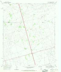 1968 Gardendale1970 Print · USGSThe West Texas oil fields of Andrews and Ector counties are captured here in the late sixties as industrial infrastructure expanded across the basin. Genealogists and historians can locate ranching landmarks like Circle Bar Ranch and early oil towns such as Scharbauer City and Gardendale.2 unique versions available
 - 1969 Map of Jal NE, 1972 Print
 1969 Jal NE1972 Print · USGSThe energy-rich borderlands of West Texas and New Mexico come into focus during a period of intense petroleum development. Trace the infrastructure of the Jal Oil Field along the stateline, including a Gas Plant and Monument Draw.3 unique versions available
 - 1969 Map of Hobbs SE, 1972 Print
 1969 Hobbs SE1972 Print · USGSThe high plains of the Texas-New Mexico border come into focus in the late 1960s as ranching and oil exploration intersect. Trace the industrial footprint across Monument Draw through its networks of pipelines and sites like Kornegay Ranch.2 unique versions available
 - 1969 Map of Eunice NE, 1972 Print
 1969 Eunice NE1972 Print · USGSThe Texas-New Mexico borderlands in the late sixties come alive with the infrastructure of the Permian Basin's petroleum industry. Researchers can trace the development of the Elliott Oil Field, locate the small settlement of Jones City, and find water sources like Baker Spring.2 unique versions available
 - 1969 Map of Eunice SE, 1972 Print
 1969 Eunice SE1972 Print · USGSThe Texas and New Mexico borderlands come alive in the late sixties as a high-production oil landscape. Researchers can trace the intensive development of the Drinkard Oil Field and Nelson Oil Field or locate the remote Giles Ranch.3 unique versions available
 - 1969 Map of Jal SE, 1973 Print
 1969 Jal SE1973 Print · USGSThe high desert of the Permian Basin comes into focus during the late sixties at the New Mexico and Texas border. Petroleum historians and researchers can trace the industrial footprint of the Dollarhide Oil Field and topographic features like Monument Draw and Shifting Sand.2 unique versions available
 - 1969 Map of Seminole SW, 1973 Print
 1969 Seminole SW1973 Print · USGSThe West Texas oil boom of the late sixties is frozen in time across these Gaines and Andrews County lines. Researchers can trace the massive footprint of the Doss Robertson Oil Field and Flanagan Harris Field through their complex web of Oil Wells and infrastructure.
 - 1970 Map of Cedar Point Ranch, 1973 Print
 1970 Cedar Point Ranch1973 Print · USGSGaines County ranching and oil production meet in the early seventies along the Gaines Co Andrews Co border. Researchers can map the footprint of the McFarland Oil Field and Arrow Field alongside the Cedar Point Ranch and Seminole Draw.
 - 1970 Map of Patricia SW, 1973 Print
 1970 Patricia SW1973 Print · USGSThe West Texas plains at the start of the 1970s are defined here by petroleum exploration and the intersection of four county lines. Researchers can trace land use through Oil Wells, McKenzie Draw, and the isolated Mill in the Flat Pond.
 - 1970 Map of Seminole SE, 1973 Print
 1970 Seminole SE1973 Print · USGSThe Permian Basin oil fields of Gaines and Andrews County appear in high detail during the early 1970s. Trace the industrial footprint of the Means North Field and Nolley Oil Field alongside Telephone Road and local Roadside Parks.2 unique versions available
 - 1970 Map of McKenzie Lake SE, 1973 Print
 1970 McKenzie Lake SE1973 Print · USGSThe Permian Basin oil industry is in full swing on the Gaines and Andrews County line during the early seventies. Trace the industrial footprint of the Glasco Oil Field through its network of Oil Wells and the Florey Pumping Sta.
Showing maps 1-25 of 246
Top cities of Andrews County
Frequently asked questions
- What are the different types of historical maps available for Andrews County?
- What is the oldest map of Andrews County?
- Where can I purchase historical maps of Andrews County for my home or office?
- Where can I download high-res historical maps of Andrews County?
- Are there historical topographic maps available for Andrews County?
- Is there historical aerial imagery available for Andrews County?
- Where are historical maps of Andrews County sourced from?