
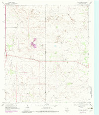
1969 Map of Eunice NE
USGS Topo · Published 1972About this map
Elliott Oil Field, Jal Monument Oil Field, and Freund Oil Field dominate this arid landscape along the Texas-New Mexico border. The map reveals an industrial geography defined by petroleum extraction, featuring a dense network of pipelines, drill holes, and a Pumping Sta that supported the region's mid-century energy boom. Aside from the small cluster at Jones City, human presence is largely limited to technical infrastructure like the Radio Facility and a lonely Roadside Park along the primary east-west highway.
Find a feature on this map
15 named features on this map. Tap any name to fly to it.
Don’t see what you’re looking for? This feature index may not catch every label — zoom into the map to look around manually.
Map Details
Editions of this 1969 Eunice NE Map
2 editions found
Other maps of this area

1954 · Hobbs
USGS Topo · 1:250,000

1958 · Hobbs
USGS Topo · 1:250,000

1969 · Hobbs SW
USGS Topo · 1:24,000

1969 · Eunice
USGS Topo · 1:24,000

1969 · Hobbs SE
USGS Topo · 1:24,000

1969 · Eunice SE
USGS Topo · 1:24,000

1969 · Rattlesnake Canyon
USGS Topo · 1:24,000

1971 · Brinson Ranch
USGS Topo · 1:24,000

1971 · Jumbo Hill
USGS Topo · 1:24,000

1971 · Frankel City SW
USGS Topo · 1:24,000