2020s Maps of Elmendorf, Texas
Explore 2 historic maps of Elmendorf from the 2020s. These maps offer a rare glimpse into what life looked like during the 2020s — showing old roads, neighborhoods, homes, and landmarks that have changed or disappeared over time.
Whether you're researching your family's past, planning a metal detecting trip, or studying how Elmendorf's landscape evolved across the 2020s, these high-resolution maps are a powerful tool for exploring the history of this region.
- Focus on a specific era: All maps on this page are from the 2020s, giving you a focused view of this time period.
- See what’s changed: Compare century-old streets, trails, and buildings to today's modern landscape using overlays and satellite layers.
- Research with precision: Use these maps for genealogy, historical research, land use analysis, or educational projects.
- View, download, or print: Maps are fully viewable online in high resolution, and can be downloaded or printed for your own records.
Start exploring Elmendorf's history through authentic maps from the 2020s. This is your window into the past.
Elmendorf, TX maps
(2)- 2022 Map of Saspamco, 2022 Print
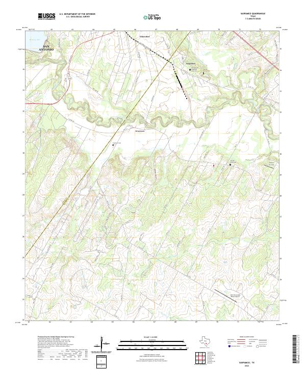 2022 Saspamco2022 Print · USGSSoutheastern Texas ranch lands and river bends come alive in this recent survey of the Wilson and Bexar county line. Local historians can trace cemetery locations like Canada Verde Cem or the industrial roots of Saspamco near the San Antonio River.
 - 2022 Map of Elmendorf, 2022 Print
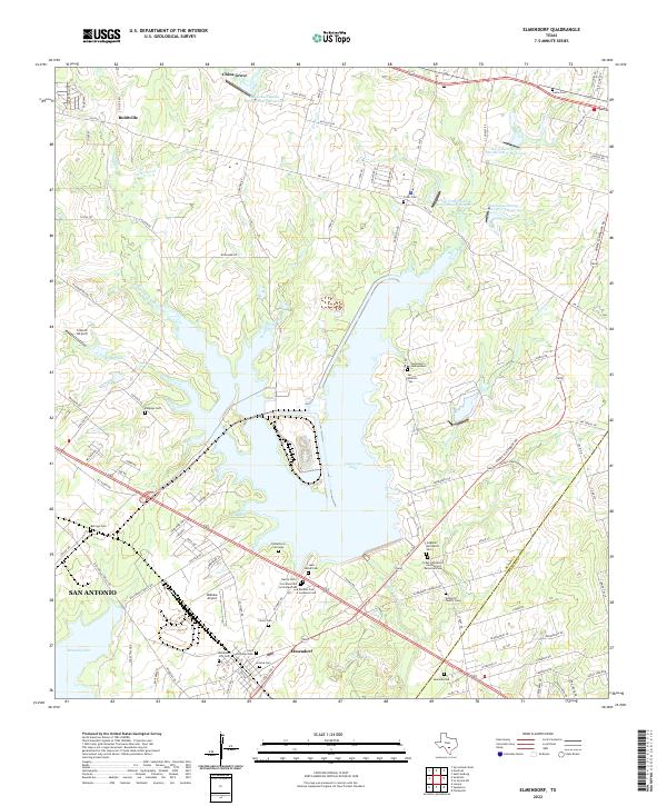 2022 Elmendorf2022 Print · USGSSoutheast of San Antonio in the 2020s, this area of Bexar County shows a unique landscape of modern reservoirs and deep-rooted family history. Researchers can trace dozens of local burial sites like Cementerio Santa Isabel, Hobrecht Family Cem, and Elmendorf City Cem.
End of results
Showing maps 1-2 of 2
Top cities near Elmendorf
- San Antonio historical maps
- Schertz historical maps
- Floresville historical maps
- Converse historical maps
- Lone Oak historical maps
- Kirby historical maps
See more
Frequently asked questions
- What are the different types of historical maps available for Elmendorf?
- What is the oldest map of Elmendorf?
- Where can I purchase historical maps of Elmendorf for my home or office?
- Where can I download high-res historical maps of Elmendorf?
- Are there historical topographic maps available for Elmendorf?
- Is there historical aerial imagery available for Elmendorf?
- Where are historical maps of Elmendorf sourced from?