1960s Maps of Brewster County, Texas
Explore 12 historic maps of Brewster County from the 1960s. These maps offer a rare glimpse into what life looked like during the 1960s — showing old roads, neighborhoods, homes, and landmarks that have changed or disappeared over time.
Whether you're researching your family's past, planning a metal detecting trip, or studying how Brewster County's landscape evolved across the 1960s, these high-resolution maps are a powerful tool for exploring the history of this region.
- Focus on a specific era: All maps on this page are from the 1960s, giving you a focused view of this time period.
- See what’s changed: Compare century-old streets, trails, and buildings to today's modern landscape using overlays and satellite layers.
- Research with precision: Use these maps for genealogy, historical research, land use analysis, or educational projects.
- View, download, or print: Maps are fully viewable online in high resolution, and can be downloaded or printed for your own records.
Start exploring Brewster County's history through authentic maps from the 1960s. This is your window into the past.
Brewster County, TX maps
(12)- 1965 Map of Emory Peak
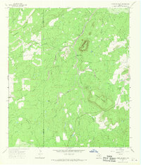
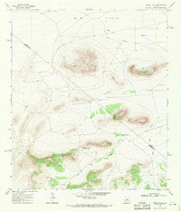
 1965 Emory Peak1965 Print · USGSThe Big Bend backcountry in the mid-1960s reveals a desert landscape of remote ranches and mercury mining. Trace the historic boundary along the Rio Grande and locate landmarks like the Fresno Mine and Panther Spring.
 - 1967 Map of Horse Mountain, 1970 Print
 1967 Horse Mountain1970 Print · USGSMason and Llano Counties are captured during the late sixties, showing a landscape of high peaks and spring-fed creeks. Researchers can locate family landmarks like Putnam Cem and trace the paths of Marschall Creek and Hickory Creek.
 - 1968 Map of Housetop Mountains, 1971 Print
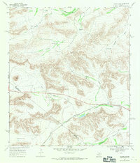
 1968 Housetop Mountains1971 Print · USGSThe Trans-Pecos high desert of the late sixties is defined here by its ranching infrastructure and critical transportation corridors. Researchers can trace the path of the Southern Pacific and Route 90 through Lemons Gap and Fin del Mundo Canyon.
 - 1968 Map of Tesnus, 1971 Print
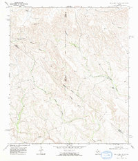
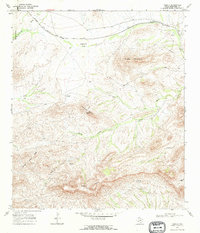 1968 Tesnus1971 Print · USGSThe Southern Pacific corridor through Brewster County is captured here in the late sixties, highlighting the remote railroad stop at Tesnus. Researchers can trace the ranching landscape through landmarks like Copeland Trap, Panther Peaks, and the curiously named Hells Half Acre.2 unique versions available
 - 1968 Map of Cap Rock Butte, 1971 Print
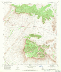
 1968 Cap Rock Butte1971 Print · USGSRanching life in the late sixties comes into focus in this corner of the Trans-Pecos, where remote outposts like Skevington Ranch relied on the Red Windmill. Trace property lines across W B Flats and follow the natural draws that define the county line.
 - 1968 Map of Big Brindle Canyon, 1971 Print
 1968 Big Brindle Canyon1971 Print · USGSWest Texas ranching life in the late sixties centers on isolated homesteads and vital water sources among the deep draws of the Trans-Pecos. Researchers can trace the boundaries of the Brown Ranch, Murrah Ranch, and the southern Ranchito near Maxon Creek.
 - 1968 Map of Fresno Creek, 1971 Print
 1968 Fresno Creek1971 Print · USGSThe Southern Pacific railroad passes through the Brewster and Pecos county line in the late 1960s. Researchers can trace remote ranching outposts like Rosenfeld and water features such as Fresno Well and High Windmill.
 - 1968 Map of Longfellow, 1971 Print
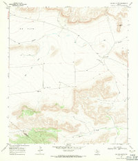
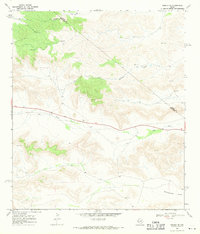
 1968 Longfellow1971 Print · USGSThe high desert of Pecos and Brewster County is captured in the late sixties as the railroad era meets modern ranching. Trace the Southern Pacific line past Longfellow and locate family-named landmarks like Steer Wells and Panther Peak.
 - 1968 Map of Tesnus SE, 1971 Print
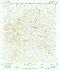
 1968 Tesnus SE1971 Print · USGSBrewster County in the late 1960s shows a landscape of remote rail outposts and aviation history among the desert canyons. Trace the path of the Southern Pacific railroad through Rosenfeld and locate features like Cox Landing Field and Maxon Creek.2 unique versions available
 - 1968 Map of Dimple Hills, 1971 Print
 1968 Dimple Hills1971 Print · USGSThe Trans-Pecos ranchlands are captured in the late 1960s, showing a remote landscape defined by high summits and critical water points. Genealogists and historians can trace the bounds of League Ranch or locate family landmarks like Gurley Windmill and Sugar Loaf Mountain.
 - 1968 Map of Tesnus NE, 1971 Print
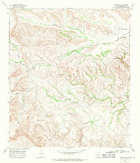
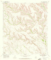
 1968 Tesnus NE1971 Print · USGSBrewster and Pecos counties meet in this arid West Texas landscape during the late sixties, where ranching and topography dictate the way of life. Genealogists and historians can trace the paths of Downie Draw and Dry Creek or locate landmarks like Rattlesnake Flats and the Gravel Pit.
 - 1969 Map of Hagler Canyon, 1972 Print
 1969 Hagler Canyon1972 Print · USGSWest Texas ranching and rail corridors are captured here at the end of the 1960s. Trace the path of the Southern Pacific through the rugged drainages of Hagler Canyon and Isinglass Canyon along the Terrell and Brewster county line.2 unique versions available
End of results
Showing maps 1-12 of 12
Top cities of Brewster County
Frequently asked questions
- What are the different types of historical maps available for Brewster County?
- What is the oldest map of Brewster County?
- Where can I purchase historical maps of Brewster County for my home or office?
- Where can I download high-res historical maps of Brewster County?
- Are there historical topographic maps available for Brewster County?
- Is there historical aerial imagery available for Brewster County?
- Where are historical maps of Brewster County sourced from?