1970s Maps of Brewster County, Texas
Explore 37 historic maps of Brewster County from the 1970s. These maps offer a rare glimpse into what life looked like during the 1970s — showing old roads, neighborhoods, homes, and landmarks that have changed or disappeared over time.
Whether you're researching your family's past, planning a metal detecting trip, or studying how Brewster County's landscape evolved across the 1970s, these high-resolution maps are a powerful tool for exploring the history of this region.
- Focus on a specific era: All maps on this page are from the 1970s, giving you a focused view of this time period.
- See what’s changed: Compare century-old streets, trails, and buildings to today's modern landscape using overlays and satellite layers.
- Research with precision: Use these maps for genealogy, historical research, land use analysis, or educational projects.
- View, download, or print: Maps are fully viewable online in high resolution, and can be downloaded or printed for your own records.
Start exploring Brewster County's history through authentic maps from the 1970s. This is your window into the past.
Brewster County, TX maps
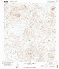
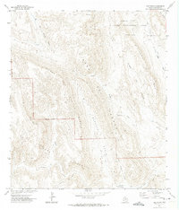
(37)- 1970 Map of Solis, 1974 Print
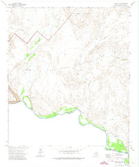
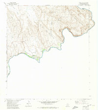
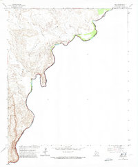 1970 Solis1974 Print · USGSThe river border within Big Bend National Park is captured here during the 1970s, showing the intersection of Texas and Coahuila. Researchers can trace remote ranching history at Solis Landing, Comptons, and the Ruins Casa de Piedra.2 unique versions available
 - 1971 Map of Yellow Hill, 1973 Print
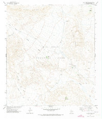
 1971 Yellow Hill1973 Print · USGSBrewster County's high desert terrain is captured here in the early seventies, showing a land defined by water and elevation. Trace the winding path of Terlingua Creek and identify remote landmarks like Lefthand Shutup and Pinks Peak.2 unique versions available
 - 1971 Map of Dagger Flat, 1973 Print
 1971 Dagger Flat1973 Print · USGSThe eastern reaches of Brewster County come into sharp focus during the 1970s, where desert basins meet high limestone ridges. Researchers can trace the rugged boundaries of Big Bend National Park, locating isolated landmarks like Dagger Tank, an old Prospect, and the winding Nine Point Draw.2 unique versions available
 - 1971 Map of Terlingua, 1973 Print
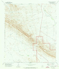
 1971 Terlingua1973 Print · USGSTerlingua and Study Butte appear in the early seventies during their transition from mercury mining hubs to desert outposts. Researchers can trace historical Mines, an Aerial Tramway, and scattered Ruins near the Big Bend National Park border.3 unique versions available
 - 1971 Map of Glenn Spring, 1973 Print
 1971 Glenn Spring1973 Print · USGSThe arid reaches of Brewster County are documented here in the early 1970s within the boundaries of the park. Researchers can locate early desert landmarks like Glenn Spring, the Rice Cem, and the evocative Robbers Roost.2 unique versions available
 - 1971 Map of Persimmon Gap, 1973 Print
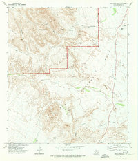
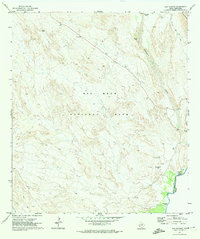
 1971 Persimmon Gap1973 Print · USGSBig Bend National Park's northern entrance is captured here in the early 1970s, showing the intersection of ranching history and federal land conservation. Researchers can trace remote water sources like Edwards Well and landmarks near the Persimmon Gap gateway.
 - 1971 Map of McKinney Springs, 1973 Print
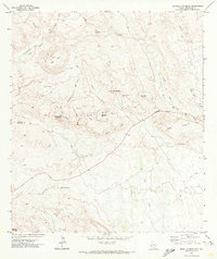
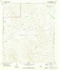
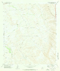 1971 McKinney Springs1973 Print · USGSBig Bend National Park's desert reaches are documented here in the early 1970s, showing the vital relationship between desert springs and historical transit. Researchers can trace the Old Ore Road to find Ruins, McKinney Springs, and the high point at Stuarts Peak.
 - 1971 Map of Cerro Castellan, 1973 Print
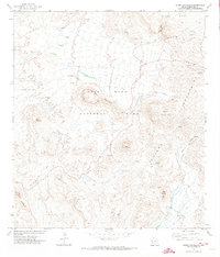 1971 Cerro Castellan1973 Print · USGSBig Bend National Park in the early seventies showcases a rugged landscape defined by volcanic peaks and desert springs. Researchers can trace historic pack routes like the Chimneys Trail and locate remote sites such as the Tule Spring Ruins and Cerro Castellan.4 unique versions available
 - 1971 Map of Grapevine Hills, 1974 Print
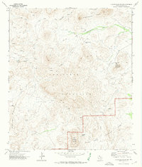
 1971 Grapevine Hills1974 Print · USGSBrewster County's high desert landscape is documented here in the early seventies, spanning the transition from active ranching to protected parkland. Researchers can trace the boundaries of Big Bend National Park and locate historic sites like Rosillos Mountain Ranch, Hannold, and the Fossil Bone Exhibit.2 unique versions available
 - 1971 Map of Amarilla Mountain, 1974 Print
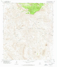
 1971 Amarilla Mountain1974 Print · USGSIn the early 1970s, this portion of Brewster County remained a landscape of remote mining claims and desert trails. Genealogists and historians can trace the paths between the Lone Star Mine, the isolated Coitrias Camp, and the deep Terlingua Sinkhole.2 unique versions available
 - 1971 Map of Christmas Mountians, 1974 Print
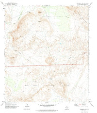
 1971 Christmas Mountians1974 Print · USGSBrewster County's high desert terrain is mapped here in the early seventies, just as the ranching and park boundaries were being firmly established. Local historians can trace the remote Terlingua Ranch Lodge, old Mines, and vital water sources like Christmas Wells Tank.
 - 1971 Map of The Solitario, 1974 Print
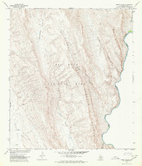
 1971 The Solitario1974 Print · USGSThe Trans-Pecos high desert unfolds in the early seventies, centered on the massive geologic formation of The Solitario. Researchers can trace isolated ranching outposts like Burnt Camp and navigation points through the Righthand Shutup and Lower Shutup.
 - 1971 Map of Hen Egg Mountain, 1974 Print
 1971 Hen Egg Mountain1974 Print · USGSBrewster County's high desert peaks and ranching outposts are captured here in the early 1970s. Researchers can locate remote sites like 3 Bar Ranch, follow the path of Terlingua Creek, or trace the rugged vicinity of Hen Egg Mountain.2 unique versions available
 - 1971 Map of Bone Spring NE, 1974 Print
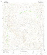
 1971 Bone Spring NE1974 Print · USGSBrewster County ranching and conservation lands come into focus in the early seventies as the desert landscape meets the high peaks. Trace remote water sources and family names at Cow Heaven Tank, Gooden Windmill, and Shackleford Well.2 unique versions available
 - 1971 Map of Reed Camp, 1974 Print
 1971 Reed Camp1974 Print · USGSThe Rio Grande border in Brewster County was a land of remote river outposts and desert trails in the early 1970s. Local history researchers can trace old desert life at Johnson Ranch, locate family-named sites like Woodsons, and follow the Dominguez Trail.
 - 1971 Map of Tule Mountain, 1974 Print
 1971 Tule Mountain1974 Print · USGSBig Bend's high desert landscape is detailed here in the early seventies, during a period of park management and preservation. Trace historical water sources and pack routes like Indian Head Spring and the Apache Canyon Trail (Pack).3 unique versions available
 - 1971 Map of Castolon, 1974 Print
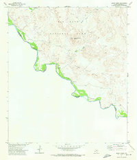
 1971 Castolon1974 Print · USGSBig Bend National Park's desert borderlands and river crossings are captured here in the early 1970s. Trace the history of remote settlements and outposts like Castolon, the ruins of Terlingua Abaja, and the Coyote Cem along the Rio Grande.2 unique versions available
 - 1971 Map of Lajitas, 1974 Print
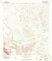
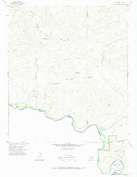 1971 Lajitas1974 Print · USGSThe Chihuahuan Desert borderlands come to life in this early 1970s survey of the river country near the Brewster and Presidio county line. Researchers can trace remote mining operations at Whitroy Mine, old cattle landmarks like Madrid Ranch, and river crossings near Lajitas.3 unique versions available
 - 1971 Map of Ernst Valley, 1974 Print
 1971 Ernst Valley1974 Print · USGSThe high desert of Brewster County in the early seventies reveals a landscape defined by historic mining routes and international river borders. Researchers can trace the Old Ore Road and find remote landmarks like Ernst Tank and the Sierra Del Caballo Muerto.
 - 1971 Map of Smoky Creek, 1974 Print
 1971 Smoky Creek1974 Print · USGSThe Rio Grande borderlands within Big Bend National Park are captured here in the early 1970s. Researchers can locate remote outposts like Buenos Aires, several sets of ruins, and a small riverside Cem tucked beneath the Sierra de Chino.
 - 1971 Map of Boquillas, 1974 Print
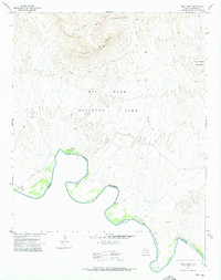
 1971 Boquillas1974 Print · USGSThe international border along the Big Bend of the Rio Grande is captured here in the early 1970s. Researchers can trace remote desert routes like the Old Ore Road and Strawhouse Trail, or locate the Boquillas Crossing (Ford) and US Customs.4 unique versions available
 - 1971 Map of San Vicente, 1974 Print
 1971 San Vicente1974 Print · USGSThe Big Bend backcountry along the Rio Grande was a landscape of remote river settlements and desert trails in the early seventies. Genealogists and historians can trace the sites of San Vicente (Site), La Noria (Site), and the historic San Vicente Crossing.2 unique versions available
 - 1971 Map of Emory Peak, 1974 Print
 1971 Emory Peak1974 Print · USGSBig Bend National Park in the early 1970s reveals a high-desert wilderness of named springs and remote ranching remnants. Researchers can trace the arduous routes of the Dodson Trail or locate historic landmarks like Blue Creek Ranch and Elephant Tusk.4 unique versions available
 - 1971 Map of Sombrero Peak, 1974 Print
 1971 Sombrero Peak1974 Print · USGSBrewster County ranching and wilderness are captured here in the early seventies as the park expanded. Researchers can trace remote sites like Sombrero Peak Ranch, Smallpox Well, and Ruins near Onion Spring.
 - 1971 Map of Sue Peaks, 1974 Print
 1971 Sue Peaks1974 Print · USGSBig Bend and the Black Gap region are captured in the early 1970s, showing the high-desert mountain ranges before modern shifts in park management. Researchers can trace historic transit routes like the Telephone Canyon Trail and Pack Trail past Sue Peaks.2 unique versions available
Showing maps 1-25 of 37
Top cities of Brewster County
Frequently asked questions
- What are the different types of historical maps available for Brewster County?
- What is the oldest map of Brewster County?
- Where can I purchase historical maps of Brewster County for my home or office?
- Where can I download high-res historical maps of Brewster County?
- Are there historical topographic maps available for Brewster County?
- Is there historical aerial imagery available for Brewster County?
- Where are historical maps of Brewster County sourced from?