1900s (20th Century) Maps of Brewster County, Texas
Explore 173 historic maps of Brewster County from the 1900s (20th Century). These maps offer a rare glimpse into what life looked like during the 1900s — showing old roads, neighborhoods, homes, and landmarks that have changed or disappeared over time.
Whether you're researching your family's past, planning a metal detecting trip, or studying how Brewster County's landscape evolved across the 1900s, these high-resolution maps are a powerful tool for exploring the history of this region.
- Focus on a specific era: All maps on this page are from the 1900s, giving you a focused view of this time period.
- See what’s changed: Compare century-old streets, trails, and buildings to today's modern landscape using overlays and satellite layers.
- Research with precision: Use these maps for genealogy, historical research, land use analysis, or educational projects.
- View, download, or print: Maps are fully viewable online in high resolution, and can be downloaded or printed for your own records.
Start exploring Brewster County's history through authentic maps from the 1900s. This is your window into the past.
Brewster County, TX maps
(173)- 1903 Map of Chisos Mountains, 1956 Print
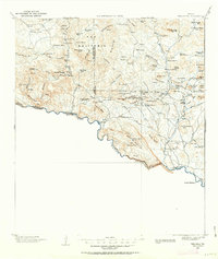
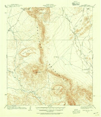
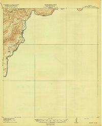
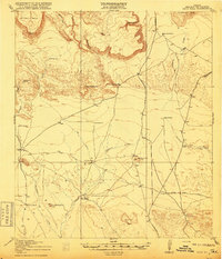
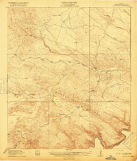
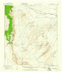
 1903 Chisos Mountains1956 Print · USGSThe Big Bend region of West Texas appears here at the start of the twentieth century, showing a landscape defined by ranching and mining. Trace early frontier outposts like Stroud's Ranch, the industrial remains at Old Smelter, and reliable water at Dugout Wells.
 - 1903 Map of Terlingua, 1963 Print
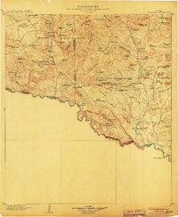
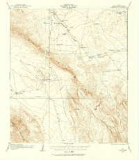
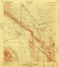
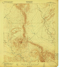
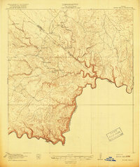
 1903 Terlingua1963 Print · USGSThe Big Bend borderlands emerge at the height of the quicksilver boom, showing the isolated ranching and mining camps along the Rio Grande. Trace the roots of early mining at Study Butte and find remote family outposts like Gourleys Ranch and Lajitas.
 - 1904 Map of Terlingua
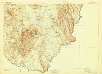
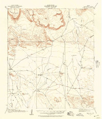
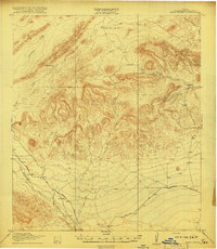
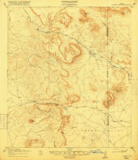
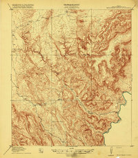
 1904 Terlingua1904 Print · USGSThe Trans-Pecos frontier is captured here at the height of the early quicksilver mining boom. Genealogists and historians can locate remote family sites like Howard's Ranch and Madril Ranch, or trace early industrial efforts at the Colquitt-Tigner Mine.5 unique versions available
 - 1905 Map of Chisos Mountains, 1940 Print
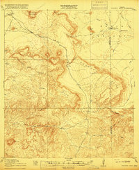
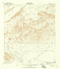
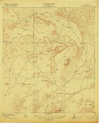
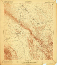
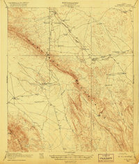
 1905 Chisos Mountains1940 Print · USGSThe Big Bend frontier of West Texas comes to life here at the dawn of the twentieth century, during a time of border expansion and ranching. Researchers can trace the early trails between family outposts like Stroud's Ranch and landmarks like the Old Smelter or Dugout Wells.2 unique versions available
 - 1917 Map of Agua Fria
 1917 Agua Fria1917 Print · USGSBrewster County's high desert landscape comes into focus during the late First World War era, showing a remote network of trails and camps. Genealogists and historians can trace early ranching and transit via the Old Stage Stand, Adams Ranch, and the Old Alpine and Terlingua Road.2 unique versions available
 - 1917 Map of Tascotal Mesa
 1917 Tascotal Mesa1917 Print · USGSThe Trans-Pecos frontier during World War I remained a land of remote cattle outposts and historic mountain passages. Researchers can trace early regional travel routes like the Marfa and Lajitas Road and locate family landmarks such as Rooney Ranch and San Jacinto Ranch.2 unique versions available
 - 1917 Map of Santiago Peak, 1955 Print
 1917 Santiago Peak1955 Print · USGSBrewster County ranching life is preserved in this Great War era survey of the rugged Trans-Pecos. Genealogists and historians can trace the footprints of early cattle operations like Buttrill Ranch and Fords Ranch beneath the shadows of Santiago Peak.3 unique versions available
 - 1917 Map of Bone Spring, 1957 Print
 1917 Bone Spring1957 Print · USGSThe Brewster County ranching frontier is captured here in the years following the first World War. Researchers can trace the early road network and family outposts like Hendersons Ranch, the Old Wax Plant, and the vital waters of Bone Spring.
 - 1917 Map of Buck Hill, 1957 Print
 1917 Buck Hill1957 Print · USGSBrewster County ranching life during the early twentieth century is captured here in a landscape of high mesas and desert draws. Genealogists and historians can locate family holdings like Kokernot Ranch, Wilsons Ranch, and the Loy Place (Abandoned).2 unique versions available
 - 1917 Map of Hood Spring, 1958 Print
 1917 Hood Spring1958 Print · USGSBrewster County in the early twentieth century was a land of desert ranches and long-haul freight roads. Map collectors and historians can trace the Marathon and Boquillas Road past landmarks like the Gage Indian Creek Ranch and Hood Spring.
 - 1918 Map of Reagan Canyon
 1918 Reagan Canyon1918 Print · USGSThe Texas-Mexico borderlands come into focus during the Great War era as the Army Corps of Engineers surveyed this river corridor. Researchers can trace the Seminole Trail, locate the historic Wax Factory, and identify the site of Horn's Ranch.4 unique versions available
 - 1918 Map of Bone Spring
 1918 Bone Spring1918 Print · USGSBrewster County ranching outposts and desert industries are captured in high detail just before the close of the Great War. Genealogists and historians can trace family landholdings and early commercial sites like Hendersons Ranch, Stillwell, and the Old Wax Plant.
 - 1918 Map of Hood Spring
 1918 Hood Spring1918 Print · USGSBrewster County’s remote ranching frontier is captured here during the First World War era, showing a landscape defined by vital water sources. Researchers can trace the original Marathon and Boquillas Road and locate sites like Indian Creek Ranch and Hood Spring.2 unique versions available
 - 1918 Map of Dove Mountain
 1918 Dove Mountain1918 Print · USGSTerrell County during the First World War was a landscape of isolated livestock operations and vital desert water tanks. Genealogists and historians can trace the early cattle industry through family-named sites like Gage Ranch, Jones Ranch, and Chambers Camp.3 unique versions available
 - 1918 Map of Buck Hill
 1918 Buck Hill1918 Print · USGSBrewster County's expansive ranching landscape is captured here during the Great War era, showing a world of isolated outposts and vital desert springs. Genealogists and historians can trace the foundations of local heritage at Kokernot Ranch, Wilson's Ranch, and the Loy Place (Abandoned).
 - 1918 Map of Santiago Peak
 1918 Santiago Peak1918 Print · USGSBrewster County ranching and rugged Trans-Pecos topography are captured here during the First World War era. Researchers can trace early family land holdings like Schuler Ranch and Fords Ranch or locate remote water sources such as KE Spring.
 - 1918 Map of Jordan Gap
 1918 Jordan Gap1918 Print · USGSWest Texas ranching and frontier life are captured in the years before the Great War, showing a network of mountain passes and isolated water sources. Researchers can trace the road To Marfa, the remote outpost at Paradise, and family landmarks like Mc Cormick Mtn.
 - 1918 Map of Bone Spring
 1918 Bone Spring1918 Print · USGSBrewster County was a land of remote ranches and vital desert springs during the years of the Great War. Genealogists and historians can trace the early road network connecting Greene Ranch, the Old Wax Plant, and the namesake Bone Spring.3 unique versions available
 - 1918 Map of Nine Point Mesa
 1918 Nine Point Mesa1918 Print · USGSBrewster County was a sparsely settled frontier during the Great War era, where survival depended on the deep canyons and rare springs of the Big Bend. Genealogists and historians can trace early ranching boundaries at Johnson Ranch, Saucier Ranch, and Buttrill Ranch.
 - 1918 Map of Bullis Gap
 1918 Bullis Gap1918 Print · USGSBrewster County's rugged borderlands come into focus during the late First World War era, showing a landscape defined by ranching and transit. Genealogists and historians can trace the Bullis Trail to isolated sites like Espanol House, Kellogg, and Valdez Goat Camp.4 unique versions available
 - 1918 Map of Indian Wells
 1918 Indian Wells1918 Print · USGSThe West Texas borderlands appear in their early ranching prime just before the 1920s, showing the isolated outposts along the river. Genealogists and local historians can trace legacy holdings at Garcia Ranch, Stewart Ranch, and the settlement of San Francisco.4 unique versions available
 - 1919 Map of Maravillas Canyon
 1919 Maravillas Canyon1919 Print · USGSBrewster County ranching and border life are documented here just after the Great War. Genealogists and historians can trace the early footprints of the Stillwell family and locate remote outposts like Pettit Ranch or the Rockhouse site along the Rio Grande.2 unique versions available
 - 1920 Map of Longfellow
 1920 Longfellow1920 Print · USGSRailroad outposts and high desert terrain define this West Texas survey from the early twentieth century. Genealogists and historians can trace the Southern Pacific line through stops like Purrington, Tesnus, and Rosenfeld, along with landmarks like the Pittsburg Boring.
 - 1920 Map of Bone Spring
 1920 Bone Spring1920 Print · USGSBrewster County's high-desert frontier is captured in the years following the Great War, showing a landscape defined by isolated ranching outposts and rugged mountain gaps. Genealogists and historians can trace family landholdings and early industry through sites like Walkers Ranch, Buttrell Ranch, and the Old Wax Plant.2 unique versions available
 - 1920 Map of Monument Spring, 1960 Print
 1920 Monument Spring1960 Print · USGSBrewster County was a rugged frontier of cattle ranches and rail stops following the first World War. Trace the early settlement of Marathon and the legendary Old Fort Pena Colorada, or locate family landmarks like Combs Headquarters Ranch.
Showing maps 1-25 of 173
Top cities of Brewster County
Frequently asked questions
- What are the different types of historical maps available for Brewster County?
- What is the oldest map of Brewster County?
- Where can I purchase historical maps of Brewster County for my home or office?
- Where can I download high-res historical maps of Brewster County?
- Are there historical topographic maps available for Brewster County?
- Is there historical aerial imagery available for Brewster County?
- Where are historical maps of Brewster County sourced from?