1990s Maps of El Paso County, Texas
Explore 24 historic maps of El Paso County from the 1990s. These maps offer a rare glimpse into what life looked like during the 1990s — showing old roads, neighborhoods, homes, and landmarks that have changed or disappeared over time.
Whether you're researching your family's past, planning a metal detecting trip, or studying how El Paso County's landscape evolved across the 1990s, these high-resolution maps are a powerful tool for exploring the history of this region.
- Focus on a specific era: All maps on this page are from the 1990s, giving you a focused view of this time period.
- See what’s changed: Compare century-old streets, trails, and buildings to today's modern landscape using overlays and satellite layers.
- Research with precision: Use these maps for genealogy, historical research, land use analysis, or educational projects.
- View, download, or print: Maps are fully viewable online in high resolution, and can be downloaded or printed for your own records.
Start exploring El Paso County's history through authentic maps from the 1990s. This is your window into the past.
El Paso County, TX maps
(24)- 1990 Map of Ysleta NW, 1991 Print
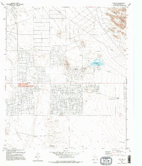
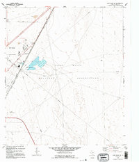
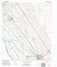
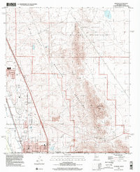
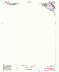 1990 Ysleta NW1991 Print · USGSThe international border south of El Paso comes into focus in this late-twentieth-century study of the river valley. Genealogists and historians can trace the growth of Alfalfa and Lakeside alongside the water networks of the Playa Intercepting Drain and Ascarate Lake.
 - 1994 Map of Fort Bliss SE
 1994 Fort Bliss SE1994 Print · USGSEl Paso saw significant suburban expansion in the early nineties as residential neighborhoods pushed toward the military boundary. Genealogists and local historians can trace family locations near Evergreen Cemetery East, Hacienda Heights, and the St Raphael Sch.
 - 1994 Map of El Paso
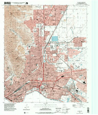
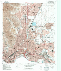 1994 El Paso1994 Print · USGSEl Paso's urban and military landscape is captured in the early 1990s as it reaches toward the Franklin Mountains. Trace the international border at the Chamizal National Memorial or locate family history at Concordia Cemetery and Britton Davis.
 - 1994 Map of Smeltertown
 1994 Smeltertown1994 Print · USGSEl Paso and the international borderlands come alive in the 1990s as industry and education reshape the river valley. Trace the legacy of the Copper Smelter in Smeltertown, locate old family sites near La Calavera, and follow the American Canal.
 - 1994 Map of Ysleta NW
 1994 Ysleta NW1994 Print · USGSEl Paso’s southeastern borderlands are captured in the mid-nineties as suburban growth met the international line. Trace the development of neighborhoods like Lakeside and locate community anchors such as Cedar Grove Sch and Ascarate Lake.
 - 1994 Map of Strauss
 1994 Strauss1994 Print · USGSThe Chihuahuan Desert meets the international border in the early nineties, revealing a landscape shaped by aviation and rail. Trace the transition from the arid Strauss uplands to the Mesilla Valley via the Southern Pacific and an Old Railroad Grade.
 - 1994 Map of Ysleta
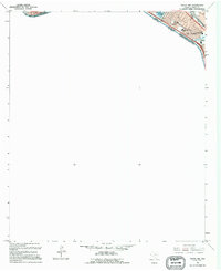
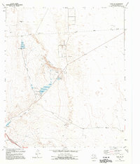
 1994 Ysleta1994 Print · USGSEl Paso's lower valley comes into focus during the early nineties, showing the historic corridor between the river and the desert mesa. Researchers can trace the heritage of the Ysleta Mission, locate La Purisima Cem, and see the layout of Socorro.
 - 1995 Map of Clint NE
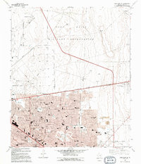
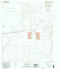
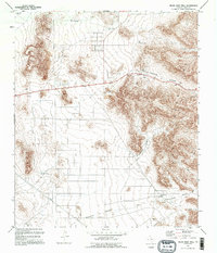
 1995 Clint NE1995 Print · USGSThe desert landscape east of El Paso was undergoing a period of infrastructure growth and recreational development in the 1990s. Researchers can trace land use through features like Mountain Shadow Lake, the Hueco Mountains foothills, and Rentleman Well.
 - 1995 Map of Nations South Well
 1995 Nations South Well1995 Print · USGSEl Paso's eastern desert fringes are captured in the mid-1990s as suburban residential grids began to meet the edges of the Fort Bliss Military Reservation. You can locate vanished landmarks like the Drive-in Theater and the Drag Strip, or trace old ranching locations at Rockhouse (Site).
 - 1995 Map of Clint NW
 1995 Clint NW1995 Print · USGSEl Paso County's desert periphery underwent significant transformation during the mid-nineties as residential communities like Horizon City expanded. Researchers can trace local infrastructure and landmarks such as West Texas Airport, Desert Hills Sch, and the Ysleta Lateral.
 - 1995 Map of Canutillo
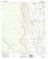
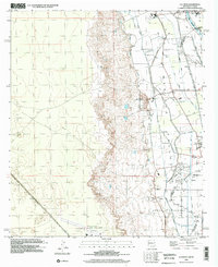
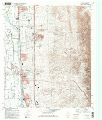 1995 Canutillo1995 Print · USGSThe Rio Grande valley meets the high desert in the mid-1990s as suburban and institutional development spreads along the Texas and New Mexico border. Researchers can trace the rail corridor of the Atchison Topeka and Santa Fe RR and locate landmarks like the La Tuna Federal Correctional Institution and Aztec Caves.2 unique versions available
 - 1995 Map of North Franklin Mountain
 1995 North Franklin Mountain1995 Print · USGSEl Paso expands toward the high desert peaks in the mid-1990s as suburban neighborhoods reach the edge of the mountains. Researchers can trace local landmarks like the Wilderness Park Museum, Irvin High School, and the Fort Bliss Military Reservation.
 - 1995 Map of Fort Bliss NE
 1995 Fort Bliss NE1995 Print · USGSEl Paso and the desert flats of the West Texas borderlands are captured here in the mid-1990s as military and industrial infrastructure expanded. Researchers can trace the El Paso corporate line against the Fort Bliss Military Reservation and locate landmarks like Plane Port.
 - 1995 Map of Clint SE
 1995 Clint SE1995 Print · USGSEastern El Paso County ranching and water infrastructure are documented here in the mid-1990s. Trace the landscape of the San Felipe Arroyo to find landmarks like Cottonwood Dam, Harry Tank, and the outskirts of Fabens.
 - 1995 Map of Helms West Well
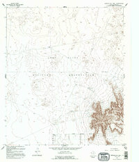
 1995 Helms West Well1995 Print · USGSThe Hueco Mountains of West Texas are captured here during the mid-nineties, showing a landscape defined by desert water management and high-desert transit. Researchers can trace historic water catchments like Noble Tank and the landmark Helms West Well (Site).
 - 1995 Map of Hueco Tanks
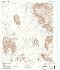 1995 Hueco Tanks1995 Print · USGSThe Hueco Mountains in the mid-1990s reveal a landscape of desert water management and military training grounds. Trace the isolated catchments of San Juan Tank and Jarilla Tank or explore the rocky reaches of Hueco Tanks State Historical Park.
 - 1995 Map of Clint
 1995 Clint1995 Print · USGSEl Paso County's river valley during the mid-nineties shows a landscape shaped by the Rio Grande and its extensive irrigation canals. Genealogists can trace family footprints at San Lorenzo Cemetery or explore the grids of Clint, Fabens, and Cuadrilla.
 - 1995 Map of Nations East Well
 1995 Nations East Well1995 Print · USGSThe West Texas desert comes into focus during the mid-1990s, centered on the strategic landscape of the Fort Bliss Military Reservation. Researchers can trace the essential water network of the era through sites like Nations East Well, Sand Tank, and San Juan Hill.
 - 1995 Map of La Union
 1995 La Union1995 Print · USGSThe Mesilla Valley river corridor comes into sharp focus in the mid-1990s as it straddles the border between New Mexico and Texas. Local researchers can trace family landmarks and civic roots at St Lukes Ch, the Cem at La Union, and the Gadsden High Sch campus.
 - 1996 Map of Smeltertown, 2002 Print
 1996 Smeltertown2002 Print · USGSEl Paso and its neighbors in New Mexico and Mexico are shown in detail during the late nineties, showcasing the area's dense urban and industrial infrastructure. Genealogists and local historians can trace the foundations of Smeltertown, locate Memory Gardens Cem, and find local institutions like the University of Texas at El Paso.
 - 1996 Map of La Union, 2002 Print
 1996 La Union2002 Print · USGSThe Rio Grande corridor south of Las Cruces in the mid-1990s shows a landscape defined by intensive Mesilla Valley irrigation and border-region development. Researchers can trace historical land divisions in Refugio Colony Tract No 1 and locate local landmarks like St Lukes Sch and the Gadsden High Sch.
 - 1996 Map of Anthony, 2002 Print
 1996 Anthony2002 Print · USGSThe high desert borderlands near the New Mexico and Texas line are captured here during a period of late-century growth. Researchers can trace the layout of Anthony and Berino, locate a local Cem, and follow the path of the Old Railroad Grade.
 - 1996 Map of Strauss, 2002 Print
 1996 Strauss2002 Print · USGSSouthern New Mexico meets the Texas and Mexico borders in the mid-nineties, showing a landscape of desert outposts and valley irrigation. Genealogists and historians can trace the Old Railroad Grade and locate sites like Strauss, Lizard, and the Santa Teresa Jr High Sch.
 - 1997 Map of El Paso, 1999 Print
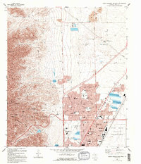
 1997 El Paso1999 Print · USGSEl Paso and the borderlands are captured here in the late nineties, showcasing the city's complex relationship with the river and the mountains. Researchers can trace the boundaries of Fort Bliss, locate graves at Concordia Cemetery, or follow the Southern Pacific rail lines.
End of results
Showing maps 1-24 of 24
Top cities of El Paso County
- El Paso historical maps
- Socorro historical maps
- Horizon City historical maps
- San Elizario historical maps
- Fabens historical maps
- Canutillo historical maps
See more
Frequently asked questions
- What are the different types of historical maps available for El Paso County?
- What is the oldest map of El Paso County?
- Where can I purchase historical maps of El Paso County for my home or office?
- Where can I download high-res historical maps of El Paso County?
- Are there historical topographic maps available for El Paso County?
- Is there historical aerial imagery available for El Paso County?
- Where are historical maps of El Paso County sourced from?