1980s Maps of El Paso County, Texas
Explore 6 historic maps of El Paso County from the 1980s. These maps offer a rare glimpse into what life looked like during the 1980s — showing old roads, neighborhoods, homes, and landmarks that have changed or disappeared over time.
Whether you're researching your family's past, planning a metal detecting trip, or studying how El Paso County's landscape evolved across the 1980s, these high-resolution maps are a powerful tool for exploring the history of this region.
- Focus on a specific era: All maps on this page are from the 1980s, giving you a focused view of this time period.
- See what’s changed: Compare century-old streets, trails, and buildings to today's modern landscape using overlays and satellite layers.
- Research with precision: Use these maps for genealogy, historical research, land use analysis, or educational projects.
- View, download, or print: Maps are fully viewable online in high resolution, and can be downloaded or printed for your own records.
Start exploring El Paso County's history through authentic maps from the 1980s. This is your window into the past.
El Paso County, TX maps
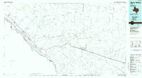
(6)- 1980 Map of Mountain Tank
 1980 Mountain Tank1980 Print · USGSThe high desert borderlands of New Mexico and Texas come into focus here during the late twentieth century. Genealogists and researchers can trace the limits of the Fort Bliss Military Reservation (Mcgregor Range) and find local landmarks like Hat Ranch and Hale Tank.
 - 1982 Map of Las Cruces
 1982 Las Cruces1982 Print · USGSThe Rio Grande valley and the Organ Mountains define this 1980s portrait of southern New Mexico's ranching and military landscape. Trace historic land divisions like the Brazito Grant alongside landmarks such as Santo Tomas and the Silver King Mine.
 - 1983 Map of El Paso
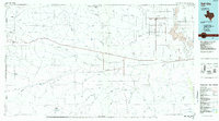
 1983 El Paso1983 Print · USGSThe Chihuahuan Desert borderlands come into sharp focus in the early eighties as the binational metro area of El Paso and Ciudad Juarez expands. Genealogists and historians can trace rail lines like the Santa Fe, military grounds at Fort Bliss, and rural valley settlements including Canutillo and Zaragoza.2 unique versions available
 - 1985 Map of Sierra Blanca
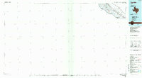
 1985 Sierra Blanca1985 Print · USGSThe Trans-Pecos desert during the mid-eighties shows a landscape of mountain ranges and critical international border crossings. Trace the old river settlements of Fort Hancock and Mc Nary, find the historic Fort Quitman (Site), or follow the legacy of the Southern Pacific railroad.2 unique versions available
 - 1985 Map of Dell City
 1985 Dell City1985 Print · USGSThe northern Chihuahuan Desert in the mid-1980s reveals a landscape of isolated farming hubs and vast salt basins. Genealogists and researchers can trace the roads and water tanks around Dell City, the remote outpost at Salt Flat, and the rugged slopes of the Sierra Diablo.2 unique versions available
 - 1985 Map of Tornillo
 1985 Tornillo1985 Print · USGSThe El Paso Valley borderlands appear in the mid-1980s as a structured landscape of irrigation and international transit. Researchers can trace the path of the Rio Grande past Fabens, the Southern Pacific rail line, and the Alamo Canal.2 unique versions available
End of results
Showing maps 1-6 of 6
Top cities of El Paso County
- El Paso historical maps
- Socorro historical maps
- Horizon City historical maps
- San Elizario historical maps
- Fabens historical maps
- Canutillo historical maps
See more
Frequently asked questions
- What are the different types of historical maps available for El Paso County?
- What is the oldest map of El Paso County?
- Where can I purchase historical maps of El Paso County for my home or office?
- Where can I download high-res historical maps of El Paso County?
- Are there historical topographic maps available for El Paso County?
- Is there historical aerial imagery available for El Paso County?
- Where are historical maps of El Paso County sourced from?