1970s Maps of El Paso County, Texas
Explore 7 historic maps of El Paso County from the 1970s. These maps offer a rare glimpse into what life looked like during the 1970s — showing old roads, neighborhoods, homes, and landmarks that have changed or disappeared over time.
Whether you're researching your family's past, planning a metal detecting trip, or studying how El Paso County's landscape evolved across the 1970s, these high-resolution maps are a powerful tool for exploring the history of this region.
- Focus on a specific era: All maps on this page are from the 1970s, giving you a focused view of this time period.
- See what’s changed: Compare century-old streets, trails, and buildings to today's modern landscape using overlays and satellite layers.
- Research with precision: Use these maps for genealogy, historical research, land use analysis, or educational projects.
- View, download, or print: Maps are fully viewable online in high resolution, and can be downloaded or printed for your own records.
Start exploring El Paso County's history through authentic maps from the 1970s. This is your window into the past.
El Paso County, TX maps
(7)- 1972 Map of Isla, 1974 Print
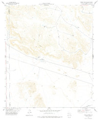
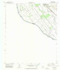 1972 Isla1974 Print · USGSThe Rio Grande valley near the Mexican border comes into sharp focus in the early seventies, detailing the complex irrigation systems of the river plain. Researchers can trace the Southern Pacific rail corridor through Fabens or locate the US Customs station at the Guadalupe Bridge.
 - 1972 Map of Tornillo, 1974 Print
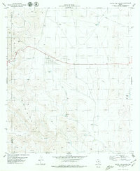
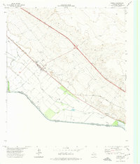 1972 Tornillo1974 Print · USGSEl Paso County’s borderlands are shown in the early seventies, capturing the valley’s intricate web of irrigation and transit. Researchers can trace the Southern Pacific rail line and local landmarks like Tornillo or the Alamo Alto gaging station.
 - 1972 Map of Fort Hancock NW, 1974 Print
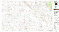
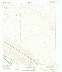 1972 Fort Hancock NW1974 Print · USGSIn the early 1970s, the West Texas borderlands along the Rio Grande were defined by a vital network of irrigation canals and the Southern Pacific rail line. Genealogists and historians can locate family-named landmarks like the Sand Ranch and trace the paths of the Kelly Drain and Tornillo Drain.
 - 1978 Map of T P Well
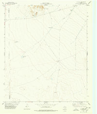 1978 T P Well1978 Print · USGSThe high-desert ranching country of the Trans-Pecos is captured here during the late 1970s. Researchers can trace essential water sources like T P Well, Indian Well, and Cottonwood Lake across this vast expanse of Hudspeth County rangeland.
 - 1978 Map of Padre Canyon
 1978 Padre Canyon1978 Print · USGSHudspeth County and El Paso County meet in this high desert landscape during the late seventies, where industrial pipelines cross the arid terrain. Local history researchers can locate the Old Padre Mine, the Hueco Pumping Sta, and wildlife water sources like Owl Tanks.
 - 1979 Map of Phone Line Canyon
 1979 Phone Line Canyon1979 Print · USGSThe Hueco Mountains of West Texas are captured here in the late seventies, showing a landscape defined by deep canyons and critical desert water tanks. Researchers can trace ranching and utility roots through labels like Phone Line Tank, Dagger Camp, and Powwow Canyon.2 unique versions available
 - 1979 Map of Crow Flats
 1979 Crow Flats1979 Print · USGSThe high desert borderlands of Otero County and West Texas are captured here during the late seventies, showing a landscape of remote ranches and military ranges. Researchers can trace land use through the Old Wright Place, Alton Jones Ranch, and the Runyan Landing Field.2 unique versions available
End of results
Showing maps 1-7 of 7
Top cities of El Paso County
- El Paso historical maps
- Socorro historical maps
- Horizon City historical maps
- San Elizario historical maps
- Fabens historical maps
- Canutillo historical maps
See more
Frequently asked questions
- What are the different types of historical maps available for El Paso County?
- What is the oldest map of El Paso County?
- Where can I purchase historical maps of El Paso County for my home or office?
- Where can I download high-res historical maps of El Paso County?
- Are there historical topographic maps available for El Paso County?
- Is there historical aerial imagery available for El Paso County?
- Where are historical maps of El Paso County sourced from?