Old Maps of El Paso County, Texas for Academic Research
Study the evolution of El Paso County with 176 high-resolution historic maps. Whether you're teaching, researching, or modeling changes in land use, these maps provide essential visual documentation of urban, environmental, and geographic change.
- Analyze long-term change: Track patterns in development, transportation, and natural features.
- Ideal for environmental or urban studies: Support academic projects with primary historical map data.
- Use in the classroom or lab: Educators and researchers rely on these maps to bring historical context to life.
These maps are a powerful tool for teaching, research, and visualizing how El Paso County has changed over the decades.
El Paso County, TX maps
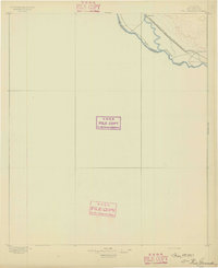
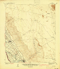
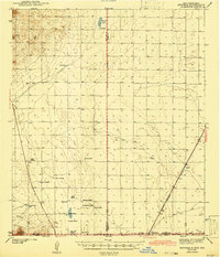
(176)- 1891 Map of Las Cruces
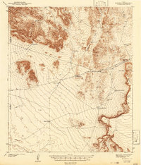
 1891 Las Cruces1891 Print · USGSThe Mesilla Valley and Organ Mountains are shown here during the late territorial era, when the railroad was transforming the region. Genealogists and historians can trace early settlements like Mesilla, Fort Selden, and the mining hub at Organ City.
 - 1893 Map of Las Cruces
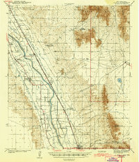
 1893 Las Cruces1893 Print · USGSSettlements along the Rio Grande flourished in the 1890s as the railroad arrived in Doña Ana County. Genealogists can trace family roots in Mesilla, Las Cruces, and Santa Tomaz, or locate the historic site of Fort Selden.4 unique versions available
 - 1894 Map of Fort Hancock
 1894 Fort Hancock1894 Print · USGSWest Texas borderlands in the 1890s centered on the strategic military and rail corridor along the Rio Grande. Trace the early footprint of Fort Hancock Post and vanished outposts like Fort Quitman (Ab'd.) and Camp Rice (Ab'd.).4 unique versions available
 - 1896 Map of El Paso
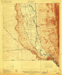
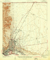
 1896 El Paso1896 Print · USGSThe El Paso borderlands were a nexus of rail and river commerce in the 1890s, where international boundaries met the western frontier. Researchers can trace the early layout of El Paso, the military presence at Fort Bliss, and historic valley settlements like Ysleta and San Elizario.2 unique versions available
 - 1896 Map of Rio Grande
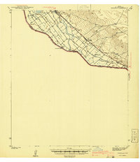
 1896 Rio Grande1896 Print · USGSEl Paso County at the end of the nineteenth century centers on the international border and the vital western rail corridor. Researchers can trace the early route of the Southern Pacific R.R. past the settlement of Fabens.4 unique versions available
 - 1903 Map of Cerro Alto, 1929 Print
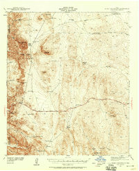
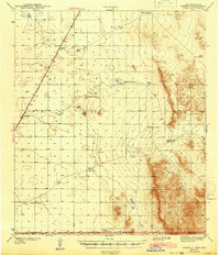
 1903 Cerro Alto1929 Print · USGSThe high desert of West Texas and the New Mexico border come alive in this turn-of-the-century survey. Trace early cattle-country water sources like Sparrow Tanks and Coyote Tanks or the peaks of the Hueco Mountains.
 - 1908 Map of El Paso
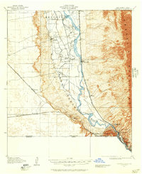
 1908 El Paso1908 Print · USGSEl Paso and the lower Rio Grande valley are seen here in the first decade of the century as the railroad and military presence transformed the borderlands. Genealogists can trace family footprints in historic river towns like San Elizario, Ysleta, and Socorro, or find early ranch sites like Newman's Ranch.2 unique versions available
 - 1917 Map of Canutillo, 1957 Print
 1917 Canutillo1957 Print · USGSThe Rio Grande valley and the international border come to life in this survey from the early twentieth century. Genealogists and researchers can trace the rail-and-river economy through old stations like Strauss, local landmarks like La Vista School, and the industrial Smelter district.
 - 1919 Map of Canutillo
 1919 Canutillo1919 Print · USGSThe Rio Grande valley at the Texas and New Mexico border comes to life in this survey from just after the Great War. Genealogists and historians can trace family-named locations and early institutions like La Vista School, the Smelter, and West El Paso PO.3 unique versions available
 - 1939 Map of Ysleta, 1958 Print
 1939 Ysleta1958 Print · USGSThe Rio Grande Valley southeast of El Paso comes alive in this pre-war survey, showing the deep-rooted mission settlements and complex irrigation networks of the borderlands. Genealogists can trace family footprints in historic Ysleta, Socorro, and San Elizario.
 - 1939 Map of Heuco Tanks, 1961 Print
 1939 Heuco Tanks1961 Print · USGSEl Paso County ranching and transit routes are documented here just before the Second World War. Trace the historic Old Butterfield Trail past Escontrias Ranch or locate family landmarks like Deep Well Ranch and Helms West Well.
 - 1940 Map of Heuco Tanks
 1940 Heuco Tanks1940 Print · USGSEl Paso County ranching and transit are captured at the end of the 1930s as the desert landscape evolved. Genealogists and historians can trace the Old Butterfield Trail and locate family outposts like Escontrias Ranch and Rockhouse.
 - 1940 Map of Bassett Lake, 1954 Print
 1940 Bassett Lake1954 Print · USGSThe high desert of Otero County at the start of the 1940s reveals a landscape organized around vital water sources and remote ranching outposts. Researchers can trace the network of desert storage like Camaleche Tanks and Escondida Tank or locate the site of Foster Ranch.
 - 1940 Map of Newman, 1965 Print
 1940 Newman1965 Print · USGSThe high desert borderlands near the New Mexico-Texas line come alive in the 1940s, showing a landscape of remote cattle operations and vital rail links. Trace family history through ranch sites like Trueblood Ranch, locate the old Blythe Sch, and follow the Southern Pacific tracks to Newman.
 - 1941 Map of El Paso
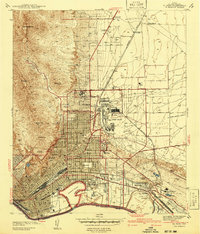 1941 El Paso1941 Print · USGSEl Paso and the borderlands are seen here just before the massive expansion of the mid-century, defined by the mountain peaks and the shifting river. Researchers can trace the unusual boundary at Cordova Island, locate early schools like Radford Sch, or find family names at Tobin Ranch.
 - 1941 Map of Clint
 1941 Clint1941 Print · USGSThe Rio Grande valley southeast of El Paso comes alive in the early 1940s, showing a landscape defined by irrigation and iron rails. Researchers can trace the development of Clint, Fabens, and Cuadrilla along the Texas and Pacific railroad.
 - 1941 Map of Ysleta
 1941 Ysleta1941 Print · USGSThe El Paso Lower Valley was a thriving corridor of irrigation and international trade just before the war. Researchers can trace the heritage of the Rio Grande through the San Antonio Mission, the Ysleta Jesuit College, and the grounds of the County Farm.
 - 1941 Map of Tornillo
 1941 Tornillo1941 Print · USGSEl Paso County's borderlands and irrigation networks are shown here at the start of the 1940s. Genealogists and historians can trace the foundations of Fabens, locate Adobe Houses, and follow the Southern Pacific railroad past Tornillo.
 - 1941 Map of Heuco Mountains, 1958 Print
 1941 Heuco Mountains1958 Print · USGSThe rugged Hueco Mountains of West Texas are captured here in the early 1940s, showing a landscape defined by ranching and historic travel routes. Trace the historic Butterfield Trail and locate family landmarks like Helms Ranch and Hueco Inn.2 unique versions available
 - 1941 Map of Desert, 1961 Print
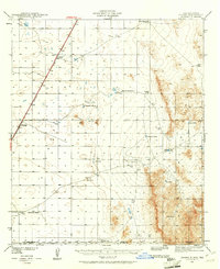 1941 Desert1961 Print · USGSThe arid borderlands of Otero County and the New Mexico-Texas line are captured here in the early 1940s, when the railroad was the primary artery of life. Genealogists and historians can trace old ranching outposts like McCracken Ranch and Davis Ranch along the Southern Pacific tracks.2 unique versions available
 - 1942 Map of Borrego
 1942 Borrego1942 Print · USGSHigh desert ranching and mining operations in Hudspeth County are documented here in the early 1940s. Researchers can locate named water improvements and local industry sites like the Old Padre Mine, Minnie Veale Well, and Cunningham Tank.3 unique versions available
 - 1942 Map of Fort Bliss
 1942 Fort Bliss1942 Print · USGSEl Paso and its military neighbors are captured here in the early 1940s as the desert landscape rapidly modernized. Researchers can trace family ranching sites like Tobin Ranch alongside the expansion of Fort Bliss and the Biggs Field.
 - 1943 Map of La Mesa
 1943 La Mesa1943 Print · USGSThe Mesilla Valley during the early years of the war reveals a complex system of desert irrigation and historic land grants. Genealogists can trace family roots through numerous local landmarks, including the Memorial Ridge Cem, San Luis Ch, and the Beasley Homestead.2 unique versions available
 - 1943 Map of Desert
 1943 Desert1943 Print · USGSOtero County ranching and rail operations are captured here during the early years of the war. Genealogists and historians can trace family landmarks and water sources like the McCracken Ranch, Davis Ranch, and the isolated Desert station along the Southern Pacific.
 - 1943 Map of Newman
 1943 Newman1943 Print · USGSThe high desert of the New Mexico and Texas borderlands comes alive in this wartime survey of the ranching country north of El Paso. Genealogists can trace the remote family outposts of the day, including Trueblood Ranch and Manning Ranch, and the isolated Blythe Sch.2 unique versions available
Showing maps 1-25 of 176
Top cities of El Paso County
- El Paso historical maps
- Socorro historical maps
- Horizon City historical maps
- San Elizario historical maps
- Fabens historical maps
- Canutillo historical maps
See more
Frequently asked questions
- What are the different types of historical maps available for El Paso County?
- What is the oldest map of El Paso County?
- Where can I purchase historical maps of El Paso County for my home or office?
- Where can I download high-res historical maps of El Paso County?
- Are there historical topographic maps available for El Paso County?
- Is there historical aerial imagery available for El Paso County?
- Where are historical maps of El Paso County sourced from?