Old Maps of Port Bolivar, Texas for Metal Detecting
Plan your next treasure hunt with 14 historic maps of Port Bolivar. Find old homesites, ghost towns, trails, and gathering spots that may be lost to time — perfect for identifying promising metal detecting locations.
- Locate forgotten sites: Uncover places like long-lost settlements, abandoned rail lines, or gathering spots.
- Plan better hunts: Use map overlays combined with LiDAR or satellite views to narrow in on historically rich areas.
- Made for detectorists: Thousands of hobbyists use these maps to discover relics, coins, and hidden history.
Use these historic maps to boost your research and find new opportunities beneath the surface of Port Bolivar.
Port Bolivar, TX maps
(14)- 1932 Map of Bolivar Point
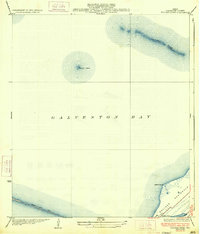
 1932 Bolivar Point1932 Print · USGSThe tip of the Bolivar Peninsula is captured in the early 1930s just as aerial surveying began to transform coastal mapping. Researchers can trace the path of the G C & S F railroad near Bolivar Point or study the shoals of Hannah Reef.
 - 1933 Map of Bolivar Point
 1933 Bolivar Point1933 Print · USGSGalveston Bay and the Bolivar Peninsula are captured here in the early 1930s as vital maritime and rail corridors. Researchers can trace the path of the G C & S F railroad toward Bolivar Point or examine the reach of the Texas City Dike.2 unique versions available
 - 1943 Map of Port Bolivar, 1952 Print
 1943 Port Bolivar1952 Print · USGSGalveston Bay and the Bolivar Peninsula are captured here during the mid-forties, showing a landscape defined by maritime defense and industrial shipping. Researchers can locate Fort Travis, the Texas City Dike, and the early layout of Port Bolivar.
 - 1950 Map of Houston, 1953 Print
 1950 Houston1953 Print · USGSCoastal Texas in the early fifties reveals a landscape of massive civil engineering and industrial transit. Genealogists and researchers can trace the growth of the Houston suburbs and the maritime infrastructure of Galveston Bay, including the Gulf Freeway and the Texas City Dike.
 - 1954 Map of Port Bolivar, 1958 Print
 1954 Port Bolivar1958 Print · USGSThe tip of the Texas coast in the mid-1950s reveals a landscape defined by heavy maritime industry and shifting shoals. Trace the early layout of Port Bolivar and the dredging history of the Houston Ship Channel near Halfmoon Shoal.4 unique versions available
 - 1956 Map of Houston, 1963 Print
 1956 Houston1963 Print · USGSSoutheast Texas in the mid-fifties is captured here as a powerhouse of oil and maritime trade. Genealogists and historians can trace the foundations of Houston and its ports, alongside landmarks like the Rice Institute and the Spindletop Oil Field.2 unique versions available
 - 1975 Map of Houston, 1977 Print
 1975 Houston1977 Print · USGSThe Texas Gulf Coast in the mid-seventies shows a sprawling Houston metropolis linked to the sea by the massive Houston Ship Channel. Researchers can trace the mid-century industrial landscape from the Astrodome to the Lyndon B. Johnson Space Center.2 unique versions available
 - 1983 Map of Galveston
 1983 Galveston1983 Print · USGSThe Texas Gulf Coast comes into sharp focus in the early eighties, centered on the thriving maritime and industrial hubs of Galveston and Texas City. Trace coastal change and land use through landmarks like Fort San Jacinto, the Texas City Dike, and the expansive Galveston Island State Park.
 - 1994 Map of Port Bolivar
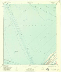
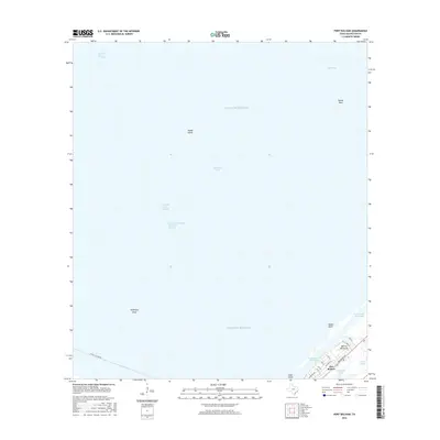
 1994 Port Bolivar1994 Print · USGSThe Texas coast at the tip of the Bolivar Peninsula comes into focus in the mid-nineties, showing the heavy industrial maritime corridors. Trace the path of the Houston Ship Channel or locate local landmarks like the Old Railroad Gr and Horseshoe Lake.
 - 2010 Map of Port Bolivar, 2010 Print
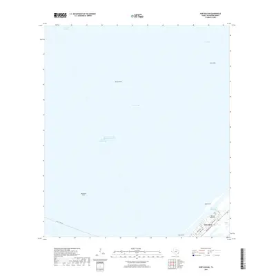
 2010 Port Bolivar2010 Print · USGSCovers Port Bolivar, including Texas City, Galveston County, and other nearby areas
 - 2013 Map of Port Bolivar, 2013 Print
 2013 Port Bolivar2013 Print · USGSCovers Port Bolivar, including Texas City, Galveston County, and other nearby areas
 - 2016 Map of Port Bolivar, 2016 Print
 2016 Port Bolivar2016 Print · USGSCovers Port Bolivar, including Texas City, Galveston County, and other nearby areas
 - 2019 Map of Port Bolivar, 2019 Print
 2019 Port Bolivar2019 Print · USGSCovers Port Bolivar, including Texas City, Galveston County, and other nearby areas
 - 2022 Map of Port Bolivar, 2022 Print
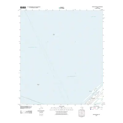
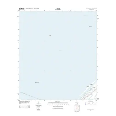
 2022 Port Bolivar2022 Print · USGSThe tip of the Bolivar Peninsula comes into sharp focus during the early twenty-first century, showcasing the maritime infrastructure of the Texas coast. Researchers can trace the town streets of Port Bolivar and locate local landmarks like Oyster Lake, Goat Island, and Hanna Reef.
End of results
Showing maps 1-14 of 14
Top cities near Port Bolivar
- Pasadena historical maps
- Galveston historical maps
- Texas City historical maps
- La Marque historical maps
- Seabrook historical maps
- Bacliff historical maps
See more
Frequently asked questions
- What are the different types of historical maps available for Port Bolivar?
- What is the oldest map of Port Bolivar?
- Where can I purchase historical maps of Port Bolivar for my home or office?
- Where can I download high-res historical maps of Port Bolivar?
- Are there historical topographic maps available for Port Bolivar?
- Is there historical aerial imagery available for Port Bolivar?
- Where are historical maps of Port Bolivar sourced from?