2020s Maps of Baytown, Texas
Explore 6 historic maps of Baytown from the 2020s. These maps offer a rare glimpse into what life looked like during the 2020s — showing old roads, neighborhoods, homes, and landmarks that have changed or disappeared over time.
Whether you're researching your family's past, planning a metal detecting trip, or studying how Baytown's landscape evolved across the 2020s, these high-resolution maps are a powerful tool for exploring the history of this region.
- Focus on a specific era: All maps on this page are from the 2020s, giving you a focused view of this time period.
- See what’s changed: Compare century-old streets, trails, and buildings to today's modern landscape using overlays and satellite layers.
- Research with precision: Use these maps for genealogy, historical research, land use analysis, or educational projects.
- View, download, or print: Maps are fully viewable online in high resolution, and can be downloaded or printed for your own records.
Start exploring Baytown's history through authentic maps from the 2020s. This is your window into the past.
Baytown, TX maps
(6)- 2022 Map of Umbrella Point, 2022 Print
 2022 Umbrella Point2022 Print · USGSTrinity Bay's northeastern shoreline comes into focus in this recent study of Chambers County. Researchers can trace local lineage at the Solomon-Barrow Cem and Fisher Cem or locate coastal landmarks like Point Barrow and Umbrella Point.
 - 2022 Map of Mont Belvieu, 2022 Print
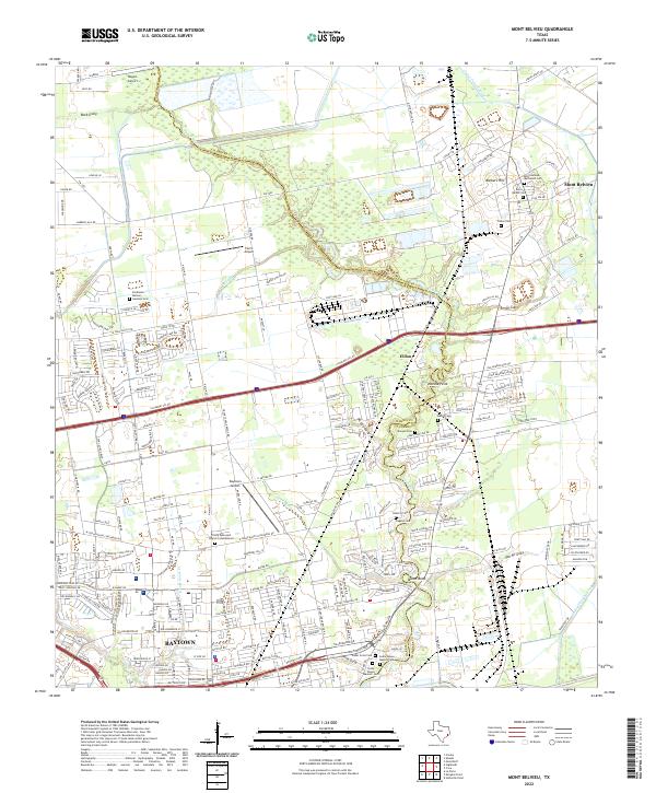 2022 Mont Belvieu2022 Print · USGSCoastal Texas industry and heritage meet along the Harris-Chambers county line in the early 2020s. Researchers can locate numerous family-named burial grounds like Amos Barber Cem and Morgan Cem or trace the winding course of Cedar Bayou.
 - 2022 Map of Morgans Point, 2022 Print
 2022 Morgans Point2022 Print · USGSCoastal Harris and Chambers counties meet at this vital maritime crossroads during the 2020s. Researchers can trace the industrial shoreline from Barbours Cut to Baytown, or locate family sites at Magnolia Cem and Morgan's Point Cem.
 - 2022 Map of Cove, 2022 Print
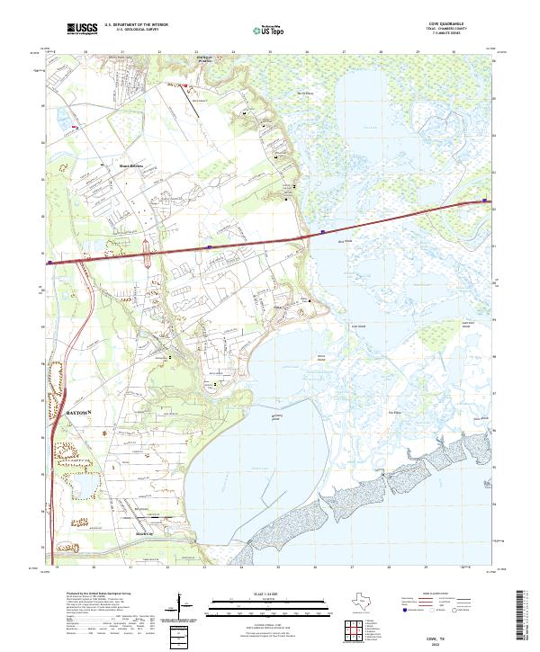 2022 Cove2022 Print · USGSCoastal Chambers County in the early twenty-first century reveals a landscape of deltaic marshlands and growing bay-side communities. Genealogists can locate several family burial grounds like Ford Cem and Stubbs Cem among the winding channels of Old River and Cotton Lake.
 - 2022 Map of La Porte, 2022 Print
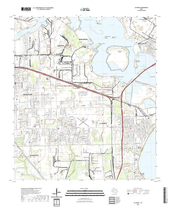 2022 La Porte2022 Print · USGSThe industrial shoreline of East Harris County is captured here in the early 2020s, showing the intersection of massive shipping channels and coastal neighborhoods. Researchers can locate small family burial sites like Habermehl Family Cem and Arthur Hale Cem alongside landmarks like Sylvan Beach.
 - 2022 Map of Highlands, 2022 Print
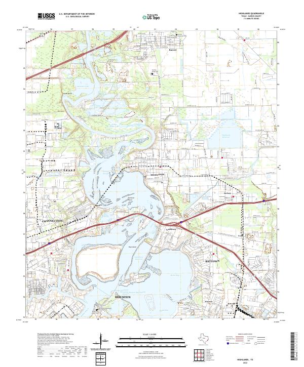 2022 Highlands2022 Print · USGSThe industrial and historical convergence of the San Jacinto River comes to life in this recent survey. Genealogists and historians can locate legacy sites like De Zavala Family Cem alongside the Houston Ship Channel and Lynchburg Reservoir.
End of results
Showing maps 1-6 of 6
Top cities near Baytown
- Houston historical maps
- Pasadena historical maps
- League City historical maps
- Channelview historical maps
- Texas City historical maps
- Friendswood historical maps
See more
Top neighborhoods of Baytown
- Pelly historical maps
- Wooster historical maps
- Brownwood historical maps
- Country Club Oaks historical maps
- Goose Creek Reserve historical maps
- Rolling Creek Estates historical maps
Frequently asked questions
- What are the different types of historical maps available for Baytown?
- What is the oldest map of Baytown?
- Where can I purchase historical maps of Baytown for my home or office?
- Where can I download high-res historical maps of Baytown?
- Are there historical topographic maps available for Baytown?
- Is there historical aerial imagery available for Baytown?
- Where are historical maps of Baytown sourced from?