1970s Maps of Hudspeth County, Texas
Explore 53 historic maps of Hudspeth County from the 1970s. These maps offer a rare glimpse into what life looked like during the 1970s — showing old roads, neighborhoods, homes, and landmarks that have changed or disappeared over time.
Whether you're researching your family's past, planning a metal detecting trip, or studying how Hudspeth County's landscape evolved across the 1970s, these high-resolution maps are a powerful tool for exploring the history of this region.
- Focus on a specific era: All maps on this page are from the 1970s, giving you a focused view of this time period.
- See what’s changed: Compare century-old streets, trails, and buildings to today's modern landscape using overlays and satellite layers.
- Research with precision: Use these maps for genealogy, historical research, land use analysis, or educational projects.
- View, download, or print: Maps are fully viewable online in high resolution, and can be downloaded or printed for your own records.
Start exploring Hudspeth County's history through authentic maps from the 1970s. This is your window into the past.
Hudspeth County, TX maps
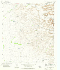
(53)- 1970 Map of Shiloh Hills SE, 1973 Print
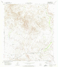
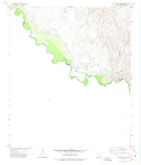
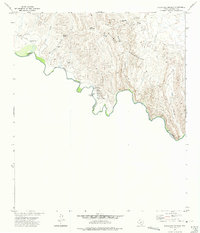
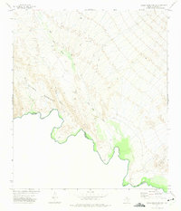
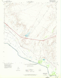
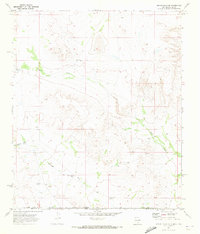 1970 Shiloh Hills SE1973 Print · USGSThe high-desert borderlands between New Mexico and Texas appear here as they were in the early 1970s, defined by isolated ranching outposts and essential water sources. Researchers can trace the footprint of the McAnally Ranch and find named desert landmarks like Sweet William Well and Cornudas Draw.
 - 1970 Map of Mc Veigh Hills, 1973 Print
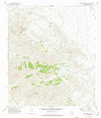
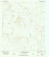
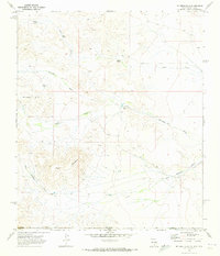 1970 Mc Veigh Hills1973 Print · USGSThe high desert of Otero and Hudspeth counties comes into focus in the early seventies, showing a landscape of isolated ranching and cattle tanks. Researchers can trace land use at the Alton Jones Ranch or locate geographic landmarks like Black Mountain and Cornudas Draw.
 - 1972 Map of Silver King Canyon, 1974 Print
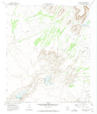
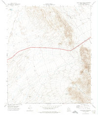 1972 Silver King Canyon1974 Print · USGSHudspeth County, Texas, was a landscape of remote mountain ranges and desert exploration in the early 1970s. Researchers can trace land use through stock water points like Rock House Tank, mining prospects at Silver King Canyon, and the Border Patrol Tower.
 - 1972 Map of Campo Grande Mountain, 1974 Print
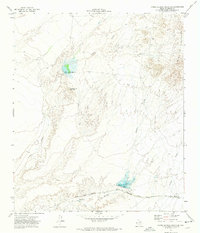 1972 Campo Grande Mountain1974 Print · USGSHudspeth County in the early seventies shows a desert landscape defined by high peaks and vital rail corridors. Trace the path of the Texas and Pacific Southern Pacific near Madden or explore water works at Madden Reservoir.
 - 1972 Map of Small, 1974 Print
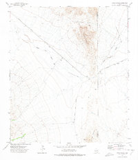
 1972 Small1974 Print · USGSThe Finlay Mountains of West Texas are captured here in the early seventies, showcasing a high-desert landscape defined by historic rail corridors. Researchers can trace the path of the Old Railroad Grade near Small or locate remote water features like Finlay Mountain Tank and Frost Ranch.
 - 1972 Map of Fort Hancock NW, 1974 Print
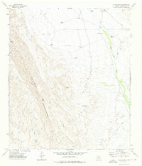
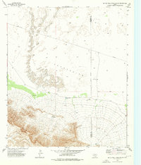
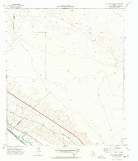 1972 Fort Hancock NW1974 Print · USGSIn the early 1970s, the West Texas borderlands along the Rio Grande were defined by a vital network of irrigation canals and the Southern Pacific rail line. Genealogists and historians can locate family-named landmarks like the Sand Ranch and trace the paths of the Kelly Drain and Tornillo Drain.
 - 1972 Map of Fort Hancock, 1974 Print
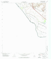
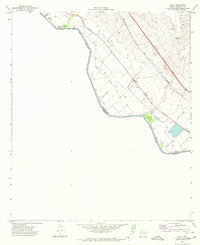
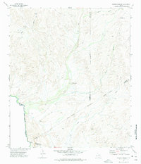
 1972 Fort Hancock1974 Print · USGSFort Hancock stood as a vital border crossing and rail hub in the early 1970s, where the desert met the irrigated fields of the Rio Grande. Genealogists and local historians can trace the foundations of the community through the Ward Sch, the local Cem, and the Port of Entry near the river.
 - 1972 Map of McNary, 1974 Print
 1972 McNary1974 Print · USGSHudspeth County agriculture and transportation meet at the Mexican border in the early seventies. Trace the path of the Texas and Pacific railroad and the Old Southern Pacific Railroad Grade near Mc Nary and the Cem (cemetery).
 - 1972 Map of Acala, 1974 Print
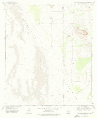
 1972 Acala1974 Print · USGSThe Texas-Mexico borderlands come into focus in the 1970s, showcasing a desert landscape transformed by the Hudspeth Main Canal. Researchers can trace the intricate irrigation network surrounding Acala and the rail corridors of the Southern Pacific.
 - 1972 Map of Cavett Lake, 1974 Print
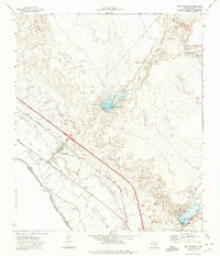
 1972 Cavett Lake1974 Print · USGSHudspeth County during the early 1970s was a landscape shaped by water management and desert ranching. Researchers can trace the engineering of Cavett Lake, the Alamo Reservoir No 1, and numerous family or local catchments like Phillip Tank.
 - 1972 Map of Lobo SW, 1975 Print
 1972 Lobo SW1975 Print · USGSThe Trans-Pecos highlands are captured here in the early 1970s, showing a landscape of mining prospects and remote ranching. Trace old industrial paths along the Old Railroad Grade or locate historic operations like the Plata Verde Mine and Mica Mine.
 - 1972 Map of Eagle Mountains NW, 1975 Print
 1972 Eagle Mountains NW1975 Print · USGSThe high-desert terrain of the Eagle Mountains comes into focus in this early 1970s survey. Researchers can trace remote ranching outposts like the Hayter Ranch, rugged tracks such as Frenchmans Jeep Trail, and vital water sources like Frenchmans Well.
 - 1972 Map of Bramlett Ranch, 1975 Print
 1972 Bramlett Ranch1975 Print · USGSThe Texas-Mexico border along the Rio Grande was a remote frontier of mining and ranching during the early seventies. Trace the isolation of Bramlett Ranch, the high-altitude Purple Sage Mine, and the narrow track of the Jeep Trail through Eagle Canyon.
 - 1972 Map of Mesquite Spring, 1975 Print
 1972 Mesquite Spring1975 Print · USGSThe High Desert borderlands along the Rio Grande appear in detail in the early 1970s. Researchers can trace remote water sources like Mesquite Spring, isolated outposts at Sixty Six, and the winding path of the Green River.
 - 1972 Map of Eagle Mountains SE, 1975 Print
 1972 Eagle Mountains SE1975 Print · USGSThe high-desert terrain of Hudspeth County is captured here in the early seventies, showcasing a landscape of remote ranching and mining. Trace historical trails and desert water sources like Indio Ranch, Black Diamond Mine, and the secluded Oxford Spring.
 - 1972 Map of Indian Hot Springs, 1975 Print
 1972 Indian Hot Springs1975 Print · USGSThe Texas-Mexico borderlands come alive in this early 1970s study of the remote Rio Grande corridor. Researchers can trace desert water sources like Indian Hot Springs and Soda Spring or locate landmarks such as Talley Ranch and the nearby Cem.
 - 1972 Map of Eagle Mountains SW, 1975 Print
 1972 Eagle Mountains SW1975 Print · USGSThe Texas-Mexico border in the early seventies was a land of high desert relief and isolated ranching outposts along the river. Researchers can trace the rugged drainage of Red Light Draw and locate the remote Guerra Farm and Landing Strip.
 - 1972 Map of Eagle Mountains NE, 1975 Print
 1972 Eagle Mountains NE1975 Print · USGSIn the early seventies, this high-desert region of West Texas remained a remote landscape of ranching and early mining ventures. Researchers can trace historic water sources and rugged travel routes including Eagle Spring, the Eagle Mountain Ranch, and several Prospect sites.
 - 1972 Map of Cedar Arroyo, 1975 Print
 1972 Cedar Arroyo1975 Print · USGSThe Hudspeth County desert remains largely unchanged since the early seventies, defined by the towering presence of the Quitman Mountains. Researchers can locate remote family holdings like Cummings Ranch and the isolated Deer Peak.
 - 1972 Map of Bass Canyon, 1975 Print
 1972 Bass Canyon1975 Print · USGSThe Trans-Pecos desert comes alive in the early seventies as ranching and mining operations dot the landscape between the Carrizo Mountains and Van Horn Mountains. Trace the Southern Pacific rail line and find the Plata Verde Mines or Piñon Ranch.
 - 1972 Map of Esperanza, 1975 Print
 1972 Esperanza1975 Print · USGSThe West Texas borderlands in the early seventies reveal a desert landscape transformed by irrigation and rail. Genealogists and historians can trace the settlement of Esperanza, follow the Southern Pacific tracks, or locate old waterworks like Fort Quitman Lake.
 - 1973 Map of Bitter Well Mountain NW, 1976 Print
 1973 Bitter Well Mountain NW1976 Print · USGSThe high desert border of Hudspeth and Culberson Counties in the early 1970s shows a landscape shaped by water scarcity. Researchers can locate remote ranching landmarks like Hardluck Well, Black John Well, and Soda Wells, alongside a secluded Landing Strip.
 - 1973 Map of Norton Mesa, 1976 Print
 1973 Norton Mesa1976 Print · USGSHudspeth County ranching life in the 1970s centered on these high desert plateaus and vital water catchments. Genealogists and historians can trace family-named sites like Fredrick Ranch, Love Ranch, and Andy Grant Tank.
 - 1973 Map of Bitter Well Mountain SW, 1976 Print
 1973 Bitter Well Mountain SW1976 Print · USGSThe high desert of West Texas meets the rising slopes of the Sierra Diablo in the early 1970s. Trace the essential water sources of the ranching era, from the remote North End Tub and Cotton Well to the deep Apache Can.
 - 1973 Map of Sneed Mountain NE, 1976 Print
 1973 Sneed Mountain NE1976 Print · USGSHudspeth County ranching country is mapped here in the early seventies, dominated by the Sierra Diablo peaks. Researchers can trace remote desert outposts and water catchments like Honeycutt Ranch, Rock Bottom Tank, and Railroad Tank.
Showing maps 1-25 of 53
Top cities of Hudspeth County
Frequently asked questions
- What are the different types of historical maps available for Hudspeth County?
- What is the oldest map of Hudspeth County?
- Where can I purchase historical maps of Hudspeth County for my home or office?
- Where can I download high-res historical maps of Hudspeth County?
- Are there historical topographic maps available for Hudspeth County?
- Is there historical aerial imagery available for Hudspeth County?
- Where are historical maps of Hudspeth County sourced from?