1960s Maps of Hudspeth County, Texas
Explore 13 historic maps of Hudspeth County from the 1960s. These maps offer a rare glimpse into what life looked like during the 1960s — showing old roads, neighborhoods, homes, and landmarks that have changed or disappeared over time.
Whether you're researching your family's past, planning a metal detecting trip, or studying how Hudspeth County's landscape evolved across the 1960s, these high-resolution maps are a powerful tool for exploring the history of this region.
- Focus on a specific era: All maps on this page are from the 1960s, giving you a focused view of this time period.
- See what’s changed: Compare century-old streets, trails, and buildings to today's modern landscape using overlays and satellite layers.
- Research with precision: Use these maps for genealogy, historical research, land use analysis, or educational projects.
- View, download, or print: Maps are fully viewable online in high resolution, and can be downloaded or printed for your own records.
Start exploring Hudspeth County's history through authentic maps from the 1960s. This is your window into the past.
Hudspeth County, TX maps
(13)- 1963 Map of Grayton Lake, 1967 Print
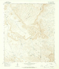
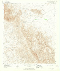
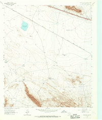 1963 Grayton Lake1967 Print · USGSHigh-desert ranching and rail history converge in 1960s Hudspeth County near the Old Spanish Trail. Researchers can trace the isolated Isbell Ranch, the mysterious Streetcar Camp, and parallel rail lines serving Eagle Flat.
 - 1964 Map of Hackett Peak, 1967 Print
 1964 Hackett Peak1967 Print · USGSWest Texas ranching and mining define this landscape during the mid-sixties, where the Texas and Pacific cuts through the high desert. Researchers can locate family outposts like Sammons Ranch, find old Prospects, and trace the route to Allamoore.
 - 1964 Map of Devil Ridge, 1967 Print
 1964 Devil Ridge1967 Print · USGSHudspeth County, Texas, was a land of desert ranching and historic corridors in the mid-sixties. Researchers can trace the path of the Old Spanish Trail and find isolated landmarks like the Old Patterson Place and Cummins Windmill.
 - 1964 Map of Allamoore, 1967 Print
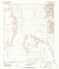
 1964 Allamoore1967 Print · USGSHudspeth County ranching and rail transport are captured here during the mid-sixties, centered on the Allamoore corridor. Trace the historic route of the Old Spanish Trail and locate family landmarks like Booth Ranch and Hot Wells.
 - 1964 Map of Sheep Peak, 1967 Print
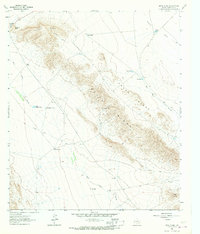
 1964 Sheep Peak1967 Print · USGSThe Trans-Pecos ranching and mining landscape of the 1960s is preserved here in the shadows of the Sierra Diablo. Researchers can trace remote mining sites like Mohawk Mine and Sancho Panza Mine alongside family holdings at Circle Ranch.
 - 1964 Map of Dome Peak, 1967 Print
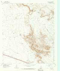 1964 Dome Peak1967 Print · USGSHudspeth County ranching and rail infrastructure are detailed in this mid-sixties survey of the Trans-Pecos. Researchers can locate remote sites like Wilkin Ranch, numerous livestock waterers including Jenkins Tank, and the path of the Texas and Pacific railroad.
 - 1964 Map of Lasca, 1967 Print
 1964 Lasca1967 Print · USGSHudspeth County, Texas, was a vital mountain passage in the 1960s, defined by high-desert ranching and the transit corridor of the Texas and Pacific. Researchers can trace the era's infrastructure through the Bonanza Mine, Love Ranch, and local watering spots like Granger Tank.3 unique versions available
 - 1964 Map of Bean Hills, 1967 Print
 1964 Bean Hills1967 Print · USGSHudspeth County ranching and mineral exploration are preserved in this mid-sixties survey of the West Texas desert. Researchers can locate remote homesteads like Keepe Ranch and trace resource infrastructure from Sand Hollow Windmill to the local Quarry sites.
 - 1964 Map of Sierra Blanca SW, 1967 Print
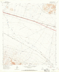
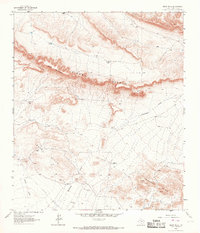
 1964 Sierra Blanca SW1967 Print · USGSThe Hudspeth County high desert is captured here in the mid-1960s, showing a landscape defined by ranching and historic transit. You can trace the Old Spanish Trail as it passes Tammin Ranch and search for water features like Davis Pond.
 - 1964 Map of Sierra Blanca, 1967 Print
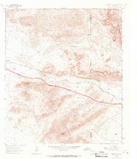
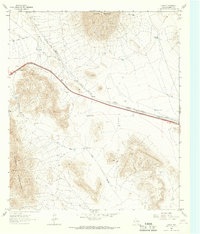
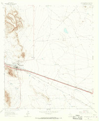 1964 Sierra Blanca1967 Print · USGSSierra Blanca sits at a vital railroad crossroads in Hudspeth County during the mid-1960s. Genealogists and historians can trace the dual routes of the Texas and Pacific and Southern Pacific past Arispe and the Faskin Ranch.3 unique versions available
 - 1965 Map of Marfa
 1965 Marfa1965 Print · USGSBig Bend ranching and high-desert rail travel come together in the 1960s along the Rio Grande and the southern reaches of the Davis Mountains. Researchers can trace the lineage of cattle outfits like Brite Ranch and historic stops like Valentine and Candelaria.
 - 1969 Map of Cienega School, 1973 Print
 1969 Cienega School1973 Print · USGSThe arid borderlands of New Mexico and Texas are captured here in the late sixties, showing a landscape defined by ranching and high-desert terrain. Genealogists and historians can trace local roots through landmarks like Cienega Cem, Cienega Sch, and the Lewis Ranch.
 - 1969 Map of Culp Draw, 1973 Print
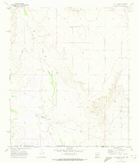 1969 Culp Draw1973 Print · USGSThe borderlands of New Mexico and Texas come into focus in the late sixties, highlighting a landscape defined by desert water management. Researchers can locate critical ranching infrastructure including China Pond, Joe Tank, and the winding Culp Draw.
End of results
Showing maps 1-13 of 13
Top cities of Hudspeth County
Frequently asked questions
- What are the different types of historical maps available for Hudspeth County?
- What is the oldest map of Hudspeth County?
- Where can I purchase historical maps of Hudspeth County for my home or office?
- Where can I download high-res historical maps of Hudspeth County?
- Are there historical topographic maps available for Hudspeth County?
- Is there historical aerial imagery available for Hudspeth County?
- Where are historical maps of Hudspeth County sourced from?