Old Maps of Hudspeth County, Texas
Explore 128 old maps of Hudspeth County, spanning from 1892 to today. These high-resolution historic maps reveal how streets, neighborhoods, landmarks, and natural features evolved over time — perfect for genealogy, metal detecting, research, and local history exploration.
What you can do with these maps:
- See how Hudspeth County changed over time: Compare historical maps to modern-day views to trace roads, homesites, rail lines & more.
- View detailed metadata: Each map includes creators, publishers, year, scale, and archive source.
- Overlay maps with satellite & LiDAR: Visualize the past alongside modern tools to explore terrain & human change.
- Trusted historical sources: Maps sourced from the USGS, Library of Congress, and other archives.
- Access maps your way: View online, download high-res files, or order prints for personal or research use.
Start exploring old maps of Hudspeth County to uncover forgotten places, hidden landmarks, and the deep history beneath your feet.
Hudspeth County, TX maps
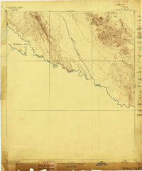
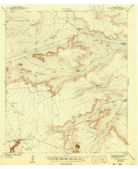
(128)- 1892 Map of Chispa, 1957 Print
 1892 Chispa1957 Print · USGSCovers Hudspeth County, including Valentine, Lomas de Arena, and other nearby areas
 - 1894 Map of Fort Hancock
 1894 Fort Hancock1894 Print · USGSCovers Hudspeth County, including El Porvenir, Fort Hancock, and other nearby areas4 unique versions available
 - 1895 Map of Chispa
 1895 Chispa1895 Print · USGSCovers Hudspeth County, including Valentine, Lomas de Arena, and other nearby areas
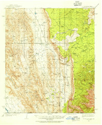
 - 1895 Map of Sierra Blanca
 1895 Sierra Blanca1895 Print · USGSCovers Hudspeth County, including Sierra Blanca, Allamoore, and other nearby areas5 unique versions available
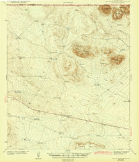
 - 1897 Map of Eagle Mountain
 1897 Eagle Mountain1897 Print · USGSCovers Hudspeth County, including Indian Hot Springs, Ojinaga, and other nearby areas3 unique versions available
 - 1897 Map of Chispa
 1897 Chispa1897 Print · USGSCovers Hudspeth County, including Valentine, Lomas de Arena, and other nearby areas3 unique versions available
 - 1903 Map of Cerro Alto, 1929 Print
 1903 Cerro Alto1929 Print · USGSCovers Hudspeth County, including Coyote Place, Loma Linda Estates Colonia, and other nearby areas
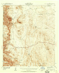
 - 1906 Map of Van Horn
 1906 Van Horn1906 Print · USGSCovers Hudspeth County, including Van Horn, Plateau, and other nearby areas5 unique versions available
 - 1916 Map of Eagle Mountain, 1929 Print
 1916 Eagle Mountain1929 Print · USGSCovers Hudspeth County, including Indian Hot Springs, Ojinaga, and other nearby areas
 - 1933 Map of Guadalupe Peak
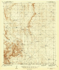
 1933 Guadalupe Peak1933 Print · USGSCovers Hudspeth County, including Pine Springs, Culberson County, and other nearby areas6 unique versions available
 - 1935 Map of El Paso Gap, 1954 Print
 1935 El Paso Gap1954 Print · USGSCovers Hudspeth County, including Otero County, Eddy County, and other nearby areas2 unique versions available
 - 1936 Map of El Paso Gap
 1936 El Paso Gap1936 Print · USGSCovers Hudspeth County, including Otero County, Eddy County, and other nearby areas
 - 1940 Map of El Paso Gap
 1940 El Paso Gap1940 Print · USGSCovers Hudspeth County, including Otero County, Eddy County, and other nearby areas3 unique versions available
 - 1940 Map of Guadalupe Peak, 1949 Print
 1940 Guadalupe Peak1949 Print · USGSCovers Hudspeth County, including Pine Springs, Culberson County, and other nearby areas2 unique versions available
 - 1940 Map of Bassett Lake, 1954 Print
 1940 Bassett Lake1954 Print · USGSCovers Hudspeth County, including Otero County, El Paso County, and other nearby areas
 - 1941 Map of Heuco Mountains, 1958 Print
 1941 Heuco Mountains1958 Print · USGSCovers Hudspeth County, including Loma Linda Estates Colonia, El Paso County, and other nearby areas2 unique versions available
 - 1942 Map of Borrego
 1942 Borrego1942 Print · USGSCovers Hudspeth County, including Coyote Place, El Paso County, and other nearby areas3 unique versions available
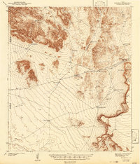
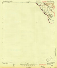
 - 1943 Map of Fort Quitman
 1943 Fort Quitman1943 Print · USGSCovers Hudspeth County, including Esperanza, Guadalupe, and other nearby areas
 - 1943 Map of Tepee Butte
 1943 Tepee Butte1943 Print · USGSCovers Hudspeth County, including United States, Texas, and other nearby areas2 unique versions available
 - 1943 Map of San Antonio Mtn
 1943 San Antonio Mtn1943 Print · USGSCovers Hudspeth County, including United States, Texas, and other nearby areas
 - 1943 Map of Heuco Mountains
 1943 Heuco Mountains1943 Print · USGSCovers Hudspeth County, including Loma Linda Estates Colonia, El Paso County, and other nearby areas
 - 1943 Map of Finlay Mountains
 1943 Finlay Mountains1943 Print · USGSCovers Hudspeth County, including Finlay, United States, and other nearby areas
 - 1943 Map of Fort Hancock
 1943 Fort Hancock1943 Print · USGSCovers Hudspeth County, including Fort Hancock, Colonia Esperanza, and other nearby areas2 unique versions available
 - 1943 Map of Bassett Lake
 1943 Bassett Lake1943 Print · USGSCovers Hudspeth County, including Otero County, El Paso County, and other nearby areas
 - 1943 Map of McNary
 1943 McNary1943 Print · USGSCovers Hudspeth County, including El Porvenir, McNary, and other nearby areas
Showing maps 1-25 of 128
Top cities of Hudspeth County
Frequently asked questions
- What are the different types of historical maps available for Hudspeth County?
- What is the oldest map of Hudspeth County?
- Where can I purchase historical maps of Hudspeth County for my home or office?
- Where can I download high-res historical maps of Hudspeth County?
- Are there historical topographic maps available for Hudspeth County?
- Is there historical aerial imagery available for Hudspeth County?
- Where are historical maps of Hudspeth County sourced from?