Old Maps of Kimble County, Texas for Metal Detecting
Plan your next treasure hunt with 174 historic maps of Kimble County. Find old homesites, ghost towns, trails, and gathering spots that may be lost to time — perfect for identifying promising metal detecting locations.
- Locate forgotten sites: Uncover places like long-lost settlements, abandoned rail lines, or gathering spots.
- Plan better hunts: Use map overlays combined with LiDAR or satellite views to narrow in on historically rich areas.
- Made for detectorists: Thousands of hobbyists use these maps to discover relics, coins, and hidden history.
Use these historic maps to boost your research and find new opportunities beneath the surface of Kimble County.
Kimble County, TX maps
(174)- 1887 Map of Mason
 1887 Mason1887 Print · USGSThe Texas Hill Country comes into focus during the late frontier era, centering on the vital cattle and trade crossroads of Mason. Researchers can trace early German-Texan settlements and rural post offices including Loyal Valley, Hoersterville, and Fredonia.
 - 1893 Map of Rock Springs
 1893 Rock Springs1893 Print · USGSThe Edwards Plateau in the early 1890s was a remote ranching frontier defined by isolated outposts and limestone river breaks. Researchers can locate early family holdings such as Marsh & Taylor's Ranch and landmarks like the Devils Sink Hole.5 unique versions available
 - 1893 Map of Fort McKavett
 1893 Fort McKavett1893 Print · USGSCentral West Texas ranching life is frozen in time during the 1890s as the frontier era transitions to established livestock spreads. Trace family landholdings and early outposts like Fort McKavett, S.S.S. Ranch, and Henderson Brothers Ranch.4 unique versions available
 - 1894 Map of Mason
 1894 Mason1894 Print · USGSTexas Hill Country ranching and frontier life are captured here in the 1890s, centered on the growing county seat. Genealogists can trace family-named settlements like Bodeville and Hoersterville or remote outposts like Camp San Saba.4 unique versions available
 - 1894 Map of Kerrville
 1894 Kerrville1894 Print · USGSThe Texas Hill Country in the late nineteenth century was a land of river-valley outposts and high divides. Genealogists and researchers can trace the early footprints of Kerrville, Harper, and Ingram, or locate rural landmarks like Johnson Resort and Steamboat Mountain.4 unique versions available
 - 1926 Map of Segovia 2-c
 1926 Segovia 2-c1926 Print · USGSKimble and Edwards Counties appear here during the mid-twenties as the South Llano River was being meticulously surveyed for water resources. Researchers can pinpoint the remote Telegraph settlement, Evergreen School, and the hydrologically significant Seven Hundred Springs.
 - 1932 Map of Junction
 1932 Junction1932 Print · USGSJunction and the surrounding Hill Country are captured in the early thirties as the local road network began to formalize. Genealogists and researchers can trace the locations of Evergreen Sch, Paint Rock Sch, and the riverside settlement of Telegraph.2 unique versions available
 - 1954 Map of Llano, 1964 Print
 1954 Llano1964 Print · USGSThe Texas Hill Country and Highland Lakes appear in the mid-fifties, just as new reservoirs began reshaping the landscape. Trace ranching history and river routes from Mason to Llano, or follow the Gulf Colorado and Santa Fe RR past Buchanan Lake.2 unique versions available
 - 1954 Map of Sonora, 1965 Print
 1954 Sonora1965 Print · USGSThe Edwards Plateau and West Texas ranching country come alive in this mid-century survey of the canyons and plateaus. Genealogists and historians can trace the remote settlements of Pandale and Loma Alta or follow the path of the Panhandle and Santa Fe RR.2 unique versions available
 - 1955 Map of Llano
 1955 Llano1955 Print · USGSCentral Texas and the Hill Country are seen here during the mid-1950s growth of the Highland Lakes. Trace old settlements and geologic landmarks from Enchanted Rock and Longhorn Cavern to the small community of Luckenbach.
 - 1956 Map of Llano, 1976 Print
 1956 Llano1976 Print · USGSThe Texas Hill Country comes alive in this mid-seventies survey of the Llano Uplift and Colorado River lakes. Genealogists and historians can trace family roots through settlements like Luckenbach and Castell or locate the famed L B J Ranch and Enchanted Rock.
 - 1958 Map of Sonora
 1958 Sonora1958 Print · USGSThe Edwards Plateau and Trans-Pecos region come alive in the late fifties, showing a landscape of remote ranchlands and historic frontier outposts. Trace the legacy of Fort Lancaster Ruins, the limestone depths of Devils Sinkhole Cavern, and the path of the Pecos River.
 - 1962 Map of Hill Ranch, 1965 Print
 1962 Hill Ranch1965 Print · USGSTexas ranching culture is well-documented in this early 1960s survey of the Kimble and Edwards County lines. Genealogists can locate specific family lands like Cardwell Ranch, Nethery Ranch, and Jetton Ranch along the waters of Knust Draw.2 unique versions available
 - 1962 Map of Roosevelt, 1966 Print
 1962 Roosevelt1966 Print · USGSThe Texas Hill Country ranching landscape comes into focus during the early sixties, centered on the settlement of Roosevelt. Genealogists and historians can trace family landholdings like Maynard Ranch and Wilson Place along the banks of the North Llano River.2 unique versions available
 - 1963 Map of McKegan Draw, 1966 Print
 1963 McKegan Draw1966 Print · USGSKimble and Sutton Counties are captured here in the early sixties, showing a landscape defined by large family holdings and the headwaters of the Llano River. Genealogists and historians can trace the boundaries of the Chadwick Ranch, locate the remote Joy Ranch, and follow the path of Copperas Creek.
 - 1963 Map of McKegan Draw NE, 1966 Print
 1963 McKegan Draw NE1966 Print · USGSThe ranchlands at the intersection of Kimble and Menard Counties are captured here in the early sixties. Researchers can trace family legacies at the Lehne Ranch, Graham Ranch, and Johnston Ranch, or locate the Murr Ch at the edge of the creek draws.2 unique versions available
 - 1968 Map of Monument Mountain, 1970 Print
 1968 Monument Mountain1970 Print · USGSThe Texas Hill Country at the end of the sixties reveals a landscape of isolated ranches and rugged highlands along the Mason-Kimble line. Researchers can locate community hubs like Blue Mountain Community Hall or trace the James River and Crocker Landing Strip.
 - 1968 Map of Sheep Run Creek, 1971 Print
 1968 Sheep Run Creek1971 Print · USGSThe Texas Hill Country landscape near the Llano River is captured in the late sixties, showing the convergence of Mason, Menard, and Kimble counties. Trace the paths of Leon Creek and Sheep Run or locate landmarks like Hogg Bluff and James River Road.2 unique versions available
 - 1968 Map of London, 1971 Print
 1968 London1971 Print · USGSLondon sits at the heart of this late-sixties Kimble County survey, where the Hill Country terrain meets the local ranching economy. Researchers can locate the London Cem and the prominent Reichenau Gap, or trace the path of the Llano River.
 - 1968 Map of Yates, 1971 Print
 1968 Yates1971 Print · USGSKimble County ranchlands and river valleys appear in high detail during the late sixties. Genealogists and local researchers can trace the roads around Yates to find Ivy Chapel, the Red Creek Cem, and the high ridges of the Blue Mountains.2 unique versions available
 - 1970 Map of Julio Draw, 1973 Print
 1970 Julio Draw1973 Print · USGSThe Menard and Kimble county line in the early 1970s reveals a ranching landscape carved by deep draws and seasonal washes. Researchers can trace the mid-century infrastructure of Baker Ranch and locate remote sites like the Roadside Park or the Pumping Station.
 - 1970 Map of Rust Ranch, 1973 Print
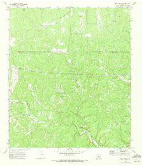 1970 Rust Ranch1973 Print · USGSThe ranching country of the Texas Hill Country appears in the early seventies, spanning the Kimble and Menard county line. Genealogists and land historians can trace family holdings like Rust Ranch and Spiller Ranch alongside the springs and Gravel Pits that supported the local economy.2 unique versions available
 - 1970 Map of Brewer Hollow, 1973 Print
 1970 Brewer Hollow1973 Print · USGSThe Kimble and Menard county borderlands are shown here in the early seventies, a landscape of ranching and remote draws. Researchers can trace family history at the Bannowsky Cem or locate old water sources like Iona Spring and Walton Spring.
 - 1970 Map of Elm Slough, 1973 Print
 1970 Elm Slough1973 Print · USGSThe Llano River valley in Kimble County is captured here in the early 1970s as ranching and new infrastructure meet. Researchers can locate family landmarks like the Bear Creek Cem and Bolt Ranch alongside the County Airport.2 unique versions available
 - 1970 Map of Stark Creek, 1973 Print
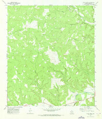 1970 Stark Creek1973 Print · USGSThe Llano River valley in the early seventies reveals a landscape of isolated ranching outposts and seasonal creeks. Researchers can locate the settlement of Cleo, the historic Cem, and rural landmarks like Stark Creek or the Corral north of the river.2 unique versions available
Showing maps 1-25 of 174
Top cities of Kimble County
Frequently asked questions
- What are the different types of historical maps available for Kimble County?
- What is the oldest map of Kimble County?
- Where can I purchase historical maps of Kimble County for my home or office?
- Where can I download high-res historical maps of Kimble County?
- Are there historical topographic maps available for Kimble County?
- Is there historical aerial imagery available for Kimble County?
- Where are historical maps of Kimble County sourced from?