1920s Maps of Montgomery County, Texas
Explore 4 historic maps of Montgomery County from the 1920s. These maps offer a rare glimpse into what life looked like during the 1920s — showing old roads, neighborhoods, homes, and landmarks that have changed or disappeared over time.
Whether you're researching your family's past, planning a metal detecting trip, or studying how Montgomery County's landscape evolved across the 1920s, these high-resolution maps are a powerful tool for exploring the history of this region.
- Focus on a specific era: All maps on this page are from the 1920s, giving you a focused view of this time period.
- See what’s changed: Compare century-old streets, trails, and buildings to today's modern landscape using overlays and satellite layers.
- Research with precision: Use these maps for genealogy, historical research, land use analysis, or educational projects.
- View, download, or print: Maps are fully viewable online in high resolution, and can be downloaded or printed for your own records.
Start exploring Montgomery County's history through authentic maps from the 1920s. This is your window into the past.
Montgomery County, TX maps
(4)- 1920 Map of Spring
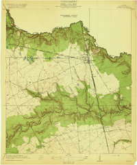 1920 Spring1920 Print · USGSNorthern Harris County is shown at a pivotal rail-junction moment as the Galveston Line and International and Great Northern meet at Spring. Genealogists can locate early community landmarks like the Kothman School, Bammel settlement, and Roth School along the winding Cypress Creek.2 unique versions available
 - 1920 Map of Hockley
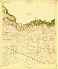 1920 Hockley1920 Print · USGSHarris County at the edge of the prairie reveals a landscape of early rail and timber industry just after the First World War. Trace local roots at Hockley and the Hegar School or locate the old Bauers Sawmill near Spring Creek.3 unique versions available
 - 1920 Map of Rose Hill
 1920 Rose Hill1920 Print · USGSNorthwest Harris County appears as a burgeoning rural community in the years following the Great War. Genealogists and local historians can trace the foundations of the district through several early schoolhouses, including East Rose Hill School and Neidorff School, as well as Cypress Church.
 - 1920 Map of Moonshine Hill
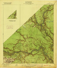 1920 Moonshine Hill1920 Print · USGSHarris County at the height of the 1920s oil boom reveals a landscape of river bends and early settlements. Trace the original footprints of Moonshine Hill and the Huffman School alongside the oxbows of Horseshoe Lake and Blue Lake.2 unique versions available
End of results
Showing maps 1-4 of 4
Top cities of Montgomery County
- The Woodlands historical maps
- Conroe historical maps
- Willis historical maps
- Oak Ridge North historical maps
- Roman Forest historical maps
- Panorama Village historical maps
See more
Frequently asked questions
- What are the different types of historical maps available for Montgomery County?
- What is the oldest map of Montgomery County?
- Where can I purchase historical maps of Montgomery County for my home or office?
- Where can I download high-res historical maps of Montgomery County?
- Are there historical topographic maps available for Montgomery County?
- Is there historical aerial imagery available for Montgomery County?
- Where are historical maps of Montgomery County sourced from?