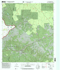
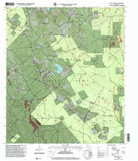
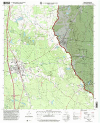
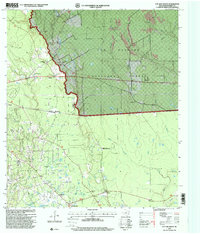
1990s Maps of Montgomery County, Texas
Explore 15 historic maps of Montgomery County from the 1990s. These maps offer a rare glimpse into what life looked like during the 1990s — showing old roads, neighborhoods, homes, and landmarks that have changed or disappeared over time.
Whether you're researching your family's past, planning a metal detecting trip, or studying how Montgomery County's landscape evolved across the 1990s, these high-resolution maps are a powerful tool for exploring the history of this region.
- Focus on a specific era: All maps on this page are from the 1990s, giving you a focused view of this time period.
- See what’s changed: Compare century-old streets, trails, and buildings to today's modern landscape using overlays and satellite layers.
- Research with precision: Use these maps for genealogy, historical research, land use analysis, or educational projects.
- View, download, or print: Maps are fully viewable online in high resolution, and can be downloaded or printed for your own records.
Start exploring Montgomery County's history through authentic maps from the 1990s. This is your window into the past.
Montgomery County, TX maps
(15)- 1995 Map of Maedan, 1999 Print
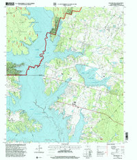
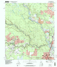 1995 Maedan1999 Print · USGSSuburban expansion meets the river bottoms of the San Jacinto in the mid-nineties as new residential developments rise near the confluence of major creeks. Researchers can trace family sites at Enloe Cem or locate the community roots of Bordersville and Maedan.
 - 1995 Map of Spring, 2000 Print
 1995 Spring2000 Print · USGSThe northern reaches of Harris County are shown in the mid-1990s during a period of rapid suburban growth. Genealogists and local historians can trace family burial sites like Wunsche Cem and Budde Cem or locate the early campus of North Harris County College.
 - 1995 Map of Moonshine Hill, 2000 Print
 1995 Moonshine Hill2000 Print · USGSGreater Houston and the San Jacinto forks are captured during a period of significant suburban expansion in the mid-nineties. Researchers can trace the development of Kingwood and Porter, or locate smaller features like Moonshine Hill, Pittsville, and Whiskey Still Pond.
 - 1997 Map of San Jacinto, 1999 Print
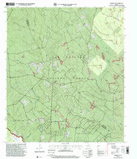
 1997 San Jacinto1999 Print · USGSThe woodlands of Montgomery and Walker counties appear here in the late nineties, centered on the Sam Houston National Forest. Researchers can trace old family sites at Lee Cemetery and Farris Chapel or locate the Fire Lookout in the deep timber.
 - 1997 Map of Moore Grove, 2000 Print
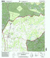
 1997 Moore Grove2000 Print · USGSWalker County at the end of the nineties shows a landscape defined by the deep woods of the Sam Houston National Forest and the rising waters of Lake Conroe. Genealogists and local historians can locate the Union Hill Cemetery, the Old Folks Home, and ranching sites like Hayman Ranch.
 - 1997 Map of Maynard, 2000 Print
 1997 Maynard2000 Print · USGSEast Texas forest lands and rural settlements are preserved here in the late nineties, centered on the Walker and San Jacinto county line. Genealogists and local historians can trace family sites at Old Waverly Cemetery, Mount Pilgrim Church, and the community of Maynard.
 - 1997 Map of Montgomery, 2000 Print
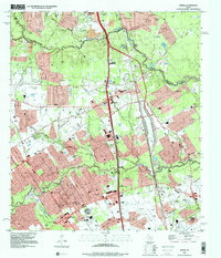
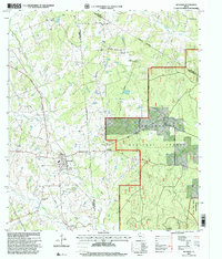
 1997 Montgomery2000 Print · USGSThe historic county seat of Montgomery and the sprawling shores of Lake Conroe are captured here in the late nineties. Local researchers can trace family roots through landmarks like China Chapel, Lincoln Sch, and the Montgomery Cemetery.
 - 1997 Map of Bear Creek, 2000 Print
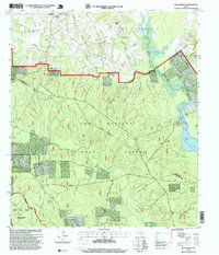
 1997 Bear Creek2000 Print · USGSThe piney woods of San Jacinto and Montgomery counties are captured here in the late nineties, showcasing the intersection of the national forest and rural Texas life. Researchers can find isolated landmarks like Purkerson Cemetery, Montague Church, and the San Jacinto Work Center.
 - 1997 Map of Willis, 2000 Print
 1997 Willis2000 Print · USGSWillis and the surrounding Montgomery County piney woods are captured here in the late nineties as the town expanded near the national forest. Genealogists and local historians can locate the New Hope Church, Turner High School, and the industrial footprint of the Pitts Gas Field.
 - 1997 Map of Cut And Shoot, 2000 Print
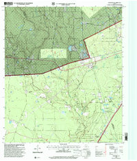
 1997 Cut And Shoot2000 Print · USGSMontgomery County was a landscape of industry and forest in the late 1990s, defined by its timber and petroleum resources. Genealogists can trace early local landmarks like the New Bethlehem Church and Ben Milam School alongside the sprawling Conroe Oil Field.
 - 1997 Map of Shepard Hill, 2000 Print
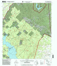
 1997 Shepard Hill2000 Print · USGSThe woodlands and shorelines of Montgomery County appear in detail during the late nineties as recreation and reservoir management shaped the landscape. Researchers can locate Shepard Cemetery and trace the complex waterways of Peach Creek and Lewis Creek Reservoir.
 - 1997 Map of Fostoria, 2000 Print
 1997 Fostoria2000 Print · USGSThe Montgomery and San Jacinto county lines converged in the late 1990s within the timberlands of the Sam Houston National Forest. Researchers can trace rural family sites and local landmarks like Security Cemetery, Morgan Cemetery, and the settlement of Fostoria.
 - 1997 Map of New Waverly, 2000 Print
 1997 New Waverly2000 Print · USGSNew Waverly and the surrounding timberlands of the Sam Houston National Forest are captured here in the late nineties. Genealogists can trace local roots through Mitchell Cemetery, Hardy Cemetery, and rural landmarks like Saint Joseph Church.
 - 1997 Map of Richards, 2000 Print
 1997 Richards2000 Print · USGSThe community of Richards and the sprawling Sam Houston National Forest take center stage in this late-century survey. Genealogists and local historians can trace family ties through David Chapel Cemetery, the settlement of Longstreet, and landmarks like Robinson Hill Church.
 - 1997 Map of Conroe NE, 2000 Print
 1997 Conroe NE2000 Print · USGSThe Piney Woods of East Texas in the late 1990s are defined here by timberlands and small community hubs. Researchers can locate Hickory Grove Cemetery and historic rural congregations like County Line Church and China Grove Church among the tributaries of Peach Creek.
End of results
Showing maps 1-15 of 15
Top cities of Montgomery County
- The Woodlands historical maps
- Conroe historical maps
- Willis historical maps
- Oak Ridge North historical maps
- Roman Forest historical maps
- Panorama Village historical maps
See more
Frequently asked questions
- What are the different types of historical maps available for Montgomery County?
- What is the oldest map of Montgomery County?
- Where can I purchase historical maps of Montgomery County for my home or office?
- Where can I download high-res historical maps of Montgomery County?
- Are there historical topographic maps available for Montgomery County?
- Is there historical aerial imagery available for Montgomery County?
- Where are historical maps of Montgomery County sourced from?