Old Maps of Montgomery County, Texas for Metal Detecting
Plan your next treasure hunt with 211 historic maps of Montgomery County. Find old homesites, ghost towns, trails, and gathering spots that may be lost to time — perfect for identifying promising metal detecting locations.
- Locate forgotten sites: Uncover places like long-lost settlements, abandoned rail lines, or gathering spots.
- Plan better hunts: Use map overlays combined with LiDAR or satellite views to narrow in on historically rich areas.
- Made for detectorists: Thousands of hobbyists use these maps to discover relics, coins, and hidden history.
Use these historic maps to boost your research and find new opportunities beneath the surface of Montgomery County.
Montgomery County, TX maps
(211)- 1916 Map of Rose Hill
 1916 Rose Hill1916 Print · USGSHarris County farming communities thrived along the Montgomery County line during the mid-1910s, years before suburban sprawl reached the area. Genealogists can trace early homesteads near Rose Hill and find historic rural landmarks like Cypress Church and the Bowers School.
 - 1916 Map of Moonshine Hill
 1916 Moonshine Hill1916 Print · USGSHarris and Montgomery counties appear here in the early twentieth century as a complex landscape of river forks and wetlands. Genealogists and historians can trace old property lines and natural landmarks like Odom Lake Swamp, Bosman Lake, and the H. E. and W. T. rail line.3 unique versions available
 - 1916 Map of Hockley
 1916 Hockley1916 Print · USGSUpper Harris County during the First World War shows a landscape defined by timber mills and early railroad junctions. Genealogists can locate family-named landmarks like Bauers Store and Hegar School, or trace the old Houston and Texas Central Road.
 - 1916 Map of Spring
 1916 Spring1916 Print · USGSNorth Harris County was a network of railroad junctions and creek-side settlements during the early twentieth century. Researchers can trace family-named roads and schools like Kothman Road, Roth School, and the junction at Spring.3 unique versions available
 - 1919 Map of Weeden
 1919 Weeden1919 Print · USGSSoutheast Texas at the end of the Great War was a landscape of creek-fed bottomlands and emerging rail hubs. Trace the early layout of Humble and locate family landmarks like the Tullus Cemetery or the route of the Bender Tramroad.2 unique versions available
 - 1920 Map of Spring
 1920 Spring1920 Print · USGSNorthern Harris County is shown at a pivotal rail-junction moment as the Galveston Line and International and Great Northern meet at Spring. Genealogists can locate early community landmarks like the Kothman School, Bammel settlement, and Roth School along the winding Cypress Creek.2 unique versions available
 - 1920 Map of Hockley
 1920 Hockley1920 Print · USGSHarris County at the edge of the prairie reveals a landscape of early rail and timber industry just after the First World War. Trace local roots at Hockley and the Hegar School or locate the old Bauers Sawmill near Spring Creek.3 unique versions available
 - 1920 Map of Rose Hill
 1920 Rose Hill1920 Print · USGSNorthwest Harris County appears as a burgeoning rural community in the years following the Great War. Genealogists and local historians can trace the foundations of the district through several early schoolhouses, including East Rose Hill School and Neidorff School, as well as Cypress Church.
 - 1920 Map of Moonshine Hill
 1920 Moonshine Hill1920 Print · USGSHarris County at the height of the 1920s oil boom reveals a landscape of river bends and early settlements. Trace the original footprints of Moonshine Hill and the Huffman School alongside the oxbows of Horseshoe Lake and Blue Lake.2 unique versions available
 - 1954 Map of Beaumont, 1964 Print
 1954 Beaumont1964 Print · USGSSoutheast Texas in the mid-fifties reveals a landscape of massive national forests, emerging reservoirs, and a booming oil economy. Genealogists and researchers can trace rural settlements like Dallardsville and Village Mills or locate early drilling sites at Sour Lake Oil Field.3 unique versions available
 - 1957 Map of Beaumont
 1957 Beaumont1957 Print · USGSSoutheast Texas in the mid-fifties is defined by the timber-rich lands between the Trinity River and Beaumont. Trace the history of the Alabama and Coushatti Indian Reservation or locate early campus sites like Prairie View College.
 - 1958 Map of Conroe, 1959 Print
 1958 Conroe1959 Print · USGSConroe and the surrounding Montgomery County landscape are caught in a period of significant mid-century growth and industrial activity. Genealogists and historians can locate old landmarks like the Conroe Normal and Industrial College, Rosewood Cem, and the extensive Conroe Oil Field.5 unique versions available
 - 1958 Map of Cowl Spur, 1959 Print
 1958 Cowl Spur1959 Print · USGSMontgomery County in the late fifties was a landscape of expanding oil fields and rural rail stops. Genealogists and historians can trace old settlements like Honea and Leonidas or locate family sites at Coplan Chapel Cemetery and Sapp Cem.4 unique versions available
 - 1958 Map of Fostoria, 1959 Print
 1958 Fostoria1959 Print · USGSThe timber country of southeast Texas is captured here in the late fifties, centered on the mill town of Fostoria. Researchers can trace old family landmarks and rural life at Pin Oak Cem, Pilgrim Rest Ch, and the logging stops along the Gulf Colorado and Santa Fe railroad.3 unique versions available
 - 1958 Map of Lake Paula, 1959 Print
 1958 Lake Paula1959 Print · USGSMontgomery County was a landscape of dense pine forests and active petroleum extraction in the late fifties. Genealogists and historians can trace family-named sites like Shepard Cem and Shepard Hill or the workings of the Willis Oil Field.3 unique versions available
 - 1958 Map of Bear Creek, 1960 Print
 1958 Bear Creek1960 Print · USGSSan Jacinto County in the late fifties was a landscape of dense woodland and emerging oil fields. Researchers can locate family landmarks like Oak Grove, Purkerson Cem, and Montague Ch within the Sam Houston National Forest.3 unique versions available
 - 1959 Map of Plum Grove, 1960 Print
 1959 Plum Grove1960 Print · USGSThe Texas coastal plains near the Liberty and Montgomery county lines come into focus in the late fifties. Researchers can trace family-named landmarks and water sources like Thompson Grass Pond, Sallas Lake, and the high point at Casey Ridge.3 unique versions available
 - 1959 Map of Moore Grove, 1960 Print
 1959 Moore Grove1960 Print · USGSThe Piney Woods of Walker County are captured here in the late fifties, showcasing a landscape of timber management and remote ranching. Trace old timber routes along the Old Railroad Grade or find family landmarks like Union Hill Cem and the Old Folks Home.3 unique versions available
 - 1959 Map of Outlaw Pond, 1960 Print
 1959 Outlaw Pond1960 Print · USGSSoutheast Texas at the end of the fifties reveals a landscape defined by petroleum and timber. Trace family ties at Mary Vick Cemetery or locate old community centers like Independent Church and the busy Conroe Oil Field.3 unique versions available
 - 1959 Map of San Jacinto, 1960 Print
 1959 San Jacinto1960 Print · USGSThe piney woods of Montgomery and Walker Counties are shown here during the late fifties as the Sam Houston National Forest defined the region's character. Genealogists and local historians can locate early community hubs like Parris Chapel, Union Grove Ch, and the Lee Cem.4 unique versions available
 - 1959 Map of Cut and Shoot, 1960 Print
 1959 Cut and Shoot1960 Print · USGSIn the late fifties, Montgomery County was a landscape of deep timber and heavy industry as the oil patch expanded into the national forest. Researchers can trace rural church and school locations like New Bethlehem Ch and Austin Sch alongside the sprawling Conroe Oil Field.3 unique versions available
 - 1959 Map of Montgomery, 1960 Print
 1959 Montgomery1960 Print · USGSSoutheast Texas in the late fifties is captured here through the timberlands and rail-dependent settlements of Montgomery County. Genealogists and historians can trace family locations and community sites like Lincoln Sch, China Chapel, and the Montgomery Cem near the Gulf Colorado and Santa Fe railroad.4 unique versions available
 - 1959 Map of Conroe NE, 1960 Print
 1959 Conroe NE1960 Print · USGSThe timberlands of East Texas are captured here in the late fifties, showing the deep woods of the Sam Houston National Forest. Researchers can trace the Old Railroad Grade and locate rural landmarks like Hickory Grove Cem and China Grove Ch.3 unique versions available
 - 1959 Map of Splendora, 1960 Print
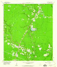 1959 Splendora1960 Print · USGSEast Texas oil production and railroad transit define the Splendora area in the late fifties. Genealogists and researchers can trace family landmarks and community hubs like Robinson Cem, Carver Sch, and the vanished tracks of the Old Grade Railroad.4 unique versions available
 - 1960 Map of Willis, 1961 Print
 1960 Willis1961 Print · USGSThe town of Willis stands at the edge of the East Texas timberlands in the early sixties, a landscape defined by forest and resource extraction. Researchers can locate family landmarks such as New Hope Ch, the Turner High Sch, and the Missouri Pacific rail line.3 unique versions available
Showing maps 1-25 of 211
Top cities of Montgomery County
- The Woodlands historical maps
- Conroe historical maps
- Willis historical maps
- Oak Ridge North historical maps
- Roman Forest historical maps
- Panorama Village historical maps
See more
Frequently asked questions
- What are the different types of historical maps available for Montgomery County?
- What is the oldest map of Montgomery County?
- Where can I purchase historical maps of Montgomery County for my home or office?
- Where can I download high-res historical maps of Montgomery County?
- Are there historical topographic maps available for Montgomery County?
- Is there historical aerial imagery available for Montgomery County?
- Where are historical maps of Montgomery County sourced from?