Old Maps of Presidio County, Texas for Hiking & Exploration
Hike through history with 495 historic maps of Presidio County. Explore old trails, ghost towns, and forgotten backroads — perfect for outdoor adventurers and local explorers.
- Rediscover forgotten places: Map out old mining camps, roads, and footpaths that no longer exist on modern maps.
- Layer with modern tools: Combine with LiDAR or satellite views to plan hikes through historical terrain.
- Made for exploration: Popular among hikers, overlanders, and local history lovers.
Use these maps to find adventure and explore the hidden past of Presidio County.
Presidio County, TX maps
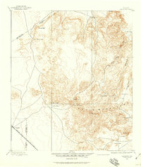
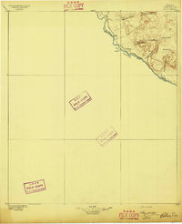
(495)- 1892 Map of Chispa, 1957 Print
 1892 Chispa1957 Print · USGSWest Texas railroad outposts and mountain passes are documented here in the final decade of the nineteenth century. Genealogists and historians can trace the early rail stops at Arno, Chispa, and Van Horn Wells along the original Southern Pacific line.
 - 1894 Map of Valentine, 1959 Print
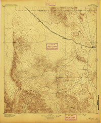
 1894 Valentine1959 Print · USGSThe high peaks of West Texas come to life in this late-frontier survey of the Trans-Pecos ranching country. Researchers can trace the early rail influence at Valentine and locate numerous historic homesteads including Hardwicks Ranch and Newmans Ranch.
 - 1895 Map of Chispa
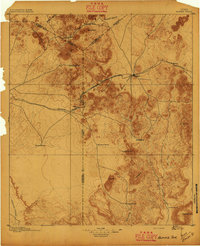
 1895 Chispa1895 Print · USGSWest Texas rail travel was in its prime during the late nineteenth century as steam engines traversed the mountain passes. Genealogists and rail historians can trace early sidings and stops like Van Horns Wells, Chispa, and the natural crossing at Vieja Pass.
 - 1895 Map of Marfa
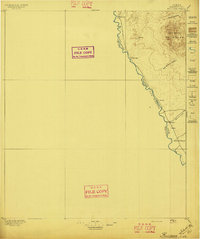
 1895 Marfa1895 Print · USGSMarfa and the high desert plains of West Texas are captured here in the late nineteenth century as the railroad began to transform the frontier. Genealogists and historians can trace early outposts like Humphris, the Stage Stand, and the Southern Pacific R. R.5 unique versions available
 - 1895 Map of Alpine
 1895 Alpine1895 Print · USGSWest Texas ranching and rail life come into focus in the 1890s, centered on the growing hub of Alpine. Family historians can trace early landholdings like Greenlee Ranch and Neville Ranch alongside the vital Southern Pacific line.6 unique versions available
 - 1896 Map of Ruidosa
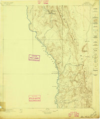
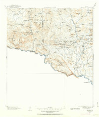
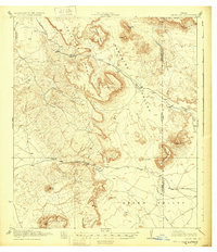
 1896 Ruidosa1896 Print · USGSPresidio County borderlands appear here in the final years of the nineteenth century, showing the remote canyon-cut geography along the Rio Grande. Researchers can locate old riverside settlements like Ruidosa, Indio, and Spencer's Ranch before modern development changed the landscape.4 unique versions available
 - 1896 Map of Polvo
 1896 Polvo1896 Print · USGSThe Big Bend river frontier comes into focus during the mid-1890s, when isolated ranching outposts were the only signs of settlement. Trace family history at Polvo or follow the early livestock trails through Bofecillos Canyon and past Burros Ranch.4 unique versions available
 - 1896 Map of San Carlos
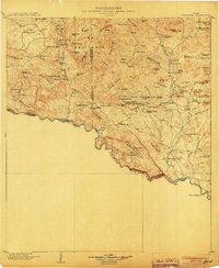
 1896 San Carlos1896 Print · USGSPresidio County at the close of the nineteenth century was a frontier landscape of remote ranching outposts and vital desert springs. Researchers can trace early West Texas heritage through sites like Bright's Ranch, San Carlos, and the river camps at Upper San Antonio.5 unique versions available
 - 1896 Map of Shafter
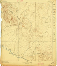 1896 Shafter1896 Print · USGSHigh-desert mining and ranching define the Trans-Pecos frontier along the border in the late nineteenth century. Trace family names at Poole's Ranch and Bogle's Ranch, or locate silver works like the Ross Mine near Shafter.5 unique versions available
 - 1897 Map of Valentine
 1897 Valentine1897 Print · USGSThe Davis Mountains frontier and the railroad town of Valentine are shown here in the mid-1890s. Researchers can locate remote high-country outposts like Prude's Ranch and Newman's Ranch or trace the early course of the Southern Pacific R. R.6 unique versions available
 - 1897 Map of Chispa
 1897 Chispa1897 Print · USGSWest Texas rail culture and high-desert landscapes take center stage in the 1890s as steam power bridges the vast distances between the Rio Grande and the interior mountains. Genealogists and historians can trace the early rail stops at Chispa and Dalberg, or locate the critical water source at Van Horn Wells.3 unique versions available
 - 1903 Map of Terlingua, 1963 Print
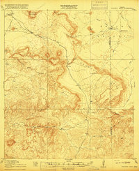
 1903 Terlingua1963 Print · USGSThe Big Bend borderlands emerge at the height of the quicksilver boom, showing the isolated ranching and mining camps along the Rio Grande. Trace the roots of early mining at Study Butte and find remote family outposts like Gourleys Ranch and Lajitas.
 - 1904 Map of Terlingua
 1904 Terlingua1904 Print · USGSThe Trans-Pecos frontier is captured here at the height of the early quicksilver mining boom. Genealogists and historians can locate remote family sites like Howard's Ranch and Madril Ranch, or trace early industrial efforts at the Colquitt-Tigner Mine.5 unique versions available
 - 1917 Map of Tascotal Mesa
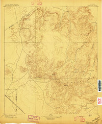
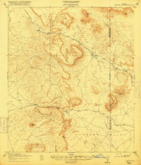
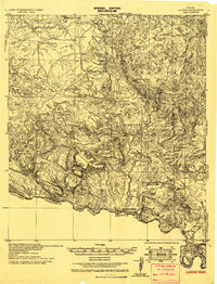
 1917 Tascotal Mesa1917 Print · USGSThe Trans-Pecos frontier during World War I remained a land of remote cattle outposts and historic mountain passages. Researchers can trace early regional travel routes like the Marfa and Lajitas Road and locate family landmarks such as Rooney Ranch and San Jacinto Ranch.2 unique versions available
 - 1918 Map of Jordan Gap
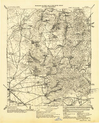
 1918 Jordan Gap1918 Print · USGSWest Texas ranching and frontier life are captured in the years before the Great War, showing a network of mountain passes and isolated water sources. Researchers can trace the road To Marfa, the remote outpost at Paradise, and family landmarks like Mc Cormick Mtn.
 - 1930 Map of Jordan Gap
 1930 Jordan Gap1930 Print · USGSPresidio and Brewster Counties are captured in the interwar years, showing a landscape of high mesas and desert passes. Genealogists and historians can trace old trails To Marfa and locate family-named landmarks like McKinney Mtn and McTurney Pk.3 unique versions available
 - 1931 Map of Lajitas
 1931 Lajitas1931 Print · USGSThe Big Bend borderlands come into focus in the early 1930s, showing the isolated ranches and rugged volcanic landscape along the Rio Grande. Genealogists and historians can trace remote outposts like Madrid Ranch, the distinctive El Solitario dome, and the old Telephone Trail.
 - 1943 Map of Valentine
 1943 Valentine1943 Print · USGSValentine and the Davis Mountains come alive in this mid-century look at the cattle and rail country of West Texas. Genealogists and historians can trace family-named holdings like Means Ranch Hdqrs., Prude's Ranch, and the isolated Foster Cabin.
 - 1944 Map of Tascotal Mesa
 1944 Tascotal Mesa1944 Print · USGSPresidio and Brewster counties were still a world of remote cattle outposts and primitive wagon roads in the years after the Great War. Genealogists and historians can trace family land holdings at San Jacinto Ranch or follow the historic Marfa and Lajitas Road through Wire Gap.2 unique versions available
 - 1954 Map of Fort Stockton, 1965 Print
 1954 Fort Stockton1965 Print · USGSWest Texas ranching and the early energy industry converge in this mid-century survey of the Trans-Pecos. Genealogists and historians can locate specific family lands like Graef Brothers Ranch and trace the paths of the Old Spanish Trail and the Southern Pacific railroad.3 unique versions available
 - 1958 Map of Fort Stockton
 1958 Fort Stockton1958 Print · USGSThe Trans-Pecos region of West Texas in the late fifties is a landscape of vast mesas and isolated ranching hubs. Genealogists and historians can trace the paths of the Texas and New Orleans RR through Alpine or locate early settlements like Bakersfield and Sanderson.
 - 1959 Map of Emory Peak, 1967 Print
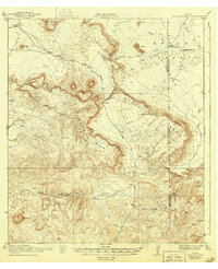
 1959 Emory Peak1967 Print · USGSThe Big Bend country of West Texas is documented here just as the national park was becoming a major destination. Researchers can trace remote desert outposts like Lajitas, Castolon, and the Terlingua Post Office along the winding Rio Grande.3 unique versions available
 - 1959 Map of Presidio, 1969 Print
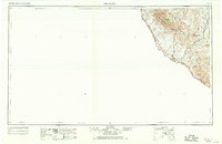 1959 Presidio1969 Print · USGSThe Texas-Mexico borderlands come into focus in the late fifties, showing a landscape defined by the Rio Grande and remote mining outposts. Researchers can trace the Atchison Topeka and Santa Fe rail line or locate historic sites like Old Fort Leaton (ruins) and the Shafter Mine.2 unique versions available
 - 1959 Map of Marfa, 1976 Print
 1959 Marfa1976 Print · USGSThe Trans-Pecos frontier is captured here in the mid-twentieth century as cattle ranching and high-altitude science shaped the landscape. Researchers can trace the Southern Pacific rail line through Valentine or locate remote border outposts like Ruidosa and Indian Hot Springs Resort.2 unique versions available
 - 1965 Map of Presidio
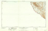 1965 Presidio1965 Print · USGSThe Big Bend borderlands appear in the mid-sixties as a rugged landscape of high-altitude ranching and retired mines. Trace the river road to the Old Fort Leaton ruins or locate family landmarks like Alamo Ranch and the Shafter Mine.
Showing maps 1-25 of 495
Top cities of Presidio County
- Presidio historical maps
- Marfa historical maps
- Redford historical maps
- Candelaria historical maps
- Ruidosa historical maps
- Plata historical maps
See more
Frequently asked questions
- What are the different types of historical maps available for Presidio County?
- What is the oldest map of Presidio County?
- Where can I purchase historical maps of Presidio County for my home or office?
- Where can I download high-res historical maps of Presidio County?
- Are there historical topographic maps available for Presidio County?
- Is there historical aerial imagery available for Presidio County?
- Where are historical maps of Presidio County sourced from?