1980s Maps of Presidio County, Texas
Explore 45 historic maps of Presidio County from the 1980s. These maps offer a rare glimpse into what life looked like during the 1980s — showing old roads, neighborhoods, homes, and landmarks that have changed or disappeared over time.
Whether you're researching your family's past, planning a metal detecting trip, or studying how Presidio County's landscape evolved across the 1980s, these high-resolution maps are a powerful tool for exploring the history of this region.
- Focus on a specific era: All maps on this page are from the 1980s, giving you a focused view of this time period.
- See what’s changed: Compare century-old streets, trails, and buildings to today's modern landscape using overlays and satellite layers.
- Research with precision: Use these maps for genealogy, historical research, land use analysis, or educational projects.
- View, download, or print: Maps are fully viewable online in high resolution, and can be downloaded or printed for your own records.
Start exploring Presidio County's history through authentic maps from the 1980s. This is your window into the past.
Presidio County, TX maps
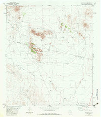
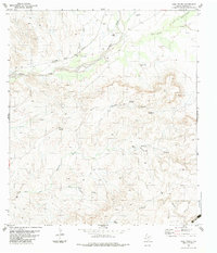
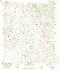
(45)- 1980 Map of Arroyo Melado
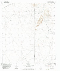
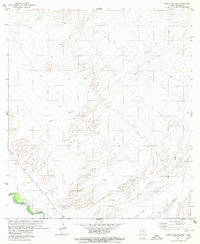 1980 Arroyo Melado1980 Print · USGSThe Texas-Mexico borderlands come into focus in 1980, as the river winds through the desert canyons of Presidio County. Family historians can locate the Ochoa Cem and trace the paths of a Jeep Trail and Landing Strip near Arroyo Melado.
 - 1980 Map of Las Conchas
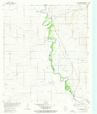 1980 Las Conchas1980 Print · USGSThe Texas-Mexico borderlands along the Rio Grande come into focus in the early 1980s, revealing a landscape of isolated river settlements and desert washes. Genealogists and historians can trace family locations near Ruidosa, Pueblo Nuevo, and the historic Ruins found along the international boundary.
 - 1983 Map of Cactus Flat
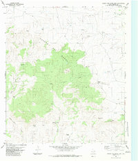
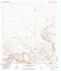 1983 Cactus Flat1983 Print · USGSPresidio and Brewster Counties are captured in the early 1980s, showing a remote ranching landscape of high mesas and desert gaps. Researchers can locate established homesteads like Crosson Ranch and trace paths through Bootlegger Canyon or Rustlers Gap.
 - 1983 Map of Ryan
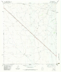 1983 Ryan1983 Print · USGSThe High Plains of West Texas are captured here in the early eighties as the Southern Pacific railroad crosses the expanse of Ryan Flat. Researchers can trace the layout of the small settlement of Ryan or locate remote sites like Evans Ranch and Horseshoe Tank.
 - 1983 Map of Tinaja NE
 1983 Tinaja NE1983 Print · USGSThe high-desert ranchlands of West Texas are captured here in the early 1980s, where the county line divides remote pastoral outposts. Genealogists and historians can trace family operations like Loma Vista Ranch or the One O One Ranch near the Atchison Topeka and Santa Fe rail line.
 - 1983 Map of Shafter
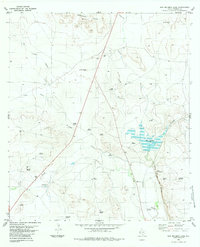
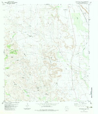
 1983 Shafter1983 Print · USGSPresidio County ranching country is captured in the early eighties, documenting the remote landscape south of Marfa. Genealogists and historians can locate Cibolo Ranch and trace the sparse network of trails that connected this isolated desert terrain.
 - 1983 Map of Tinaja
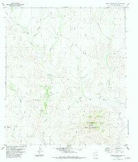
 1983 Tinaja1983 Print · USGSHigh desert ranching in Presidio County comes into focus during the early eighties, centered on the Atchison Topeka and Santa Fe rail line. Researchers can trace the water-dependent landscape through family-named landmarks like Antelope Spring Ranch, Porter Windmill, and Mitchell.
 - 1983 Map of Plata
 1983 Plata1983 Print · USGSPresidio County's arid cattle country is documented here in the early eighties, centered on the railroad siding of Plata. Genealogists and historians can trace family land and water rights through features like the Alamito Cem, Jack Brown Spring, and the Atchison Topeka and Santa Fe rail line.
 - 1983 Map of Smith Hills
 1983 Smith Hills1983 Print · USGSThe West Texas high desert at the Presidio and Jeff Davis county line is captured here in the early 1980s. Researchers can trace the drainage of South Fork Alamito Creek or locate landmarks like Big Hill, the Marfa Municipal Airport, and Red Tanks.
 - 1983 Map of San Esteban Lake
 1983 San Esteban Lake1983 Print · USGSThe high desert of Presidio County in the early eighties is defined by its railroad corridor and scattered ranching infrastructure. Genealogists and researchers can trace family-named sites like Atkins Windmill and Carpenter Windmill or follow the route of the Atchison Topeka and Santa Fe.
 - 1983 Map of Marfa
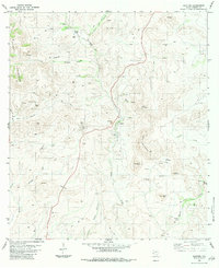
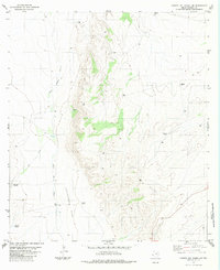
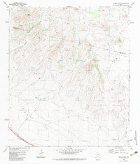
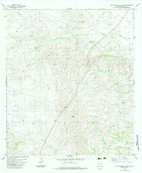
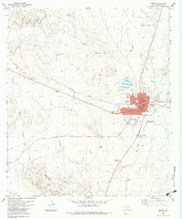 1983 Marfa1983 Print · USGSMarfa is shown here as a critical high-plateau rail and ranching center in the early 1980s. Researchers can trace the town's civic layout around the Courthouse, locate the St Marys Sch, or explore outlying landmarks like Holmes Cem and Porter Waterhole.
 - 1983 Map of Cerro Redondo
 1983 Cerro Redondo1983 Print · USGSPresidio County and the Texas-Mexico border are shown here in the early 1980s, before modern shifts changed the local ranching landscape. Researchers can trace the path of the Atchison Topeka and Santa Fe and find remote sites like Botilla Camp and Calera Spring.
 - 1983 Map of Aragon
 1983 Aragon1983 Print · USGSPresidio County's high-desert plains appear during the late twentieth century as a landscape shaped by the Southern Pacific railroad. Researchers can trace the rail siding at Aragon, a remote Landing Strip, and landmarks like Big Trestle Draw.
 - 1983 Map of Cuesta Del Burro East
 1983 Cuesta Del Burro East1983 Print · USGSPresidio County ranching lands are captured here in the early 1980s, centered on the prominent Cuesta Del Burro landform. Researchers can trace remote desert outposts and water infrastructure like Nopalosa Camp, Socotoso Spring, and several family-named windmills.
 - 1983 Map of Frenchman Hills
 1983 Frenchman Hills1983 Print · USGSPresidio County ranch lands and desert peaks are captured here in the early eighties. Genealogists and historians can locate remote family outposts like Mollard Ranch or trace the Atchison Topeka and Santa Fe rail line along Alamito Creek.
 - 1983 Map of Cienega Mountains
 1983 Cienega Mountains1983 Print · USGSPresidio County ranching life is well-documented in this early eighties survey of the high desert. Researchers can trace the layout of Cienega Ranch and Rancho Tinaja China or locate remote landmarks like Cerro Redondo and the Landing Strip.
 - 1983 Map of Cuesta Del Burro NW
 1983 Cuesta Del Burro NW1983 Print · USGSPresidio County ranching life is documented here in the late twentieth century, showing the infrastructure of the West Texas desert. Researchers can trace historic water rights and camp locations through labels like Mc Minn Camp, Brite Well, and Freemont Windmill.
 - 1983 Map of Casa Piedra
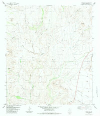
 1983 Casa Piedra1983 Print · USGSPresidio County in the early 1980s is captured here as a landscape of isolated rail sidings and remote desert outposts. Researchers can trace the Atchison Topeka and Santa Fe railroad line past Casa Piedra or locate local landmarks like Holguin Camp and the Loma Alta Windmill.
 - 1983 Map of Burro Draw
 1983 Burro Draw1983 Print · USGSThe high desert of Presidio and Jeff Davis counties is captured here in the early eighties, where ranching infrastructure meets the railroad. Trace the path of the Southern Pacific and locate remote water sources like Thick Tank Well or Buck Mountain.
 - 1983 Map of Deer Peak
 1983 Deer Peak1983 Print · USGSPresidio County ranch lands and the Southern Pacific rail corridor are captured here during the early 1980s. Researchers can locate remote desert outposts like Dutch Wells Ranch and trace vital water landmarks such as Red House Windmill and Jake Tank.
 - 1983 Map of Devils Den
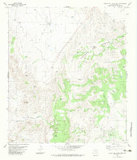
 1983 Devils Den1983 Print · USGSPresidio County's high-desert landscape is documented here in the early eighties, where scientific research meets traditional ranching. Researchers can locate the University of Texas Radio Astronomy Observatory and name-specific landmarks like Lourdes Windmill or the Atchison Topeka and Santa Fe rail line.
 - 1983 Map of Cerros Prietos
 1983 Cerros Prietos1983 Print · USGSPresidio County's high-desert ranchlands are captured in the early eighties, showing the remote drainages and cattle country of the Trans-Pecos. Researchers can locate Laks Ranch and trace the paths of Cienega Creek and Charco Bracero Creek across the desert floor.
 - 1983 Map of Cieneguita
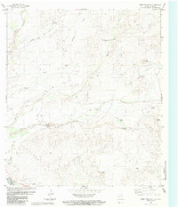
 1983 Cieneguita1983 Print · USGSPresidio County ranching country is captured here during the 1970s, showing a landscape shaped by water and high-desert relief. Researchers can trace the rugged network of Jeep Trails and Trails connecting landmarks like Elephant Rock and the Shipping Pen.
 - 1983 Map of San Esteban Lake SW
 1983 San Esteban Lake SW1983 Print · USGSPresidio County ranching life in the early eighties was defined by isolated water sources and long desert tracks. Researchers can locate remote landmarks like the Stage Stand Windmill, Cow Heaven Windmill, and the Roadside Park.
 - 1983 Map of Cuesta Del Burro West
 1983 Cuesta Del Burro West1983 Print · USGSPresidio County ranching and rugged desert peaks are captured here in the early eighties. Researchers can trace the legacy of remote outposts like Petan Ranch and find named water sources like Buenos Aires Windmill and The Old Hole Spring.
Showing maps 1-25 of 45
Top cities of Presidio County
- Presidio historical maps
- Marfa historical maps
- Redford historical maps
- Candelaria historical maps
- Ruidosa historical maps
- Plata historical maps
See more
Frequently asked questions
- What are the different types of historical maps available for Presidio County?
- What is the oldest map of Presidio County?
- Where can I purchase historical maps of Presidio County for my home or office?
- Where can I download high-res historical maps of Presidio County?
- Are there historical topographic maps available for Presidio County?
- Is there historical aerial imagery available for Presidio County?
- Where are historical maps of Presidio County sourced from?