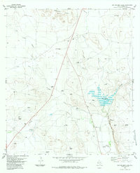
1983 Map of San Esteban Lake
USGS Topo · Published 1983About this map
San Esteban Lake serves as a central landmark in this Presidio County landscape, where water management is the primary driver of development. The 1983 survey reveals a sophisticated network of family-named and descriptive water features, including Gavilan Windmill, Agua Fria Windmill, and Desahije Windmill, which support ranching activities across the Rancheria Hills. The Atchison Topeka and Santa Fe railroad cuts a definitive path through the territory, running parallel to Alamito Creek and providing a vital transport corridor in an area otherwise marked by remote draws like Long Draw and Big Trestle Draw. Significant natural watering holes, or tinajas, are also noted, such as Tinaja San Esteban near the foot of Tinaja Hill, illustrating the enduring importance of these sites for local geography and survival.
Find a feature on this map
32 named features on this map. Tap any name to fly to it.
Don’t see what you’re looking for? This feature index may not catch every label — zoom into the map to look around manually.
Map Details
Editions of this 1983 San Esteban Lake Map
This is the sole edition of this map. No revisions or reprints were ever made.
Other maps of this area

1895 · Marfa
USGS Topo · 1:125,000

1895 · Alpine
USGS Topo · 1:125,000

1954 · Fort Stockton
USGS Topo · 1:250,000

1958 · Fort Stockton
USGS Topo · 1:250,000

1959 · Marfa
USGS Topo · 1:250,000

1965 · Marfa
USGS Topo · 1:250,000

1972 · Nopal
USGS Topo · 1:24,000

1973 · Fort Stockton
USGS Topo · 1:250,000
1983 · Tinaja
USGS Topo · 1:24,000
1983 · Marfa
USGS Topo · 1:24,000